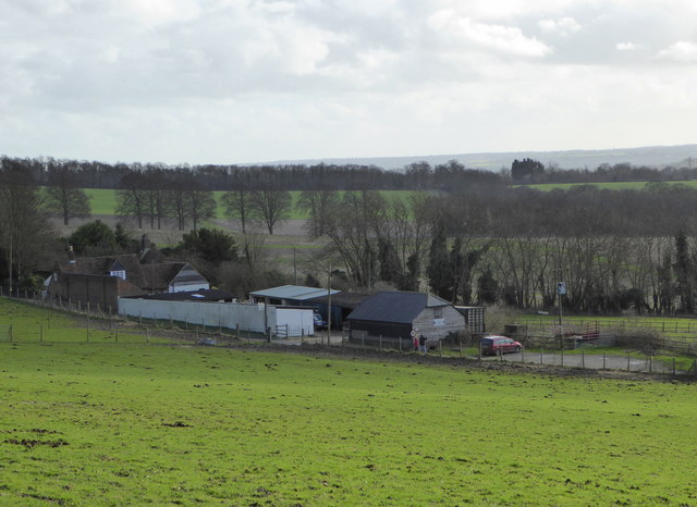
Boarley Warren

Downs, Moorland in Kent Maidstone

England

Boarley Warren

M20 Junction 6 from the air The M20 runs from left to right through the junction, with the A229 running top to bottom. The M2 motorway can be seen crossing the River Medway in the distance. Viewed from a gatwick bound flight from Prague.
M20 Junction 6 from the air Credit: Thomas Nugent

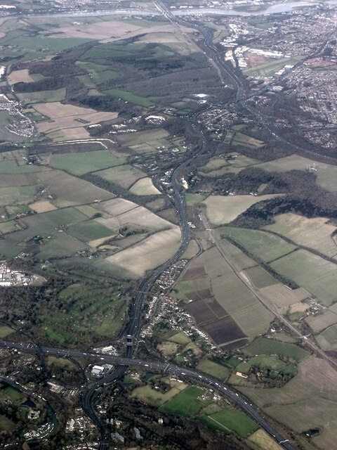
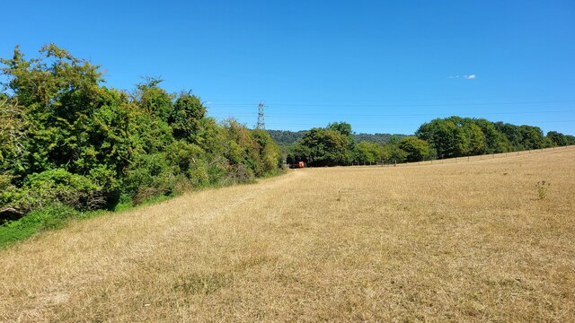
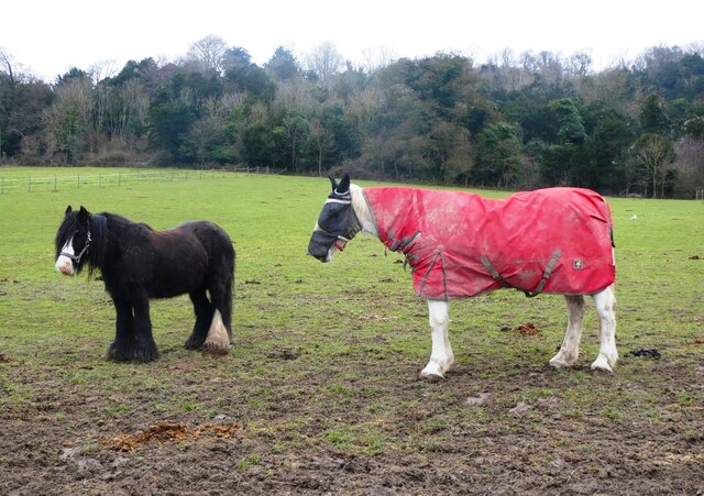
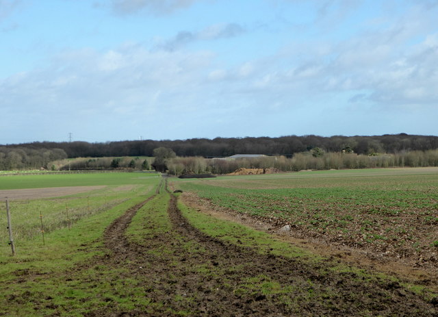
Boarley Warren is a picturesque area located in Kent, England. Situated on the Downs and Moorland, it offers breathtaking views and a tranquil atmosphere. The region is known for its rolling hills, expansive meadows, and ancient woodlands, making it an ideal destination for nature enthusiasts.

The Downs in Boarley Warren are characterized by their chalk grasslands, which are home to a diverse range of plant and animal species. Visitors can witness the vibrant display of wildflowers, including orchids, cowslips, and harebells, during the spring and summer months. The area also provides a habitat for a variety of bird species, such as kestrels, skylarks, and yellowhammers, making it a popular spot for birdwatching.

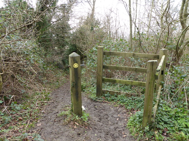
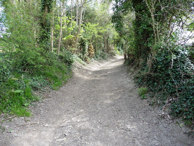
Moorland, on the other hand, offers a different landscape with its heather-covered expanses and scattered gorse bushes. This unique habitat provides shelter for many rare species, including the Dartford warbler and the silver-studded blue butterfly. Visitors can explore the moorland through well-marked trails and enjoy the solitude and serenity it offers.

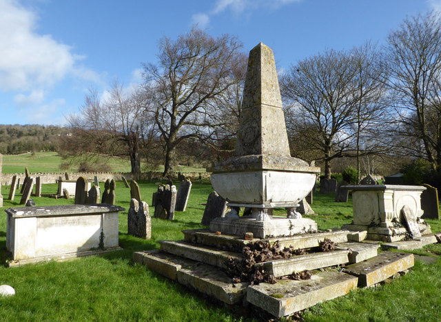
Boarley Warren is also rich in history, with ancient burial mounds and archaeological sites scattered throughout the area. These remnants of the past provide a glimpse into the region's fascinating heritage.

Overall, Boarley Warren in Kent is a haven for nature lovers, offering diverse landscapes, abundant wildlife, and a sense of tranquility. Whether it's hiking, birdwatching, or simply enjoying the beauty of the surroundings, this area has something to offer for everyone.

If you have any feedback on the listing, please let us know in the comments section below.

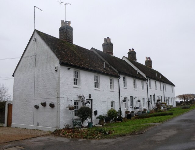
Boarley Warren Images

Images are sourced within 2km of 51.310419/0.53309778 or Grid Reference TQ7659. Thanks to Geograph Open Source API. All images are credited.

M20 Junction 6 from the air The M20 runs from left to right through the junction, with the A229 running top to bottom. The M2 motorway can be seen crossing the River Medway in the distance. Viewed from a gatwick bound flight from Prague.
M20 Junction 6 from the air
The M20 runs from left to right through the junction, with the A229 running top to bottom. The M2 motorway can be seen crossing the River Medway in the distance. Viewed from a gatwick bound flight from Prague.
Footpath heading north to Grange Lane The path is named Sheep Wash, it has a tunnel under the M20 from Penenden Heath a suburb of Maidstone.
Footpath heading north to Grange Lane
The path is named Sheep Wash, it has a tunnel under the M20 from Penenden Heath a suburb of Maidstone.
Horse and pony, Boxley Riding School On Pilgrims Way.
Horse and pony, Boxley Riding School
On Pilgrims Way.
Hatchett and Styles Cottage, Boxley On Styles Lane. Grade II listed, 16th century and 20th century.
Hatchett and Styles Cottage, Boxley
On Styles Lane. Grade II listed, 16th century and 20th century.
Greenfield Cottages, The  Street, Boxley Formerly four farm cottages, built in the early 1800s
Greenfield Cottages, The Street, Boxley
Formerly four farm cottages, built in the early 1800s
Footpath north of the North Downs Way Near Boxley. The path leads to Grange Farm.
Footpath north of the North Downs Way
Near Boxley. The path leads to Grange Farm.
Footpath to Boxley From the North Downs Way.
Footpath to Boxley
From the North Downs Way.
North Downs Way near Boxley To the left is a footpath to Grange Farm and to the right the path leads down to Boxley.
North Downs Way near Boxley
To the left is a footpath to Grange Farm and to the right the path leads down to Boxley.
Footpath leading to Boxley Steep path from the North Downs Way through Boxley Wood to the village.
Footpath leading to Boxley
Steep path from the North Downs Way through Boxley Wood to the village.
Footpath to Boxley Steep path from the North Downs Way through Boxley Wood to the village.
Footpath to Boxley
Steep path from the North Downs Way through Boxley Wood to the village.
Village sign and path to Boxley Church The Church of St. Mary the Virgin and All Saints is a Grade I listed building dating from the 12th century and the lych gate is Grade II listed.
Village sign and path to Boxley Church
The Church of St. Mary the Virgin and All Saints is a Grade I listed building dating from the 12th century and the lych gate is Grade II listed.
The village sign, Boxley Making reference to the church, the oast houses, Boxley Wood and the riding school.
The village sign, Boxley
Making reference to the church, the oast houses, Boxley Wood and the riding school.
The church of St. Mary the Virgin and All Saints, Boxley Viewed from the war memorial. The church is a Grade I listed building dating from the 12th century and restored in 1875-6.
The church of St. Mary the Virgin and All Saints, Boxley
Viewed from the war memorial. The church is a Grade I listed building dating from the 12th century and restored in 1875-6.
Monument to members of the Dunning family, Boxley Dating from the early 19th century it is Grade II listed and is situated to the south east of St. Mary and All Saints church.
Monument to members of the Dunning family, Boxley
Dating from the early 19th century it is Grade II listed and is situated to the south east of St. Mary and All Saints church.
The church of St. Mary the Virgin and All Saints The church is a Grade I listed building dating from the 12th century and restored in 1875-6.
The church of St. Mary the Virgin and All Saints
The church is a Grade I listed building dating from the 12th century and restored in 1875-6.
View above Boxley From a footpath north of Pilgrims Way looking back towards Warren Farm and Boxley Riding School.
View above Boxley
From a footpath north of Pilgrims Way looking back towards Warren Farm and Boxley Riding School.
The North Downs Way near the White Horse Stone
The North Downs Way in Westfield Wood
Show me another place!

Boarley Warren is located at Grid Ref: TQ7659 (Lat: 51.310419, Lng: 0.53309778)

Administrative County: Kent

District: Maidstone

Police Authority: Kent

What 3 Words

///bounding.spent.investors. Near Aylesford, Kent

Nearby Locations

Boarley Warren

Related Wikis

Boxley Warren

Boxley Warren is a 83-hectare (210-acre) Local Nature Reserve north of Maidstone in Kent. It is privately owned and managed by Maidstone Borough Council...

Boxley

Boxley is a village and civil parish in the Maidstone District of Kent, England. It lies below the slope of the North Downs approximately 2 miles (3.2...

St Mary's and All Saints Church, Boxley

St Mary's and All Saints is a parish church in Boxley, Kent begun in the 13th century and with additions in the 14th and 15th centuries. The church was...

Boxley Abbey

Boxley Abbey was a Cistercian monastery in Sandling, near Maidstone in Kent, England. It sits at the foot of the North Downs and falls within the parish...

National Cycle Route 17

National Cycle Route 17 is part of the United Kingdom's National Cycle Network. It presently runs southwards from Rochester, via Maidstone to Ashford where...

Smythe's Megalith

Smythe's Megalith, also known as the Warren Farm Chamber, was a chambered long barrow east of Blue Bell Hill, north of Maidstone, in the south-eastern...

Tyland Barn

Tyland Barn, in Sandling, north of Maidstone, Kent, is the headquarters of the Kent Wildlife Trust.It has a nature park which is designed to show the variety...
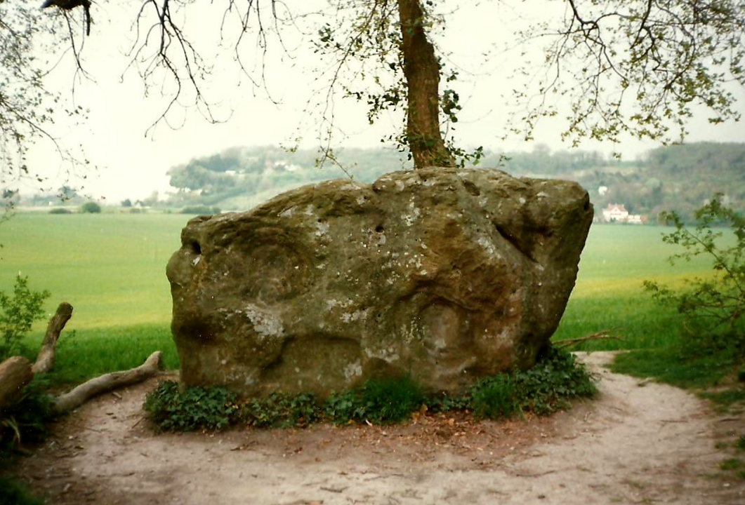
White Horse Stone

The White Horse Stone is a name given to two separate sarsen megaliths east of Blue Bell Hill, near the hamlet of Sandling and the village of Aylesford...

Related Videos

Hiking Boxley Circuit in Southeast England

An abbey, yew trees, the Pilgrims Way, sheep, and the downs in a 5-mile hike near Rochester. #nomadlife #nomadover50 ...

Evening walk on the side of River Medway

Evening walk on the side of River Medway 4k video in YouTube/click bio link #rivermedway #walking #nature #kent ...

A Place Away From Home | Hilton Maidstone #weekendtrip #travel #travelvlog

Subscribe to my channel for more videos https://www.youtube.com/ @ChricelsChannelUK #youtubevideo #hiltonmaidstone ...

Nearby Amenities

Located within 500m of 51.310419,0.53309778
Barrier: kissing_gate
Foot: yes
Lat/Long: 51.3116556/0.5279628
The data included in this document is from www.openstreetmap.org. The data is made available under ODbL.

Have you been to Boarley Warren?

Leave your review of Boarley Warren below (or comments, questions and feedback).