Cavenham Heath

Downs, Moorland in Suffolk West Suffolk

England

Cavenham Heath

All Saints Church, Icklingham All Saints church is a medieval church dating from the 11th century, complete with a thatched roof.  Today this Grade I listed <span class="nowrap"><a title="https://historicengland.org.uk/listing/the-list/list-entry/1351332?section=official-list-entry" rel="nofollow ugc noopener" href="https://historicengland.org.uk/listing/the-list/list-entry/1351332?section=official-list-entry">Link</a><img style="margin-left:2px;" alt="External link" title="External link - shift click to open in new window" src="https://s1.geograph.org.uk/img/external.png" width="10" height="10"/></span> church is redundant and in the care of the Churches Conservation Trust.
All Saints Church, Icklingham Credit: Philip Halling

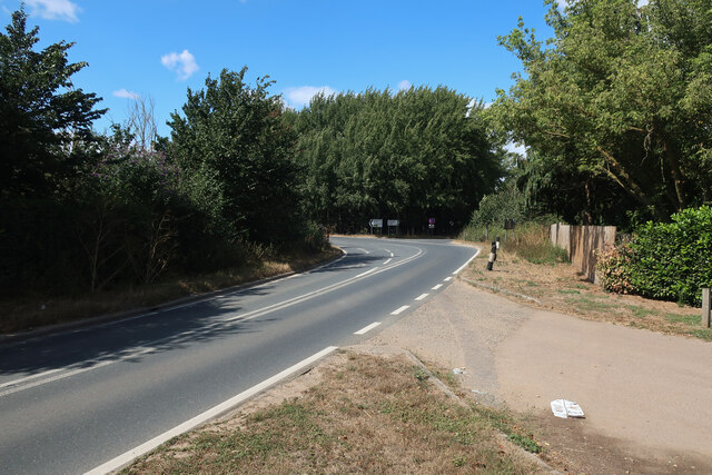
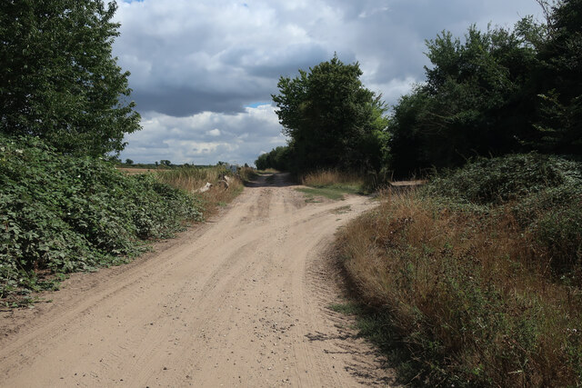
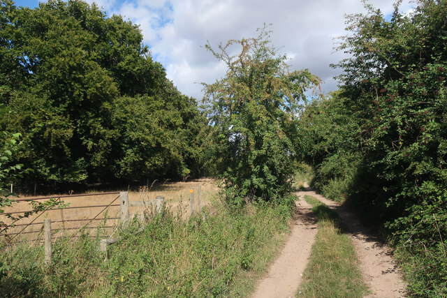
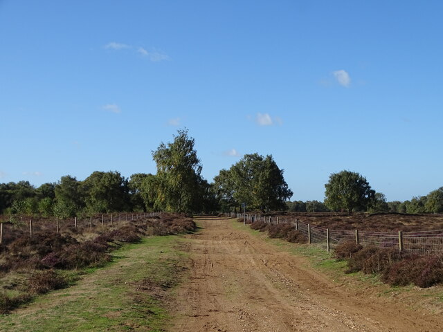
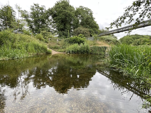
Cavenham Heath is a unique and picturesque area located in Suffolk, England. Stretching over approximately 220 acres, it is characterized by a diverse landscape of downs and moorland, offering a tranquil and unspoiled environment for both locals and visitors to enjoy.

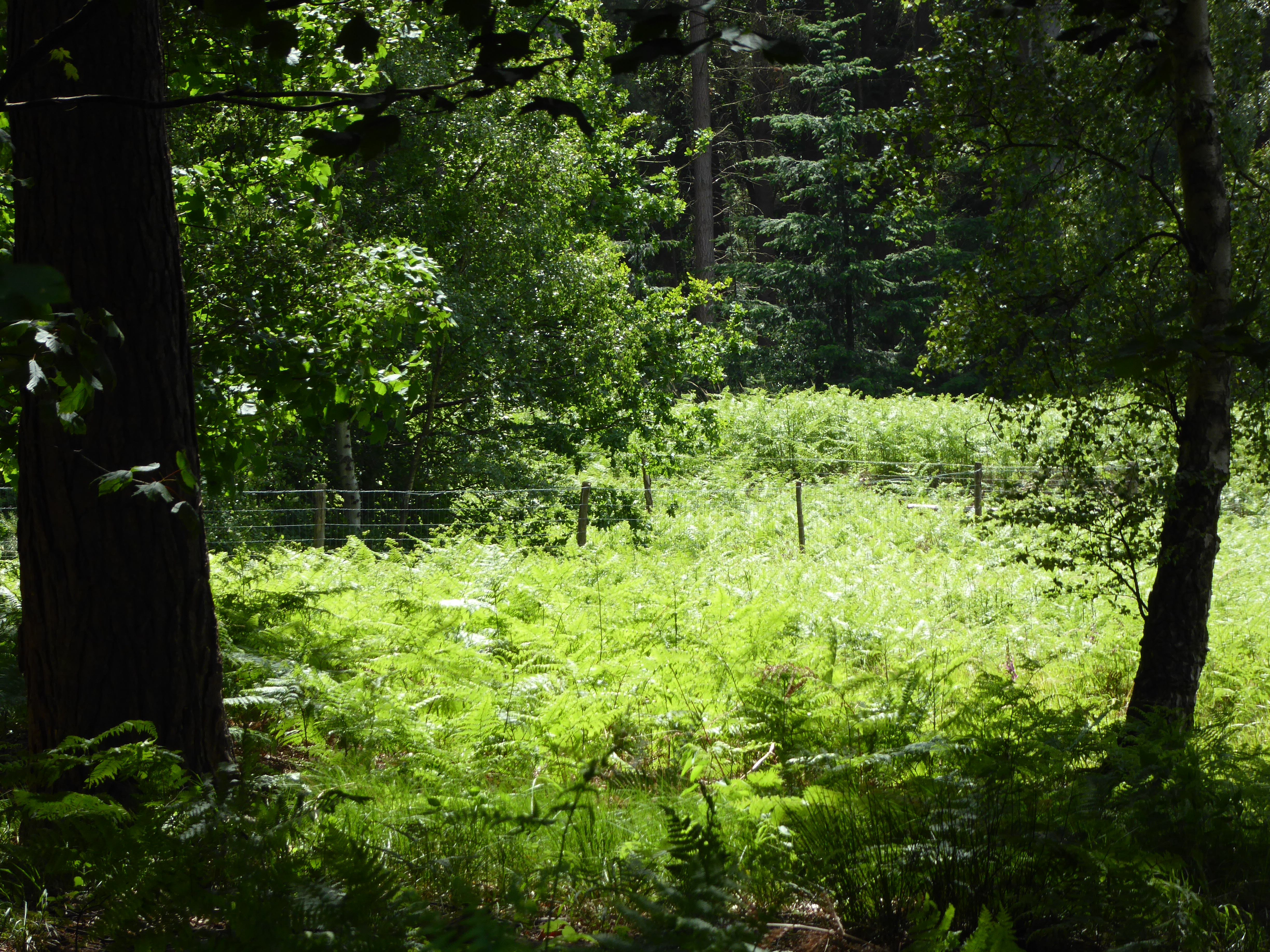
The heath is renowned for its rich biodiversity, with a variety of flora and fauna calling it home. The open grasslands are covered in vibrant wildflowers during the warmer months, including heather, gorse, and orchids. These floral displays attract a wide range of insects and butterflies, creating a colorful and buzzing ecosystem.

The heath is also a haven for birdwatchers, as it provides a habitat for several rare and endangered bird species. Visitors may catch a glimpse of the iconic stone curlew, nightjar, or woodlark, among others. The area is designated as a Site of Special Scientific Interest (SSSI), acknowledging its importance in preserving the local wildlife and habitats.

Cavenham Heath offers a network of footpaths and trails, allowing visitors to explore the area at their own pace. The paths meander through open fields, winding through patches of woodland, and along the edges of babbling brooks. The peaceful surroundings make it an ideal spot for walking, picnicking, or simply immersing oneself in nature.

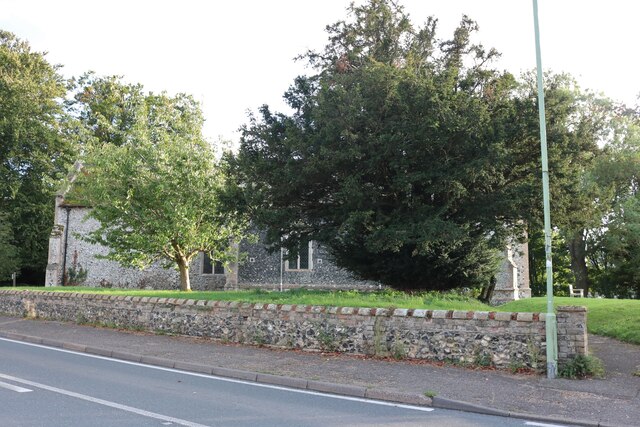
Managed by the Suffolk Wildlife Trust, Cavenham Heath is carefully conserved and protected to ensure its natural beauty remains intact for future generations. It serves as a valuable educational resource, hosting nature walks and events that offer an opportunity to learn more about the local ecology and conservation efforts.

In conclusion, Cavenham Heath in Suffolk is a stunning natural landscape that showcases the beauty and diversity of the English countryside. With its unique downs and moorland, rich wildlife, and accessible trails, it provides a peaceful haven for nature enthusiasts and those seeking a break from the hustle and bustle of everyday life.

If you have any feedback on the listing, please let us know in the comments section below.

Cavenham Heath Images

Images are sourced within 2km of 52.320999/0.57733032 or Grid Reference TL7572. Thanks to Geograph Open Source API. All images are credited.

All Saints Church, Icklingham All Saints church is a medieval church dating from the 11th century, complete with a thatched roof.  Today this Grade I listed <span class="nowrap"><a title="https://historicengland.org.uk/listing/the-list/list-entry/1351332?section=official-list-entry" rel="nofollow ugc noopener" href="https://historicengland.org.uk/listing/the-list/list-entry/1351332?section=official-list-entry">Link</a><img style="margin-left:2px;" alt="External link" title="External link - shift click to open in new window" src="https://s1.geograph.org.uk/img/external.png" width="10" height="10"/></span> church is redundant and in the care of the Churches Conservation Trust.
All Saints Church, Icklingham
All Saints church is a medieval church dating from the 11th century, complete with a thatched roof. Today this Grade I listed LinkExternal link church is redundant and in the care of the Churches Conservation Trust.
Thatched cottage in Icklingham This thatched cottage is situated opposite All Saints church.
Thatched cottage in Icklingham
This thatched cottage is situated opposite All Saints church.
Village of Icklingham The village sign on the A1011 entering the village of Icklingham.
Village of Icklingham
The village sign on the A1011 entering the village of Icklingham.
Interior of All Saints church The interior of All Saints church, a medieval church dating from the 11th century.  Today this Grade I listed <span class="nowrap"><a title="https://historicengland.org.uk/listing/the-list/list-entry/1351332?section=official-list-entry" rel="nofollow ugc noopener" href="https://historicengland.org.uk/listing/the-list/list-entry/1351332?section=official-list-entry">Link</a><img style="margin-left:2px;" alt="External link" title="External link - shift click to open in new window" src="https://s1.geograph.org.uk/img/external.png" width="10" height="10"/></span> church is redundant and in the care of the Churches Conservation Trust.
Interior of All Saints church
The interior of All Saints church, a medieval church dating from the 11th century. Today this Grade I listed LinkExternal link church is redundant and in the care of the Churches Conservation Trust.
All Saints Church, Icklingham All Saints church is a medieval church dating from the 11th century, complete with a thatched roof.  Today this Grade I listed <span class="nowrap"><a title="https://historicengland.org.uk/listing/the-list/list-entry/1351332?section=official-list-entry" rel="nofollow ugc noopener" href="https://historicengland.org.uk/listing/the-list/list-entry/1351332?section=official-list-entry">Link</a><img style="margin-left:2px;" alt="External link" title="External link - shift click to open in new window" src="https://s1.geograph.org.uk/img/external.png" width="10" height="10"/></span> church is redundant and in the care of the Churches Conservation Trust.  Here the church is viewed from the north.
All Saints Church, Icklingham
All Saints church is a medieval church dating from the 11th century, complete with a thatched roof. Today this Grade I listed LinkExternal link church is redundant and in the care of the Churches Conservation Trust. Here the church is viewed from the north.
Medieval stained glass Medieval 14th century stained glass in All Saints Church, Icklingham.
Medieval stained glass
Medieval 14th century stained glass in All Saints Church, Icklingham.
Church of St James, Icklingham The church of St James is medieval and restored in the 19th century.  The church is Grade II* listed, see: <span class="nowrap"><a title="https://historicengland.org.uk/listing/the-list/list-entry/1037582?section=official-list-entry" rel="nofollow ugc noopener" href="https://historicengland.org.uk/listing/the-list/list-entry/1037582?section=official-list-entry">Link</a><img style="margin-left:2px;" alt="External link" title="External link - shift click to open in new window" src="https://s1.geograph.org.uk/img/external.png" width="10" height="10"/></span>
Church of St James, Icklingham
The church of St James is medieval and restored in the 19th century. The church is Grade II* listed, see: LinkExternal link
Houses in Icklingham Houses on the A1011 in the village of Icklingham.
Houses in Icklingham
Houses on the A1011 in the village of Icklingham.
A1101 out of Icklingham
Byway by Icklingham
Byway by Icklingham
Byway from Icklingham
River Lark
River Lark
Icknield Way
Icknield Way
Temple Bridge Ford This ford is found at Temple Bridge on the River Lark.
Temple Bridge Ford
This ford is found at Temple Bridge on the River Lark.
Church of St James, Icklingham
The Street, Icklingham St James Church is on the right
The Street, Icklingham
St James Church is on the right
Edge of Cavenham Heath
Cavenham Heath With some ground stripped to help the heathland birds of the area.
Cavenham Heath
With some ground stripped to help the heathland birds of the area.
Show me another place!

Cavenham Heath is located at Grid Ref: TL7572 (Lat: 52.320999, Lng: 0.57733032)

Administrative County: Suffolk

District: West Suffolk

Police Authority: Suffolk

What 3 Words

///panels.shopper.throat. Near Mildenhall, Suffolk

Related Wikis

Cavenham–Icklingham Heaths

Cavenham–Icklingham Heaths is a 419 hectare biological Site of Special Scientific Interest west of Icklingham in Suffolk. It is a Nature Conservation Review...

RAF Tuddenham

Royal Air Force Tuddenham or RAF Tuddenham is a former Royal Air Force station located 3.2 miles (5.1 km) south east of Mildenhall, Suffolk, England and...
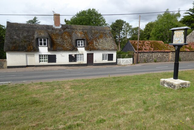
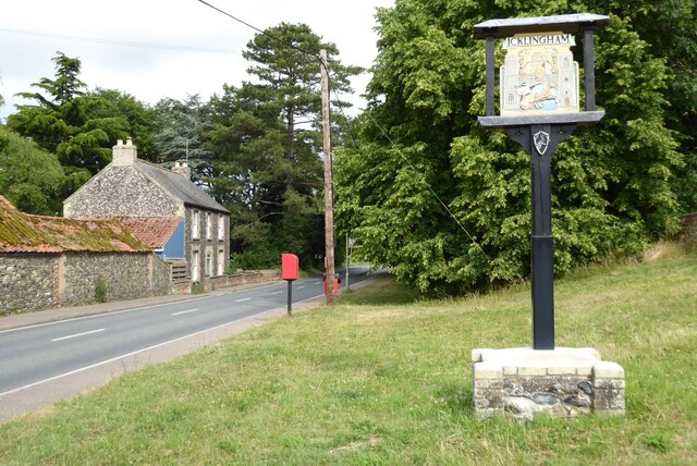
Icklingham

Icklingham is a village and civil parish in the West Suffolk district of Suffolk in eastern England. It is located about 7 miles (11 km) north-west of...

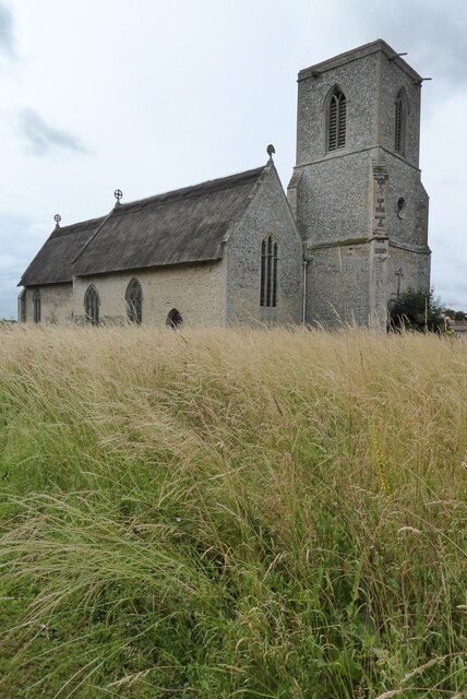
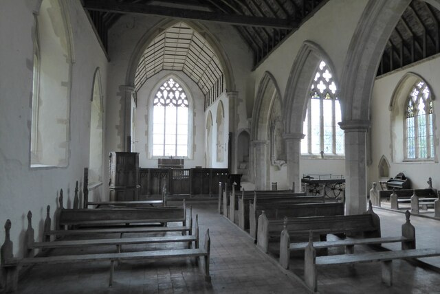
All Saints' Church, Icklingham

All Saints' Church is a redundant Anglican church in the village of Icklingham, Suffolk, England. It is recorded in the National Heritage List for England...

Tuddenham

Tuddenham is a village and civil parish in the West Suffolk district of Suffolk in eastern England. In 2005 it had a population of 450. falling to 423...

Cavenham

Cavenham is a village and civil parish in Suffolk, England, 10 kilometres (6 mi) northwest of Bury St Edmunds. It is in the local government district of...

Deadman's Grave, Icklingham

Deadman's Grave, Icklingham is a 127.3-hectare (315-acre) biological Site of Special Scientific Interest north-east of Icklingham in Suffolk. It is a Nature...

Rex Graham nature reserve

Rex Graham Reserve is a 2.8-hectare (6.9-acre) biological Site of Special Scientific Interest east of Mildenhall in Suffolk. It is a Special Area of Conservation...

Nearby Amenities

Located within 500m of 52.320999,0.57733032
Cavenham Heath
Place: locality
Lat/Long: 52.321261/0.5771847
Bunker Type: pillbox
Historic: yes
Military: bunker
Lat/Long: 52.3244756/0.578747
Information: guidepost
Ref: 6
Tourism: information
Lat/Long: 52.3205088/0.5713236
Historic: ruins
Military: unknown
Lat/Long: 52.3207947/0.578635
Bunker Type: pillbox
Military: bunker
Note: Approximate position from triangulation
Lat/Long: 52.322515/0.5755028
Barrier: kissing_gate
Bicycle: no
Foot: yes
Lat/Long: 52.3250299/0.5801151
The data included in this document is from www.openstreetmap.org. The data is made available under ODbL.

Have you been to Cavenham Heath?

Leave your review of Cavenham Heath below (or comments, questions and feedback).