Glynleigh Level

Downs, Moorland in Sussex Wealden

England

Glynleigh Level

Ditch on Pevensey Levels seen from the 1066 Country Walk This is just south of Bridge Farm at Rickney. It is part of Pevensey Levels which cover an area of around 47 square miles. They are a Site of Special Scientific Interest and are jointly owned by Natural England and the Sussex Wildlife Trust. There are many nationally rare plants and invertebrates. 

The 1066 Country Walk runs from Pevensey where William of Normandy gathered his invading army of Normans and prepared to meet King Harold to Rye passing through Battle. It seeks to link the places and the people of 1066.
Ditch on Pevensey Levels seen from the 1066 Country Walk Credit: Marathon

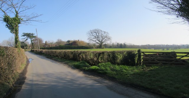
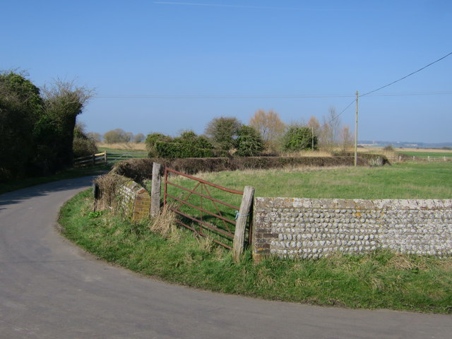
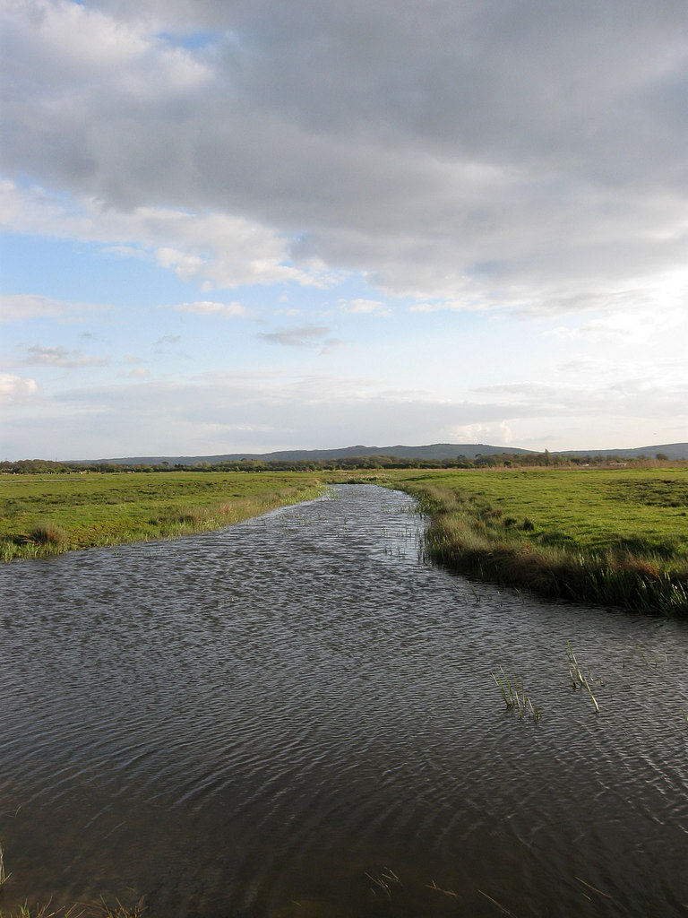
Glynleigh Level is a picturesque area located in Sussex, England. Nestled amidst the stunning Sussex Downs and Moorland, this region is renowned for its natural beauty and diverse landscape.

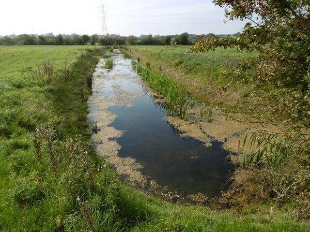
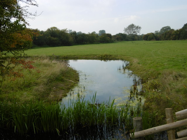
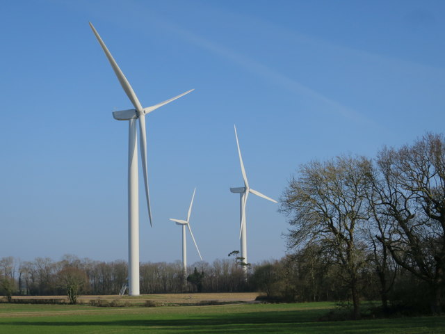
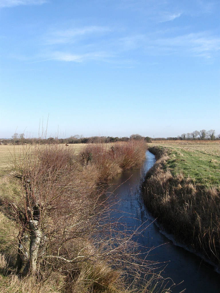
The Downs in Glynleigh Level are characterized by rolling hills, vast green meadows, and steep slopes, providing breathtaking panoramic views of the surrounding countryside. The area is home to a rich variety of flora and fauna, including rare species of wildflowers and birds, making it a haven for nature enthusiasts and birdwatchers. The tranquil moorland adds another dimension to the area, with its heather-covered hills and open expanses, creating a unique and enchanting atmosphere.

Glynleigh Level is also known for its historical significance. The region is dotted with ancient burial grounds, prehistoric sites, and remnants of Iron Age settlements, providing a fascinating insight into the area's rich heritage. Visitors can explore these archaeological sites and learn about the region's past, adding an educational aspect to their experience.

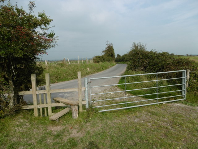
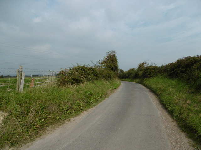
With its idyllic countryside charm, Glynleigh Level offers a range of outdoor activities for visitors to enjoy. Hiking and walking trails are available, allowing visitors to explore the undulating landscape and discover hidden gems along the way. The area is also popular for cycling, horse riding, and picnicking, providing ample opportunities to immerse oneself in the natural surroundings.

In conclusion, Glynleigh Level in Sussex is a captivating destination, offering a combination of stunning natural landscapes, historical sites, and outdoor activities. Whether you are seeking tranquility, adventure, or a glimpse into the past, this region has something to offer for everyone.

If you have any feedback on the listing, please let us know in the comments section below.

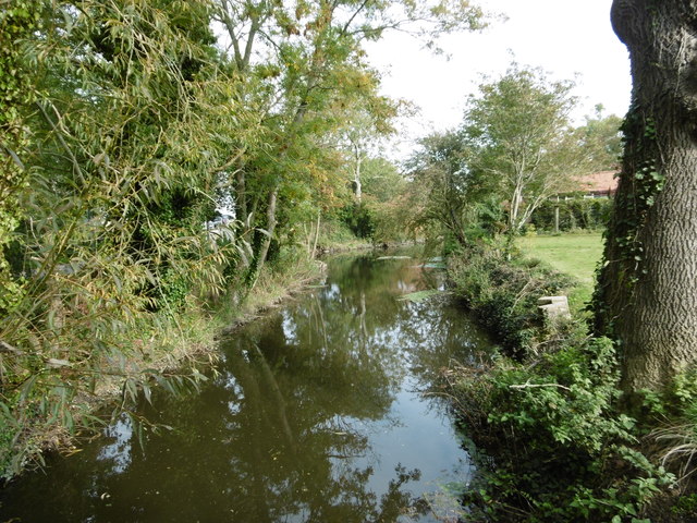
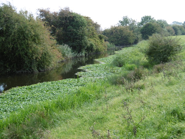
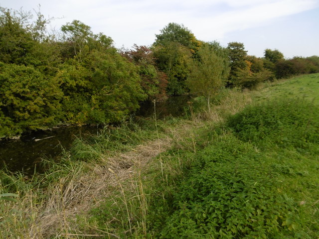
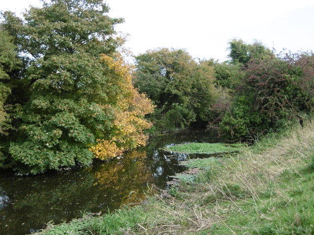
Glynleigh Level Images

Images are sourced within 2km of 50.837783/0.29326006 or Grid Reference TQ6106. Thanks to Geograph Open Source API. All images are credited.

Ditch on Pevensey Levels seen from the 1066 Country Walk This is just south of Bridge Farm at Rickney. It is part of Pevensey Levels which cover an area of around 47 square miles. They are a Site of Special Scientific Interest and are jointly owned by Natural England and the Sussex Wildlife Trust. There are many nationally rare plants and invertebrates. 

The 1066 Country Walk runs from Pevensey where William of Normandy gathered his invading army of Normans and prepared to meet King Harold to Rye passing through Battle. It seeks to link the places and the people of 1066.
Ditch on Pevensey Levels seen from the 1066 Country Walk
This is just south of Bridge Farm at Rickney. It is part of Pevensey Levels which cover an area of around 47 square miles. They are a Site of Special Scientific Interest and are jointly owned by Natural England and the Sussex Wildlife Trust. There are many nationally rare plants and invertebrates. The 1066 Country Walk runs from Pevensey where William of Normandy gathered his invading army of Normans and prepared to meet King Harold to Rye passing through Battle. It seeks to link the places and the people of 1066.
Ditch next to Pevensey Haven seen from 1066 Country Walk This is part of Pevensey Levels which cover an area of around 47 square miles. They are a Site of Special Scientific Interest and are jointly owned by Natural England and the Sussex Wildlife Trust. There are many nationally rare plants and invertebrates. 

The 1066 Country Walk runs from Pevensey where William of Normandy gathered his invading army of Normans and prepared to meet King Harold to Rye passing through Battle. It seeks to link the places and the people of 1066.
Ditch next to Pevensey Haven seen from 1066 Country Walk
This is part of Pevensey Levels which cover an area of around 47 square miles. They are a Site of Special Scientific Interest and are jointly owned by Natural England and the Sussex Wildlife Trust. There are many nationally rare plants and invertebrates. The 1066 Country Walk runs from Pevensey where William of Normandy gathered his invading army of Normans and prepared to meet King Harold to Rye passing through Battle. It seeks to link the places and the people of 1066.
Footpath approaching Rickney Lane This is approaching Rickney Lane on the Pevensey Levels. Pevensey Levels cover an area of around 47 square miles. They are a Site of Special Scientific Interest and are jointly owned by Natural England and the Sussex Wildlife Trust. There are many nationally rare plants and invertebrates.
Footpath approaching Rickney Lane
This is approaching Rickney Lane on the Pevensey Levels. Pevensey Levels cover an area of around 47 square miles. They are a Site of Special Scientific Interest and are jointly owned by Natural England and the Sussex Wildlife Trust. There are many nationally rare plants and invertebrates.
Rickney Lane This is Rickney Lane on the Pevensey Levels. Pevensey Levels cover an area of around 47 square miles. They are a Site of Special Scientific Interest and are jointly owned by Natural England and the Sussex Wildlife Trust. There are many nationally rare plants and invertebrates.
Rickney Lane
This is Rickney Lane on the Pevensey Levels. Pevensey Levels cover an area of around 47 square miles. They are a Site of Special Scientific Interest and are jointly owned by Natural England and the Sussex Wildlife Trust. There are many nationally rare plants and invertebrates.
Glynleigh Sewer at Bridge Farm The Glynleigh Sewer joins the stream known as Pevensey Haven just ahead. Sewer in this context refers to a drainage ditch. This is on the Pevensey Levels.

Pevensey Levels cover an area of around 47 square miles. They are a Site of Special Scientific Interest and are jointly owned by Natural England and the Sussex Wildlife Trust. There are many nationally rare plants and invertebrates.
Glynleigh Sewer at Bridge Farm
The Glynleigh Sewer joins the stream known as Pevensey Haven just ahead. Sewer in this context refers to a drainage ditch. This is on the Pevensey Levels. Pevensey Levels cover an area of around 47 square miles. They are a Site of Special Scientific Interest and are jointly owned by Natural England and the Sussex Wildlife Trust. There are many nationally rare plants and invertebrates.
Pevensey Haven seen from the 1066 Country Walk This is part of Pevensey Levels which cover an area of around 47 square miles. They are a Site of Special Scientific Interest and are jointly owned by Natural England and the Sussex Wildlife Trust. There are many nationally rare plants and invertebrates. 

The 1066 Country Walk runs from Pevensey where William of Normandy gathered his invading army of Normans and prepared to meet King Harold to Rye passing through Battle. It seeks to link the places and the people of 1066.
Pevensey Haven seen from the 1066 Country Walk
This is part of Pevensey Levels which cover an area of around 47 square miles. They are a Site of Special Scientific Interest and are jointly owned by Natural England and the Sussex Wildlife Trust. There are many nationally rare plants and invertebrates. The 1066 Country Walk runs from Pevensey where William of Normandy gathered his invading army of Normans and prepared to meet King Harold to Rye passing through Battle. It seeks to link the places and the people of 1066.
Hankham Hall Road
Hankham Hall Road
Shepham Windfarm Three wind turbines, constructed 2016.
Shepham Windfarm
Three wind turbines, constructed 2016.
Old Court Cottages
Old Court Cottages
Hankham Barn
Hankham Barn
Rickney Lane junction
Drainage ditch by Rickney Lane
Lugear Farm, Rickney Lane
Rickney Lane Approaching Lugear Farm.
Rickney Lane
Approaching Lugear Farm.
Show me another place!

Glynleigh Level is located at Grid Ref: TQ6106 (Lat: 50.837783, Lng: 0.29326006)

Administrative County: East Sussex

District: Wealden

Police Authority: Sussex

What 3 Words

///brave.error.replying. Near Pevensey, East Sussex

Nearby Locations

Glynleigh Level

Related Wikis

Drockmill Hill Gut

Drockmill Hill Gut is a 3.1-kilometre (1.9 mi) long river in the Wealden District of East Sussex, England, that is a tributary to Glynleigh Sewer. It is...

Down Sewer

Down Sewer is a 1.3-kilometre (0.81 mi) long river in the Wealden District of East Sussex, England, that is a tributary to Hurst Haven. Located in the...

Marland Sewer

Marland Sewer is a minor, 767-metre (2,516 ft) long river (brook) and drainage ditch in the Pevensey Levels of Hailsham, Wealden District, East Sussex...

Crossing Sewer

Crossing Sewer is the name of two minor streams (brooks) of the Pevensey Levels in Hailsham, Wealden District of East Sussex, England. Both streams serve...

Glynleigh Sewer

Glynleigh Sewer is a river in Hailsham, Wealden District, East Sussex, England. Located partly in the Pevensey Levels, Glynleigh Sewer joins Hurst Haven...

Hurst Haven

Hurst Haven is a 10.2-kilometre (6.3 mi) long river in Hailsham, Wealden District, East Sussex, England. Located partly in the Pevensey Levels, Hurst Haven...

White Dyke Sewer

White Dyke Sewer, also known as simply White Dyke, is a 1.9-kilometre (1.2 mi) long stream (brook) and drainage ditch of the Pevensey Levels in Hailsham...

Saltmarsh Sewer

Saltmarsh Sewer is a minor river (brook) and drainage ditch of the Pevensey Levels in Hailsham, Wealden District of East Sussex, England. Comprising multiple...

Nearby Amenities

Located within 500m of 50.837783,0.29326006
Barrier: stile
Lat/Long: 50.8349894/0.2985592
The data included in this document is from www.openstreetmap.org. The data is made available under ODbL.

Have you been to Glynleigh Level?

Leave your review of Glynleigh Level below (or comments, questions and feedback).