Eridge Park

Downs, Moorland in Sussex Wealden

England

Eridge Park

The Deer Park Campsite This is just outside the Deer Park Cafe.
The Deer Park Campsite Credit: Marathon

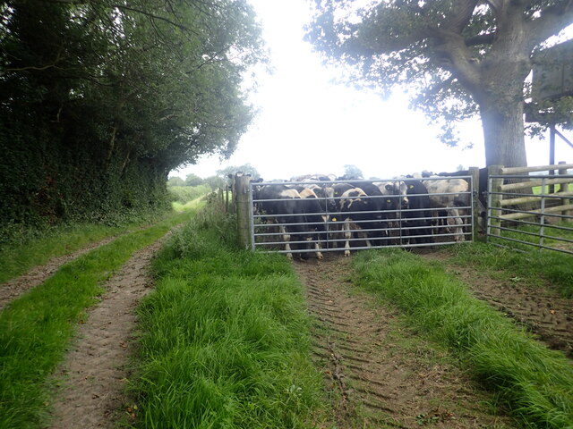
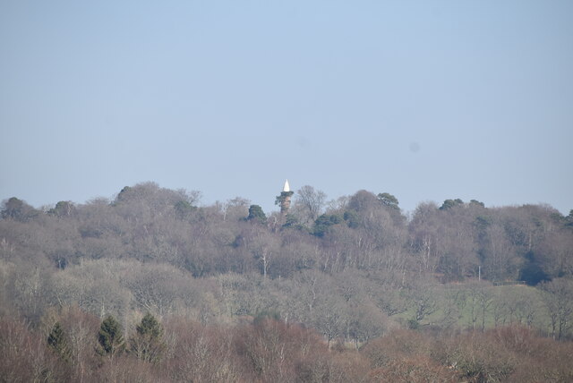
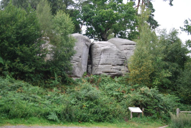
Eridge Park is a historic estate located in East Sussex, England, situated on the edge of the Sussex Downs and surrounded by beautiful moorland. The park covers over 3,000 acres of picturesque countryside, with rolling hills, woodlands, and meadows that provide a perfect setting for outdoor activities such as hiking, cycling, and birdwatching.

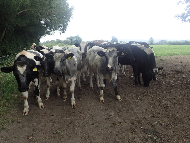
The estate is home to a variety of wildlife, including deer, foxes, and a wide range of bird species, making it a popular destination for nature enthusiasts. Eridge Park also boasts a rich history, with a grand country house dating back to the 15th century that has been home to various noble families over the centuries.

Visitors to Eridge Park can explore the extensive grounds, which feature a network of walking trails and bridleways that offer stunning views of the surrounding landscape. The estate also hosts a range of events throughout the year, including country fairs, music festivals, and equestrian competitions, making it a vibrant and dynamic destination for visitors of all ages.

If you have any feedback on the listing, please let us know in the comments section below.

Eridge Park Images

Images are sourced within 2km of 51.091437/0.24776284 or Grid Reference TQ5734. Thanks to Geograph Open Source API. All images are credited.

The Deer Park Campsite This is just outside the Deer Park Cafe.
The Deer Park Campsite
This is just outside the Deer Park Cafe.
Stream near Forge Wood House This stream flows from the main lake in Eridge Park.
Stream near Forge Wood House
This stream flows from the main lake in Eridge Park.
The Tunbridge Wells Circular Walk passes through Eridge Park The current Georgian-style house of Eridge Park was built in the late 1930s to replace the neo-Gothic Eridge Castle that had been inspired by Strawberry Hill House in Twickenham. The Castle had been begun in 1787. Eridge Park is said to be the oldest enclosed deer park in the country. The lakes were created in the 16th century to hold water to power iron works on the estate.
The Tunbridge Wells Circular Walk passes through Eridge Park
The current Georgian-style house of Eridge Park was built in the late 1930s to replace the neo-Gothic Eridge Castle that had been inspired by Strawberry Hill House in Twickenham. The Castle had been begun in 1787. Eridge Park is said to be the oldest enclosed deer park in the country. The lakes were created in the 16th century to hold water to power iron works on the estate.
Lake in Eridge Park The current Georgian-style house of Eridge Park was built in the late 1930s to replace the neo-Gothic Eridge Castle that had been inspired by Strawberry Hill House in Twickenham. The Castle had been begun in 1787. Eridge Park is said to be the oldest enclosed deer park in the country. The lakes were created in the 16th century to hold water to power iron works on the estate.

This view is from the Tunbridge Wells Circular Walk where it passes through the park.
Lake in Eridge Park
The current Georgian-style house of Eridge Park was built in the late 1930s to replace the neo-Gothic Eridge Castle that had been inspired by Strawberry Hill House in Twickenham. The Castle had been begun in 1787. Eridge Park is said to be the oldest enclosed deer park in the country. The lakes were created in the 16th century to hold water to power iron works on the estate. This view is from the Tunbridge Wells Circular Walk where it passes through the park.
The Tunbridge Wells Circular Walk passes through Eridge Park The current Georgian-style house of Eridge Park was built in the late 1930s to replace the neo-Gothic Eridge Castle that had been inspired by Strawberry Hill House in Twickenham. The Castle had been begun in 1787. Eridge Park is said to be the oldest enclosed deer park in the country. The lakes were created in the 16th century to hold water to power iron works on the estate.
The Tunbridge Wells Circular Walk passes through Eridge Park
The current Georgian-style house of Eridge Park was built in the late 1930s to replace the neo-Gothic Eridge Castle that had been inspired by Strawberry Hill House in Twickenham. The Castle had been begun in 1787. Eridge Park is said to be the oldest enclosed deer park in the country. The lakes were created in the 16th century to hold water to power iron works on the estate.
Outflow from the lake in Eridge Park The current Georgian-style house of Eridge Park was built in the late 1930s to replace the neo-Gothic Eridge Castle that had been inspired by Strawberry Hill House in Twickenham. The Castle had been begun in 1787. Eridge Park is said to be the oldest enclosed deer park in the country. The lakes were created in the 16th century to hold water to power iron works on the estate.

This view is from the Tunbridge Wells Circular Walk where it passes through the park. See <a title="https://www.geograph.org.uk/photo/6950791" href="https://www.geograph.org.uk/photo/6950791">Link</a>  for a view of the lake.
Outflow from the lake in Eridge Park
The current Georgian-style house of Eridge Park was built in the late 1930s to replace the neo-Gothic Eridge Castle that had been inspired by Strawberry Hill House in Twickenham. The Castle had been begun in 1787. Eridge Park is said to be the oldest enclosed deer park in the country. The lakes were created in the 16th century to hold water to power iron works on the estate. This view is from the Tunbridge Wells Circular Walk where it passes through the park. See Link for a view of the lake.
The Tunbridge Wells Circular Walk passes through Eridge Park The current Georgian-style house of Eridge Park was built in the late 1930s to replace the neo-Gothic Eridge Castle that had been inspired by Strawberry Hill House in Twickenham. The Castle had been begun in 1787. Eridge Park is said to be the oldest enclosed deer park in the country. The lakes were created in the 16th century to hold water to power iron works on the estate.
The Tunbridge Wells Circular Walk passes through Eridge Park
The current Georgian-style house of Eridge Park was built in the late 1930s to replace the neo-Gothic Eridge Castle that had been inspired by Strawberry Hill House in Twickenham. The Castle had been begun in 1787. Eridge Park is said to be the oldest enclosed deer park in the country. The lakes were created in the 16th century to hold water to power iron works on the estate.
Lake in Eridge Park The current Georgian-style house of Eridge Park was built in the late 1930s to replace the neo-Gothic Eridge Castle that had been inspired by Strawberry Hill House in Twickenham. The Castle had been begun in 1787. Eridge Park is said to be the oldest enclosed deer park in the country. The lakes were created in the 16th century to hold water to power iron works on the estate.

This view is from the Tunbridge Wells Circular Walk where it passes through the park. The house is at the top of the slope on the left, out of the picture.
Lake in Eridge Park
The current Georgian-style house of Eridge Park was built in the late 1930s to replace the neo-Gothic Eridge Castle that had been inspired by Strawberry Hill House in Twickenham. The Castle had been begun in 1787. Eridge Park is said to be the oldest enclosed deer park in the country. The lakes were created in the 16th century to hold water to power iron works on the estate. This view is from the Tunbridge Wells Circular Walk where it passes through the park. The house is at the top of the slope on the left, out of the picture.
Sham Farm Road The Deer Park Cafe and Camp Site is just ahead.
Sham Farm Road
The Deer Park Cafe and Camp Site is just ahead.
Bullocks next to a footpath The footpath leads from the A267 at Pococksgate to Down Lane. The bullocks had all come down to see what was going on as we passed by.
Bullocks next to a footpath
The footpath leads from the A267 at Pococksgate to Down Lane. The bullocks had all come down to see what was going on as we passed by.
Sheep rounded up on the Tunbridge Wells Circular Walk These sheep had been expertly rounded up by two sheepdogs.
Sheep rounded up on the Tunbridge Wells Circular Walk
These sheep had been expertly rounded up by two sheepdogs.
Saxonbury Tower
Saxonbury Tower
Cottages, Warren Farm Lane A 27 mile circular walk around the town of Tunbridge Wells. The route was established in 1989 as part of the centenary celebrations of the town being granted the Borough Charter. There is no official start or end to the walk. The walk visits Southborough, Pembury, Frant, Eridge, Groombridge and Speldhurst as well as Eridge Rocks and Harrison Rocks. It is well signed along its entire length. As well as the main path there are four link paths from Tunbridge Wells and High Brooms stations to meet the path at Groombridge, Speldhurst, Southborough and Hawkenbury.
Cottages, Warren Farm Lane
A 27 mile circular walk around the town of Tunbridge Wells. The route was established in 1989 as part of the centenary celebrations of the town being granted the Borough Charter. There is no official start or end to the walk. The walk visits Southborough, Pembury, Frant, Eridge, Groombridge and Speldhurst as well as Eridge Rocks and Harrison Rocks. It is well signed along its entire length. As well as the main path there are four link paths from Tunbridge Wells and High Brooms stations to meet the path at Groombridge, Speldhurst, Southborough and Hawkenbury.
Staircase Villa
Staircase Villa
Holy Trinity Church Grade II listed.
Holy Trinity Church
Grade II listed.
Holy Trinity Church Listed buildings and structures are officially designated as being of special architectural, historical or cultural significance. There are over half a million listed structures in the United Kingdom, covered by around 375,000 listings.
Listed status is more commonly associated with buildings or groups of buildings, however it can cover many other structures, including bridges, headstones, steps, ponds, monuments, walls, phone boxes, wrecks, parks, and heritage sites, and in more recent times a road crossing (Abbey Road) and graffiti art (Banksy 'Spy-booth') have been included.

In England and Wales there are three main listing designations;
Grade I (2.5%) - exceptional interest, sometimes considered to be internationally important.
Grade II* (5.5%) - particularly important buildings of more than special interest. 
Grade II (92%) - nationally important and of special interest. 

There are also locally listed structures (at the discretion of local authorities) using A, B and C designations.

In Scotland three classifications are also used but the criteria are different. There are around 47,500 Listed buildings.
Category A (8%)- generally equivalent to Grade I and II* in England and Wales
Category B (51%)- this appears generally to cover the ground of Grade II, recognising national importance.
Category C (41%)- buildings of local importance, probably with some overlap with English Grade II.

In Northern Ireland the criteria are similar to Scotland, but the classifications are:
Grade A (2.3%)
Grade B+ (4.7%)
Grade B (93%)

Read more at Wikipedia <span class="nowrap"><a title="http://en.wikipedia.org/wiki/Listed_building" rel="nofollow ugc noopener" href="http://en.wikipedia.org/wiki/Listed_building">Link</a><img style="margin-left:2px;" alt="External link" title="External link - shift click to open in new window" src="https://s1.geograph.org.uk/img/external.png" width="10" height="10"/></span>
Holy Trinity Church
Listed buildings and structures are officially designated as being of special architectural, historical or cultural significance. There are over half a million listed structures in the United Kingdom, covered by around 375,000 listings. Listed status is more commonly associated with buildings or groups of buildings, however it can cover many other structures, including bridges, headstones, steps, ponds, monuments, walls, phone boxes, wrecks, parks, and heritage sites, and in more recent times a road crossing (Abbey Road) and graffiti art (Banksy 'Spy-booth') have been included. In England and Wales there are three main listing designations; Grade I (2.5%) - exceptional interest, sometimes considered to be internationally important. Grade II* (5.5%) - particularly important buildings of more than special interest. Grade II (92%) - nationally important and of special interest. There are also locally listed structures (at the discretion of local authorities) using A, B and C designations. In Scotland three classifications are also used but the criteria are different. There are around 47,500 Listed buildings. Category A (8%)- generally equivalent to Grade I and II* in England and Wales Category B (51%)- this appears generally to cover the ground of Grade II, recognising national importance. Category C (41%)- buildings of local importance, probably with some overlap with English Grade II. In Northern Ireland the criteria are similar to Scotland, but the classifications are: Grade A (2.3%) Grade B+ (4.7%) Grade B (93%) Read more at Wikipedia LinkExternal link
Show me another place!

Eridge Park is located at Grid Ref: TQ5734 (Lat: 51.091437, Lng: 0.24776284)

Administrative County: East Sussex

District: Wealden

Police Authority: Sussex

What 3 Words

///requires.bead.thus. Near Town Row, East Sussex

Nearby Locations

Eridge Park

Related Wikis

Eridge Park

Eridge Park () is a village and historic park located north of the parish of Rotherfield, to the north-east of Crowborough in East Sussex, England. The...

Frant

Frant is a village and civil parish in the Wealden District of East Sussex, England, on the Kentish border about three miles (5 km) south of Royal Tunbridge...

St Alban's Church, Frant

St Alban's Church is a Church of England parish church in Frant, East Sussex, England. It was built in 1819–22 in a fifteenth-century gothic revival style...

Eridge Green

Eridge Green is a 8.4-hectare (21-acre) biological Site of Special Scientific Interest north-east of Crowborough in East Sussex. It is part of the 44 hectares...

Nearby Amenities

Located within 500m of 51.091437,0.24776284
Barrier: kissing_gate
Lat/Long: 51.0928723/0.2416179
The data included in this document is from www.openstreetmap.org. The data is made available under ODbL.

Have you been to Eridge Park?

Leave your review of Eridge Park below (or comments, questions and feedback).