Burwell Fen

Downs, Moorland in Cambridgeshire East Cambridgeshire

England

Burwell Fen

Church of St Etheldreda, Reach – 1978 Built in 1860 to the design of C F Hayward as a replacement for a ruinous medieval church. The War Memorial in the foreground dates from around 1920. Both are Listed Grade II.

The bus belonged to local operator Burwell & District, a small family firm whose principal service ran between Burwell and Cambridge. The business was sold to Eastern Counties (part of the National Bus Company) in 1979 after the owners failed to find a private buyer to continue independent operation. The bus seen here was on an enthusiast tour, and is one of several Daimler Fleetlines that were bought second hand from Nottingham City Transport in the mid 1970s.

This is one of a series of views featuring buses in the 60s, 70s, and 80s. <a title="https://www.geograph.org.uk/search.php?i=137652761" href="https://www.geograph.org.uk/search.php?i=137652761">Link</a>
Church of St Etheldreda, Reach – 1978 Credit: Alan Murray-Rust

Burwell Fen, located in Cambridgeshire, England, is a remarkable natural fenland habitat that encompasses both downs and moorland. Fens are a type of wetland characterized by their rich mineral and peat soil, making them incredibly fertile and biodiverse. Covering an extensive area, Burwell Fen is home to a diverse range of plant and animal species.

The downs in Burwell Fen are rolling hills covered with short grass and scattered shrubs. These open areas provide a perfect habitat for various bird species, including skylarks and meadow pipits. The downs are also home to various butterfly species, such as the common blue and the small copper, which thrive in the abundant wildflowers that grow in this habitat.

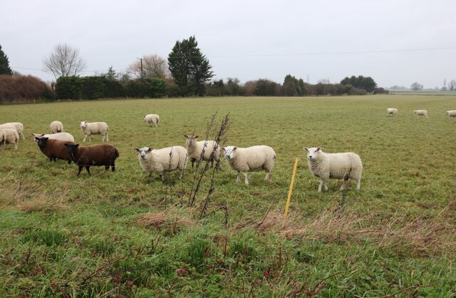
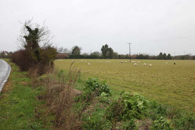
In contrast, the moorland of Burwell Fen is a wetter and more marshy area. Here, visitors can find a variety of wetland plants, including reeds and sedges, as well as several species of water-loving birds, such as the snipe and the bittern. The moorland is also home to the rare fen orchid, which adds to the uniqueness and beauty of this area.

Burwell Fen is not only a haven for wildlife but also provides valuable ecosystem services. The fenland acts as a natural floodplain, reducing the risk of flooding in surrounding areas. Additionally, the peat soil in the fen acts as a carbon sink, helping to mitigate climate change.

Overall, Burwell Fen in Cambridgeshire is a captivating and ecologically significant landscape, offering visitors a chance to experience the beauty and diversity of both downs and moorland habitats.

If you have any feedback on the listing, please let us know in the comments section below.
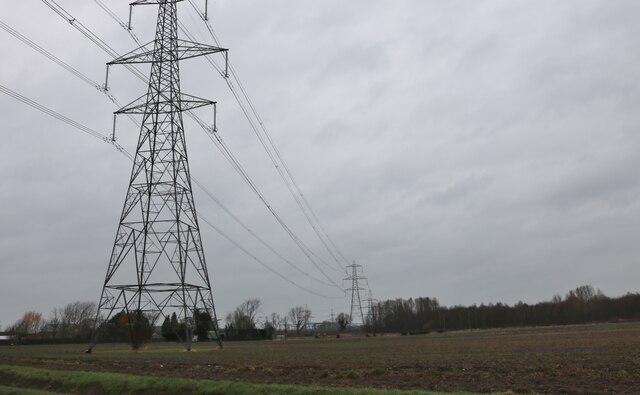
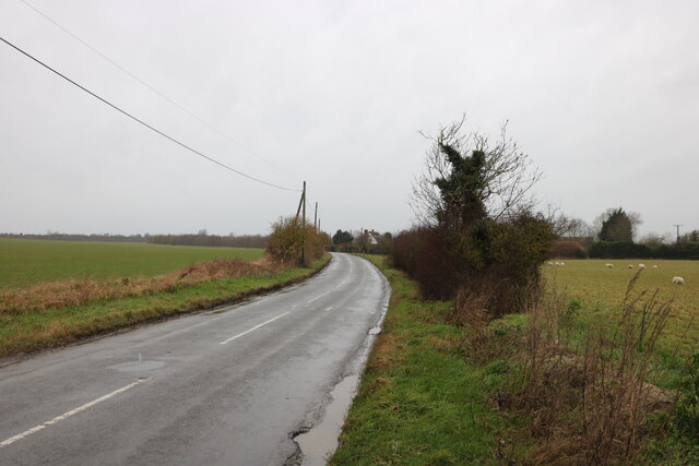
Burwell Fen Images

Images are sourced within 2km of 52.283365/0.30327905 or Grid Reference TL5767. Thanks to Geograph Open Source API. All images are credited.

Church of St Etheldreda, Reach – 1978 Built in 1860 to the design of C F Hayward as a replacement for a ruinous medieval church. The War Memorial in the foreground dates from around 1920. Both are Listed Grade II.

The bus belonged to local operator Burwell & District, a small family firm whose principal service ran between Burwell and Cambridge. The business was sold to Eastern Counties (part of the National Bus Company) in 1979 after the owners failed to find a private buyer to continue independent operation. The bus seen here was on an enthusiast tour, and is one of several Daimler Fleetlines that were bought second hand from Nottingham City Transport in the mid 1970s.

This is one of a series of views featuring buses in the 60s, 70s, and 80s. <a title="https://www.geograph.org.uk/search.php?i=137652761" href="https://www.geograph.org.uk/search.php?i=137652761">Link</a>
Church of St Etheldreda, Reach – 1978
Built in 1860 to the design of C F Hayward as a replacement for a ruinous medieval church. The War Memorial in the foreground dates from around 1920. Both are Listed Grade II. The bus belonged to local operator Burwell & District, a small family firm whose principal service ran between Burwell and Cambridge. The business was sold to Eastern Counties (part of the National Bus Company) in 1979 after the owners failed to find a private buyer to continue independent operation. The bus seen here was on an enthusiast tour, and is one of several Daimler Fleetlines that were bought second hand from Nottingham City Transport in the mid 1970s. This is one of a series of views featuring buses in the 60s, 70s, and 80s. Link
Burwell & District bus at Fair Green, Reach – 1978 Burwell & District was a small family firm whose main bus service ran between Burwell and Cambridge. The business was sold to Eastern Counties (part of the National Bus Company) in 1979. The bus (9DER) is a Daimler Fleetline with rather spartan Willowbrook bodywork, bought new in 1963.

This is one of a series of views featuring buses in the 60s, 70s, and 80s. <a title="https://www.geograph.org.uk/search.php?i=137652761" href="https://www.geograph.org.uk/search.php?i=137652761">Link</a>

The three nearest cottages on the left date back to around 1700 and are Listed Grade II. The nearest one was formerly the White Horse Inn.
Burwell & District bus at Fair Green, Reach – 1978
Burwell & District was a small family firm whose main bus service ran between Burwell and Cambridge. The business was sold to Eastern Counties (part of the National Bus Company) in 1979. The bus (9DER) is a Daimler Fleetline with rather spartan Willowbrook bodywork, bought new in 1963. This is one of a series of views featuring buses in the 60s, 70s, and 80s. Link The three nearest cottages on the left date back to around 1700 and are Listed Grade II. The nearest one was formerly the White Horse Inn.
Reach: onions only In the grounds of the church of St Etheldreda and the Holy Trinity. Your guess is as good as mine. I don't think there is any liturgical significance.
Reach: onions only
In the grounds of the church of St Etheldreda and the Holy Trinity. Your guess is as good as mine. I don't think there is any liturgical significance.
Reach War Memorial
Reach War Memorial
Fingerpost on Great Lane, Reach
Blackberry Droveway, Reach Leading to Reach Fen
Blackberry Droveway, Reach
Leading to Reach Fen
Pylons by Reach Road, Burwell
Sheep by Burwell Road, Reach They all looked up from their grazing when I arrived.
Sheep by Burwell Road, Reach
They all looked up from their grazing when I arrived.
Sheep grazing by Burwell Road, Reach
Burwell Road, Reach
Burwell Road, Reach
Burwell Road, Reach
Burwell Road, Reach
Fair Green, Reach
Fair Green, Reach
Church on Fair Green, Reach The Village Centre (hall) is on the left.
Church on Fair Green, Reach
The Village Centre (hall) is on the left.
Fair Green, Reach
Fair Green, Reach
Bus shelter on Fair Green, Reach
Fair Green, Reach
Fair Green, Reach
Reach: cottages on Fair Green The remarkably unattractive Victorian church is on the left.
Reach: cottages on Fair Green
The remarkably unattractive Victorian church is on the left.
Reach: Hill Farmhouse, Fair Green "Farmhouse, original C17 building with lobby entry plan retaining original central stack, rebuilt in C18 and mid C19. Rebuilding to south-east C18, local yellow gault brick with clunch gable and rear walls, to north-west C19 gault brick, plain tile roofs at two levels" (Grade II listing).
Reach: Hill Farmhouse, Fair Green
"Farmhouse, original C17 building with lobby entry plan retaining original central stack, rebuilt in C18 and mid C19. Rebuilding to south-east C18, local yellow gault brick with clunch gable and rear walls, to north-west C19 gault brick, plain tile roofs at two levels" (Grade II listing).
Show me another place!

Burwell Fen is located at Grid Ref: TL5767 (Lat: 52.283365, Lng: 0.30327905)

Administrative County: Cambridgeshire

District: East Cambridgeshire

Police Authority: Cambridgeshire

What 3 Words

///stickler.rucksack.informed. Near Burwell, Cambridgeshire

Nearby Locations

Hallard's Fen Burwell Fen

Related Wikis

Reach, Cambridgeshire

Reach is a small village and civil parish on the edge of the fenland in East Cambridgeshire, England at the north end of Devil's Dyke, about 1.5 miles...

Burwell, Cambridgeshire

Burwell is a village and civil parish in Cambridgeshire, England, some 10 miles (16 km) north-east of Cambridge. It lies on the south-east edge of the...

Burwell Castle

Burwell Castle was an unfinished medieval enclosure castle in Burwell, Cambridgeshire, England. == Details == Burwell Castle was built near the village...

Burwell Museum

The Burwell Museum (also known as Burwell Museum and Windmill) is located in Burwell, Cambridgeshire, England. The museum depicts life through the centuries...

Burwell railway station

Burwell railway station was on the Cambridge and Mildenhall branch of the Great Eastern Railway. After the closure of the line, the site of Burwell station...

Exning Road Halt railway station

Exning Road Halt railway station served the village of Exning, Suffolk, England from 1922 to 1962 on the Cambridge to Mildenhall railway. == History... ==

Wicken Fen

Wicken Fen is a 254.5-hectare (629-acre) biological Site of Special Scientific Interest west of Wicken in Cambridgeshire. It is also a National Nature...

Wicken, Cambridgeshire

Wicken is a small village on the edge of The Fens near Soham in East Cambridgeshire, ten miles north east of Cambridge and five miles south of Ely. It...

Nearby Amenities

Located within 500m of 52.283365,0.30327905
Power: tower
Source: Bing
Lat/Long: 52.2794791/0.3043522
Hallard's Fen
Created By: Potlatch 0.10b
Place: locality
Source: npe
Lat/Long: 52.2839637/0.3035082
Power: tower
Source: Bing
Lat/Long: 52.2797567/0.307105
Power: pole
Lat/Long: 52.2841541/0.305447
Power: pole
Lat/Long: 52.2867679/0.3055917
Power: pole
Lat/Long: 52.2831204/0.3053987
Power: pole
Lat/Long: 52.2876226/0.3056239
Power: pole
Lat/Long: 52.2852304/0.305514
Power: pole
Lat/Long: 52.2820883/0.3053182
Power: pole
Lat/Long: 52.2860575/0.3055489
Power: pole
Lat/Long: 52.2810571/0.3077566
Power: pole
Lat/Long: 52.281583/0.3064999
Power: pole
Lat/Long: 52.2827868/0.2960196
Power: pole
Lat/Long: 52.2814871/0.2991253
Power: pole
Lat/Long: 52.2800955/0.3024081
Power: pole
Lat/Long: 52.2820975/0.2976826
Power: pole
Lat/Long: 52.2808064/0.300747
The data included in this document is from www.openstreetmap.org. The data is made available under ODbL.

Have you been to Burwell Fen?

Leave your review of Burwell Fen below (or comments, questions and feedback).