Lady Fen

Downs, Moorland in Norfolk King's Lynn and West Norfolk

England

Lady Fen

The Ouse Washes: Welney Wildfowl and Wetlands Trust centre The Ouse Washes, also known as The Hundred Foot Washes, is an area of  grassland (washland) that can be deliberately flooded lying between the Old and New Bedford Rivers. These rivers are derived from the River Great Ouse, a major tributary of East Anglia's Wash. They were dug in the 16th & 17th centuries as part of a programme to drain The Fens of floodwater for agriculture. In 1630, King Charles I granted a drainage charter to the 4th Earl of Bedford who engaged the Dutch engineer Cornelius Vermuyden to construct the two Bedford rivers. The purpose of the new rivers was to facilitate drainage of the River Great Ouse between Earith and Downham Market. 
The New Bedford River flows through the entire length of the washland and The River Delph flows through the washes either side of Welney. The flood waters are contained between 2 parallel embankments - The Old Bedford Barrier Bank and the Hundred Foot Bank - and the area between the banks is approximately 20 miles long and half a mile wide in places. It is permanent grassland and used for livestock grazing when not flooded and acts as washland or flood reservoir allowing the flow of water to the sea to be contained and released in a controlled way during the winter and occasionally in summer.
Please visit <span class="nowrap"><a title="http://www.ousewashes.info/index.htm" rel="nofollow ugc noopener" href="http://www.ousewashes.info/index.htm">Link</a><img style="margin-left:2px;" alt="External link" title="External link - shift click to open in new window" src="https://s1.geograph.org.uk/img/external.png" width="10" height="10"/></span> for more information.
The Ouse Washes: Welney Wildfowl and Wetlands Trust centre Credit: Christopher Hilton

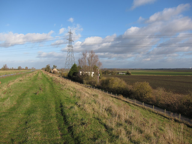
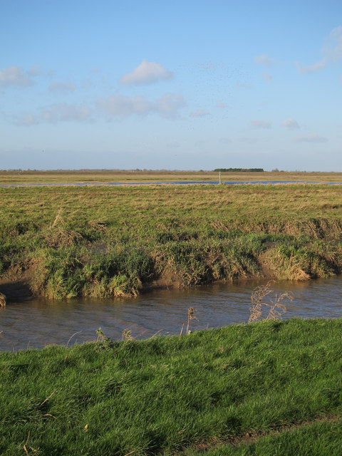
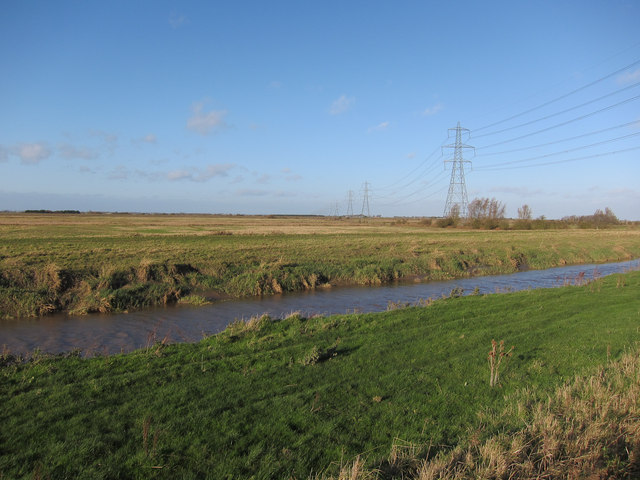
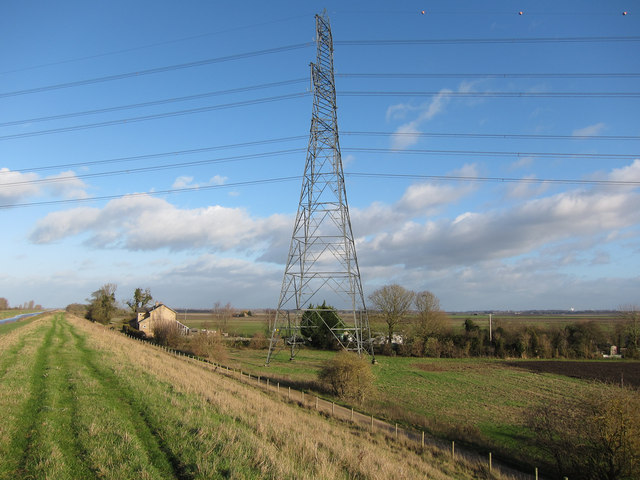
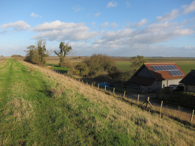
Lady Fen is a picturesque nature reserve located in Norfolk, England. It is a diverse and ecologically rich area, encompassing downs, moorland, and wetlands. Covering an area of approximately 200 hectares, Lady Fen is renowned for its natural beauty and its importance for wildlife conservation.

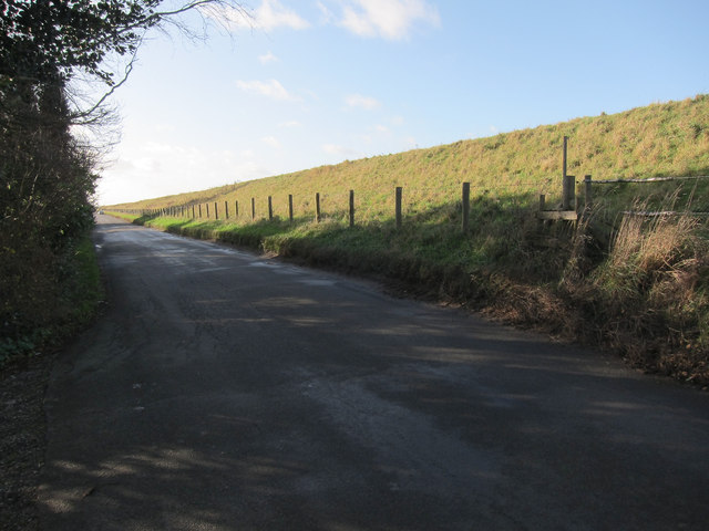
The reserve is characterized by its undulating downs, which offer stunning panoramic views of the surrounding countryside. These downs are adorned with an array of vibrant wildflowers, including orchids, cowslips, and harebells, creating a colorful tapestry during the summer months. It is also home to various species of grasses and sedges, contributing to the unique biodiversity of the area.

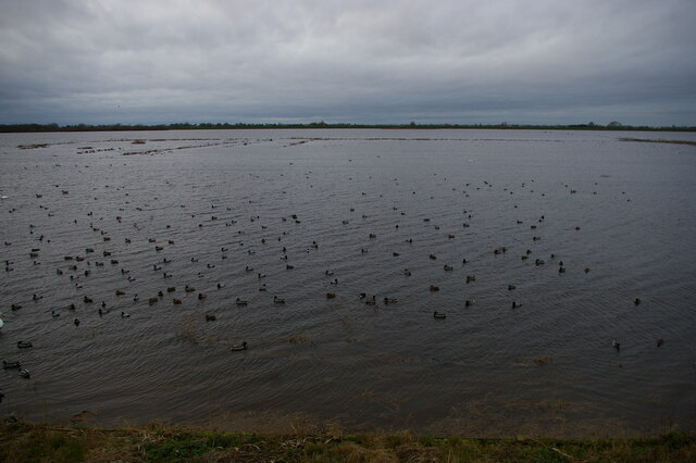
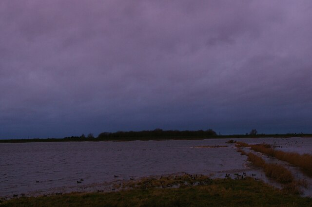
Lady Fen's moorland is a haven for many bird species, including the rare stone curlew and the Eurasian hobby. This habitat provides excellent breeding grounds for these birds, as well as a vital stopover site for migratory species. Moorland plants, such as heather and gorse, thrive in this environment, adding to the scenic beauty of the area.

The reserve's wetlands are a vital part of its ecosystem, providing a habitat for numerous amphibians, reptiles, and insects. The wetlands are dotted with small pools and marshes, which are home to various species of dragonflies, water lilies, and reeds. This diverse range of habitats ensures that Lady Fen is a haven for wildlife enthusiasts and nature lovers alike.

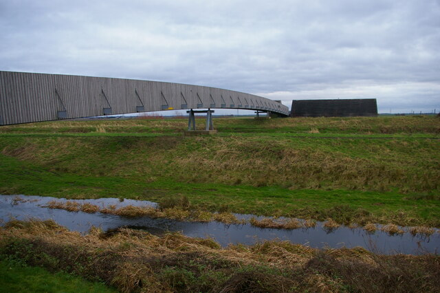
Managed by the Norfolk Wildlife Trust, Lady Fen offers visitors the opportunity to explore its natural wonders through a network of well-maintained trails. The reserve also hosts educational programs and events, providing a platform for learning and appreciation of the local flora and fauna.

If you have any feedback on the listing, please let us know in the comments section below.

Lady Fen Images

Images are sourced within 2km of 52.529575/0.28880852 or Grid Reference TL5594. Thanks to Geograph Open Source API. All images are credited.

The Ouse Washes: Welney Wildfowl and Wetlands Trust centre The Ouse Washes, also known as The Hundred Foot Washes, is an area of  grassland (washland) that can be deliberately flooded lying between the Old and New Bedford Rivers. These rivers are derived from the River Great Ouse, a major tributary of East Anglia's Wash. They were dug in the 16th & 17th centuries as part of a programme to drain The Fens of floodwater for agriculture. In 1630, King Charles I granted a drainage charter to the 4th Earl of Bedford who engaged the Dutch engineer Cornelius Vermuyden to construct the two Bedford rivers. The purpose of the new rivers was to facilitate drainage of the River Great Ouse between Earith and Downham Market. 
The New Bedford River flows through the entire length of the washland and The River Delph flows through the washes either side of Welney. The flood waters are contained between 2 parallel embankments - The Old Bedford Barrier Bank and the Hundred Foot Bank - and the area between the banks is approximately 20 miles long and half a mile wide in places. It is permanent grassland and used for livestock grazing when not flooded and acts as washland or flood reservoir allowing the flow of water to the sea to be contained and released in a controlled way during the winter and occasionally in summer.
Please visit <span class="nowrap"><a title="http://www.ousewashes.info/index.htm" rel="nofollow ugc noopener" href="http://www.ousewashes.info/index.htm">Link</a><img style="margin-left:2px;" alt="External link" title="External link - shift click to open in new window" src="https://s1.geograph.org.uk/img/external.png" width="10" height="10"/></span> for more information.
The Ouse Washes: Welney Wildfowl and Wetlands Trust centre
The Ouse Washes, also known as The Hundred Foot Washes, is an area of grassland (washland) that can be deliberately flooded lying between the Old and New Bedford Rivers. These rivers are derived from the River Great Ouse, a major tributary of East Anglia's Wash. They were dug in the 16th & 17th centuries as part of a programme to drain The Fens of floodwater for agriculture. In 1630, King Charles I granted a drainage charter to the 4th Earl of Bedford who engaged the Dutch engineer Cornelius Vermuyden to construct the two Bedford rivers. The purpose of the new rivers was to facilitate drainage of the River Great Ouse between Earith and Downham Market. The New Bedford River flows through the entire length of the washland and The River Delph flows through the washes either side of Welney. The flood waters are contained between 2 parallel embankments - The Old Bedford Barrier Bank and the Hundred Foot Bank - and the area between the banks is approximately 20 miles long and half a mile wide in places. It is permanent grassland and used for livestock grazing when not flooded and acts as washland or flood reservoir allowing the flow of water to the sea to be contained and released in a controlled way during the winter and occasionally in summer. Please visit LinkExternal link for more information.
Ouse Washes, Welney Wetland and Wildfowl Trust centre The Ouse Washes, also known as The Hundred Foot Washes, is an area of  grassland (washland) that can be deliberately flooded lying between the Old and New Bedford Rivers. These rivers are derived from the River Great Ouse, a major tributary of East Anglia's Wash. They were dug in the 16th & 17th centuries as part of a programme to drain The Fens of floodwater for agriculture. In 1630, King Charles I granted a drainage charter to the 4th Earl of Bedford who engaged the Dutch engineer Cornelius Vermuyden to construct the two Bedford rivers. The purpose of the new rivers was to facilitate drainage of the River Great Ouse between Earith and Downham Market. 
The New Bedford River flows through the entire length of the washland and The River Delph flows through the washes either side of Welney. The flood waters are contained between 2 parallel embankments - The Old Bedford Barrier Bank and the Hundred Foot Bank - and the area between the banks is approximately 20 miles long and half a mile wide in places. It is permanent grassland and used for livestock grazing when not flooded and acts as washland or flood reservoir allowing the flow of water to the sea to be contained and released in a controlled way during the winter and occasionally in summer.
Please visit <span class="nowrap"><a title="http://www.ousewashes.info/index.htm" rel="nofollow ugc noopener" href="http://www.ousewashes.info/index.htm">Link</a><img style="margin-left:2px;" alt="External link" title="External link - shift click to open in new window" src="https://s1.geograph.org.uk/img/external.png" width="10" height="10"/></span> for more information.
Ouse Washes, Welney Wetland and Wildfowl Trust centre
The Ouse Washes, also known as The Hundred Foot Washes, is an area of grassland (washland) that can be deliberately flooded lying between the Old and New Bedford Rivers. These rivers are derived from the River Great Ouse, a major tributary of East Anglia's Wash. They were dug in the 16th & 17th centuries as part of a programme to drain The Fens of floodwater for agriculture. In 1630, King Charles I granted a drainage charter to the 4th Earl of Bedford who engaged the Dutch engineer Cornelius Vermuyden to construct the two Bedford rivers. The purpose of the new rivers was to facilitate drainage of the River Great Ouse between Earith and Downham Market. The New Bedford River flows through the entire length of the washland and The River Delph flows through the washes either side of Welney. The flood waters are contained between 2 parallel embankments - The Old Bedford Barrier Bank and the Hundred Foot Bank - and the area between the banks is approximately 20 miles long and half a mile wide in places. It is permanent grassland and used for livestock grazing when not flooded and acts as washland or flood reservoir allowing the flow of water to the sea to be contained and released in a controlled way during the winter and occasionally in summer. Please visit LinkExternal link for more information.
The Ouse Washes: Welney Wildfowl and Wetlands Trust centre Seen here, looking back from the wetland reserve, is the footbridge from the WWT centre building over the New Bedford River.  The River itself is invisible behind embankments: the water in the foreground is a subsidiary drain.
The Ouse Washes: Welney Wildfowl and Wetlands Trust centre
Seen here, looking back from the wetland reserve, is the footbridge from the WWT centre building over the New Bedford River. The River itself is invisible behind embankments: the water in the foreground is a subsidiary drain.
Sunset over the New Bedford River Viewed from the footbridge at the WWT Welney Wetland Centre.
Sunset over the New Bedford River
Viewed from the footbridge at the WWT Welney Wetland Centre.
Bridleway along Ouse Washes Next stop Denver Sluice.
Bridleway along Ouse Washes
Next stop Denver Sluice.
New Bedford River and Ouse Washes The river is tidal at this point. The washes have some standing water but not much for the time of year after a dry summer and autumn.
New Bedford River and Ouse Washes
The river is tidal at this point. The washes have some standing water but not much for the time of year after a dry summer and autumn.
Power lines across the Ouse Washes Looking over the New Bedford River (also known as Hundred Foot Drain).
Power lines across the Ouse Washes
Looking over the New Bedford River (also known as Hundred Foot Drain).
Pylon by Ouse Washes With the bridleway to Denver Sluice going under the power lines.
Pylon by Ouse Washes
With the bridleway to Denver Sluice going under the power lines.
Solar panels at Wry Necked Mill These solar panels have become fairly common recently. They are paid for by the homeowners but in return they get a very good rate for the electricity produced, through the power companies and therefore ultimately their customers. The scheme is government backed but run through the energy companies so doesn't count as an official Private Finance Initiative (PFI) scheme, but ultimately as we all have to pay our energy bills it effectively is. The rates for electricity produced are to be cut in December 2011, leading to much longer payback periods for the investment (about 10-15 years when these were installed, the contract being for 25 years).
Solar panels at Wry Necked Mill
These solar panels have become fairly common recently. They are paid for by the homeowners but in return they get a very good rate for the electricity produced, through the power companies and therefore ultimately their customers. The scheme is government backed but run through the energy companies so doesn't count as an official Private Finance Initiative (PFI) scheme, but ultimately as we all have to pay our energy bills it effectively is. The rates for electricity produced are to be cut in December 2011, leading to much longer payback periods for the investment (about 10-15 years when these were installed, the contract being for 25 years).
Ouse Washes With a sluice into the New Bedford River.
Ouse Washes
With a sluice into the New Bedford River.
Ouse Washes A small flooded area but the washes were still largely dry.
Ouse Washes
A small flooded area but the washes were still largely dry.
Bridleway along Ouse Washes The power lines are coloured, presumably to try to make them more visible to the swans and ducks that winter on the washes.
Bridleway along Ouse Washes
The power lines are coloured, presumably to try to make them more visible to the swans and ducks that winter on the washes.
Ouse Washes With some power lines crossing the washes and signs warning against casting fishing line too close to the wires.
Ouse Washes
With some power lines crossing the washes and signs warning against casting fishing line too close to the wires.
Stile on Hundred Foot Bank Linking the road and the bridleway along the top of the bank.
Stile on Hundred Foot Bank
Linking the road and the bridleway along the top of the bank.
Hundred Foot bank Looking towards Bank Farm with the access bridge to the Welney nature reserve beyond.
Hundred Foot bank
Looking towards Bank Farm with the access bridge to the Welney nature reserve beyond.
Bridleway along Ouse Washes With some of the houses by Hundred Foot Bank just northeast of where the road turns away from the washes.
Bridleway along Ouse Washes
With some of the houses by Hundred Foot Bank just northeast of where the road turns away from the washes.
Bridleway along Ouse Washes The gates where the road turns away from the washes provide a link between the bridleway and the road (that doesn't involve ducking through the barbed wire fence)
Bridleway along Ouse Washes
The gates where the road turns away from the washes provide a link between the bridleway and the road (that doesn't involve ducking through the barbed wire fence)
Track across Welney Fen With the plume from <a href="https://www.geograph.org.uk/photo/575821">TL6597 : Wissington Sugar Factory</a> visible (just over 10km away).
Track across Welney Fen
With the plume from TL6597 : Wissington Sugar Factory visible (just over 10km away).
Show me another place!

Lady Fen is located at Grid Ref: TL5594 (Lat: 52.529575, Lng: 0.28880852)

Administrative County: Norfolk

District: King's Lynn and West Norfolk

Police Authority: Norfolk

What 3 Words

///shape.loopholes.lined. Near Southery, Norfolk

Nearby Locations

Lady Fen

Related Wikis

Hilgay railway station

Hilgay railway station was a station in Hilgay, Norfolk, United Kingdom which is now closed. It was on the Fen Line between King's Lynn and Cambridge....

Welney

Welney is a village and civil parish in the Fens of England, and the county of Norfolk. The village is about 10 miles (16 km) south-west of the town of...

Tipps End

Tipps End is an English hamlet on the B1100 road between Welney and Christchurch, Cambridgeshire. It is also sometimes referred to as "Tips End". It is...

Black Horse Drove

Black Horse Drove is a linear hamlet that lies 7 miles (11 km) north-north-east of Ely in Cambridgeshire, England in the civil parish of Littleport ....

Ouse Bridge railway station

Ouse Bridge railway station was a railway station in Norfolk, England. == History == The Lynn and Ely Railway (L&ER) had opened between King's Lynn and...

River Wissey

The River Wissey is a river in Norfolk, eastern England. It rises near Bradenham, and flows for nearly 31 miles (50 km) to join the River Great Ouse at...

Modeney Priory

Modeney Priory—also spelled Modney and Modeny—was a Benedictine priory in the civil parish of Hilgay, Norfolk, England. Located less than a mile east of...

Nordelph

Nordelph is a civil parish near Downham Market in the English county of Norfolk. The parish covers an area of 16.57 km2 (6.40 sq mi) and had a population...

Nearby Amenities

Located within 500m of 52.529575,0.28880852
The data included in this document is from www.openstreetmap.org. The data is made available under ODbL.

Have you been to Lady Fen?

Leave your review of Lady Fen below (or comments, questions and feedback).