The Smeeth

Downs, Moorland in Norfolk King's Lynn and West Norfolk

England

The Smeeth

Dismantled railway, Marshland St. James: aerial 2022
Dismantled railway, Marshland St. James: aerial 2022 Credit: Chris

The Smeeth, located in Norfolk, England, is a picturesque area that comprises downs and moorland. Stretching across vast expanses of rolling hills and open grasslands, this region offers a diverse and scenic landscape.

The downs of The Smeeth are characterized by their gently sloping hills, covered in lush green grasses and scattered with wildflowers. These hills provide breathtaking panoramic views of the surrounding countryside, making it a popular destination for hikers, nature enthusiasts, and photographers alike.

Adjacent to the downs, the moorland of The Smeeth offers a striking contrast with its rugged and untamed beauty. Here, visitors can explore expansive heathlands, dotted with gorse bushes, bracken, and heather. The moorland is also home to a variety of wildlife, including birds, butterflies, and small mammals, making it a haven for nature lovers.

The Smeeth's downs and moorland are crisscrossed by a network of walking trails and footpaths, allowing visitors to explore the area and take in its natural wonders. The trails vary in difficulty, catering to both casual walkers and experienced hikers. Along these routes, one can encounter ancient burial mounds, remnants of old settlements, and even the occasional grazing sheep or cattle.

Overall, The Smeeth in Norfolk offers a captivating blend of downs and moorland, providing visitors with a scenic retreat where they can immerse themselves in the beauty of nature and enjoy the tranquility of the countryside.

If you have any feedback on the listing, please let us know in the comments section below.
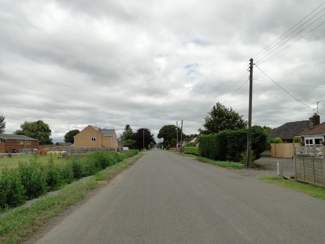
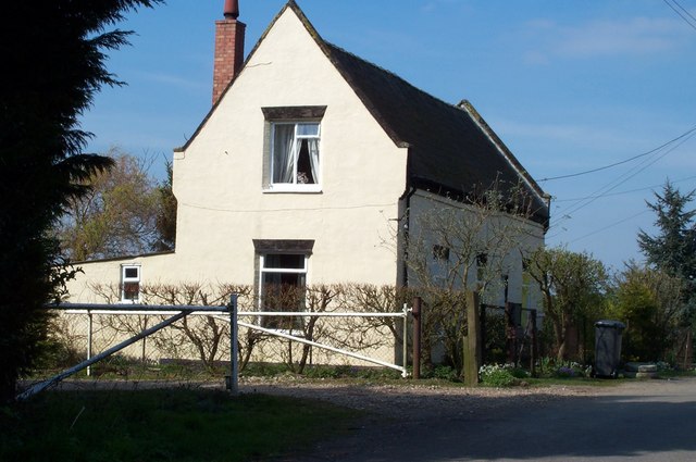
The Smeeth Images

Images are sourced within 2km of 52.659815/0.25719011 or Grid Reference TF5209. Thanks to Geograph Open Source API. All images are credited.

Dismantled railway, Marshland St. James: aerial 2022
Bonnett's Lane junction on Smeeth Road, Marshland
New house at Fenberry Fruit Farm, Marshland
Rands Drove Rands Road on the map but Rands Drove on the road sign.
Rands Drove
Rands Road on the map but Rands Drove on the road sign.
School Road
School Road
School Road
School Road
Fields by School Road
Orchard by Moyse's Bank
Moyse's Bank
Moyse's Bank
Forty Foot Drain From Forty Foot Bridge
Forty Foot Drain
From Forty Foot Bridge
School Road at Forty Foot Bridge
Horse paddocks by School Road Another non-productive use of agricultural land, presumably the next in the firing line from the Environment Minister after solar farms.
Horse paddocks by School Road
Another non-productive use of agricultural land, presumably the next in the firing line from the Environment Minister after solar farms.
Marshland Service Centre
Village sign in Smeeth Road, Marshland St James Village signs are typically placed along the principal road or in a prominent location such as a village green or close by the church. The design often depicts a particularly feature of the village or a scene from its history, heritage, or culture. They are typically made of wood or metal or a combination of both, the designs are often made by the local community.
Although they do appear in villages and towns all over the country they are more prominent in East Anglia than elsewhere in the country.
Village sign in Smeeth Road, Marshland St James
Village signs are typically placed along the principal road or in a prominent location such as a village green or close by the church. The design often depicts a particularly feature of the village or a scene from its history, heritage, or culture. They are typically made of wood or metal or a combination of both, the designs are often made by the local community. Although they do appear in villages and towns all over the country they are more prominent in East Anglia than elsewhere in the country.
The War Memorial at Marshland St. James The memorial faces the road and is situated just inside the cemetery gates. It is a memorial to the 16 men of Marshland Smeeth, Marshland Fen who lost their lives in WW1 as well as the five that were lost in WW2.
The War Memorial at Marshland St. James
The memorial faces the road and is situated just inside the cemetery gates. It is a memorial to the 16 men of Marshland Smeeth, Marshland Fen who lost their lives in WW1 as well as the five that were lost in WW2.
Fruit Farm Packhouse off Smeeth Road
Bowling Green at The Smeeth
Fine willows by the Smeeth Lode near Trafford House
Show me another place!

The Smeeth is located at Grid Ref: TF5209 (Lat: 52.659815, Lng: 0.25719011)

Administrative County: Norfolk

District: King's Lynn and West Norfolk

Police Authority: Norfolk

What 3 Words

///pinks.built.proper. Near Emneth, Norfolk

Related Wikis

Related Videos

March to Kings Lynn by bike

Check this great 26 mile bike ride from March to Kings Lynn. Passing.. Whitemoor prison, Twenty Foot River station, Waldersea ...

Home For Sale St Johns Fen End ABODA Fine Homes

YOU WILL LOVE!!!! Arriving home through your electric gates and entering your private grounds to your exquisite dream home, ...

Home For Sale St Johns Fen End ABODA Fine Homes

YOU WILL LOVE!!!! Arriving home through your electric gates and entering your private grounds to your exquisite dream home, ...

Nearby Amenities

Located within 500m of 52.659815,0.25719011
Marker: post
Source: survey
Utility: gas
Lat/Long: 52.6623354/0.2591953
The data included in this document is from www.openstreetmap.org. The data is made available under ODbL.

Have you been to The Smeeth?

Leave your review of The Smeeth below (or comments, questions and feedback).