Little Wilbraham Fen

Downs, Moorland in Cambridgeshire South Cambridgeshire

England

Little Wilbraham Fen

Through wheat to Fulbourn This path - always well defined - runs from Hawk Mill Farm at Little Wilbraham to Fulbourn (ahead). These fields are near the southern end of the Cambridgeshire Fens and are not so pancake-flat as those further north. Comparable views: <a href="https://www.geograph.org.uk/photo/5499134">TL5357 : Path through beans</a> and <a href="https://www.geograph.org.uk/photo/6462676">TL5357 : Footpath to Fulbourn</a>.
Through wheat to Fulbourn Credit: John Sutton

Little Wilbraham Fen is a picturesque village located in the county of Cambridgeshire, England. Situated approximately seven miles east of the city of Cambridge, the village is nestled amidst the enchanting landscape of the Cambridgeshire Fens. The area is characterized by its flat and fertile terrain, offering stunning views of vast expanses of marshland and meadows.

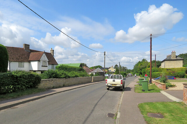
The village itself is relatively small, with a population of around 300 residents. It exudes a peaceful and idyllic charm, making it a desirable location for those seeking a tranquil countryside retreat. The architectural style of the village is predominantly traditional, with charming thatched cottages and historic buildings that add to its rural appeal.

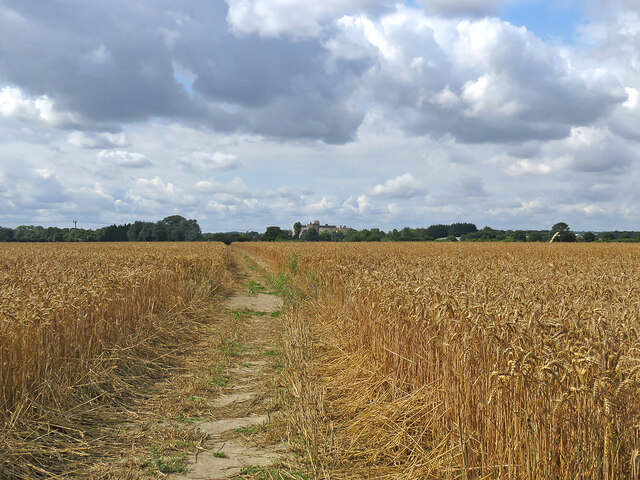
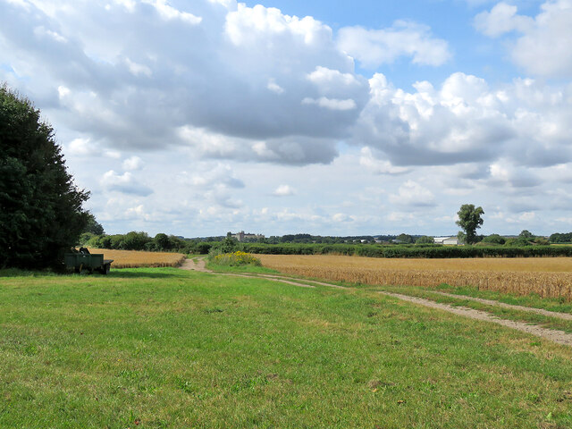
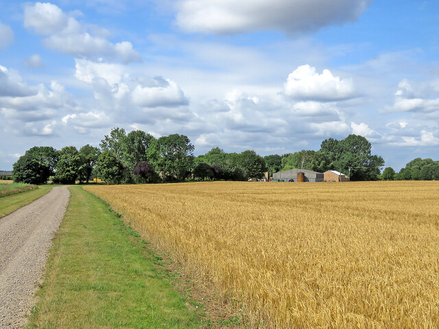
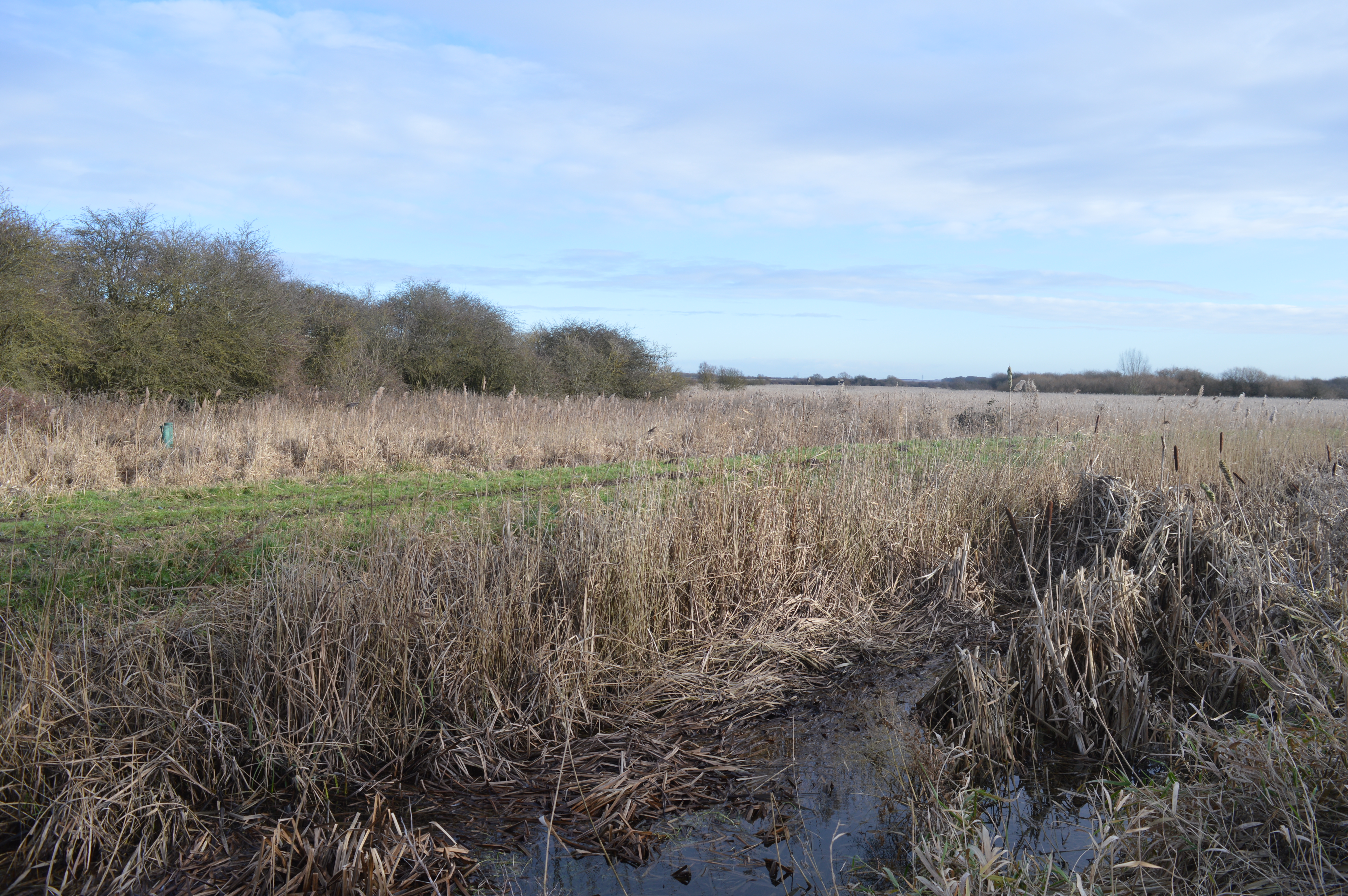
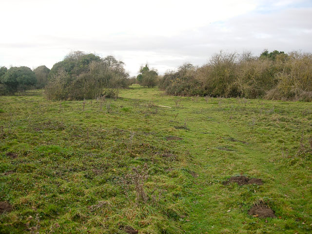
The surrounding area is abundant in natural beauty, boasting a range of habitats such as downs and moorland. This diverse landscape provides a sanctuary for various wildlife species, making it a haven for nature enthusiasts and birdwatchers. The fenland area is crisscrossed by an intricate network of waterways, including the River Cam, which offers opportunities for boating and fishing.

Little Wilbraham Fen is also dotted with several historic landmarks, including the St. John the Evangelist Church, a Grade II listed building with a rich history dating back to the 13th century. Additionally, the village is home to a local pub, providing a cozy spot for residents and visitors to socialize and enjoy traditional British cuisine.

Overall, Little Wilbraham Fen is a charming and unspoiled village, offering a serene escape from the hustle and bustle of city life. Its natural beauty, historical significance, and tranquil atmosphere make it a hidden gem within the Cambridgeshire countryside.

If you have any feedback on the listing, please let us know in the comments section below.

Little Wilbraham Fen Images

Images are sourced within 2km of 52.20631/0.22801224 or Grid Reference TL5258. Thanks to Geograph Open Source API. All images are credited.

Through wheat to Fulbourn This path - always well defined - runs from Hawk Mill Farm at Little Wilbraham to Fulbourn (ahead). These fields are near the southern end of the Cambridgeshire Fens and are not so pancake-flat as those further north. Comparable views: <a href="https://www.geograph.org.uk/photo/5499134">TL5357 : Path through beans</a> and <a href="https://www.geograph.org.uk/photo/6462676">TL5357 : Footpath to Fulbourn</a>.
Through wheat to Fulbourn
This path - always well defined - runs from Hawk Mill Farm at Little Wilbraham to Fulbourn (ahead). These fields are near the southern end of the Cambridgeshire Fens and are not so pancake-flat as those further north. Comparable views: TL5357 : Path through beans and TL5357 : Footpath to Fulbourn.
From Hawk Mill Farm to Fulbourn The farm track is shared by the public footpath to Fulbourn, which diverges to the left 150 yards or so ahead. The S&B Herba plant on Station Road in Fulbourn shows on the skyline just to the left of centre.
From Hawk Mill Farm to Fulbourn
The farm track is shared by the public footpath to Fulbourn, which diverges to the left 150 yards or so ahead. The S&B Herba plant on Station Road in Fulbourn shows on the skyline just to the left of centre.
Little Wilbraham: a barley field at Hawk Mill Farm The farm road is shared by a public footpath, which passes through the farmyard. Thereafter, turn left for Fulbourn or right to Quy, both pleasant routes.
Little Wilbraham: a barley field at Hawk Mill Farm
The farm road is shared by a public footpath, which passes through the farmyard. Thereafter, turn left for Fulbourn or right to Quy, both pleasant routes.
Little Wilbraham High Street A sunny early-August morning which was about to cloud over. For a better idea of the Grade II listed 16th-century house on the left, see <a href="https://www.geograph.org.uk/photo/5312748">TL5458 : Little Wilbraham: White Hall</a>. I was taken by the bright green corrugated-iron roof of the outbuildings next door and the post box's vivid splash of red opposite.
Little Wilbraham High Street
A sunny early-August morning which was about to cloud over. For a better idea of the Grade II listed 16th-century house on the left, see TL5458 : Little Wilbraham: White Hall. I was taken by the bright green corrugated-iron roof of the outbuildings next door and the post box's vivid splash of red opposite.
The A1303 This is a very busy road and waiting for a gap in the traffic took some time, even so there is a lorry and car visible.
The A1303
This is a very busy road and waiting for a gap in the traffic took some time, even so there is a lorry and car visible.
Working the land in November Sugar beet has been lifted from this large field on the edge of the Cambridgeshire Fens and is on its way to the refinery - see <a href="https://www.geograph.org.uk/photo/7013788">TL5159 : Stow-cum-Quy: loading sugar beet</a>, taken a couple of minutes earlier. Stow-cum-Quy church tower is on the skyline in the centre of the picture.
Working the land in November
Sugar beet has been lifted from this large field on the edge of the Cambridgeshire Fens and is on its way to the refinery - see TL5159 : Stow-cum-Quy: loading sugar beet, taken a couple of minutes earlier. Stow-cum-Quy church tower is on the skyline in the centre of the picture.
Stow-cum-Quy: loading sugar beet Beet is piled at the edge of the field and a tractor and a conveyor transfer it to the lorry which will take it to the sugar refinery (the nearest is at Bury St Edmunds).
Stow-cum-Quy: loading sugar beet
Beet is piled at the edge of the field and a tractor and a conveyor transfer it to the lorry which will take it to the sugar refinery (the nearest is at Bury St Edmunds).
On Little Wilbraham Road in November The long narrow plantation marks the line of part of the main runway of Bottisham Airfield (1940-6), which at first had a grass runway. According to the American Air Museum in Britain website “The P-47 Thunderbolts of the 361st Fighter Group damaged the surfaces of the airfield so much in the first months of flying from Bottisham that American engineers were called in to lay a new runway. In January 1944 they constructed a 1,470-yard-long runway with pierced-steel planking in just three days”.

These images may be of interest: <a href="https://www.geograph.org.uk/photo/5991392">TL5458 : Little Wilbraham: a farm track with a history</a>, <a href="https://www.geograph.org.uk/photo/5610857">TL5460 : Restored buildings at Bottisham Airfield Museum</a> and <a href="https://www.geograph.org.uk/photo/5610851">TL5460 : The Stars and Stripes at Bottisham Airfield Museum</a>.
On Little Wilbraham Road in November
The long narrow plantation marks the line of part of the main runway of Bottisham Airfield (1940-6), which at first had a grass runway. According to the American Air Museum in Britain website “The P-47 Thunderbolts of the 361st Fighter Group damaged the surfaces of the airfield so much in the first months of flying from Bottisham that American engineers were called in to lay a new runway. In January 1944 they constructed a 1,470-yard-long runway with pierced-steel planking in just three days”. These images may be of interest: TL5458 : Little Wilbraham: a farm track with a history, TL5460 : Restored buildings at Bottisham Airfield Museum and TL5460 : The Stars and Stripes at Bottisham Airfield Museum.
Gulls in a fenland field After being disturbed, these gulls had briefly circled (<a href="https://www.geograph.org.uk/photo/7014143">TL5357 : Gulls circling on a November morning</a>) before settling again on this autumn-sown field north of the Fulbourn to Great Wilbraham road. The fields round these two villages are the southernmost in the Cambridgeshire Fens.
Gulls in a fenland field
After being disturbed, these gulls had briefly circled (TL5357 : Gulls circling on a November morning) before settling again on this autumn-sown field north of the Fulbourn to Great Wilbraham road. The fields round these two villages are the southernmost in the Cambridgeshire Fens.
Gulls circling on a November morning Something disturbed these gulls before I could take a picture of them on the ground. They briefly circled before settling again on this autumn-sown field north of the Fulbourn to Great Wilbraham road (<a href="https://www.geograph.org.uk/photo/7014134">TL5357 : Gulls in a fenland field</a>). The fields round these two villages are the southernmost in the Cambridgeshire Fens.
Gulls circling on a November morning
Something disturbed these gulls before I could take a picture of them on the ground. They briefly circled before settling again on this autumn-sown field north of the Fulbourn to Great Wilbraham road (TL5357 : Gulls in a fenland field). The fields round these two villages are the southernmost in the Cambridgeshire Fens.
Fulbourn to the Wilbrahams in December Not far out of Fulbourn on the road to Great and Little Wilbraham (ahead). These are the three most southerly villages in the Cambridgeshire Fens.
Fulbourn to the Wilbrahams in December
Not far out of Fulbourn on the road to Great and Little Wilbraham (ahead). These are the three most southerly villages in the Cambridgeshire Fens.
Cycleway to the A1303 Newmarket Road Off High Ditch Road
Fen Ditton Cycleway No.51
Cycleway to the A1303 Newmarket Road
Off High Ditch Road Fen Ditton Cycleway No.51
High Ditch Road, Fen Ditton At the junction with the A1303 Newmarket Road
High Ditch Road, Fen Ditton
At the junction with the A1303 Newmarket Road
Cycleway signpost on High Ditch Road <span class="nowrap"><a title="https://en.wikipedia.org/wiki/Fen_Ditton" rel="nofollow ugc noopener" href="https://en.wikipedia.org/wiki/Fen_Ditton">Link</a><img style="margin-left:2px;" alt="External link" title="External link - shift click to open in new window" src="https://s1.geograph.org.uk/img/external.png" width="10" height="10"/></span>
Cycleway signpost on High Ditch Road
High Ditch Road, Fen Ditton At the junction with the A1303 Newmarket Road
High Ditch Road, Fen Ditton
At the junction with the A1303 Newmarket Road
Cycleway to the A1303 Newmarket Road Off High Ditch Road
Fen Ditton Cycleway No.51
Cycleway to the A1303 Newmarket Road
Off High Ditch Road Fen Ditton Cycleway No.51
Cycleway signpost on High Ditch Road Fen Ditton Cycleway No.51
Cycleway signpost on High Ditch Road
Fen Ditton Cycleway No.51
Cycleway signpost on High Ditch Road Fen Ditton Cycleway No.51
Cycleway signpost on High Ditch Road
Fen Ditton Cycleway No.51
Show me another place!

Little Wilbraham Fen is located at Grid Ref: TL5258 (Lat: 52.20631, Lng: 0.22801224)

Administrative County: Cambridgeshire

District: South Cambridgeshire

Police Authority: Cambridgeshire

What 3 Words

///asset.excusing.daffodils. Near Fulbourn, Cambridgeshire

Nearby Locations

Little Wilbraham Fen

Related Wikis

Wilbraham Fens

Wilbraham Fens is a 62.5-hectare (154-acre) biological Site of Special Scientific Interest east of Cambridge.This is an example of a fen habitat, which...

Great Wilbraham Common

Great Wilbraham Common is a 23.5-hectare (58-acre) biological Site of Special Scientific Interest west of Great Wilbraham in Cambridgeshire. It is managed...

Stow cum Quy

Stow cum Quy , commonly referred to as Quy, is a village and civil parish in Cambridgeshire, England. Situated around 4 miles (6.4 km) north east of Cambridge...

Fulbourn railway station

Fulbourn railway station (for some time misspelled "Fulbourne" by British Rail) is a disused railway station on the Ipswich to Ely Line, and located between...

RAF Bottisham

Royal Air Force Bottisham or more simply RAF Bottisham is a former Royal Air Force station located 5 miles (8 km) east of Cambridge, Cambridgeshire, England...

Little Wilbraham

Little Wilbraham is a village in Cambridgeshire, England, 6 miles (10 km) east of Cambridge between the A1303 and the A11. It is in the district of South...

Quy Hall

Quy Hall is a Grade II* listed English country house at Stow cum Quy, Cambridgeshire. Originally dating from the late 15th century, it was completely remodelled...

Fulbourn

Fulbourn is a village in Cambridgeshire, England, with evidence of settlement dating back to Neolithic times. The village was probably established under...

Nearby Amenities

Located within 500m of 52.20631,0.22801224
Ele: 9.74
Lat/Long: 52.206287/0.2209626
The data included in this document is from www.openstreetmap.org. The data is made available under ODbL.

Have you been to Little Wilbraham Fen?

Leave your review of Little Wilbraham Fen below (or comments, questions and feedback).