Bristoe Field

Downs, Moorland in Norfolk King's Lynn and West Norfolk

England

Bristoe Field

Village Sign The new village sign at Walpole St Andrew.
The sign commemorates the very successful steam rally that used to be held in the village for many years.
In the background is the tower of St Andrew's Church.
Village Sign Credit: Tony Bennett

Bristoe Field is a vast expanse of open land located in Norfolk, England. Situated in the area known as Norfolk Downs, the field is bordered by the Moorland village. This picturesque landscape offers a peaceful and serene environment to visitors, making it a popular destination for nature lovers and outdoor enthusiasts.

The field spans over several acres, characterized by rolling hills, fertile meadows, and scattered woodlands. The undulating terrain offers breathtaking panoramic views of the surrounding countryside. The field is home to a rich variety of flora and fauna, with wildflowers and grasses painting the landscape in vibrant colors during the spring and summer months. The diverse habitat supports a wide range of wildlife, including birds, butterflies, and small mammals.

Visitors can explore the field through a network of footpaths and trails that crisscross the area, allowing for leisurely walks and hikes. These paths offer opportunities for birdwatching and nature photography, with numerous bird species frequenting the field throughout the year. The field also provides a tranquil setting for picnics and family outings, with ample space for recreational activities such as frisbee or kite flying.

Bristoe Field is easily accessible, with parking facilities available nearby. The field's proximity to the Moorland village also provides visitors with convenient access to amenities such as cafes, shops, and accommodations. Whether seeking solace in nature or simply looking for a scenic spot to unwind, Bristoe Field offers a delightful experience for all who visit.

If you have any feedback on the listing, please let us know in the comments section below.

Bristoe Field Images

Images are sourced within 2km of 52.731496/0.24954601 or Grid Reference TF5117. Thanks to Geograph Open Source API. All images are credited.

Village Sign The new village sign at Walpole St Andrew.
The sign commemorates the very successful steam rally that used to be held in the village for many years.
In the background is the tower of St Andrew's Church.
Village Sign
The new village sign at Walpole St Andrew. The sign commemorates the very successful steam rally that used to be held in the village for many years. In the background is the tower of St Andrew's Church.
Walpole St Peter: passage under the chancel In "England's Thousand Best Churches" Simon Jenkins wrote: "This is not just a 'bolt-hole', its local nickname, but a passage with cobbles underfoot, tierceron vault and no fewer than 12 bosses. It must form the handsomest covered street in England. The purpose is unknown, but it was probably an ancient processional route of such significance that nobody dared divert it when the chancel was rebuilt above."  The building framed by the arch is the last house on School Lane.
Walpole St Peter: passage under the chancel
In "England's Thousand Best Churches" Simon Jenkins wrote: "This is not just a 'bolt-hole', its local nickname, but a passage with cobbles underfoot, tierceron vault and no fewer than 12 bosses. It must form the handsomest covered street in England. The purpose is unknown, but it was probably an ancient processional route of such significance that nobody dared divert it when the chancel was rebuilt above." The building framed by the arch is the last house on School Lane.
Walpole St Peter: sunlight and shadows "It is a place not of curiosity but of subtle proportion, of the play of light on stone and wood. If English churches were Dutch Old Masters, this would be St Pieter de Hooch" (Simon Jenkins: "England's Thousand Best Churches").
Walpole St Peter: sunlight and shadows
"It is a place not of curiosity but of subtle proportion, of the play of light on stone and wood. If English churches were Dutch Old Masters, this would be St Pieter de Hooch" (Simon Jenkins: "England's Thousand Best Churches").
New house, Chalk Road
The Church of Walpole St Peter
Dovecot, Walpole St Peter's Attractive cottage on Church Road, dating from 1598.
Dovecot, Walpole St Peter's
Attractive cottage on Church Road, dating from 1598.
Ceiling bosses, Walpole St Peter In the church porch.
Ceiling bosses, Walpole St Peter
In the church porch.
Please remove your pattens at the door "It is requested that all persons will take off their Pattens at the Church Door" says the sign in the church porch ...... in the days before metalled roads and good sanitation, streets and footpaths were frequently muddy and/or strewn with human and animal waste, so pattens were worn to raise the wearer from the mess underfoot.  Pattens were a kind of strap-on overshoe, with a wooden sole raised on a metal substructure (a pair are on display above the notice), needing quite a bit of practice to be worn successfully.
Please remove your pattens at the door
"It is requested that all persons will take off their Pattens at the Church Door" says the sign in the church porch ...... in the days before metalled roads and good sanitation, streets and footpaths were frequently muddy and/or strewn with human and animal waste, so pattens were worn to raise the wearer from the mess underfoot. Pattens were a kind of strap-on overshoe, with a wooden sole raised on a metal substructure (a pair are on display above the notice), needing quite a bit of practice to be worn successfully.
"Hudd", Walpole St Peter's The "hudd" was a shelter used by the priest at rainy funerals (I guess the 'ordinary' mourners just got wet).  Now it serves as a handy storage-place for folding tables.
"Hudd", Walpole St Peter's
The "hudd" was a shelter used by the priest at rainy funerals (I guess the 'ordinary' mourners just got wet). Now it serves as a handy storage-place for folding tables.
Lych gate, Walpole St Peter The wooden plaque reads:
"This lych gate was given by parishioners and friends in memory of Henry Collingwood Staveley Rector of Walpole 1905 - 1928.  He restored the church and enlarged the churchyard".
Lych gate, Walpole St Peter
The wooden plaque reads: "This lych gate was given by parishioners and friends in memory of Henry Collingwood Staveley Rector of Walpole 1905 - 1928. He restored the church and enlarged the churchyard".
A17 at Station Road South junction
A17 eastbound nears Market Lane junction
Walpole St Peter: the west front of St Peter's Church The Grade I listed "Cathedral of the Fens" is big, so you need to stand a decent way away to get it all in and keep the verticals vertical. It would have been good to have better light and colour than were on offer at ten past two on a rainy October afternoon.
Walpole St Peter: the west front of St Peter's Church
The Grade I listed "Cathedral of the Fens" is big, so you need to stand a decent way away to get it all in and keep the verticals vertical. It would have been good to have better light and colour than were on offer at ten past two on a rainy October afternoon.
Walpole St Peter: lychgate and Dovecot Farmhouse A view across the west end of the churchyard. Dovecot Farmhouse is 16th century and was restored in 1930: for its British Listed Buildings citation, see <span class="nowrap"><a title="http://www.britishlistedbuildings.co.uk/en-428554-dovecot-farmhouse-walpole-norfolk" rel="nofollow ugc noopener" href="http://www.britishlistedbuildings.co.uk/en-428554-dovecot-farmhouse-walpole-norfolk">Link</a><img style="margin-left:2px;" alt="External link" title="External link - shift click to open in new window" src="https://s1.geograph.org.uk/img/external.png" width="10" height="10"/></span> .
Walpole St Peter: lychgate and Dovecot Farmhouse
A view across the west end of the churchyard. Dovecot Farmhouse is 16th century and was restored in 1930: for its British Listed Buildings citation, see LinkExternal link .
Walpole St Peter: nave and south aisle The cool light of a rainy October afternoon spills through the clear, high windows of the south aisle of this noble church. The benches date from the 15th to the 17th centuries, the chandelier from 1701.
Walpole St Peter: nave and south aisle
The cool light of a rainy October afternoon spills through the clear, high windows of the south aisle of this noble church. The benches date from the 15th to the 17th centuries, the chandelier from 1701.
Walpole St Peter: 17th-century screen Looking from the south door to the smaller north one. "The rear of the nave is enclosed by a 17th-century screen running the whole width of the building. This has three pediments and turns the rear of the nave into a foyer, as if guarding the entrance to a theatre" (Simon Jenkins, "England's Thousand Best Churches").
Walpole St Peter: 17th-century screen
Looking from the south door to the smaller north one. "The rear of the nave is enclosed by a 17th-century screen running the whole width of the building. This has three pediments and turns the rear of the nave into a foyer, as if guarding the entrance to a theatre" (Simon Jenkins, "England's Thousand Best Churches").
A rainy afternoon in Walpole St Peter The north side of St Peter's Church and a corner of the Parish Hall.
A rainy afternoon in Walpole St Peter
The north side of St Peter's Church and a corner of the Parish Hall.
The Church of St Peter at Walpole St Peter Viewed from the north-west.
The Church of St Peter at Walpole St Peter
Viewed from the north-west.
Show me another place!

Bristoe Field is located at Grid Ref: TF5117 (Lat: 52.731496, Lng: 0.24954601)

Administrative County: Norfolk

District: King's Lynn and West Norfolk

Police Authority: Norfolk

What 3 Words

///possible.defenders.dimension. Near Terrington St John, Norfolk

Nearby Locations

Worm Field Bristoe Field

Related Wikis

St Peter's Church, Walpole St Peter

St Peter's Church is an active Anglican parish church in Walpole St Peter, Norfolk, England. One of the largest churches in the county, it is known as...

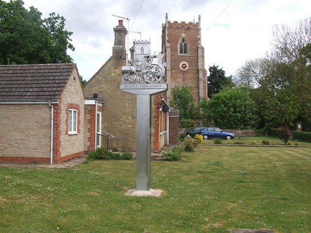
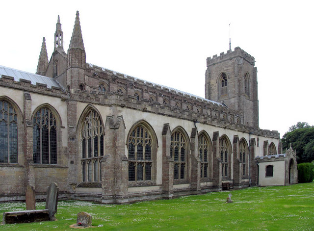
St Andrew's Church, Walpole

St Andrew's Church is a redundant Anglican church in the village of Walpole, Norfolk, England. It is recorded in the National Heritage List for England...

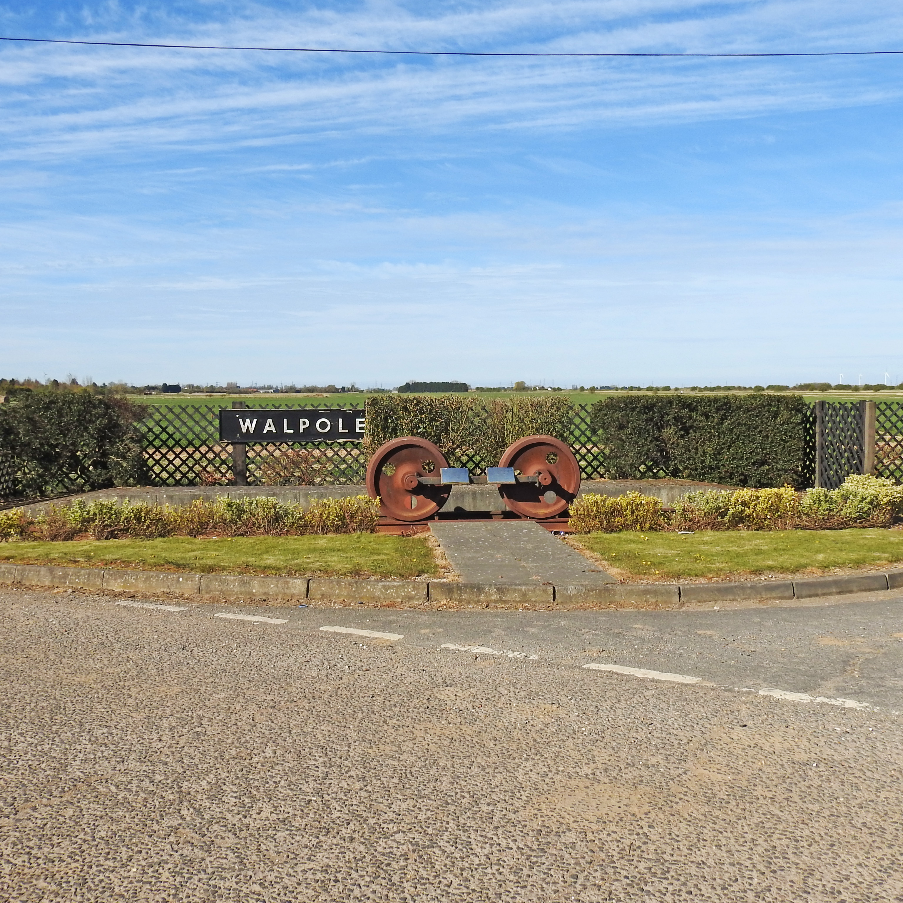
Walpole railway station (England)

Walpole railway station was a station in Norfolk. It is now disused. First opened in 1882, it was part of the Midland and Great Northern Joint Railway...

Walpole, Norfolk

Walpole is a civil parish in Norfolk, England. The parish includes the conjoined villages of Walpole St Andrew and Walpole St Peter. Walpole Highway and...

Walpole Cross Keys

Walpole Cross Keys is a village and civil parish in the English county of Norfolk. It covers an area of 4.03 km2 (1.56 sq mi) and had a population of 469...

Walpole Highway

Walpole Highway is a village and civil parish in the English county of Norfolk. It covers an area of 10.48 km2 (4.05 sq mi) and had a population of 685...

Terrington railway station

Terrington railway station is a former station in Terrington St Clement, Norfolk. It opened in 1866 and was closed in 1959. It was on the Midland and Great...

Terrington St John

Terrington St John is a village and civil parish in the English county of Norfolk. The village lies to the south of the route of the A47 between Peterborough...

Nearby Amenities

Located within 500m of 52.731496,0.24954601
Bristoe Field
Place: locality
Lat/Long: 52.7321092/0.2492767
Bustards Farm
Place: farm
Lat/Long: 52.7334753/0.24481
Give Way
Lat/Long: 52.7329233/0.2451231
Give Way
Lat/Long: 52.7328328/0.2451398
Communication Microwave: yes
Communication Mobile Phone: yes
Man Made: mast
Material: metal
Operator: EE
Tower Construction: lattice
Tower Type: communication
Lat/Long: 52.7332445/0.2447053
The data included in this document is from www.openstreetmap.org. The data is made available under ODbL.

Have you been to Bristoe Field?

Leave your review of Bristoe Field below (or comments, questions and feedback).