Chear Fen

Downs, Moorland in Cambridgeshire South Cambridgeshire

England

Chear Fen

Twenty Pence Cottage, Wilburton, Cambs beside the River Gt Ouse.
Twenty Pence Cottage, Wilburton, Cambs Credit: Rodney Burton

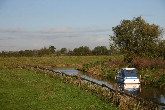
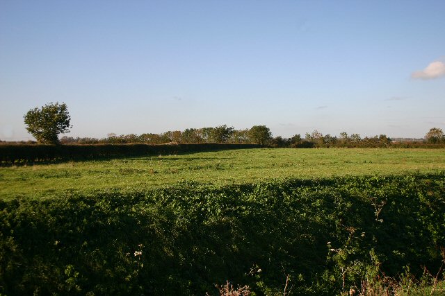
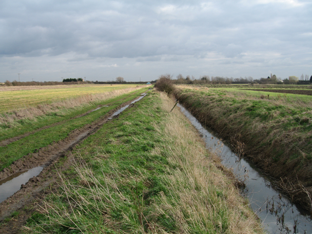
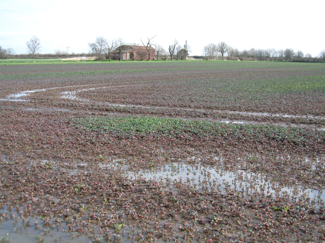
Chear Fen is a picturesque area located in Cambridgeshire, England. Situated in the eastern part of the county, it is characterized by its beautiful downs and moorland landscapes. This region is known for its diverse flora and fauna, offering a unique and captivating experience for both nature enthusiasts and tourists.

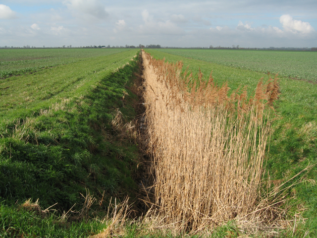
The downs of Chear Fen are vast, rolling hills covered in lush green grass. These hills provide a stunning backdrop for the area and offer breathtaking views of the surrounding countryside. The moorland, on the other hand, comprises of open, wild expanses with heather, gorse, and grasses dominating the landscape. This creates a rich and colorful tapestry, particularly during the summer months when the heather blooms.

The area is home to a variety of wildlife, including several species of birds, such as skylarks and meadow pipits, which can be spotted throughout the year. Additionally, the downs and moorland attract numerous insects, butterflies, and bees, adding to the area's biodiversity.

Apart from its natural beauty, Chear Fen offers various recreational activities for visitors. The downs provide ample opportunities for hiking, walking, and even picnicking, while the moorland is perfect for bird watching and nature photography. The area is also a popular spot for horse riding and cycling, with designated trails and paths available.

Overall, Chear Fen, Cambridgeshire, is a stunning region that showcases the beauty of the downs and moorland landscapes. With its diverse flora and fauna, it offers a tranquil escape from the hustle and bustle of everyday life, making it an ideal destination for nature lovers and outdoor enthusiasts.

If you have any feedback on the listing, please let us know in the comments section below.

Chear Fen Images

Images are sourced within 2km of 52.321329/0.19374106 or Grid Reference TL4971. Thanks to Geograph Open Source API. All images are credited.

Twenty Pence Cottage, Wilburton, Cambs beside the River Gt Ouse.
Twenty Pence Cottage, Wilburton, Cambs
beside the River Gt Ouse.
Twenty Pence Marina and thistly washland beside the River Gt Ouse between Cottenham and Wilburton.
Twenty Pence Marina and thistly washland
beside the River Gt Ouse between Cottenham and Wilburton.
Potato crop, Mitchell Hill Common, Cottenham, Cambs
Long Drove and Engine Drain, Cottenham, Cambs
River Great Ouse at Chear Fen This boat is moored in a small channel leading south from the river.
River Great Ouse at Chear Fen
This boat is moored in a small channel leading south from the river.
The Undertakers This strangely named area of fenland lies to the west of the A10 at Chittering.
The Undertakers
This strangely named area of fenland lies to the west of the A10 at Chittering.
Red Hill Drove, Stretham, Cambs – view NNW across Snoots Common.
Red Hill Drove, Stretham, Cambs
– view NNW across Snoots Common.
Red Hill Drove, Stretham, Cambs – view SE towards the A10 Cambridge Road.
Red Hill Drove, Stretham, Cambs
– view SE towards the A10 Cambridge Road.
Grange Farm, Stretham, Cambs The oilseed rape crop is showing poor growth from surface waterlogging on the slaked topsoil of these Peacock soil series, calcareous humic gley soils.
Grange Farm, Stretham, Cambs
The oilseed rape crop is showing poor growth from surface waterlogging on the slaked topsoil of these Peacock soil series, calcareous humic gley soils.
Reedy drain, Lazier Fen, Stretham, Cambs
Engine Drain At the northern end of Cottenham Long Drove. The track is a public footpath to Chittering.
Engine Drain
At the northern end of Cottenham Long Drove. The track is a public footpath to Chittering.
Engine Drain Looking towards the B1049.
Engine Drain
Looking towards the B1049.
River Great Ouse Frozen over on the last day of a cold spell.
River Great Ouse
Frozen over on the last day of a cold spell.
River Great Ouse The B1049 bridge over the partially frozen river.
River Great Ouse
The B1049 bridge over the partially frozen river.
Cottenham Lode The bridge carries the footpath that follows the southern bank of the River Great Ouse. The ground in the foreground has been poached by grazing cattle.
Cottenham Lode
The bridge carries the footpath that follows the southern bank of the River Great Ouse. The ground in the foreground has been poached by grazing cattle.
Cattle by Great Ouse Relying on provided food in the frozen conditions.
Cattle by Great Ouse
Relying on provided food in the frozen conditions.
Bridge over Cottenham Lode With a bar across to stop the cattle, not easy to cross.
Bridge over Cottenham Lode
With a bar across to stop the cattle, not easy to cross.
Game rearing Maize crop left for the birds and a rearing pen.
Game rearing
Maize crop left for the birds and a rearing pen.
Show me another place!

Chear Fen is located at Grid Ref: TL4971 (Lat: 52.321329, Lng: 0.19374106)

Administrative County: Cambridgeshire

District: South Cambridgeshire

Police Authority: Cambridgeshire

What 3 Words

///dangerously.blushed.rigs. Near Stretham, Cambridgeshire

Nearby Locations

Chear Fen

Related Wikis

Huntingdonshire Football Association

The Huntingdonshire Football Association, also simply known as the Huntingdonshire FA, is the governing body of football in Huntingdonshire. == References... ==

Chittering, Cambridgeshire

Chittering is a hamlet about 8 miles (13 km) north of Cambridge in Cambridgeshire, England. For administrative purposes it is part of the parish of Waterbeach...

Stretham Old Engine

Stretham Old Engine is a steam-powered engine just south of Stretham in Cambridgeshire, England, that was used to pump water from flood-affected areas...

Denny Abbey

Denny Abbey is a former abbey near Waterbeach, about 6 miles (10 km) north of Cambridge in Cambridgeshire, England. It is now the Farmland Museum and Denny...

Nearby Amenities

Located within 500m of 52.321329,0.19374106
Power: pole
Lat/Long: 52.3244469/0.1952915
Power: pole
Lat/Long: 52.3191368/0.1912226
Power: pole
Lat/Long: 52.3253436/0.195203
Power: pole
Lat/Long: 52.3200271/0.1919522
Power: pole
Lat/Long: 52.3227944/0.1942588
Power: pole
Lat/Long: 52.3179301/0.1895597
Power: pole
Lat/Long: 52.3182514/0.1904448
Power: pole
Lat/Long: 52.3234814/0.1954042
Power: pole
Lat/Long: 52.3218173/0.193446
Power: pole
Lat/Long: 52.320937/0.1927084
The data included in this document is from www.openstreetmap.org. The data is made available under ODbL.

Have you been to Chear Fen?

Leave your review of Chear Fen below (or comments, questions and feedback).