Crockstead Green

Downs, Moorland in Sussex Wealden

England

Crockstead Green

Black Lion Inn Old coaching inn on the A22/B2192 crossroads. The road to Uckfield is straight ahead that to Lewes is to the left.
Black Lion Inn Credit: Simon Carey

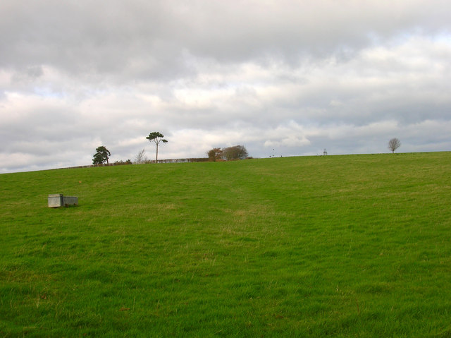
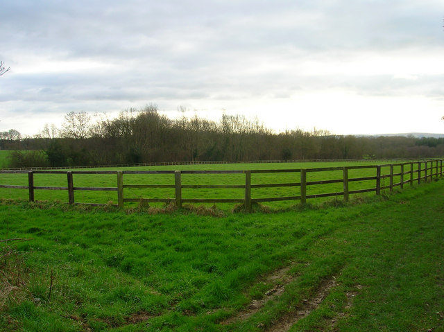
Crockstead Green is a picturesque village located in the county of Sussex, England. Situated amidst the stunning backdrop of the Sussex Downs and Moorland, it is a haven for nature lovers and outdoor enthusiasts. The village is nestled in a secluded valley, surrounded by rolling hills and verdant meadows.

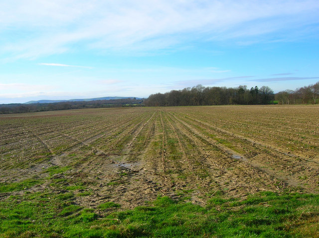
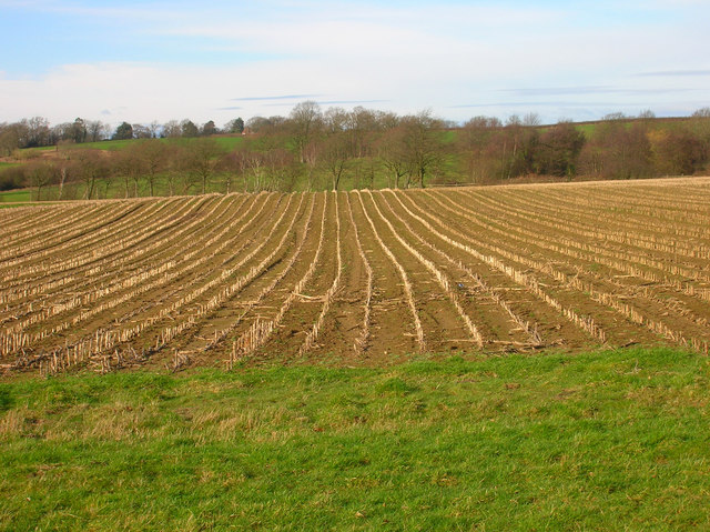
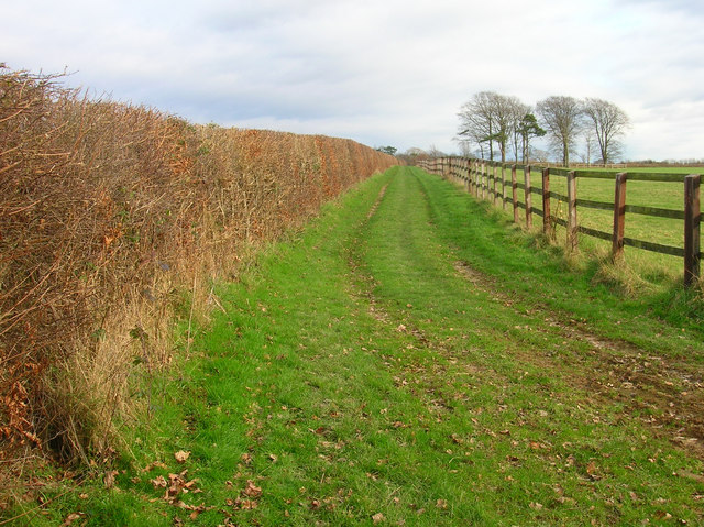
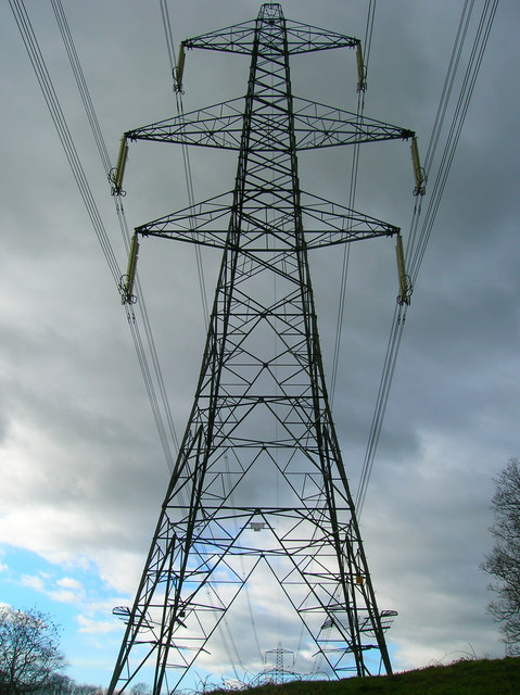
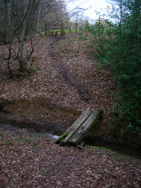
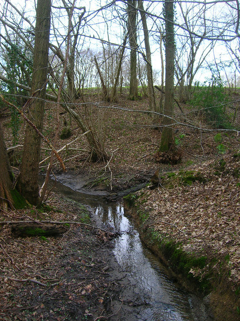
The landscape of Crockstead Green is characterized by its undulating terrain, with expansive fields and grazing land for livestock. The area is known for its diverse flora and fauna, with an abundance of wildflowers, including orchids, poppies, and buttercups, dotting the countryside during the spring and summer months. The Downs and Moorland offer breathtaking panoramic views, making it an ideal destination for hikers, cyclists, and photographers.

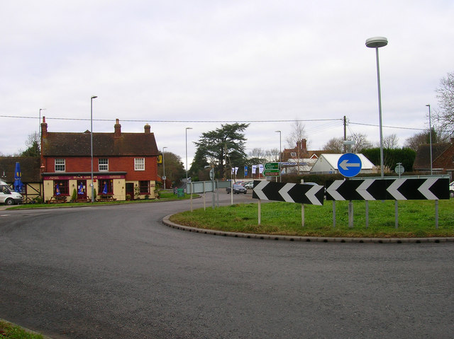
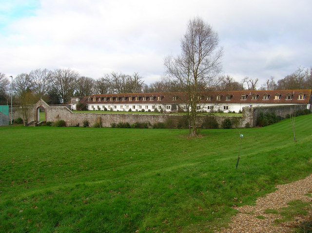
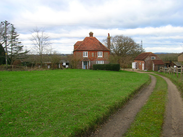
The village itself exudes a quaint charm, with a collection of traditional cottages and farmhouses dotting the landscape. The local community is tight-knit, with a friendly and welcoming atmosphere. The village pub, The Green Man, is a popular meeting spot for locals and visitors alike, offering a warm ambiance and a selection of local ales.

Crockstead Green is also home to Crockstead Farm Hotel, a converted 17th-century farmhouse that now serves as a luxury accommodation option for tourists. The hotel provides a tranquil retreat, with spacious rooms, a restaurant specializing in locally sourced cuisine, and a range of leisure facilities, including a swimming pool and tennis courts.

In conclusion, Crockstead Green is a hidden gem in Sussex, combining the beauty of the Downs and Moorland with a charming village atmosphere. It is a place where one can escape the hustle and bustle of city life and immerse themselves in the natural splendor of the English countryside.

If you have any feedback on the listing, please let us know in the comments section below.

Crockstead Green Images

Images are sourced within 2km of 50.935857/0.12521837 or Grid Reference TQ4917. Thanks to Geograph Open Source API. All images are credited.

Black Lion Inn Old coaching inn on the A22/B2192 crossroads. The road to Uckfield is straight ahead that to Lewes is to the left.
Black Lion Inn
Old coaching inn on the A22/B2192 crossroads. The road to Uckfield is straight ahead that to Lewes is to the left.
Looking Towards Bog Shaw Taken from the footpath that links Halland with Rowlands Wood. The South Downs can be seen in the background.
Looking Towards Bog Shaw
Taken from the footpath that links Halland with Rowlands Wood. The South Downs can be seen in the background.
Field of Stalks near Halland Park Farm Looking back towards Halland, the trees to the right hide the pond in the next grid square. The building on the hill is Hartfield Farm.
Field of Stalks near Halland Park Farm
Looking back towards Halland, the trees to the right hide the pond in the next grid square. The building on the hill is Hartfield Farm.
Footpath to Slays Wood? According to the map it should be but no sign or entrance to the field could be found. The field layouts do not agree with the map either. Most of the land around here is owned by Hesmond Stud a horse breeders who have fenced out the fields and diverted other footpaths though they are not too well signposted coming from the direction of Old Whyley. This looks up towards the peak of a hill marked 73 on the OS Map.

Edit: Five years on the footpath is now marked out, see <a href="https://www.geograph.org.uk/photo/2882890">TQ5117 : Footpath to Annandale Farm</a>.
Footpath to Slays Wood?
According to the map it should be but no sign or entrance to the field could be found. The field layouts do not agree with the map either. Most of the land around here is owned by Hesmond Stud a horse breeders who have fenced out the fields and diverted other footpaths though they are not too well signposted coming from the direction of Old Whyley. This looks up towards the peak of a hill marked 73 on the OS Map. Edit: Five years on the footpath is now marked out, see TQ5117 : Footpath to Annandale Farm.
Sweetwillow Shaw The fenced field belongs to Hesmond Stud.
Sweetwillow Shaw
The fenced field belongs to Hesmond Stud.
Two Types of Field Boundaries The older hedges to the left and the newer fences to the right for the horses of Hesmond Stud. Taken at the point where the footpath heads towards Annan Court.
Two Types of Field Boundaries
The older hedges to the left and the newer fences to the right for the horses of Hesmond Stud. Taken at the point where the footpath heads towards Annan Court.
Annan Court Conference and holiday centre for the London City Church.
Annan Court
Conference and holiday centre for the London City Church.
Stile next to Crossroads, Palehouse Common Much negotiation required to avoid wet feet if trying to escape this field. The point where the footpath from Honey's Green meets a crossroads of minor lanes. The buildings behind belong to Palehouse Common Farm.
Stile next to Crossroads, Palehouse Common
Much negotiation required to avoid wet feet if trying to escape this field. The point where the footpath from Honey's Green meets a crossroads of minor lanes. The buildings behind belong to Palehouse Common Farm.
Electricity Pylon near The Lews Taken from the footpath from Honey's Green
Electricity Pylon near The Lews
Taken from the footpath from Honey's Green
Electricity Pylons near The Lews Straight on view of <a href="https://www.geograph.org.uk/photo/323458">TQ5018 : Electricity Pylon near The Lews</a> as the iron giant and his dark black cloud bear down on a lonely geographer. Actually the picture is taken in a small dip next to a stream looking up the slope towards the pylon.
Electricity Pylons near The Lews
Straight on view of TQ5018 : Electricity Pylon near The Lews as the iron giant and his dark black cloud bear down on a lonely geographer. Actually the picture is taken in a small dip next to a stream looking up the slope towards the pylon.
Footbridge over Unnamed Stream, The Lews The stream actually carves out a small gorge here, the drop from either side of the footpath towards the footbridge is quite steep. This view looks northwards.
Footbridge over Unnamed Stream, The Lews
The stream actually carves out a small gorge here, the drop from either side of the footpath towards the footbridge is quite steep. This view looks northwards.
Two Streams Converging, The Lews Taken from the footbridge <a href="https://www.geograph.org.uk/photo/323477">TQ5017 : Footbridge over Unnamed Stream, The Lews</a> looking westwards.
Two Streams Converging, The Lews
Taken from the footbridge TQ5017 : Footbridge over Unnamed Stream, The Lews looking westwards.
Upper Honeys Green Farm The footpath follows the track then turns right next to the barn.
Upper Honeys Green Farm
The footpath follows the track then turns right next to the barn.
Old Health Close Small cul-de-sac between the Heathfield Road (B2192) and Bentley Wood.
Old Health Close
Small cul-de-sac between the Heathfield Road (B2192) and Bentley Wood.
Bentley Wood There are two Bentley Woods in the vicinity of Halland. One to the west near to Bentley House and this one which is to the east lining the northern part of the A22 and road to East Hoathly. Whether both were once one I do not know.
Bentley Wood
There are two Bentley Woods in the vicinity of Halland. One to the west near to Bentley House and this one which is to the east lining the northern part of the A22 and road to East Hoathly. Whether both were once one I do not know.
Hartfield Farm House, Heathfield Road Possibly the old farm house for Hartfield Farm which is south of the hamlet on the Lewes Road. If you look closely to the left of the centre upstairs window, over the door, is the coat of arms of the Pelham family, the old Dukes of Newcastle, who owned substantial holdings in this part of the Weald, including Laughton Manor and nearby Halland Manor now Halland Park Farm. The house is now next to the roundabout on the western side of the Heathfield Road.
Hartfield Farm House, Heathfield Road
Possibly the old farm house for Hartfield Farm which is south of the hamlet on the Lewes Road. If you look closely to the left of the centre upstairs window, over the door, is the coat of arms of the Pelham family, the old Dukes of Newcastle, who owned substantial holdings in this part of the Weald, including Laughton Manor and nearby Halland Manor now Halland Park Farm. The house is now next to the roundabout on the western side of the Heathfield Road.
View north to Bentley Wood The A 22 is hidden by the trees on the right
View north to Bentley Wood
The A 22 is hidden by the trees on the right
The Shaw roundabout On the A 22 near East Hoathly
The Shaw roundabout
On the A 22 near East Hoathly
Show me another place!

Crockstead Green is located at Grid Ref: TQ4917 (Lat: 50.935857, Lng: 0.12521837)

Administrative County: East Sussex

District: Wealden

Police Authority: Sussex

What 3 Words

///deep.named.refusals. Near Uckfield, East Sussex

Nearby Locations

Crockstead Green

Related Wikis

Bentley Wildfowl and Motor Museum

The Bentley Wildfowl and Motor Museum was a visitor attraction near Halland, East Sussex, England. As of October 2018, it is closed to the public. ��2...

East Sussex National Golf Club

East Sussex National Golf Club is a golf course located near to Uckfield in East Sussex. It is considered one of the finer golf courses in the British...

Framfield

Framfield is a village and civil parish in the Wealden District of East Sussex, England. The village is located two miles (3 km) east of Uckfield; the...

Horsted Place

Horsted Place is a Tudor Revival country house, now a hotel, in Little Horsted, East Sussex, England. The current building dates to 1850, when it was built...

Little Horsted

Little Horsted (also known as Horsted Parva) is a village and civil parish in the Wealden district of East Sussex, England. It is located two miles (3...

Park Corner Heath

Park Corner Heath is a 2.9-hectare (7.2-acre) biological Site of Special Scientific Interest about 1.2 miles (2 km) south of East Hoathly, adjacent to...

East Hoathly with Halland

East Hoathly with Halland is a civil parish in the Wealden District of East Sussex, England. The parish contains the two villages of East Hoathly and...

Plashett Park Wood

Plashett Park Wood is a 157.6-hectare (389-acre) biological Site of Special Scientific Interest between Lewes and Uckfield in East Sussex.This ancient...

Nearby Amenities

Located within 500m of 50.935857,0.12521837
Post Box
Operator: Royal Mail
Operator Wikidata: Q638098
Ref: BN8 534
Lat/Long: 50.9354295/0.1267621
Bus Stop
Sand Hill Lane
Covered: yes
Naptan AtcoCode: 1400WE0397
Naptan NaptanCode: esudadap
Public Transport: platform
Shelter: yes
Lat/Long: 50.936006/0.1263493
Bus Stop
Sand Hill Lane
Naptan AtcoCode: 1400WE0398
Naptan NaptanCode: esudadat
Public Transport: platform
Lat/Long: 50.9356898/0.1267802
Crockstead Green
Place: locality
Source: OS_OpenData_StreetView
Lat/Long: 50.9364989/0.1250875
High Hoad Farm
Place: farm
Source Name: OS_OpenData_StreetView
Lat/Long: 50.9356436/0.1240253
Power: pole
Source: Bing
Lat/Long: 50.9363366/0.1315892
Crockstead Farm
Place: farm
Lat/Long: 50.9393181/0.1240403
Addr Housename: The Sheiling
Building: house
Lat/Long: 50.9337419/0.1284635
Addr Housename: Hazel Bank
Building: house
Lat/Long: 50.9337075/0.1283216
Barrier: yes
Lat/Long: 50.9327005/0.127656
Barrier: yes
Lat/Long: 50.9326104/0.1269633
The data included in this document is from www.openstreetmap.org. The data is made available under ODbL.

Have you been to Crockstead Green?

Leave your review of Crockstead Green below (or comments, questions and feedback).