Berriew

Settlement in Montgomeryshire

Wales

Berriew

Ordnance Survey Flush Bracket (12046) This OS Flush Bracket can be found on an outbuilding at Fail Fach. It marks a point 86.854m above mean sea level.
Ordnance Survey Flush Bracket (12046) Credit: Adrian Dust

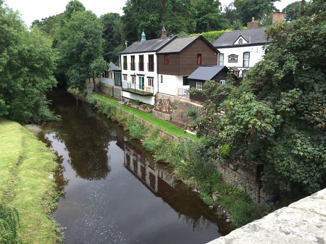
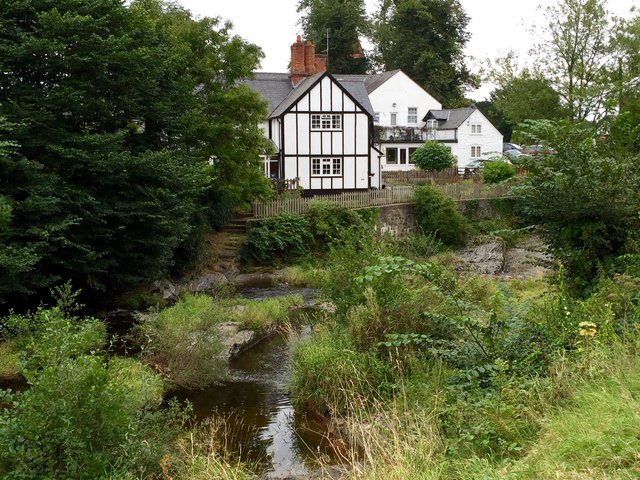
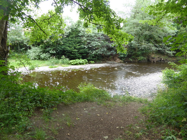
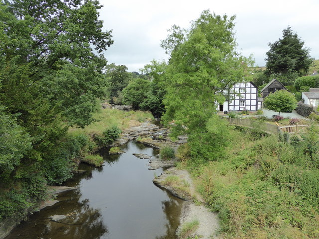
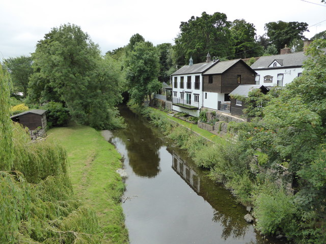
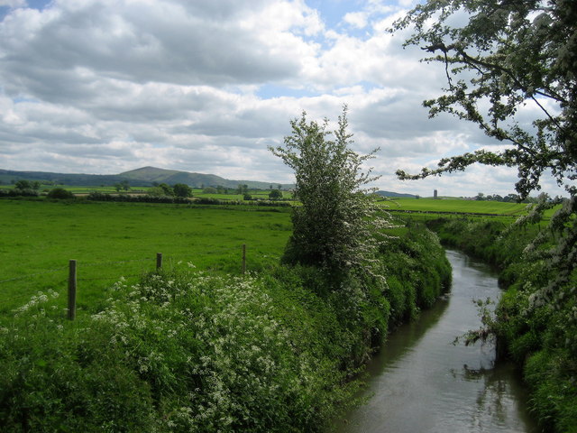
Berriew is a village located in the historical county of Montgomeryshire, Wales. Situated on the banks of the River Rhiw, it is nestled within the picturesque Welsh countryside. The village is approximately 6 miles west of Welshpool and 5 miles south of Montgomery.

Berriew has a rich history, with evidence of human habitation dating back to the Bronze Age. The village grew around the local wool industry during the medieval period and became an important trading hub. Today, it is a charming and peaceful community that attracts visitors with its idyllic setting and well-preserved architecture.

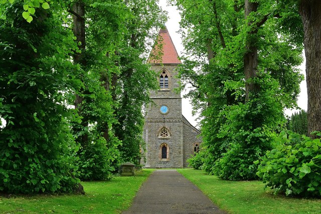
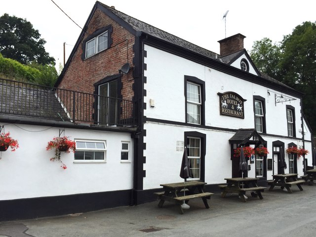
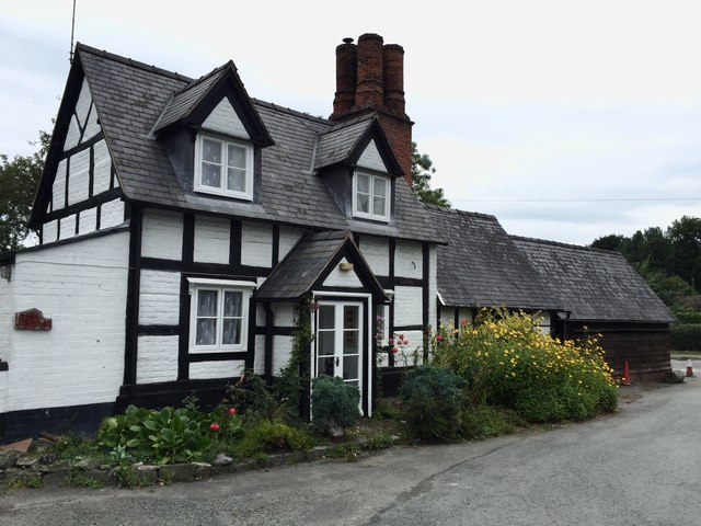
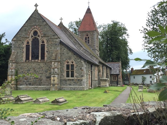
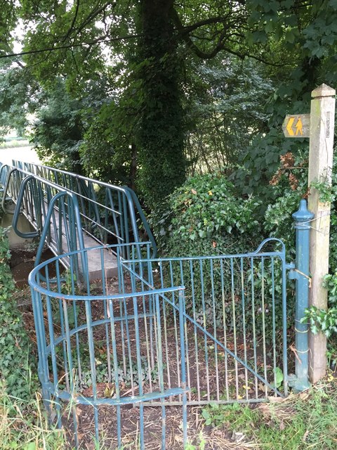
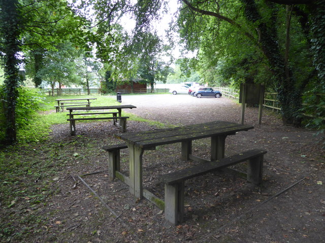
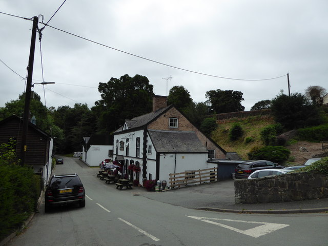
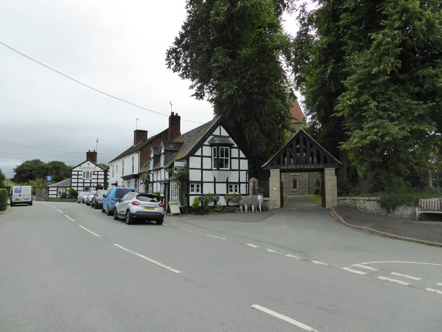
The village is known for its traditional Welsh buildings, including the stunning St. Beuno's Church, which dates back to the 13th century. Other notable landmarks include the Montgomery Canal, which passes through Berriew and offers a tranquil setting for leisurely walks and boating. The village also boasts a number of quaint cottages, a village green, and a local pub, providing a warm and welcoming atmosphere.

Despite its small size, Berriew offers a range of amenities to its residents and visitors. These include a primary school, community center, sports facilities, and a variety of local shops and services. The village hosts several annual events, such as the Berriew Show, which showcases local produce and crafts.

With its stunning natural surroundings and rich cultural heritage, Berriew is a charming village that offers a peaceful retreat for those seeking a taste of rural Wales.

If you have any feedback on the listing, please let us know in the comments section below.

Berriew Images

Images are sourced within 2km of 52.599456/-3.199792 or Grid Reference SJ1800. Thanks to Geograph Open Source API. All images are credited.

Ordnance Survey Flush Bracket (12046) This OS Flush Bracket can be found on an outbuilding at Fail Fach. It marks a point 86.854m above mean sea level.
Ordnance Survey Flush Bracket (12046)
This OS Flush Bracket can be found on an outbuilding at Fail Fach. It marks a point 86.854m above mean sea level.
Ordnance Survey Flush Bracket 12046 This can be found on the wall of a building in Refail.
For more detail see : <span class="nowrap"><a title="http://www.bench-marks.org.uk/bm21562" rel="nofollow ugc noopener" href="http://www.bench-marks.org.uk/bm21562">Link</a><img style="margin-left:2px;" alt="External link" title="External link - shift click to open in new window" src="https://s1.geograph.org.uk/img/external.png" width="10" height="10"/></span>
Ordnance Survey Flush Bracket 12046
This can be found on the wall of a building in Refail. For more detail see : LinkExternal link
St Beuno, Berriew. Powys An unusual Lime tree avenue at St Beuno's Church.
St Beuno, Berriew. Powys
An unusual Lime tree avenue at St Beuno's Church.
The Talbot Hotel The Talbot Hotel, Berriew.
The Talbot Hotel
The Talbot Hotel, Berriew.
River View View across the river Rhiw at Berriew.
River View
View across the river Rhiw at Berriew.
Timbered House An attractive timbered house at Berriew.
Timbered House
An attractive timbered house at Berriew.
St. Beuno's Church Church of St. Beuno, Berriew.
St. Beuno's Church
Church of St. Beuno, Berriew.
Footbridge over the Rhiw An old footbridge spanning the river Rhiw.
Footbridge over the Rhiw
An old footbridge spanning the river Rhiw.
Footbridge over the Rhiw The footbridge across the Rhiw at Berriew.
Footbridge over the Rhiw
The footbridge across the Rhiw at Berriew.
The Old Mill The Old Mill, Berriew.
The Old Mill
The Old Mill, Berriew.
Canal Bridge Canal bridge over the Rhiw at Berriew.
Canal Bridge
Canal bridge over the Rhiw at Berriew.
Under the Montgomeryshire Canal at Berriew Just one of many scenes in this picturesque village that is so well worth exploring.
Under the Montgomeryshire Canal at Berriew
Just one of many scenes in this picturesque village that is so well worth exploring.
Car park and picnic tables in Berriew below the canal aqueduct A great amenity here for visitors to this lovely village, though the picnic tables, having been sited under overhanging mature trees, are a little neglected and would benefit from some attention.
Car park and picnic tables in Berriew below the canal aqueduct
A great amenity here for visitors to this lovely village, though the picnic tables, having been sited under overhanging mature trees, are a little neglected and would benefit from some attention.
Part of the Afon Rhiw at Berriew Lovely little river. I was looking out for Kingfishers but didn't spot any.
Part of the Afon Rhiw at Berriew
Lovely little river. I was looking out for Kingfishers but didn't spot any.
The Talbot Hotel & Restaurant at Berriew Lovely village pub, hotel and eatery.
The Talbot Hotel & Restaurant at Berriew
Lovely village pub, hotel and eatery.
Part of the Afon Rhiw at Berriew Bridge What a lovely river, well worth a walk and explore.
Part of the Afon Rhiw at Berriew Bridge
What a lovely river, well worth a walk and explore.
Part of the Afon Rhiw below Berriew Bridge
Part of Berriew village What a picturesque village this is.
Part of Berriew village
What a picturesque village this is.
Show me another place!

Berriew is located at Grid Ref: SJ1800 (Lat: 52.599456, Lng: -3.199792)

Unitary Authority: Powys

Police Authority: Dyfed Powys

Also known as: Aberriw

What 3 Words

///traded.typified.unzipped. Near Welshpool, Powys

Nearby Locations

Aberriw Berriew

Related Wikis

St Beuno's Church, Berriew

St Beuno’s Church is the parish church of Berriew, in the historic county of Montgomeryshire, now Powys. The church stands in an almost oval churchyard...

Berriew

Berriew (Welsh: Aberriw) is a village and community in Montgomeryshire, Powys, Wales. It is on the Montgomeryshire Canal and the Afon Rhiw, near the confluence...

Berriew F.C.

Berriew Football Club is a Welsh football team based in Berriew. They played in the Ardal Leagues North East, which is in the third level of the Welsh...

Vaynor Park

Vaynor Park is a country house in a landscaped park, standing on high ground to the south-west of Berriew village, in the historic county of Montgomeryshire...

Brithdir, Powys

Brithdir is an area in the community of Berriew, Powys, Wales, which is 78 miles (126 km) from Cardiff and 151 miles (243 km) from London. It lies to the...

River Camlad

The River Camlad (or just Camlad) is a minor river in Powys and Shropshire. It forms part of the border between Wales and England in places, before flowing...
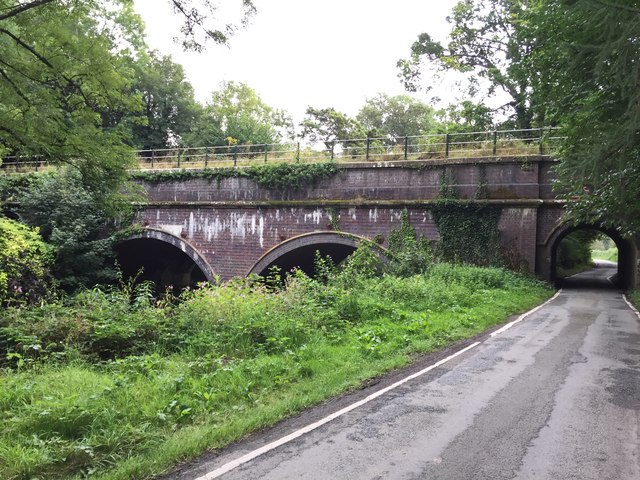
Caerhowel Bridge

Caerhowel Bridge (Welsh: Pont Caerhywel) is a two-arch cast-iron, Grade II listed bridge over the River Severn, west of Caerhowel, Powys, Wales. The 6...

Forden railway station

Forden railway station was a station in Forden, Powys, Wales. The station was opened on 10 June 1861 by the Oswestry and Newtown Railway on the section...

Nearby Amenities

Located within 500m of 52.599456,-3.199792
Aberriw
Is In: Powys
Name Cy: Aberriw
Name En: Berriew
Place: village
Source: npe
Wikidata: Q3309484
Lat/Long: 52.5994717/-3.2009082
Telephone
Booth: K6
Covered: booth
Listed Status: Grade II
Operator: BT
Phone: +44 1686 640201
Lat/Long: 52.5989738/-3.202135
Post Box
Post Box Type: wall
Royal Cypher: EIIR
Royal Cypher Wikidata: Q33102113
Lat/Long: 52.5990987/-3.2019015
Man Made: mast
Tower Type: lighting
Lat/Long: 52.5959721/-3.1969548
Communication Mobile Phone: yes
Man Made: mast
Tower Type: lighting;communication
Lat/Long: 52.5963476/-3.1977
Man Made: mast
Tower Type: lighting
Lat/Long: 52.5953913/-3.197734
Man Made: mast
Tower Type: lighting
Lat/Long: 52.5957831/-3.1984944
Man Made: mast
Tower Type: lighting
Lat/Long: 52.5962755/-3.1983865
Man Made: mast
Tower Type: lighting
Lat/Long: 52.596389/-3.1982311
Man Made: mast
Tower Type: lighting
Lat/Long: 52.5965849/-3.1986146
Man Made: mast
Tower Type: lighting
Lat/Long: 52.596475/-3.1987837
Power: pole
Lat/Long: 52.5966536/-3.1960522
Power: pole
Lat/Long: 52.5958496/-3.1966449
Direction: SSE
Generator Method: photovoltaic
Generator Output Electricity: yes
Generator Solar Modules: 8
Generator Source: solar
Generator Type: solar_photovoltaic_panel
Location: roof
Power: generator
Lat/Long: 52.5998605/-3.1972407
Direction: SSE
Generator Method: photovoltaic
Generator Output Electricity: yes
Generator Solar Modules: 8
Generator Source: solar
Generator Type: solar_photovoltaic_panel
Location: roof
Power: generator
Lat/Long: 52.5997831/-3.1974054
Direction: 215
Generator Method: photovoltaic
Generator Output Electricity: yes
Generator Solar Modules: 16
Generator Source: solar
Generator Type: solar_photovoltaic_panel
Location: roof
Power: generator
Lat/Long: 52.5983932/-3.2005969
Direction: S
Generator Method: photovoltaic
Generator Output Electricity: yes
Generator Solar Modules: 6
Generator Source: solar
Generator Type: solar_photovoltaic_panel
Location: roof
Power: generator
Lat/Long: 52.5998552/-3.2032033
Direction: 195
Generator Method: photovoltaic
Generator Output Electricity: yes
Generator Solar Modules: 20
Generator Source: solar
Generator Type: solar_photovoltaic_panel
Location: roof
Power: generator
Lat/Long: 52.5997674/-3.2041615
Berriew Turning Point
Maxlength: 70Ft
Waterway: Turning_point
Lat/Long: 52.6001649/-3.1954539
Direction: 175
Generator Method: photovoltaic
Generator Output Electricity: yes
Generator Solar Modules: 12
Generator Source: solar
Generator Type: solar_photovoltaic_panel
Location: roof
Power: generator
Lat/Long: 52.5988046/-3.2070181
Toilets
Lat/Long: 52.5955499/-3.198411
Toilets
Lat/Long: 52.5956769/-3.1983638
The data included in this document is from www.openstreetmap.org. The data is made available under ODbL.

Have you been to Berriew?

Leave your review of Berriew below (or comments, questions and feedback).