Baliasta

Settlement in Shetland

Scotland

Baliasta

Mill Burn flowing into the Houb, Baltasound, in the snow
Mill Burn flowing into the Houb, Baltasound, in the snow Credit: Mike Pennington

The requested URL returned error: 429 Too Many Requests

If you have any feedback on the listing, please let us know in the comments section below.

Baliasta Images

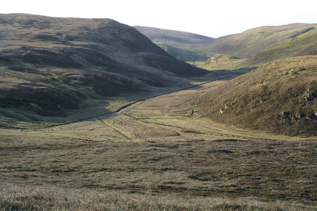
Images are sourced within 2km of 60.764913/-0.89464 or Grid Reference HP6009. Thanks to Geograph Open Source API. All images are credited.

Mill Burn flowing into the Houb, Baltasound, in the snow
Redshank (Tringa totanus) and Jack Snipe (Lymnocryptes minima) on open water near the Houb, Baltasound
SHE from the Houb, Baltasound, in the snow
Laggans, beside Loch of Cliff
Houlland The house at Houlland above Loch of Cliff.
Houlland
The house at Houlland above Loch of Cliff.
Houllna Gruna Looking north along Loch of Cliff towards Saxa Vord.
Houllna Gruna
Looking north along Loch of Cliff towards Saxa Vord.
Crop at Houlland An increasingly common practice is to grow a crop and then let sheep in to eat it themselves; this was cabbages (kale/keel).
Crop at Houlland
An increasingly common practice is to grow a crop and then let sheep in to eat it themselves; this was cabbages (kale/keel).
Dale of Woodwick Looking south from the Knowe of Tronamires.
Dale of Woodwick
Looking south from the Knowe of Tronamires.
Houlland Looking east from the Knowe of Tronamires towards a ruined croft at Houlland and the hill of Crussa Field beyond that.
Houlland
Looking east from the Knowe of Tronamires towards a ruined croft at Houlland and the hill of Crussa Field beyond that.
Shetland ponies at Houlland
View north from Houllna Grouna Looking towards the Loch of Cliff and Saxa Vord.
View north from Houllna Grouna
Looking towards the Loch of Cliff and Saxa Vord.
View from Houlland A sheep or pony shelter in the foreground and a panoramic view across Baltasound beyond.
View from Houlland
A sheep or pony shelter in the foreground and a panoramic view across Baltasound beyond.
House beside Loch of Cliff, north of Houlland Occupied until very recently, this house appears to be named Laggans on the maps, but I'm sure it had a different name locally. The view is up Loch of Cliff, across the Ness of Queyhoose to Saxa Vord on the right, with Hermaness away on the left.
House beside Loch of Cliff, north of Houlland
Occupied until very recently, this house appears to be named Laggans on the maps, but I'm sure it had a different name locally. The view is up Loch of Cliff, across the Ness of Queyhoose to Saxa Vord on the right, with Hermaness away on the left.
West shore of Loch of Cliff, between Houlland and Petester Looking north from Laggans, north of Houlland. Houses of Petester can just be seen perched above the bend in the loch, and Hermaness Hill is in the distance.
West shore of Loch of Cliff, between Houlland and Petester
Looking north from Laggans, north of Houlland. Houses of Petester can just be seen perched above the bend in the loch, and Hermaness Hill is in the distance.
Peat track on Houllna Grouna This track leads from Houlland to the currently abandoned peat workings on the hill of Houllna Grouna (but known as Cliffsie locally). It is almost always wet, and even in summer often has a small stream flowing along it.
Peat track on Houllna Grouna
This track leads from Houlland to the currently abandoned peat workings on the hill of Houllna Grouna (but known as Cliffsie locally). It is almost always wet, and even in summer often has a small stream flowing along it.
Houlland and Houllna Grouna in the snow Looking from Baltasound Junior High School towards the house of Houlland on the slopes of Houllna Grouna.
Houlland and Houllna Grouna in the snow
Looking from Baltasound Junior High School towards the house of Houlland on the slopes of Houllna Grouna.
Houlland from Baliasta House on the slopes of Houllna Grouna.
Houlland from Baliasta
House on the slopes of Houllna Grouna.
Show me another place!

Baliasta is located at Grid Ref: HP6009 (Lat: 60.764913, Lng: -0.89464)

Unitary Authority: Shetland Islands

Police Authority: Highlands and Islands

What 3 Words

///immediate.envoy.bronze. Near Baltasound, Shetland Islands

Nearby Locations

Baliasta

Related Wikis

Unst

Unst (; Scots: Unst; Norn: Ønst) is one of the North Isles of the Shetland Islands, Scotland. It is the northernmost of the inhabited British Isles and...

1992 New Year's Day Storm

The New Year's Day Storm (Norwegian: Nyttårsorkanen), known in Scotland as the 'Hogmanay Hurricane', was an intense European windstorm that affected much...

Baltasound

Baltasound (or Baltasund) is the largest settlement on the island of Unst in Shetland, Scotland. It comes from the Old Norse man's name Balti (Baltisund...

Unst Airport

Unst Airport also called Baltasound Airport is an unlicensed airfield near Baltasound, on the island of Unst, Shetland Islands, Scotland. The airfield...

Nearby Amenities

Located within 500m of 60.764913,-0.89464
Passing Place
Lat/Long: 60.7663374/-0.8930256
Baliasta
Place: hamlet
Lat/Long: 60.7647445/-0.8905989
Man Made: utility_pole
Lat/Long: 60.7680438/-0.8958121
Man Made: utility_pole
Lat/Long: 60.7675513/-0.8943449
Man Made: utility_pole
Lat/Long: 60.7672015/-0.8933123
Man Made: utility_pole
Lat/Long: 60.7670391/-0.8928161
Man Made: utility_pole
Lat/Long: 60.766802/-0.8921133
Man Made: utility_pole
Lat/Long: 60.7663422/-0.8907427
Man Made: utility_pole
Lat/Long: 60.765982/-0.8896645
Man Made: utility_pole
Lat/Long: 60.7655655/-0.8884333
Man Made: utility_pole
Lat/Long: 60.7650782/-0.8869769
Man Made: utility_pole
Lat/Long: 60.7646904/-0.8858316
Man Made: utility_pole
Lat/Long: 60.7646223/-0.8863788
Man Made: utility_pole
Lat/Long: 60.7685761/-0.8974037
Man Made: utility_pole
Lat/Long: 60.768952/-0.8985222
Passing Place
Lat/Long: 60.7622217/-0.887916
Power: pole
Lat/Long: 60.7665346/-0.8936031
Power: pole
Lat/Long: 60.7663473/-0.8949576
Power: pole
Lat/Long: 60.7609927/-0.8912024
Power: pole
Lat/Long: 60.7619492/-0.891798
Power: pole
Lat/Long: 60.762485/-0.8921441
Power: pole
Lat/Long: 60.7629474/-0.8911945
Power: pole
Lat/Long: 60.7634977/-0.8901056
Power: pole
Lat/Long: 60.7638055/-0.8894913
Passing Place
Lat/Long: 60.7636334/-0.8897352
Power: pole
Lat/Long: 60.7656038/-0.8950465
Scrafield
Place: locality
Lat/Long: 60.7649883/-0.8970071
Power: pole
Lat/Long: 60.7645024/-0.8928496
Power: pole
Lat/Long: 60.7649022/-0.8926844
Power: pole
Lat/Long: 60.7646146/-0.8922928
Power: pole
Lat/Long: 60.7655352/-0.8936889
Power: pole
Lat/Long: 60.7661338/-0.894287
Power: pole
Lat/Long: 60.7661312/-0.894617
Power: pole
Lat/Long: 60.7659242/-0.8943139
Power: pole
Lat/Long: 60.7657474/-0.8946974
Power: pole
Lat/Long: 60.7673104/-0.8965205
Power: pole
Lat/Long: 60.7670249/-0.8960511
Power: pole
Lat/Long: 60.7674768/-0.8920479
Power: pole
Lat/Long: 60.7679012/-0.8913291
Power: pole
Lat/Long: 60.7683701/-0.8905459
Passing Place
Lat/Long: 60.7673484/-0.8916748
Power: pole
Lat/Long: 60.7616574/-0.8937919
Power: pole
Lat/Long: 60.7620426/-0.8930194
Power: pole
Lat/Long: 60.7609788/-0.8951544
Power: pole
Lat/Long: 60.7646898/-0.8858257
Power: pole
Lat/Long: 60.7650674/-0.8869507
Power: pole
Lat/Long: 60.7655696/-0.8884325
Power: pole
Lat/Long: 60.7659772/-0.8896656
Power: pole
Lat/Long: 60.7663361/-0.8907305
Power: pole
Lat/Long: 60.7667992/-0.8921007
Power: pole
Lat/Long: 60.7670271/-0.8927808
Power: pole
Lat/Long: 60.7671956/-0.8932947
Power: pole
Lat/Long: 60.7675374/-0.8943347
Power: pole
Lat/Long: 60.7680375/-0.8958018
Power: pole
Lat/Long: 60.7685745/-0.8973979
Power: pole
Lat/Long: 60.7689442/-0.89851
Power: pole
Lat/Long: 60.7646196/-0.8863758
Power: pole
Lat/Long: 60.7644478/-0.8881947
Power: pole
Lat/Long: 60.7676865/-0.8971161
Power: pole
Lat/Long: 60.7666985/-0.8955325
Power: pole
Lat/Long: 60.7651541/-0.89307
The data included in this document is from www.openstreetmap.org. The data is made available under ODbL.

Have you been to Baliasta?

Leave your review of Baliasta below (or comments, questions and feedback).