Halton Fen

Downs, Moorland in Lincolnshire East Lindsey

England

Halton Fen

Bell Water Gowt, Dowse's Sewer and Drain Bank Plantation: aerial 2023
Bell Water Gowt, Dowse's Sewer and Drain Bank Plantation: aerial 2023 Credit: Chris

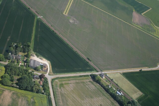
Halton Fen is a region located in the county of Lincolnshire, England. Situated in the southern part of the county, Halton Fen is characterized by its diverse landscape, combining downs and moorland. The area spans over a significant expanse, providing a rich and varied habitat for a range of flora and fauna.

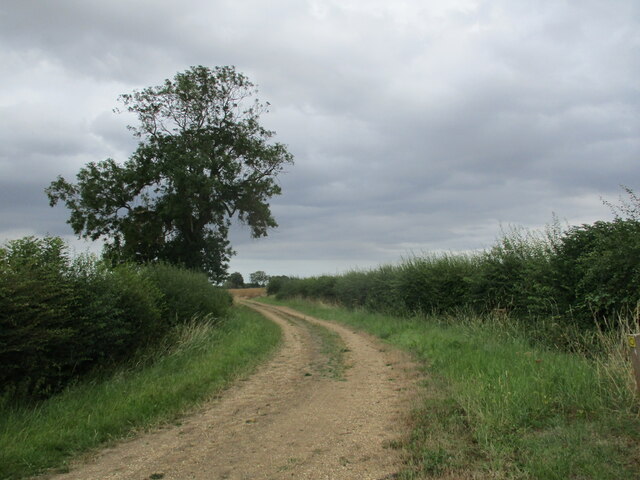
The downs of Halton Fen are marked by rolling hills and open grasslands, offering breathtaking panoramic views of the surrounding countryside. The grasslands are home to a variety of plant species, including wildflowers such as cowslips and harebells, which add a vibrant splash of color to the landscape during the warmer months. The downs are also interspersed with small patches of woodland, providing shelter for a diverse range of bird species and other wildlife.

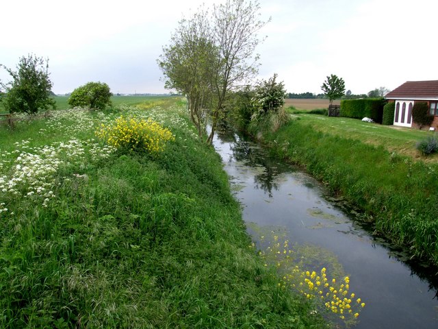
In contrast, the moorland of Halton Fen is characterized by its heather-covered expanses and peat bogs. This unique ecosystem supports a range of plant life, including heather, bilberry, and cotton grass. Moorland birds such as curlews, lapwings, and red grouse are commonly sighted in the area, adding to its ecological significance.

Halton Fen serves as an important conservation area, with efforts in place to protect and preserve its natural beauty. The region is home to several nature reserves, which offer opportunities for visitors to explore and appreciate the unique flora and fauna of the area through various walking trails and observation points.

Overall, Halton Fen in Lincolnshire presents a captivating blend of downs and moorland, creating a diverse and ecologically significant landscape.

If you have any feedback on the listing, please let us know in the comments section below.

Halton Fen Images

Images are sourced within 2km of 53.13042/0.13157978 or Grid Reference TF4261. Thanks to Geograph Open Source API. All images are credited.

Bell Water Gowt, Dowse's Sewer and Drain Bank Plantation: aerial 2023
Ings Drove, Halton Fenside
Path of trench through field near Thorpe Culvert: aerial 2023
Station House, Station Road, Little Steeping: aerial 2023
Railway passing through Little Steeping Ings: aerial 2023 Steeping River top right.
Railway passing through Little Steeping Ings: aerial 2023
Steeping River top right.
Farm track Farmers access running North from East Lincolnshire railway.
Farm track
Farmers access running North from East Lincolnshire railway.
Farm Road by the Bellwater Drain The road ends not much further away, but I don't think my car suspension would have stood much more of it.
Farm Road by the Bellwater Drain
The road ends not much further away, but I don't think my car suspension would have stood much more of it.
Thorpe Farm from Bell Water Drain Bank
Track alongside Bell Water Drain
Fen Bridge over East Fen Catchwater Drain, Halton Fenside As part of Rennie’s scheme to drain the East and West Fens, large numbers of brick bridges were built, many still identifiable by the oval cast iron plates bearing the bridge’s reference number in Egyptian-style numerals above the arch.

See: <span class="nowrap"><a title="https://rbt.org.uk/john-rennie/projects/east-fen-west-fen-and-wildmore-fen-drainage/" rel="nofollow ugc noopener" href="https://rbt.org.uk/john-rennie/projects/east-fen-west-fen-and-wildmore-fen-drainage/">Link</a><img style="margin-left:2px;" alt="External link" title="External link - shift click to open in new window" src="https://s1.geograph.org.uk/img/external.png" width="10" height="10"/></span>
Fen Bridge over East Fen Catchwater Drain, Halton Fenside
As part of Rennie’s scheme to drain the East and West Fens, large numbers of brick bridges were built, many still identifiable by the oval cast iron plates bearing the bridge’s reference number in Egyptian-style numerals above the arch. See: LinkExternal link
Ings Drove, Halton Fenside
Subsiding road, Station Road, Little Steeping Subsiding roads are a way of life on the East Fen, which was once an area of meres and marshland, with some deeper parts (there is an area called The Deeps nearby in TF4358). 

P.203 of "A History of the Fens of South East Lincolnshire" (W.H.Wheeler, 1897, <span class="nowrap"><a title="https://archive.org/stream/cu31924014023893#page/n3/mode/2up" rel="nofollow ugc noopener" href="https://archive.org/stream/cu31924014023893#page/n3/mode/2up">Link</a><img style="margin-left:2px;" alt="External link" title="External link - shift click to open in new window" src="https://s1.geograph.org.uk/img/external.png" width="10" height="10"/></span> ) quotes Camden (1602), who describes the East Fen as "quite in a state of nature and exhibits a specimen of what the country was before the introduction of draining".

Various drainage schemes have been implemented here over the centuries. The marsh has been tamed - or has it? The roads do not sit well on their peaty foundations and the area is traversed by switchbacks like this one, which throw vehicles off the road and into deep watery dykes. So it seems the ghost of the banished marsh still lurks, and claims its sacrifices.
Subsiding road, Station Road, Little Steeping
Subsiding roads are a way of life on the East Fen, which was once an area of meres and marshland, with some deeper parts (there is an area called The Deeps nearby in TF4358). P.203 of "A History of the Fens of South East Lincolnshire" (W.H.Wheeler, 1897, LinkExternal link ) quotes Camden (1602), who describes the East Fen as "quite in a state of nature and exhibits a specimen of what the country was before the introduction of draining". Various drainage schemes have been implemented here over the centuries. The marsh has been tamed - or has it? The roads do not sit well on their peaty foundations and the area is traversed by switchbacks like this one, which throw vehicles off the road and into deep watery dykes. So it seems the ghost of the banished marsh still lurks, and claims its sacrifices.
Down the track to an unnamed wood, Halton Fenside
Farmland and tree, Halton Fen, south of Halton Fenside
Halton Fen: Albion Farm
Railway embankment SE of Little Steeping
Field track from the railway crossing SE of Little Steeping
Pub and unloved telephone box in Little Steeping From the point of view of a villager whose call box was stolen overnight and replaced with a boring modern one, it makes me sad to see the state of this one.

However there is no doubt that these are little used facilities these days, and villages are to be asked to buy them for £1 and thereafter be responsible for them. I suppose it depends on how many willing helpers there are in the village...
Pub and unloved telephone box in Little Steeping
From the point of view of a villager whose call box was stolen overnight and replaced with a boring modern one, it makes me sad to see the state of this one. However there is no doubt that these are little used facilities these days, and villages are to be asked to buy them for £1 and thereafter be responsible for them. I suppose it depends on how many willing helpers there are in the village...
Show me another place!

Halton Fen is located at Grid Ref: TF4261 (Lat: 53.13042, Lng: 0.13157978)

Administrative County: Lincolnshire

District: East Lindsey

Police Authority: Lincolnshire

What 3 Words

///sanded.feared.elders. Near Spilsby, Lincolnshire

Related Wikis

Little Steeping railway station

Little Steeping was a railway station on the East Lincolnshire Railway which served the hamlet of Little Steeping in Lincolnshire between 1848 and 1964...

Little Steeping

Little Steeping is a village and civil parish in the East Lindsey district of Lincolnshire, England, about 3 miles (5 km) south-east from the town of Spilsby...

Old All Saints Church, Great Steeping

Old All Saints Church is a redundant Anglican church in the village of Great Steeping, Lincolnshire, England. It is recorded in the National Heritage...

Toynton St Peter

Toynton St Peter is a village and civil parish in the East Lindsey district of Lincolnshire, England, approximately 2 miles (3 km) south from the town...

Toynton Fen Side

Toynton Fen Side is a hamlet and linear settlement on Fenside Road in the East Lindsey district of Lincolnshire, England. The hamlet is partly in the civil...

Great Steeping

Great Steeping is a village and civil parish in the East Lindsey district of Lincolnshire, England. It is situated approximately 3 miles (5 km) from Spilsby...

Halton Holegate railway station

Halton Holegate Railway Station is a former station in Halton Holegate, Lincolnshire. It was on a short branch from Firsby to Spilsby. == History of... ==

Firsby

Firsby is a small rural linear village and civil parish in the East Lindsey district of Lincolnshire, England. It is situated 30 miles (48 km) east from...

Nearby Amenities

Located within 500m of 53.13042,0.13157978
Bus Stop
8 Thorpe Bank
Naptan AtcoCode: 270000009419
Naptan Bearing: SW
Naptan BusStopType: CUS
Naptan CommonName: 8 Thorpe Bank
Naptan Indicator: adj
Naptan Landmark: Number 8
Naptan NaptanCode: linjatwt
Naptan Street: Thorpe Bank
Naptan Verified: no
Source: naptan_import
Lat/Long: 53.1269597/0.1339097
Bus Stop
The Willows
Naptan AtcoCode: 270000010506
Naptan Bearing: S
Naptan CommonName: The Willows
Naptan Indicator: adj
Naptan Landmark: The Willows
Naptan NaptanCode: linjmwat
Naptan Street: Fenside
Naptan Verified: no
Source: naptan_import
Lat/Long: 53.1306433/0.1305494
Bus Stop
The Willows
Naptan AtcoCode: 2700LHHF1874
Naptan Bearing: N
Naptan CommonName: The Willows
Naptan Indicator: opp
Naptan Landmark: The Willows
Naptan NaptanCode: linamtwm
Naptan Street: Fenside
Naptan Verified: no
Source: naptan_import
Lat/Long: 53.1306267/0.1304738
Bus Stop
8 Thorpe Bank
Naptan AtcoCode: 2700LLSB5631
Naptan Bearing: NE
Naptan BusStopType: CUS
Naptan CommonName: 8 Thorpe Bank
Naptan Indicator: opp
Naptan Landmark: Number 8
Naptan NaptanCode: lindwdja
Naptan Street: Thorpe Bank
Naptan Verified: no
Source: naptan_import
Lat/Long: 53.1270776/0.1338558
Albion Cottage
Place: isolated_dwelling
Lat/Long: 53.1332431/0.1300507
Greenbanks
Place: isolated_dwelling
Lat/Long: 53.1296135/0.1302058
Rosebank
Place: isolated_dwelling
Lat/Long: 53.1299651/0.1313089
The Willows
Place: isolated_dwelling
Lat/Long: 53.1309682/0.1303437
Place: farm
Lat/Long: 53.1343212/0.1280612
The data included in this document is from www.openstreetmap.org. The data is made available under ODbL.

Have you been to Halton Fen?

Leave your review of Halton Fen below (or comments, questions and feedback).