New Ground Common

Downs, Moorland in Cambridgeshire South Cambridgeshire

England

New Ground Common

Rampton, All Saints <span class="nowrap"><a title="http://www.druidic.org/camchurch/churches/rampton.htm" rel="nofollow ugc noopener" href="http://www.druidic.org/camchurch/churches/rampton.htm">Link</a><img style="margin-left:2px;" alt="External link" title="External link - shift click to open in new window" src="https://s1.geograph.org.uk/img/external.png" width="10" height="10"/></span>
Rampton, All Saints Credit: mym

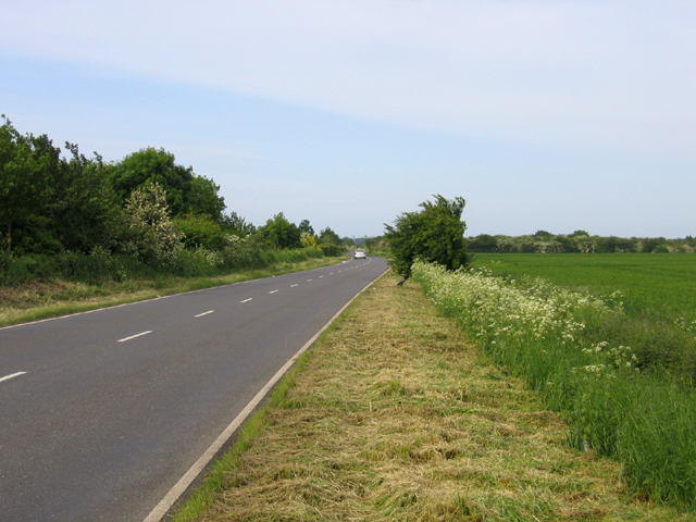
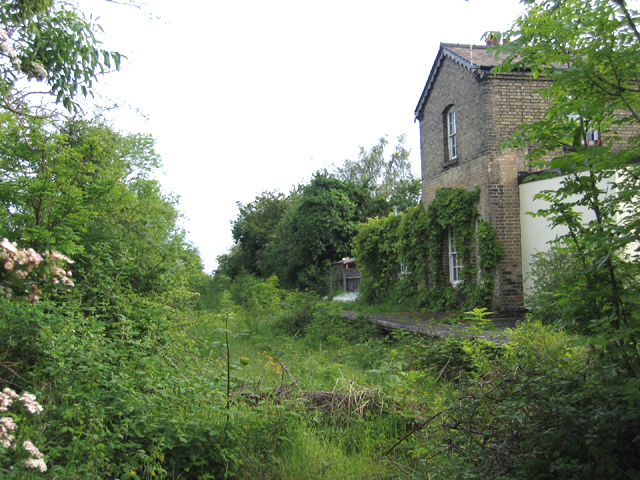
New Ground Common is a picturesque area located in Cambridgeshire, England. It encompasses a vast expanse of downs and moorland, offering visitors a breathtaking natural landscape to explore. Covering an area of approximately 500 acres, it is a haven for nature enthusiasts, hikers, and birdwatchers alike.

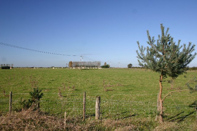
The common is characterized by rolling hills covered in vibrant green grasses and dotted with wildflowers, creating a stunning visual spectacle throughout the year. The downs provide ample space for leisure activities such as picnicking and kite flying, while the moorland offers a unique habitat for various plant and animal species.

The diverse ecosystem found in New Ground Common attracts a wide range of wildlife, making it a popular destination for wildlife enthusiasts. Visitors may spot rare bird species such as the skylark and the stonechat, as well as rabbits, foxes, and even deer.

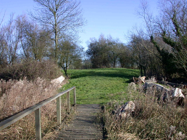
Several walking trails crisscross the common, allowing visitors to explore its beauty at their own pace. These trails offer stunning views of the surrounding countryside and provide an opportunity to immerse oneself in the tranquility of nature.

New Ground Common also holds historical significance, with ancient burial mounds and remnants of Iron Age settlements scattered throughout the area. These remnants serve as a testament to the rich history and cultural heritage of the region.

Overall, New Ground Common in Cambridgeshire is a captivating natural landscape that provides a serene escape from the hustle and bustle of everyday life. Its downs and moorland offer visitors a chance to connect with nature and experience the beauty of the British countryside.

If you have any feedback on the listing, please let us know in the comments section below.

New Ground Common Images

Images are sourced within 2km of 52.287617/0.085168466 or Grid Reference TL4267. Thanks to Geograph Open Source API. All images are credited.

Rampton, All Saints <span class="nowrap"><a title="http://www.druidic.org/camchurch/churches/rampton.htm" rel="nofollow ugc noopener" href="http://www.druidic.org/camchurch/churches/rampton.htm">Link</a><img style="margin-left:2px;" alt="External link" title="External link - shift click to open in new window" src="https://s1.geograph.org.uk/img/external.png" width="10" height="10"/></span>
Rampton, All Saints
The Black Horse, Rampton CB4 Dating from 1851, or earlier.
The Black Horse, Rampton CB4
Dating from 1851, or earlier.
Little North Fen, Cottenham CB4 Little North fen, west of Cottenham village, was recorded as early as 1330.
Little North Fen, Cottenham CB4
Little North fen, west of Cottenham village, was recorded as early as 1330.
Oakington Road, Cottenham, Cambs – view towards Westwick as the road crosses Further or Farm Field.
Oakington Road, Cottenham, Cambs
– view towards Westwick as the road crosses Further or Farm Field.
Rampton Bridge, Cambs spanning the Westwick Brook, taken from the footpath forming the parish boundary between Rampton and Cottenham.
Rampton Bridge, Cambs
spanning the Westwick Brook, taken from the footpath forming the parish boundary between Rampton and Cottenham.
New Cut drain, Cottenham, Cambs at the bend where it heads across the North Fen.
New Cut drain, Cottenham, Cambs
at the bend where it heads across the North Fen.
Reynolds' Drove, Rampton, Cambs a public byway crossing Brook Field, from Cuckoo Lane towards Longstanton.
Reynolds' Drove, Rampton, Cambs
a public byway crossing Brook Field, from Cuckoo Lane towards Longstanton.
Cottages by The Green, Rampton, Cambs
Corrugated metal roof, Rampton, Cambs on the south side of King Street.
Corrugated metal roof, Rampton, Cambs
on the south side of King Street.
Cottages by The Green, Rampton, Cambs No. 19 and 20, built in 1902.
Cottages by The Green, Rampton, Cambs
No. 19 and 20, built in 1902.
Free Church Mission Hall, Rampton, Cambs erected 1902 on the corner of High Street and Cow Lane.
Free Church Mission Hall, Rampton, Cambs
erected 1902 on the corner of High Street and Cow Lane.
Parish pump, Rampton, Cambs located on The Green.
Parish pump, Rampton, Cambs
located on The Green.
Farm in Little Field, Rampton, Cambs beside Rampton Road bend.
Farm in Little Field, Rampton, Cambs
beside Rampton Road bend.
Cuckoo Hill Farm A small farm north-east of Westwick.
Cuckoo Hill Farm
A small farm north-east of Westwick.
Former Oakington Barracks, Longstanton The former Oakington Barracks in Cambridgeshire was used formerly as an RAF base during World War II, and then an army base until the end of the 20th century when the site was released for development. A new town, Northstowe, is due to be built on the site over the coming decade.
Former Oakington Barracks, Longstanton
The former Oakington Barracks in Cambridgeshire was used formerly as an RAF base during World War II, and then an army base until the end of the 20th century when the site was released for development. A new town, Northstowe, is due to be built on the site over the coming decade.
Brookfield Farm, Longstanton, Cambridgeshire
Poplar windbreak A common sight in the fens, protecting buildings and fields from the wind (not much else to get in the way). Autumn-sown cereal crop in the field, a farming method that removes the need to leave stubble fields.
Poplar windbreak
A common sight in the fens, protecting buildings and fields from the wind (not much else to get in the way). Autumn-sown cereal crop in the field, a farming method that removes the need to leave stubble fields.
Rampton Drift A byway open to all traffic, except when it's not. A sign at the entrance said that it was closed October-April except for access - there was one bit where a non-4x4 would have struggled, and there would be plenty more with more use.
Rampton Drift
A byway open to all traffic, except when it's not. A sign at the entrance said that it was closed October-April except for access - there was one bit where a non-4x4 would have struggled, and there would be plenty more with more use.
Show me another place!

New Ground Common is located at Grid Ref: TL4267 (Lat: 52.287617, Lng: 0.085168466)

Administrative County: Cambridgeshire

District: South Cambridgeshire

Police Authority: Cambridgeshire

What 3 Words

///landowner.widen.glare. Near Cottenham, Cambridgeshire

Nearby Locations

New Ground Common

Related Wikis

Rampton, Cambridgeshire

Rampton is a village in Cambridgeshire, England, situated on the edge of The Fens six miles to the north of Cambridge. == History == The edge of the Fens...

Rampton Castle

Rampton Castle, known locally as Giant's Hill, is the earthwork remains of a motte and bailey castle in Rampton, Cambridgeshire. It is believed that the...

Northstowe Secondary College

Northstowe Secondary College is a co-educational secondary school and sixth form located in Northstowe in the English county of Cambridgeshire.The school...

Northstowe

Northstowe is a new town that will eventually have up to 10,000 homes, with an anticipated population of 24,400 in Cambridgeshire, England, UK. On 1 April...

Oakington Immigration Reception Centre

Oakington Immigration Reception Centre was an immigration detention centre located in Cambridgeshire run by UK Visas and Immigration. Originally a World...

Westwick, Cambridgeshire

Westwick is a hamlet and former civil parish, now in the parish of Oakington and Westwick, in the South Cambridgeshire district, in the county of Cambridgeshire...

RAF Oakington

Royal Air Force Oakington or more simply RAF Oakington was a Royal Air Force station located 0.5 miles (0.80 km) north of Oakington, Cambridgeshire, England...

Oakington railway station

Oakington railway station was a station in Oakington, Cambridgeshire, on the line between Cambridge and St Ives. It opened in 17 August 1847 and was closed...

Nearby Amenities

Located within 500m of 52.287617,0.085168466
Frequency: 50
Phases: 1
Power: pole
Source: survey
Transformer: distribution
Voltage: 11000
Lat/Long: 52.2883046/0.081
Power: pole
Lat/Long: 52.290024/0.0809759
Power: pole
Lat/Long: 52.2892529/0.0809544
Frequency: 50
Line Attachment: anchor
Phases: 3
Power: pole
Transformer: distribution
Voltage: 11000
Lat/Long: 52.2908705/0.0809947
Barrier: kissing_gate
Lat/Long: 52.2849896/0.0810519
Barrier: kissing_gate
Lat/Long: 52.2858835/0.0828965
Generator Method: photovoltaic
Generator Output Electricity: yes
Generator Source: solar
Generator Type: solar_photovoltaic_panel
Location: roof
Power: generator
Lat/Long: 52.2906572/0.0845486
Generator Method: photovoltaic
Generator Output Electricity: yes
Generator Source: solar
Generator Type: solar_photovoltaic_panel
Location: roof
Power: generator
Lat/Long: 52.2907064/0.0845915
Generator Method: photovoltaic
Generator Output Electricity: yes
Generator Source: solar
Generator Type: solar_photovoltaic_panel
Location: roof
Power: generator
Lat/Long: 52.2911002/0.0844225
Generator Method: photovoltaic
Generator Output Electricity: yes
Generator Source: solar
Generator Type: solar_photovoltaic_panel
Location: roof
Power: generator
Lat/Long: 52.2912314/0.0853318
Generator Method: photovoltaic
Generator Output Electricity: yes
Generator Source: solar
Generator Type: solar_photovoltaic_panel
Location: roof
Power: generator
Lat/Long: 52.2909312/0.0856644
Generator Method: photovoltaic
Generator Output Electricity: yes
Generator Source: solar
Generator Type: solar_photovoltaic_panel
Location: roof
Power: generator
Lat/Long: 52.2906096/0.0853613
Generator Method: photovoltaic
Generator Output Electricity: yes
Generator Source: solar
Generator Type: solar_photovoltaic_panel
Location: roof
Power: generator
Lat/Long: 52.2906178/0.0854632
Generator Method: photovoltaic
Generator Output Electricity: yes
Generator Source: solar
Generator Type: solar_photovoltaic_panel
Location: roof
Power: generator
Lat/Long: 52.2906211/0.0855973
Generator Method: photovoltaic
Generator Output Electricity: yes
Generator Source: solar
Generator Type: solar_photovoltaic_panel
Location: roof
Power: generator
Lat/Long: 52.2905128/0.0862089
Generator Method: photovoltaic
Generator Output Electricity: yes
Generator Source: solar
Generator Type: solar_photovoltaic_panel
Location: roof
Power: generator
Lat/Long: 52.2905161/0.0863403
Generator Method: photovoltaic
Generator Output Electricity: yes
Generator Source: solar
Generator Type: solar_photovoltaic_panel
Location: roof
Power: generator
Lat/Long: 52.2905178/0.0864503
Generator Method: photovoltaic
Generator Output Electricity: yes
Generator Source: solar
Generator Type: solar_photovoltaic_panel
Location: roof
Power: generator
Lat/Long: 52.2904997/0.0881991
Generator Method: photovoltaic
Generator Output Electricity: yes
Generator Source: solar
Generator Type: solar_photovoltaic_panel
Location: roof
Power: generator
Lat/Long: 52.2906342/0.0878799
Generator Method: photovoltaic
Generator Output Electricity: yes
Generator Source: solar
Generator Type: solar_photovoltaic_panel
Location: roof
Power: generator
Lat/Long: 52.2905637/0.090664
Generator Method: photovoltaic
Generator Output Electricity: yes
Generator Source: solar
Generator Type: solar_photovoltaic_panel
Location: roof
Power: generator
Lat/Long: 52.2907507/0.0901946
Generator Method: photovoltaic
Generator Output Electricity: yes
Generator Source: solar
Generator Type: solar_photovoltaic_panel
Location: roof
Power: generator
Lat/Long: 52.2910756/0.0888777
Generator Method: photovoltaic
Generator Output Electricity: yes
Generator Source: solar
Generator Type: solar_photovoltaic_panel
Location: roof
Power: generator
Lat/Long: 52.2910181/0.0883225
The data included in this document is from www.openstreetmap.org. The data is made available under ODbL.

Have you been to New Ground Common?

Leave your review of New Ground Common below (or comments, questions and feedback).