Brook Field

Downs, Moorland in Cambridgeshire South Cambridgeshire

England

Brook Field

Cambridge Golf Club, Longstanton, Cambs entrance on Station Road.
Cambridge Golf Club, Longstanton, Cambs Credit: Rodney Burton

Brook Field is a picturesque area located in Cambridgeshire, England. Nestled amidst the rolling hills and scenic landscapes, it is a popular destination for nature enthusiasts and those seeking tranquility away from the bustling city life.

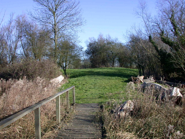
The area is characterized by its diverse ecosystems, including downs and moorland. Downs are vast open spaces covered with grass and scattered with patches of shrubs and trees. They are often used for farming and grazing livestock. Moorland, on the other hand, is characterized by its wet and boggy terrain, covered with heather, grasses, and mosses. It provides a unique habitat for various plant and animal species.

Brook Field boasts an abundance of wildlife, with numerous species of birds, such as skylarks and lapwings, making it their home. Visitors can also spot rabbits, hares, and occasionally deer roaming freely in the area. The tranquil atmosphere is further enhanced by the gentle sound of the brook that runs through the field, adding to the overall charm and serenity of the surroundings.

The area is a haven for outdoor enthusiasts, offering an array of activities such as hiking, birdwatching, and photography. There are several well-marked trails and footpaths that allow visitors to explore the downs and moorland at their own pace. The stunning panoramic views from the hilltops are truly breathtaking, providing an opportunity to appreciate the natural beauty of the Cambridgeshire countryside.

Overall, Brook Field is a hidden gem in Cambridgeshire, offering visitors a chance to immerse themselves in the beauty of nature and experience the tranquility of the downs and moorland.

If you have any feedback on the listing, please let us know in the comments section below.
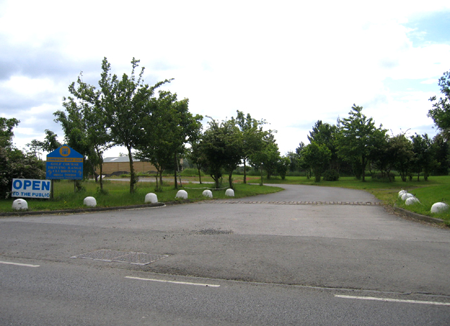
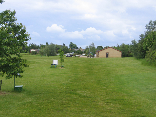
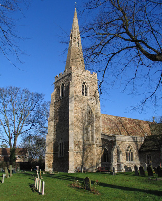
Brook Field Images

Images are sourced within 2km of 52.287013/0.074025955 or Grid Reference TL4167. Thanks to Geograph Open Source API. All images are credited.

Cambridge Golf Club, Longstanton, Cambs entrance on Station Road.
Cambridge Golf Club, Longstanton, Cambs
entrance on Station Road.
Cambridge Golf Club, Longstanton, Cambs – view towards the club house.
Cambridge Golf Club, Longstanton, Cambs
– view towards the club house.
Level crossing, Longstanton, Cambs On the disused Cambridge–St Ives line, closed to regular passenger traffic in 1970.
Level crossing, Longstanton, Cambs
On the disused Cambridge–St Ives line, closed to regular passenger traffic in 1970.
All Saints' Church, Longstanton
Longstanton Junction, Cambridgeshire Guided Busway This guided busway junction with the Longstanton to Willingham Road replaces the old railway level crossing.
Longstanton Junction, Cambridgeshire Guided Busway
This guided busway junction with the Longstanton to Willingham Road replaces the old railway level crossing.
Inflating a hot-air balloon at Longstanton Brilliant six-in-the-morning sun lights up the inside of the partly-inflated balloon as the Virgin pilot checks all is well. At this stage of the proceedings the balloon is still on its side on the ground, as is the basket. It will soon be time for an hour-long trip from here at the golf course at Longstanton to a field near Stow cum Quy, passing over Histon, Milton and Fen Ditton, with breathtaking views over the fens and across Cambridge from the north. (I was able to take this picture as I was one of two passengers holding the mouth of the balloon open while portable fans blew in cold air to begin inflation, which was completed a few minutes later by some blasts from the gas jets.)
Inflating a hot-air balloon at Longstanton
Brilliant six-in-the-morning sun lights up the inside of the partly-inflated balloon as the Virgin pilot checks all is well. At this stage of the proceedings the balloon is still on its side on the ground, as is the basket. It will soon be time for an hour-long trip from here at the golf course at Longstanton to a field near Stow cum Quy, passing over Histon, Milton and Fen Ditton, with breathtaking views over the fens and across Cambridge from the north. (I was able to take this picture as I was one of two passengers holding the mouth of the balloon open while portable fans blew in cold air to begin inflation, which was completed a few minutes later by some blasts from the gas jets.)
Rampton, All Saints <span class="nowrap"><a title="http://www.druidic.org/camchurch/churches/rampton.htm" rel="nofollow ugc noopener" href="http://www.druidic.org/camchurch/churches/rampton.htm">Link</a><img style="margin-left:2px;" alt="External link" title="External link - shift click to open in new window" src="https://s1.geograph.org.uk/img/external.png" width="10" height="10"/></span>
Rampton, All Saints
The Black Horse, Rampton CB4 Dating from 1851, or earlier.
The Black Horse, Rampton CB4
Dating from 1851, or earlier.
Little North Fen, Cottenham CB4 Little North fen, west of Cottenham village, was recorded as early as 1330.
Little North Fen, Cottenham CB4
Little North fen, west of Cottenham village, was recorded as early as 1330.
Rampton Bridge, Cambs spanning the Westwick Brook, taken from the footpath forming the parish boundary between Rampton and Cottenham.
Rampton Bridge, Cambs
spanning the Westwick Brook, taken from the footpath forming the parish boundary between Rampton and Cottenham.
Reynolds' Drove, Rampton, Cambs a public byway crossing Brook Field, from Cuckoo Lane towards Longstanton.
Reynolds' Drove, Rampton, Cambs
a public byway crossing Brook Field, from Cuckoo Lane towards Longstanton.
Cottages by The Green, Rampton, Cambs
Corrugated metal roof, Rampton, Cambs on the south side of King Street.
Corrugated metal roof, Rampton, Cambs
on the south side of King Street.
Cottages by The Green, Rampton, Cambs No. 19 and 20, built in 1902.
Cottages by The Green, Rampton, Cambs
No. 19 and 20, built in 1902.
Free Church Mission Hall, Rampton, Cambs erected 1902 on the corner of High Street and Cow Lane.
Free Church Mission Hall, Rampton, Cambs
erected 1902 on the corner of High Street and Cow Lane.
Parish pump, Rampton, Cambs located on The Green.
Parish pump, Rampton, Cambs
located on The Green.
Farm in Little Field, Rampton, Cambs beside Rampton Road bend.
Farm in Little Field, Rampton, Cambs
beside Rampton Road bend.
Rampton Road, Willingham, Cambs at the entrance to the village.
Rampton Road, Willingham, Cambs
at the entrance to the village.
Show me another place!

Brook Field is located at Grid Ref: TL4167 (Lat: 52.287013, Lng: 0.074025955)

Administrative County: Cambridgeshire

District: South Cambridgeshire

Police Authority: Cambridgeshire

What 3 Words

///curving.alleyway.compiled. Near Longstanton, Cambridgeshire

Nearby Locations

Snout Common Brook Field

Related Wikis

Northstowe Secondary College

Northstowe Secondary College is a co-educational secondary school and sixth form located in Northstowe in the English county of Cambridgeshire.The school...

Northstowe

Northstowe is a new town that will eventually have up to 10,000 homes, with an anticipated population of 24,400 in Cambridgeshire, England, UK. On 1 April...

Rampton, Cambridgeshire

Rampton is a village in Cambridgeshire, England, situated on the edge of The Fens six miles to the north of Cambridge. == History == The edge of the Fens...

Rampton Castle

Rampton Castle, known locally as Giant's Hill, is the earthwork remains of a motte and bailey castle in Rampton, Cambridgeshire. It is believed that the...

Related Videos

Countryside Walk with My Baby

One of the reasons why I love England. There are so many hidden gems waiting to be explored.

2021 Lucy's August message

"We're all going on a summer holiday.... " This August Lucy reflects on the lyrics of Cliff Richard's song.

ADVENT CALENDAR DAY 1 - Mystic Myrrh

It's day 1 lovelies and finally we can open our wax melt advent calendars! Today's scent is Mystic Myrrh - the perfect scent to kick ...

Nearby Amenities

Located within 500m of 52.287013,0.074025955
Crossing
Bicycle: no
Crossing: uncontrolled
Wheelchair: no
Lat/Long: 52.2862401/0.0699075
Barrier: cycle_barrier
Bicycle: yes
Motor Vehicle: no
Lat/Long: 52.2862213/0.0698654
Barrier: bollard
Bicycle: yes
Motor Vehicle: no
Lat/Long: 52.2863679/0.0702017
Frequency: 50
Phases: 1
Power: pole
Source: survey
Transformer: distribution
Voltage: 11000
Lat/Long: 52.2883046/0.081
Board Type: history
Information: board
Tourism: information
Lat/Long: 52.2863302/0.070236
Bench
Backrest: yes
Material: wood
Lat/Long: 52.2832169/0.0718829
The data included in this document is from www.openstreetmap.org. The data is made available under ODbL.

Have you been to Brook Field?

Leave your review of Brook Field below (or comments, questions and feedback).