Dimlington High Land

Downs, Moorland in Yorkshire

England

Dimlington High Land

Cliffs at Easington
Cliffs at Easington Credit: Jonathan Thacker

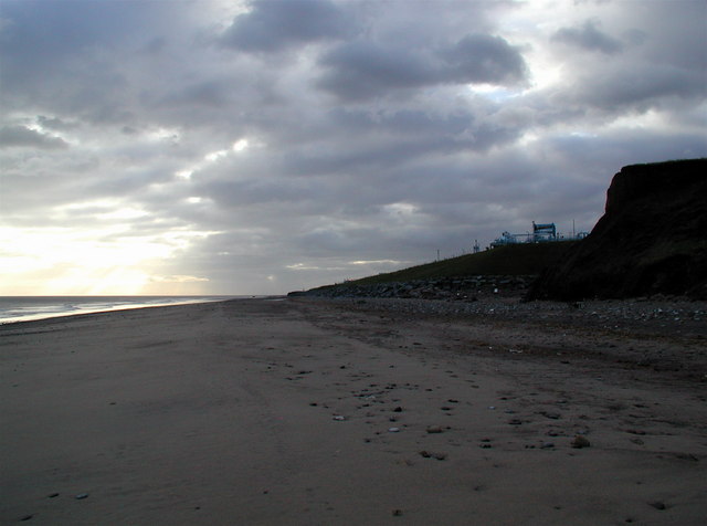
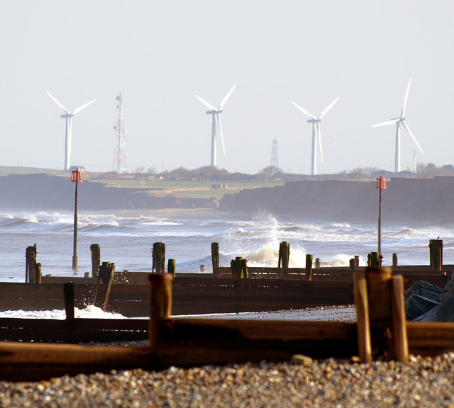
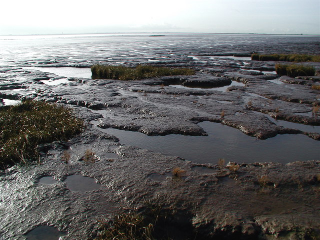
Dimlington High Land is a geographical region located in the East Riding of Yorkshire, England. Situated on the North Sea coast, it is known for its diverse natural landscapes, including downs and moorlands. The area covers an approximate area of 10 square miles.

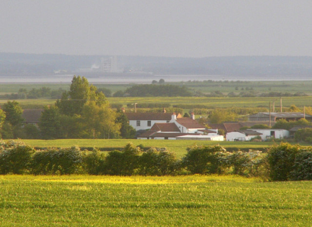
The downs in Dimlington High Land are characterized by expansive grasslands with rolling hills. These areas offer sweeping views of the surrounding countryside and provide a habitat for various plant and animal species. The downs are often used for grazing livestock, and sheep farming is a common sight in the region.

In contrast, the moorlands in Dimlington High Land are marked by heather-covered hills and vast stretches of open, rugged terrain. These moorlands are renowned for their unique beauty and are a popular destination for hikers and nature enthusiasts. The moors are home to a variety of bird species, including grouse and curlew, and are often dotted with picturesque streams and ponds.

The climate in Dimlington High Land is influenced by its coastal location, experiencing mild summers and cool winters. The region receives a moderate amount of rainfall throughout the year, which contributes to the lush greenery and vibrant flora found in the downs and moorlands.

Overall, Dimlington High Land offers visitors and residents alike a chance to experience the beauty and tranquility of the Yorkshire countryside. With its diverse landscapes and rich biodiversity, it is a haven for outdoor activities, wildlife spotting, and exploring the natural wonders of the region.

If you have any feedback on the listing, please let us know in the comments section below.

Dimlington High Land Images

Images are sourced within 2km of 53.671676/0.10102472 or Grid Reference TA3821. Thanks to Geograph Open Source API. All images are credited.

Cliffs at Easington
Cliffs at Easington
Dimlington Beach
Dimlington Beach
Soft cliffs near gas terminal
Easington Gas Terminal This terminal has a very precarious position on the rapidly eroding cliffs above Easington beach. It deals with gas from the Amethyst field.
Easington Gas Terminal
This terminal has a very precarious position on the rapidly eroding cliffs above Easington beach. It deals with gas from the Amethyst field.
Dimlington Beach North of Easington the coastline is dominated by the huge, secure compound of the natural gas terminal. At low tide you might find the occasional angler or dog-walker on the beach but otherwise it's deserted.
Dimlington Beach
North of Easington the coastline is dominated by the huge, secure compound of the natural gas terminal. At low tide you might find the occasional angler or dog-walker on the beach but otherwise it's deserted.
Easington Natural Gas Terminal Between 1975 and 2006 the Easington gas terminal's main functions were to receive and separate natural gas from the Rough offshore field and the BP operated Amethyst field, to receive treated gas from BP's Dimlington terminal and transfer it into the National Transmission System, and to withdraw gas from the National Transmission System during periods of low gas demand and re-inject it into the Rough field for storage.

In October 2006 the Easington end of Langeled was opened, a 1,200 kilometre long subsea gas pipeline connecting the Ormen Lange field's gas plant at Nyhamna in Aukra, Norway, with the reception facility here in Easington. Langeled is expected to supply the UK with 20 per cent of its gas requirements for now and the near future.
Easington Natural Gas Terminal
Between 1975 and 2006 the Easington gas terminal's main functions were to receive and separate natural gas from the Rough offshore field and the BP operated Amethyst field, to receive treated gas from BP's Dimlington terminal and transfer it into the National Transmission System, and to withdraw gas from the National Transmission System during periods of low gas demand and re-inject it into the Rough field for storage. In October 2006 the Easington end of Langeled was opened, a 1,200 kilometre long subsea gas pipeline connecting the Ormen Lange field's gas plant at Nyhamna in Aukra, Norway, with the reception facility here in Easington. Langeled is expected to supply the UK with 20 per cent of its gas requirements for now and the near future.
The cliff top at Dimlington, East Yorkshire
Walking south at Dimlington
Car Park off Dimlington Road
Out Newton Wind Farm seen from Fosse Hill
Three Foot Lane (track)
Cliff Farm, Out Newton
Soft clay cliffs near Dimlington
Beach near Dimlington
High Grange Farm, Out Newton
Farmland and wind farm
Drainage ditch beside Out Newton Road
Out Newton Road
Out Newton Road
Show me another place!

Dimlington High Land is located at Grid Ref: TA3821 (Lat: 53.671676, Lng: 0.10102472)

Division: East Riding

Unitary Authority: East Riding of Yorkshire

Police Authority: Humberside

What 3 Words

///lecturers.donor.longer. Near Easington, North Yorkshire

Related Wikis

Out Newton

Out Newton is a hamlet in the civil parish of Easington, in the East Riding of Yorkshire, England, in an area known as Holderness. It is situated just...

Easington, East Riding of Yorkshire

Easington is a small village and civil parish in the East Riding of Yorkshire, England, in the area known as Holderness. A coastal settlement, it is situated...

RAF Holmpton

Royal Air Force Holmpton or more simply RAF Holmpton is a former Royal Air Force Cold War era nuclear bunker that was built in the 1950s as an early warning...

Skeffling

Skeffling is a village and civil parish in the East Riding of Yorkshire, England, in an area known as Holderness. It is situated approximately 5 miles...

Holmpton

Holmpton is a village and civil parish in the East Riding of Yorkshire, England, in an area known as Holderness. It is situated approximately 3 miles...

Weeton, East Riding of Yorkshire

Weeton is a hamlet in the East Riding of Yorkshire, England, in an area known as Holderness. It is situated approximately 1 mile (1.6 km) south-east of...

Birstall Priory

Birstall Priory or Burstall Priory was a priory in the East Riding of Yorkshire, England. The priory was built around 1219 and continuing as an inhabited...

Welwick

Welwick is a village and civil parish in the East Riding of Yorkshire, England, in an area known as Holderness. It is situated approximately 4 miles (6...

Nearby Amenities

Located within 500m of 53.671676,0.10102472
Source: PGS
Lat/Long: 53.6720493/0.1055138
Source: PGS
Lat/Long: 53.6736067/0.1039835
Source: PGS
Lat/Long: 53.6756773/0.1016555
Generator Method: wind_turbine
Generator Output Electricity: yes
Generator Source: wind
Generator Type: horizontal_axis
Power: generator
Source: Bing
Lat/Long: 53.6685509/0.1033078
Generator Method: wind_turbine
Generator Output Electricity: yes
Generator Source: wind
Generator Type: horizontal_axis
Power: generator
Source: Bing
Lat/Long: 53.6687097/0.0962374
Generator Method: wind_turbine
Generator Output Electricity: yes
Generator Source: wind
Generator Type: horizontal_axis
Power: generator
Source: Bing
Lat/Long: 53.6687029/0.0998313
Generator Method: wind_turbine
Generator Output Electricity: yes
Generator Source: wind
Generator Type: horizontal_axis
Power: generator
Source: Bing
Lat/Long: 53.6717197/0.1012015
Generator Method: wind_turbine
Generator Output Electricity: yes
Generator Source: wind
Generator Type: horizontal_axis
Power: generator
Source: Bing
Lat/Long: 53.6725363/0.0979884
The data included in this document is from www.openstreetmap.org. The data is made available under ODbL.

Have you been to Dimlington High Land?

Leave your review of Dimlington High Land below (or comments, questions and feedback).