Little Fen

Downs, Moorland in Huntingdonshire Huntingdonshire

England

Little Fen

St Mary, Bluntisham: late September 2021
St Mary, Bluntisham: late September 2021 Credit: Basher Eyre

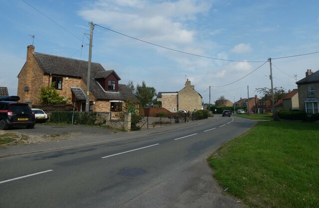
Little Fen is a small village located in the Huntingdonshire district of Cambridgeshire, England. Situated amidst picturesque surroundings, the village is renowned for its enchanting downs and moorland landscapes. With a population of approximately 500 residents, Little Fen exudes a tranquil and close-knit community atmosphere.

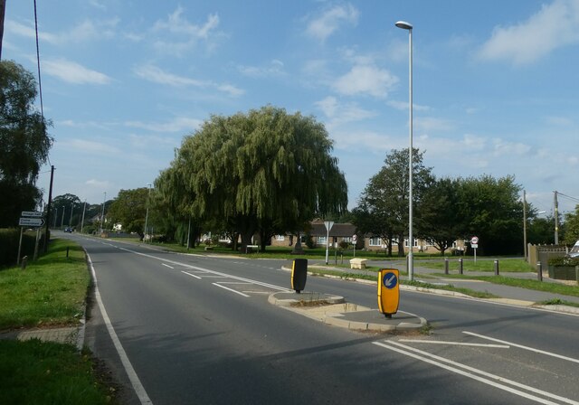
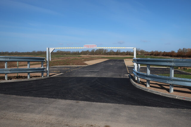
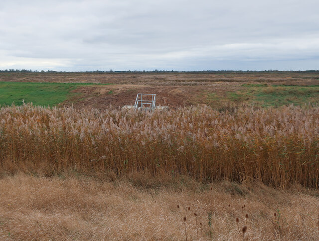
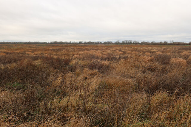
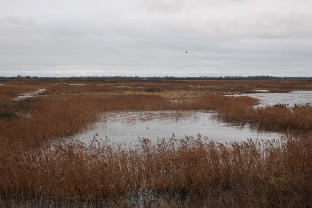
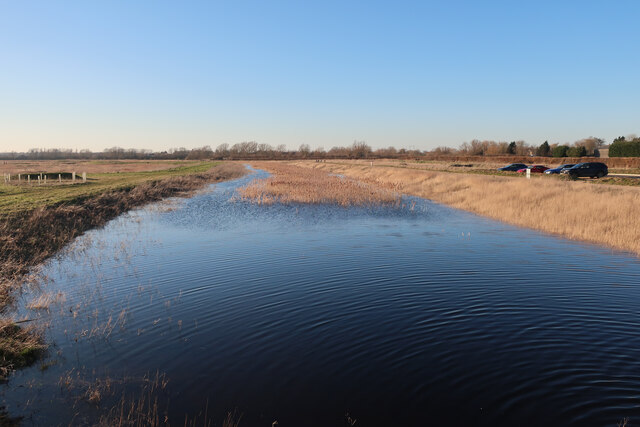
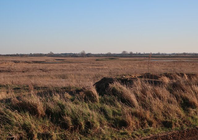
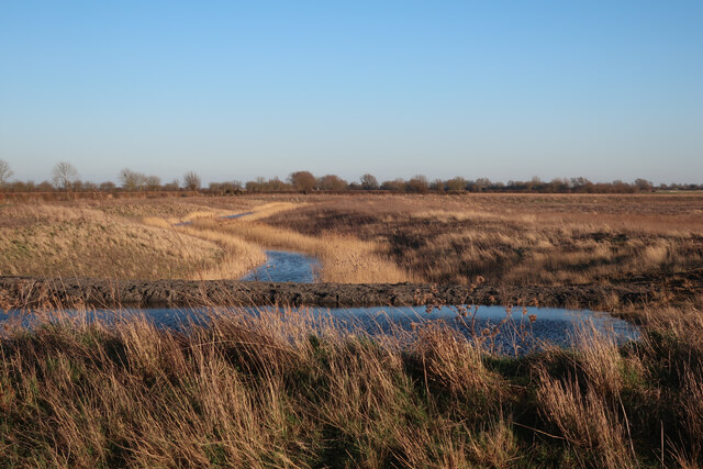
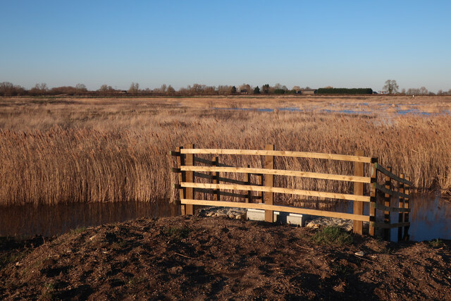
The village is characterized by its charming thatched-roof cottages, which add to its quintessential English countryside feel. The downs, sprawling across the outskirts of the village, offer breathtaking views and are a popular spot for outdoor activities such as hiking, picnicking, and bird-watching. Nature enthusiasts are drawn to the diverse wildlife that thrives in the moorland, including deer, rabbits, and various bird species.

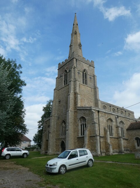
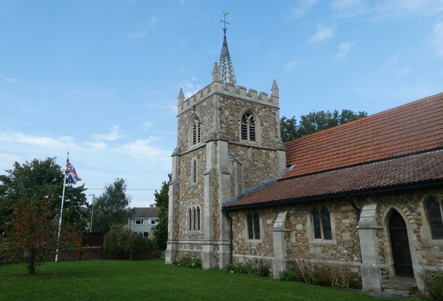
Little Fen boasts a rich history, with evidence of human habitation dating back to the Neolithic period. The village's historic church, St. Mary's, is a prominent landmark, showcasing beautiful architecture and providing a glimpse into the area's past.

Although small in size, the village is well-equipped with amenities to cater to its residents' needs. A local pub, The Fen Inn, offers a welcoming space for socializing and enjoying traditional British cuisine. Additionally, a village hall serves as a hub for community events and gatherings.

Little Fen offers a peaceful and idyllic lifestyle, making it an attractive destination for those seeking a retreat from the hustle and bustle of city life. Its natural beauty and strong community spirit make it a gem within Huntingdonshire.

If you have any feedback on the listing, please let us know in the comments section below.
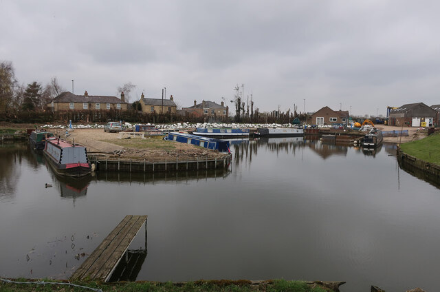
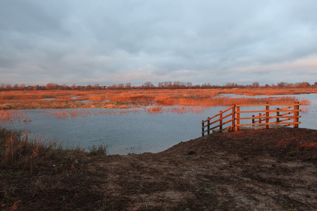
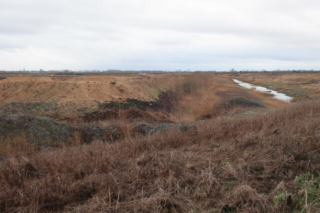
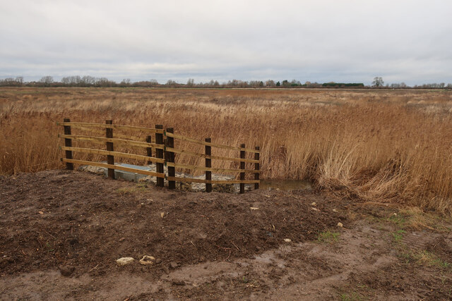
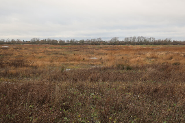
Little Fen Images

Images are sourced within 2km of 52.351492/0.022684299 or Grid Reference TL3774. Thanks to Geograph Open Source API. All images are credited.

St Mary, Bluntisham: late September 2021
Approaching the junction of the A1123 with Holliday's Road
Village sign, Colne
Village sign, Colne
St Helen, Colne: late September 2021
Looking north-east along the High Street
Ouse Fen RSPB car park A new car park off the B1050 near Earith, very soon before it opened.
Ouse Fen RSPB car park
A new car park off the B1050 near Earith, very soon before it opened.
New sluice at Ouse Fen Allowing water level control of the next phase of the wetland creation project that is following the sand and gravel quarry.
New sluice at Ouse Fen
Allowing water level control of the next phase of the wetland creation project that is following the sand and gravel quarry.
Hermitage Marina
Hermitage Marina
Crane's Fen (Cell 8) flooded After a prolonged wait for the sluices, the northern end of Ouse Fen RSPB reserve is starting to be flooded to make more reedbeds.
Crane's Fen (Cell 8) flooded
After a prolonged wait for the sluices, the northern end of Ouse Fen RSPB reserve is starting to be flooded to make more reedbeds.
Gravel works by Ouse Fen The Hanson sand and gravel quarry is being turned into wetland habitat by the RSPB after each area is completed.
Gravel works by Ouse Fen
The Hanson sand and gravel quarry is being turned into wetland habitat by the RSPB after each area is completed.
Lockspit's Mere (Cell 9) The northern end of Ouse Fen RSPB, soon to be flooded to create new wetland habitat. The area has been lowered by a sand and gravel quarry, allowing it to become wetland, after landscaping and water level management work.
Lockspit's Mere (Cell 9)
The northern end of Ouse Fen RSPB, soon to be flooded to create new wetland habitat. The area has been lowered by a sand and gravel quarry, allowing it to become wetland, after landscaping and water level management work.
Crane's Fen (Cell 8) flooded After a prolonged wait for the sluices, the northern end of Ouse Fen RSPB reserve is starting to be flooded to make more reedbeds.
Crane's Fen (Cell 8) flooded
After a prolonged wait for the sluices, the northern end of Ouse Fen RSPB reserve is starting to be flooded to make more reedbeds.
Ouse Fen canal The water levels in the reedbed cells in the reserve can be controlled, supplied by the canal around the outside. The water is currently from the active quarry being drained, in the long term it will come from the river during high water levels.
Ouse Fen canal
The water levels in the reedbed cells in the reserve can be controlled, supplied by the canal around the outside. The water is currently from the active quarry being drained, in the long term it will come from the river during high water levels.
Cell 10 to be, Ouse Fen After the sand and gravel quarry has moved on from an area it is reprofiled to become part of the Ouse Fen RSPB wetland reserve. This cell is landscaped but not flooded.
Cell 10 to be, Ouse Fen
After the sand and gravel quarry has moved on from an area it is reprofiled to become part of the Ouse Fen RSPB wetland reserve. This cell is landscaped but not flooded.
Lockspit's Mere (Cell 9) This area was arable land, then a sand and gravel quarry, then profiled to be a wetland nature reserve and is now finally flooded. See <a href="https://www.geograph.org.uk/photo/3207556">TL3974 : No 18 Drove</a>, <a href="https://www.geograph.org.uk/photo/4044817">TL3974 : Stripped and ready for extraction</a>, <a href="https://www.geograph.org.uk/photo/4664779">TL3974 : Hanson Aggregates quarry</a> and <a href="https://www.geograph.org.uk/photo/7062680">TL3974 : Lockspit's Mere (Cell 9)</a>
Lockspit's Mere (Cell 9)
This area was arable land, then a sand and gravel quarry, then profiled to be a wetland nature reserve and is now finally flooded. See TL3974 : No 18 Drove, TL3974 : Stripped and ready for extraction, TL3974 : Hanson Aggregates quarry and TL3974 : Lockspit's Mere (Cell 9)
Show me another place!

Little Fen is located at Grid Ref: TL3774 (Lat: 52.351492, Lng: 0.022684299)

Administrative County: Cambridgeshire

District: Huntingdonshire

Police Authority: Cambridgeshire

What 3 Words

///cuddling.shirt.daunting. Near Earith, Cambridgeshire

Nearby Locations

Berry Fen Little Fen

Related Wikis

Berry Fen

Berry Fen is a 15.3-hectare (38-acre) biological Site of Special Scientific Interest on the western outskirts of Earith in Cambridgeshire.This neutral...

Earith

Earith is a village and civil parish in Cambridgeshire, England. Lying approximately 10 miles (16 km) east of Huntingdon, Earith is situated within Huntingdonshire...

Bluntisham

Bluntisham is a village and civil parish in Cambridgeshire, England. The population of the civil parish at the 2011 census was 2,003. Bluntisham lies approximately...

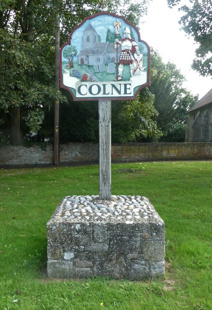
Colne, Cambridgeshire

Colne is a village and civil parish in Cambridgeshire, England. Colne lies about 9 miles (14 km) east of Huntingdon; the villages of Bluntisham, Woodhurst...

Bluntisham railway station

Bluntisham railway station was a station in Bluntisham, Cambridgeshire on the Ely and St Ives Railway. The station closed for regular passenger services...

Old Bedford River

The Old Bedford River is an artificial, partial diversion of the waters of the River Great Ouse in the Fens of Cambridgeshire, England. It was named after...

Earith Bridge railway station

Earith Bridge railway station was a station in Earith, Cambridgeshire on the Ely and St Ives Railway. It was closed to regular passenger trains in 1931...

New Bedford River

The New Bedford River, also known as the Hundred Foot Drain because of the distance between the tops of the two embankments on either side of the river...

Nearby Amenities

Located within 500m of 52.351492,0.022684299
Barrier: kissing_gate
Lat/Long: 52.349839/0.0236359
Bus Stop
Marina
Bus: yes
Naptan AtcoCode: 0500HEARI013
Naptan Bearing: SW
Naptan BusStopType: CUS
Naptan CommonName: Marina
Naptan Indicator: near
Naptan Landmark: Marina
Naptan NaptanCode: cmbdmwjt
Naptan ShortCommonName: Marina
Naptan Street: High Street
Naptan Verified: no
Public Transport: platform
Source: naptan_import
Lat/Long: 52.3538512/0.0256828
Bus Stop
Marina
Bus: yes
Naptan AtcoCode: 0500HEARI014
Naptan Bearing: NE
Naptan CommonName: Marina
Naptan Indicator: opp
Naptan Landmark: Marina
Naptan NaptanCode: cmbdmwjw
Naptan ShortCommonName: Marina
Naptan Street: High Street
Naptan Verified: no
Public Transport: platform
Source: naptan_import
Lat/Long: 52.3539531/0.0256583
Barrier: kissing_gate
Lat/Long: 52.3531167/0.026631
Mooring: yes
Seamark Mooring Category: mooring
Seamark Type: berth
Lat/Long: 52.3527479/0.0289976
Fuel
Boat fueling point
Contact Phone: 01487 840089
Contact Website: 01487 840089 info@http://www.westviewmarina.co.uk/contact-us/
Note: Location may be inaccurate.
Seamark Small Craft Facility Category: fuel_station
Seamark Type: small_craft_facility
Waterway: fuel
Lat/Long: 52.3519565/0.0283258
Little Fen
Place: locality
Lat/Long: 52.3513949/0.0213486
Ouse Fen Wash
Place: locality
Lat/Long: 52.3503752/0.0265006
Barrier: stile
Step Count: 2
Stile: stepover
Lat/Long: 52.3498906/0.0271892
Bench
Backrest: yes
Material: wood
Lat/Long: 52.3543573/0.0175579
Waterway: sluice_gate
Lat/Long: 52.3490419/0.0217483
Crane: mobile
Man Made: crane
Lat/Long: 52.3530534/0.0273647
The data included in this document is from www.openstreetmap.org. The data is made available under ODbL.

Have you been to Little Fen?

Leave your review of Little Fen below (or comments, questions and feedback).