Marden Park

Downs, Moorland in Surrey Tandridge

England

Marden Park

A22 at Caterham Going south and nearing access to the southern M25 London orbital motorway
A22 at Caterham Credit: Nigel Freeman

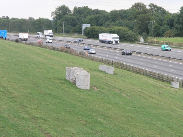
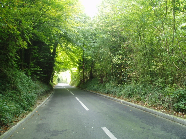
Marden Park, located in Surrey, England, is a picturesque area encompassing both downs and moorland landscapes. Situated in the North Downs, it offers a diverse and stunning natural environment that attracts visitors from all over.

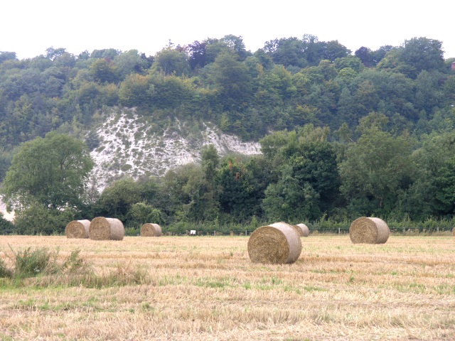
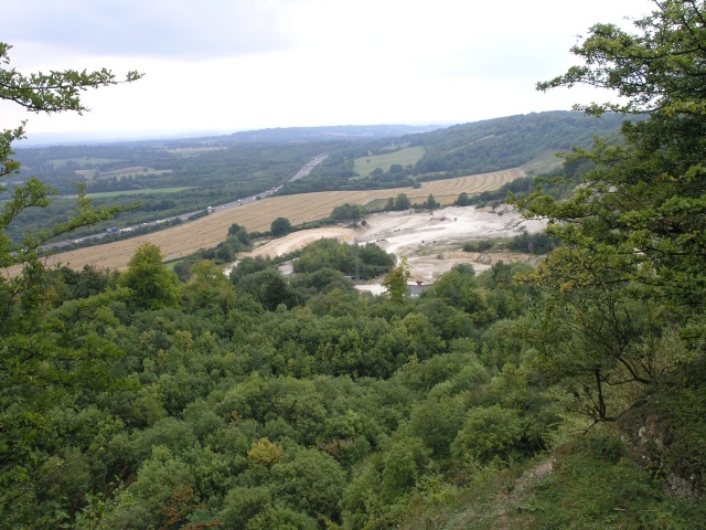
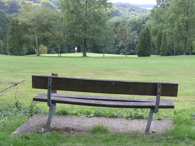
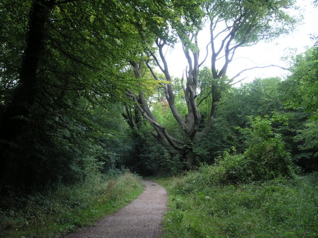
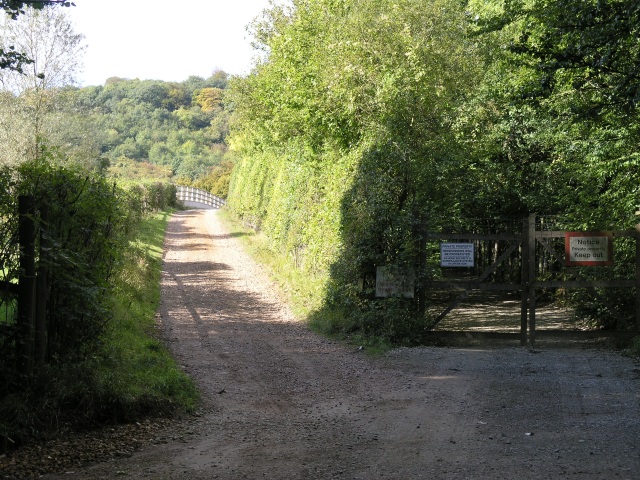
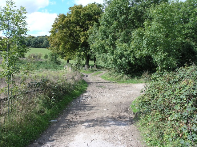
The park spans an area of approximately 400 hectares and is known for its scenic beauty, with rolling hills and expansive open spaces. The downs, which are grassy slopes, provide panoramic views of the surrounding countryside, including the nearby Surrey Hills Area of Outstanding Natural Beauty. These downs are perfect for leisurely walks, picnics, and enjoying the tranquility of nature.

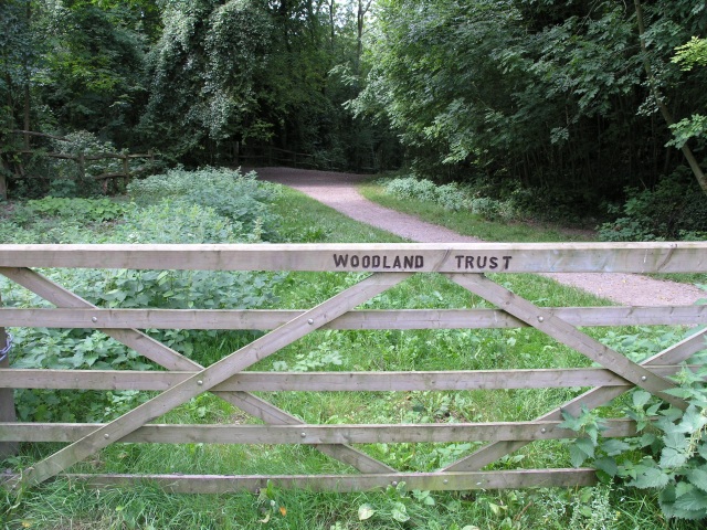
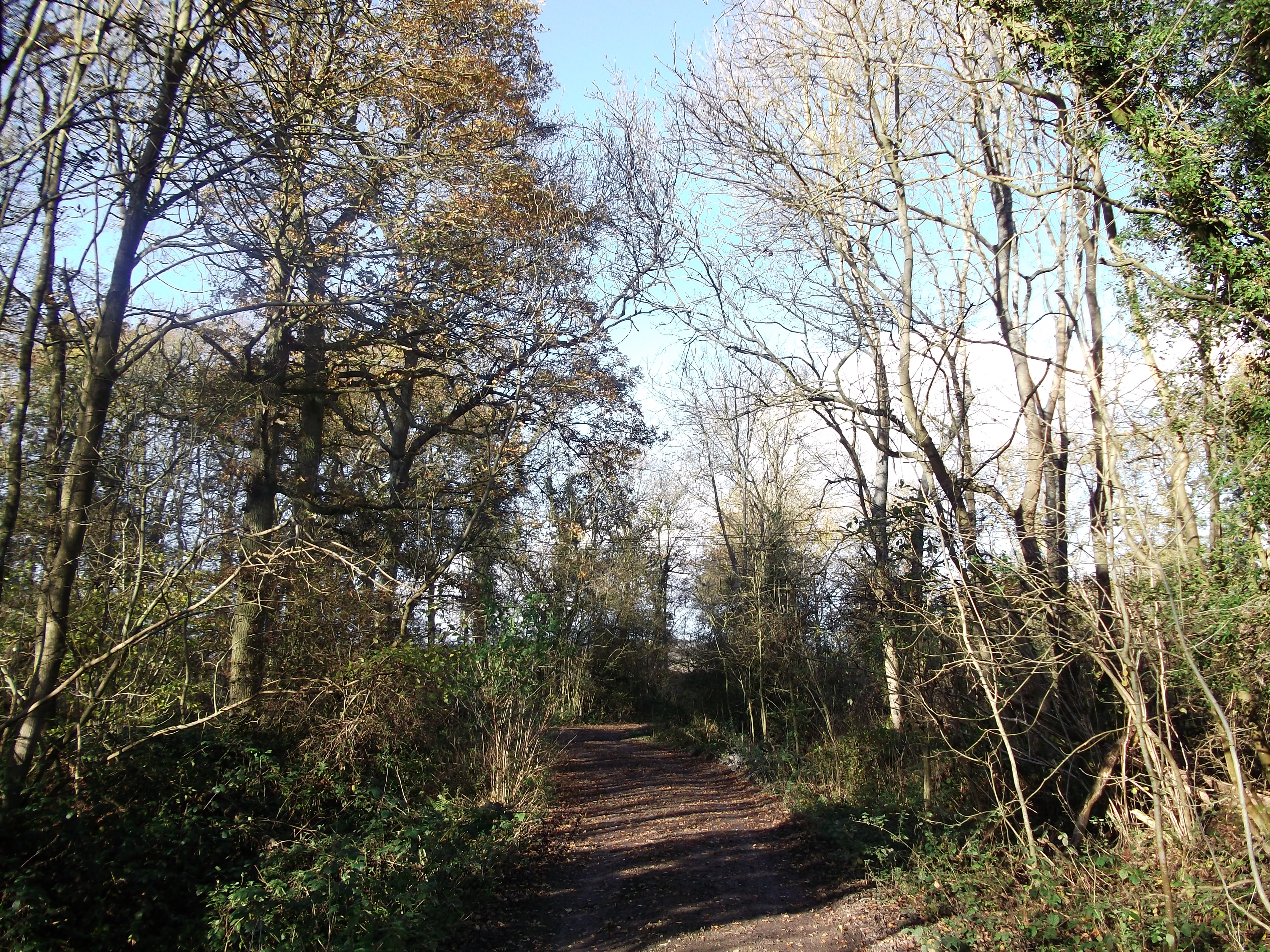
In addition to the downs, Marden Park also features moorland, which is characterized by heather, gorse, and a variety of wildflowers. The moorland areas offer a different landscape, with their rugged terrain and vibrant colors, attracting hikers and nature enthusiasts alike.

The park is home to a rich array of wildlife, including various bird species, butterflies, and small mammals. It is a haven for birdwatchers, who can spot species such as skylarks, kestrels, and buzzards soaring through the skies.

Marden Park is also known for its historical significance. It was originally part of the estate of Marden Park House, a grand mansion dating back to the 19th century. Although the house no longer exists, remnants of its gardens and parkland can still be found, adding a touch of heritage to the area.

Overall, Marden Park offers a delightful blend of natural beauty, diverse landscapes, and historical charm, making it a popular destination for outdoor enthusiasts and those seeking a peaceful retreat in Surrey.

If you have any feedback on the listing, please let us know in the comments section below.

Marden Park Images

Images are sourced within 2km of 51.272951/-0.043163888 or Grid Reference TQ3654. Thanks to Geograph Open Source API. All images are credited.

A22 at Caterham Going south and nearing access to the southern M25 London orbital motorway
A22 at Caterham
Going south and nearing access to the southern M25 London orbital motorway
Hay Fields with the North Downs in the background The hay has been collected ready for storage.  In the background a quarry can be seen cutting into the North Downs.
Hay Fields with the North Downs in the background
The hay has been collected ready for storage. In the background a quarry can be seen cutting into the North Downs.
Quarry, looking down from the top Looking down from the edge of the quarry that occupies much of this square.
Quarry, looking down from the top
Looking down from the edge of the quarry that occupies much of this square.
North Downs Golf Course This seat commands a good view of several of the greens on the North Downs Golf Course
North Downs Golf Course
This seat commands a good view of several of the greens on the North Downs Golf Course
Woodland Footpath, part of the Woldingham Country Walk This footpath is managed by the Woodlands Trust and is about 5.5 miles of walk ending up in Woldingham station.
Woodland Footpath, part of the Woldingham Country Walk
This footpath is managed by the Woodlands Trust and is about 5.5 miles of walk ending up in Woldingham station.
Marlesdon Park footpath A public footpath that runs through Marlesdon Park.  Marlesdon Park was a barren stretch of land until Sir Robert Claydon, the Lord Mayer of London (1679-80) built his home and estate there, planting many trees.
Marlesdon Park footpath
A public footpath that runs through Marlesdon Park. Marlesdon Park was a barren stretch of land until Sir Robert Claydon, the Lord Mayer of London (1679-80) built his home and estate there, planting many trees.
Field, next to M25 This field next to the M25 has numerous curious looking pipes sticking vertically out of it.  On occasion, surveyors have been seen taking measurements around the pipes.  The pipes were inserted a few years ago as countermeasures when a serious landslip caused the field to subside substantially, partially obscuring the M25.
Field, next to M25
This field next to the M25 has numerous curious looking pipes sticking vertically out of it. On occasion, surveyors have been seen taking measurements around the pipes. The pipes were inserted a few years ago as countermeasures when a serious landslip caused the field to subside substantially, partially obscuring the M25.
Field South West of Woldingham Used for horses, this field is bordered by Little Church Wood and, on the right of the photo, the railway line between Croydon and Oxted.
Field South West of Woldingham
Used for horses, this field is bordered by Little Church Wood and, on the right of the photo, the railway line between Croydon and Oxted.
Cattle Trough on Woldingham Village Green According to its difficult-to-read inscription, this dates from 1907.
Cattle Trough on Woldingham Village Green
According to its difficult-to-read inscription, this dates from 1907.
Narrow steep road past the quarry The road allows you to descend from the north Downs at Woldingham to Oxted
Narrow steep road past the quarry
The road allows you to descend from the north Downs at Woldingham to Oxted
Convent of the Sacred Heart, Marden Park, Woldingham, Surrey Viewed looking northwards from the public bridleway
Convent of the Sacred Heart, Marden Park, Woldingham, Surrey
Viewed looking northwards from the public bridleway
Millennium Centre, Woldingham School, Surrey Just a small part of this large progressive Roman Catholic girls' school
Millennium Centre, Woldingham School, Surrey
Just a small part of this large progressive Roman Catholic girls' school
Mixed dairy herd at Marden Hillboxes Farm, Surrey The herd includes Herefords and Holstein Friesians as well as the three Channel Islands breeds
Mixed dairy herd at Marden Hillboxes Farm, Surrey
The herd includes Herefords and Holstein Friesians as well as the three Channel Islands breeds
Country bridleway with M25 bridge in the distance This bridleway runs through the land of Barrow Green Court.  The residents definitely don't want unwanted visitors judging by the multiple signs and security features.  In the distance, the bridlepath can be seen crossing the M25.
Country bridleway with M25 bridge in the distance
This bridleway runs through the land of Barrow Green Court. The residents definitely don't want unwanted visitors judging by the multiple signs and security features. In the distance, the bridlepath can be seen crossing the M25.
Parting of the ways After crossing the M25, this bridleway parts into two.  A nice rural looking scene.  In reality accompanied by the roar of traffic from the M25.
Parting of the ways
After crossing the M25, this bridleway parts into two. A nice rural looking scene. In reality accompanied by the roar of traffic from the M25.
St Agatha's Church, Woldingham, Surrey The ancient parish church of Woldingham
St Agatha's Church, Woldingham, Surrey
The ancient parish church of Woldingham
Cottages, Chalkpit Lane, Oxted Former quarryworkers cottages for the nearby Oxted Quarry.
Cottages, Chalkpit Lane, Oxted
Former quarryworkers cottages for the nearby Oxted Quarry.
Entrance to Oxted Quarry The quarry is now being developed as a landfill site.
Entrance to Oxted Quarry
The quarry is now being developed as a landfill site.
Show me another place!

Marden Park is located at Grid Ref: TQ3654 (Lat: 51.272951, Lng: -0.043163888)

Administrative County: Surrey

District: Tandridge

Police Authority: Surrey

What 3 Words

///filed.pigs.sculpture. Near Woldingham, Surrey

Nearby Locations

Stubbs Copse Marden Park

Related Wikis

Woldingham and Oxted Downs

Woldingham and Oxted Downs is a 128.4-hectare (317-acre) biological Site of Special Scientific Interest east of Caterham in Surrey.This sloping site on...

Woldingham School

Woldingham School is an independent boarding and day school for girls, located in the former Marden Park of 700 acres (280 ha) outside the village of Woldingham...

Titsey Woods

Titsey Woods is a 45.3-hectare (112-acre) biological Site of Special Scientific Interest north-west of Oxted in Surrey.This site is composed of wet semi...

Hill Park, Tatsfield

Hill Park, Tatsfield is a 24.5-hectare (61-acre) Local Nature Reserve south of Tatsfield in Surrey. It is owned by Surrey County Council and managed by...

Nearby Amenities

Located within 500m of 51.272951,-0.043163888
Traffic Calming: hump
Lat/Long: 51.2747675/-0.0494254
Traffic Calming: hump
Lat/Long: 51.2746759/-0.048614
Traffic Calming: hump
Lat/Long: 51.2745518/-0.0479204
Traffic Calming: hump
Lat/Long: 51.2743575/-0.0472118
Traffic Calming: hump
Lat/Long: 51.2742314/-0.0468287
Bench
Backrest: yes
Material: wood
Seats: 3
Lat/Long: 51.2694117/-0.0404853
Barrier: kissing_gate
Foot: yes
Lat/Long: 51.2745449/-0.0458366
Fire Hydrant
Emergency: fire_hydrant
Fire Hydrant Diameter: 80
Fire Hydrant Position: sidewalk
Fire Hydrant Type: underground
Lat/Long: 51.274224/-0.0466981
Barrier: kissing_gate
Foot: yes
Source: Photo P142-0110
Lat/Long: 51.2709206/-0.0435298
Traffic Calming: hump
Lat/Long: 51.2744032/-0.047436
Marden Park
Place: locality
Source Name: OS OpenData StreetView
Lat/Long: 51.2738234/-0.0430656
Power: pole
Source: Bing
Lat/Long: 51.2749644/-0.0410673
Power: pole
Source: Bing
Lat/Long: 51.2751423/-0.041526
Power: pole
Source: Bing
Lat/Long: 51.274701/-0.0422059
Power: pole
Source: Bing
Lat/Long: 51.274414/-0.0426418
Power: pole
Source: Bing
Lat/Long: 51.2738788/-0.043425
Material: wood
Power: pole
Source: Bing
Lat/Long: 51.2730805/-0.0446494
Material: wood
Power: pole
Source: Bing
Lat/Long: 51.2727277/-0.0452221
Power: pole
Source: Bing
Lat/Long: 51.2734123/-0.0441438
Material: wood
Power: pole
Source: Bing
Lat/Long: 51.2722289/-0.0459965
Material: wood
Power: pole
Source: Bing
Lat/Long: 51.2716889/-0.0468072
Power: pole
Source: Bing
Lat/Long: 51.2714641/-0.0482261
Power: pole
Source: Bing
Lat/Long: 51.2712879/-0.0493714
Bench
Backrest: yes
Lat/Long: 51.2749781/-0.0378786
Power: pole
Source: bing
Lat/Long: 51.2694151/-0.0438032
Power: pole
Source: gps
Lat/Long: 51.2708281/-0.0441813
Material: wood
Power: pole
Source: gps
Lat/Long: 51.2721571/-0.0446641
Material: wood
Power: pole
Source: gps;Bing
Lat/Long: 51.2714037/-0.0445247
Bench
Backrest: yes
Lat/Long: 51.2743159/-0.0368911
The data included in this document is from www.openstreetmap.org. The data is made available under ODbL.

Have you been to Marden Park?

Leave your review of Marden Park below (or comments, questions and feedback).