Whaplode Fen

Downs, Moorland in Lincolnshire South Holland

England

Whaplode Fen

Mill Gate near St Catherine's Bridge
Mill Gate near St Catherine's Bridge Credit: Jonathan Thacker

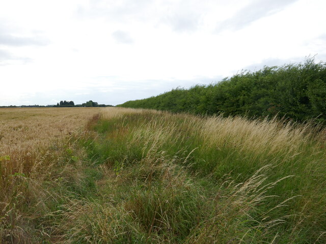
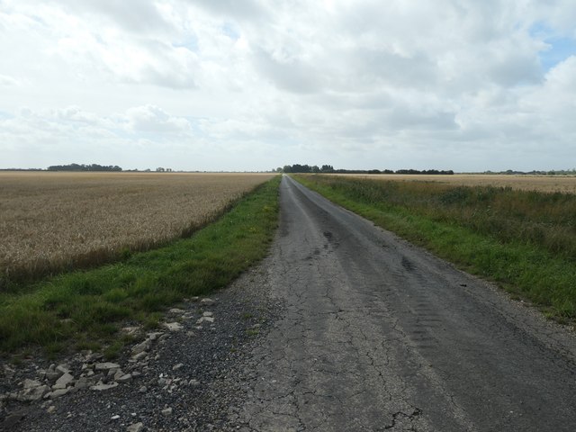
Whaplode Fen is a nature reserve located in Lincolnshire, England, known for its diverse wildlife and tranquil surroundings. The fen covers an area of approximately 600 acres and is home to a variety of habitats, including wetlands, marshes, and grasslands.

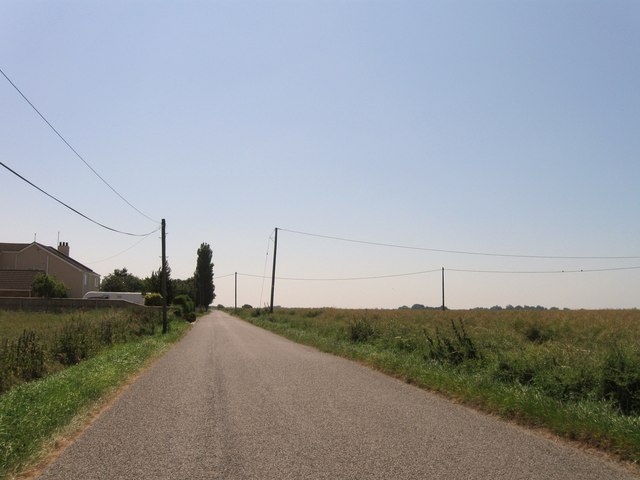
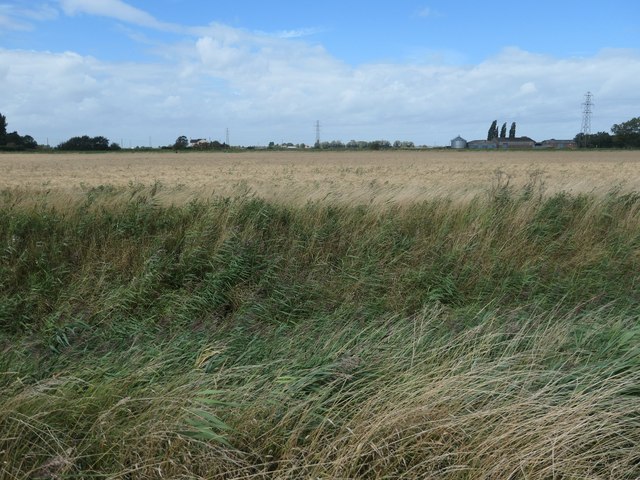
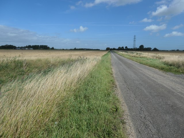
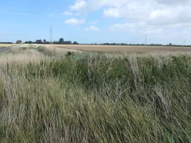
The landscape of Whaplode Fen is characterized by its flat terrain and open vistas, offering visitors an opportunity to explore and observe the natural beauty of the area. The reserve is rich in biodiversity, with a wide range of plant and animal species thriving in the wetland environment.

Visitors to Whaplode Fen can expect to see a variety of bird species, including wading birds, waterfowl, and raptors. The reserve is also home to mammals such as otters, water voles, and deer. In addition to its wildlife, Whaplode Fen is also known for its unique flora, with a variety of plant species adapted to the wet and marshy conditions.

Overall, Whaplode Fen offers a peaceful and serene escape for nature lovers and wildlife enthusiasts, providing a glimpse into the diverse ecosystems of the Lincolnshire countryside.

If you have any feedback on the listing, please let us know in the comments section below.

Whaplode Fen Images

Images are sourced within 2km of 52.760576/-0.03712436 or Grid Reference TF3219. Thanks to Geograph Open Source API. All images are credited.

Mill Gate near St Catherine's Bridge
Wheat field off Gelder's Lane A field of barley in the distance.
Wheat field off Gelder's Lane
A field of barley in the distance.
Drain off Gelder's Lane
Barley field and hedge off Cranesgate South
Little South Holland Drain
Drain alongside Daw's Gate
Wheat field near Bees Farm Bees Farm is hidden by the trees.
Wheat field near Bees Farm
Bees Farm is hidden by the trees.
Alongside Little South Holland Drain Near St Catharine's Bridge.
Alongside Little South Holland Drain
Near St Catharine's Bridge.
Entrance to Whaplode St Catherine
B1165 eastbound
B1165 eastbound
The Blue Bell Inn
The Blue Bell Inn
The Blue Bell Inn
The Blue Bell Inn
Mill Gate
Mill Gate
Mill Gate
Mill Gate
Fox Headings, looking south A minor road south-west of Whaplode St Catherine. It connects the B1165 with Jekil's Bank.
Fox Headings, looking south
A minor road south-west of Whaplode St Catherine. It connects the B1165 with Jekil's Bank.
Fenland field, west side of Fox Headings About 3 metres above sea level.
Fenland field, west side of Fox Headings
About 3 metres above sea level.
Fox Headings, looking north A minor road south-west of Whaplode St Catherine. It connects the B1165 with Jekil's Bank.
Fox Headings, looking north
A minor road south-west of Whaplode St Catherine. It connects the B1165 with Jekil's Bank.
Drain on the east side of Fox Headings Drains are the seams in South Holland's patchwork of fields.
Drain on the east side of Fox Headings
Drains are the seams in South Holland's patchwork of fields.
Show me another place!

Whaplode Fen is located at Grid Ref: TF3219 (Lat: 52.760576, Lng: -0.03712436)

Administrative County: Lincolnshire

District: South Holland

Police Authority: Lincolnshire

What 3 Words

///onions.quicksand.emulating. Near Moulton Chapel, Lincolnshire

Nearby Locations

Whaplode Fen

Related Wikis

Elloes

Elloes was a local justice area (LJA) and former petty sessional division in Lincolnshire, England. It was formed in 1990 by a merger of the former East...

Moulton Castle

Moulton Castle, also known as King's Hall Park, is a medieval earthwork and scheduled monument situated 1.5 miles (2.4 km) to the south of Moulton, Lincolnshire...

Fenland Airfield

Fenland Airfield or Fenland Aerodrome (ICAO: EGCL) is located 6 nautical miles (11 km; 6.9 mi) southeast of the town Spalding near the small village of...

Holbeach St Johns

Holbeach St Johns is a small village in South Holland district of Lincolnshire, England. It is situated approximately 4 miles (6 km) south from the town...

Related Videos

low cloud day, but patience prevailed.

a short flight to fenland from Boughton. waited 2 hours to finally get airborne waiting for the weather to improve. finally managed it ...

Fenland Flight | Friends Reunion | G-AVZV

Haven't seen the air racing crew since November last year and I am glad to see them again. Decided to have a small flight to ...

Qualifying Cross Country 🛫(Fenland - Beccles)🛬

Hello, in this video I fly my first leg of my qualifying cross country. The next video of my flight into Earls Colne will come soon!

Nearby Amenities

Located within 500m of 52.760576,-0.03712436
Bus Stop
St Catherine's Bridge
Naptan AtcoCode: 270000009670
Naptan Bearing: W
Naptan CommonName: St Catherine's Bridge
Naptan Indicator: Westbound
Naptan Landmark: St Catherine's Bridge
Naptan NaptanCode: linjdpat
Naptan Street: Raven's Bank
Naptan Verified: no
Source: naptan_import
Lat/Long: 52.7585263/-0.0335131
Bus Stop
St Catherine's Bridge
Naptan AtcoCode: 270000009671
Naptan Bearing: E
Naptan CommonName: St Catherine's Bridge
Naptan Indicator: Eastbound
Naptan Landmark: St Catherine's Bridge
Naptan NaptanCode: linjdpaw
Naptan Street: Raven's Bank
Naptan Verified: no
Source: naptan_import
Lat/Long: 52.7585989/-0.0335543
Bus Stop
St Catherine's Bridge
Naptan AtcoCode: 270000014519
Naptan Bearing: S
Naptan CommonName: St Catherine's Bridge
Naptan Indicator: Southbound
Naptan Landmark: St Catherine's Bridge
Naptan NaptanCode: linjpwag
Naptan Street: Millgate
Naptan Verified: no
Source: naptan_import
Lat/Long: 52.7588016/-0.033308
Bus Stop
St Catherine's Bridge
Naptan AtcoCode: 270002700545
Naptan Bearing: N
Naptan CommonName: St Catherine's Bridge
Naptan Indicator: Northbound
Naptan Landmark: St Catherine's Bridge
Naptan Street: Millgate
Naptan Verified: no
Source: naptan_import
Lat/Long: 52.7588041/-0.0334561
Power: pole
Source: bing
Lat/Long: 52.7647338/-0.0343941
Power: pole
Source: bing
Lat/Long: 52.7644141/-0.0375081
Power: pole
Source: bing
Lat/Long: 52.7646056/-0.0358344
Power: pole
Source: bing
Lat/Long: 52.7638994/-0.0421196
Power: pole
Source: bing
Lat/Long: 52.7642581/-0.0389519
Power: pole
Source: bing
Lat/Long: 52.7641155/-0.0402091
Rookery Farm
Place: farm
Source: Bing
Lat/Long: 52.7583394/-0.0344832
Power: pole
Lat/Long: 52.761971/-0.0309046
Power: pole
Lat/Long: 52.7621053/-0.0317996
Power: pole
Lat/Long: 52.7622665/-0.0333294
Power: pole
Lat/Long: 52.7624595/-0.034833
Power: pole
Lat/Long: 52.7625962/-0.0360083
Power: pole
Lat/Long: 52.7627724/-0.0372624
Power: pole
Lat/Long: 52.7629281/-0.0385814
Power: pole
Lat/Long: 52.763093/-0.0398667
Power: pole
Lat/Long: 52.763253/-0.0411504
Power: pole
Lat/Long: 52.7633969/-0.0423973
The data included in this document is from www.openstreetmap.org. The data is made available under ODbL.

Have you been to Whaplode Fen?

Leave your review of Whaplode Fen below (or comments, questions and feedback).