Moulton Common

Downs, Moorland in Lincolnshire South Holland

England

Moulton Common

Field ditch off Common Road, Moulton Common
Field ditch off Common Road, Moulton Common Credit: Guy Erwood

Moulton Common is a picturesque area located in Lincolnshire, England. Covering an expansive landscape of downs and moorland, it offers visitors a tranquil and serene escape from the hustle and bustle of everyday life.

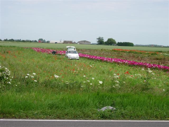
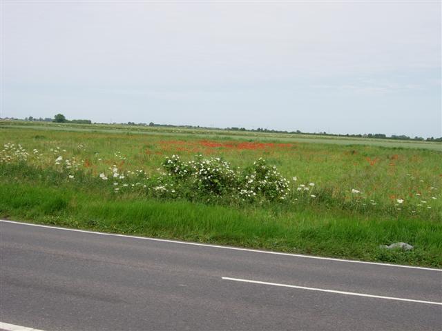
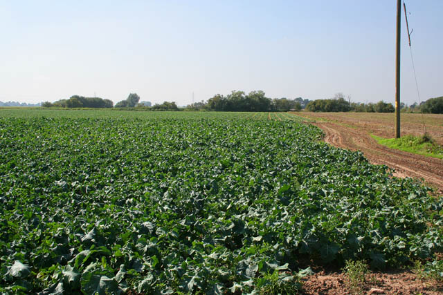
The common is characterized by its rolling hills, lush green meadows, and scattered pockets of woodland. It is home to an array of diverse flora and fauna, making it a popular destination for nature enthusiasts and wildlife watchers. Visitors can expect to encounter various species of birds, mammals, and butterflies as they explore the area.

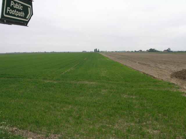
The terrain of Moulton Common is primarily made up of gently sloping hills and open grasslands, creating a perfect setting for walking, hiking, and picnicking. The pathways and trails throughout the common are well-maintained, allowing visitors to easily navigate and explore the different areas.

One of the notable features of Moulton Common is its rich history and archaeological significance. The area has evidence of human habitation dating back thousands of years, with numerous ancient burial mounds and earthworks scattered across the landscape. These historical landmarks offer a glimpse into the past and provide a fascinating insight into the region's heritage.

Overall, Moulton Common is a hidden gem in Lincolnshire, offering visitors a chance to connect with nature, enjoy outdoor activities, and immerse themselves in the area's rich history. With its stunning landscapes and diverse wildlife, it is a must-visit destination for those seeking a peaceful and scenic retreat.

If you have any feedback on the listing, please let us know in the comments section below.

Moulton Common Images

Images are sourced within 2km of 52.840912/-0.038313886 or Grid Reference TF3228. Thanks to Geograph Open Source API. All images are credited.

Field ditch off Common Road, Moulton Common
Man cutting flowers for sale, near the A17 Patches of flowers like this one, apparently grown for sale, border the A17 on this stretch.
Man cutting flowers for sale, near the A17
Patches of flowers like this one, apparently grown for sale, border the A17 on this stretch.
Flat fens landscape near the A19
Golden Lion This Golden Lion pub stands at the junction of Pipwell Gate and Seas End Road.
Golden Lion
This Golden Lion pub stands at the junction of Pipwell Gate and Seas End Road.
Footpath and Farm The footpath leads to the River Welland.  The farm is clearly operating on an industrial scale in its food production.
Footpath and Farm
The footpath leads to the River Welland. The farm is clearly operating on an industrial scale in its food production.
Farm Track and Shadow This farm track leads over the flat fields to the A17.  The white and red dots on the horizon, left, are lorries which are using this busy route.
Farm Track and Shadow
This farm track leads over the flat fields to the A17. The white and red dots on the horizon, left, are lorries which are using this busy route.
Flat Fenland Footpath This footpath leads from a road between Saracen's Head and Moulton Seas End, to the nearby A17.
Flat Fenland Footpath
This footpath leads from a road between Saracen's Head and Moulton Seas End, to the nearby A17.
Fen farmland Looking east from Carrington Road
Fen farmland
Looking east from Carrington Road
Ancient sea defences Mill Marsh Road runs along the top of the bank to the left, about a metre higher than the land straight in front of the view point. The farmland to the right of the drain is another metre lower. The bank was built in the 17th century during a large drainage project. The present day defences are several miles further west along the River Welland and northeast at the Wash.
Ancient sea defences
Mill Marsh Road runs along the top of the bank to the left, about a metre higher than the land straight in front of the view point. The farmland to the right of the drain is another metre lower. The bank was built in the 17th century during a large drainage project. The present day defences are several miles further west along the River Welland and northeast at the Wash.
Mill Marsh Road Looking towards Moulton Seas End. The road runs along the top of the old sea bank and the farmland is considerably lower either side. Middle Farm, shown in <a href="https://www.geograph.org.uk/photo/188647">TF3127 : Footpath and Farm</a>, is on the horizon.
Mill Marsh Road
Looking towards Moulton Seas End. The road runs along the top of the old sea bank and the farmland is considerably lower either side. Middle Farm, shown in TF3127 : Footpath and Farm, is on the horizon.
Farm track at Crown Farm This bridleway goes from Carrington Road to the River Welland in <a href="https://www.geograph.org.uk/gridref/TF2892">TF2892</a>.
Farm track at Crown Farm
This bridleway goes from Carrington Road to the River Welland in TF2892.
Carrington Road There are several houses and farms dotted along this road that leads to Moulton Marsh.
Carrington Road
There are several houses and farms dotted along this road that leads to Moulton Marsh.
Public footpath to Middle Farm Not at all well defined, one would need a compass or gps to find the route to the other end at <a href="https://www.geograph.org.uk/photo/188647">TF3127 : Footpath and Farm</a>.
Public footpath to Middle Farm
Not at all well defined, one would need a compass or gps to find the route to the other end at TF3127 : Footpath and Farm.
Farmland off Carrington Road Looking towards the A17 (you can just make out the traffic on the horizon), Fosdyke Bridge and the Wash.
Farmland off Carrington Road
Looking towards the A17 (you can just make out the traffic on the horizon), Fosdyke Bridge and the Wash.
Carrington Road looking towards Moulton Marsh Straight Fenland road leading to the River Welland. The orange mesh sacks contain newly harvested onions.
Carrington Road looking towards Moulton Marsh
Straight Fenland road leading to the River Welland. The orange mesh sacks contain newly harvested onions.
Farming on the Lincolnshire Fens Brassica growing seems to be a favourite occupation round here. The River Wellend is just beyond the trees on the distant horizon in <a href="https://www.geograph.org.uk/gridref/TF2829">TF2829</a>
Farming on the Lincolnshire Fens
Brassica growing seems to be a favourite occupation round here. The River Wellend is just beyond the trees on the distant horizon in TF2829
Farmland on the Lincolnshire Fens Looking across Moulton Common. The traffic on the A17 can be seen on the horizon, <a href="https://www.geograph.org.uk/gridref/TF3229">TF3229</a>. The track from Middle Farm <a href="https://www.geograph.org.uk/photo/188647">TF3127 : Footpath and Farm</a> to Three Bridges <a href="https://www.geograph.org.uk/gridref/TF3230">TF3230</a> runs across the middle of the photograph You can see a change in the vegetation were it follows a drain across the fields.
Farmland on the Lincolnshire Fens
Looking across Moulton Common. The traffic on the A17 can be seen on the horizon, TF3229. The track from Middle Farm TF3127 : Footpath and Farm to Three Bridges TF3230 runs across the middle of the photograph You can see a change in the vegetation were it follows a drain across the fields.
Curly kale by the A17 Vickers Farm is in square in the misty distance.
Curly kale by the A17
Vickers Farm is in square in the misty distance.
Show me another place!

Moulton Common is located at Grid Ref: TF3228 (Lat: 52.840912, Lng: -0.038313886)

Administrative County: Lincolnshire

District: South Holland

Police Authority: Lincolnshire

What 3 Words

///meals.hamsters.chatting. Near Whaplode, Lincolnshire

Nearby Locations

Moulton Common

Related Wikis

Parts of Holland

The Parts of Holland is a historical division of Lincolnshire, England, encompassing the south-east of the county. The name is still recognised locally...

Moulton Seas End

Moulton Seas End is a village in the civil parish of The Moultons and the South Holland district of Lincolnshire, England. It is 5 miles (8 km) north...

Holbeach Clough

Holbeach Clough (today synonymous with Saracen's Head) is a fenland village in the South Holland district of Lincolnshire, England. It is just under 2...

Holbeach Bank

Holbeach Bank is a fenland village in the South Holland district of Lincolnshire, England. It is just under 2 miles (3 km) north from the market town of...

Nearby Amenities

Located within 500m of 52.840912,-0.038313886
Moulton Common
Place: locality
Source: Bing
Lat/Long: 52.8402439/-0.0330094
Bucks Cottage
Place: isolated_dwelling
Source: Bing
Lat/Long: 52.8403143/-0.03726
Field House
Place: isolated_dwelling
Source: Bing
Lat/Long: 52.8397321/-0.0382238
Rose Villa
Place: isolated_dwelling
Source: Bing
Lat/Long: 52.8372355/-0.0371946
Warren Lodge
Place: isolated_dwelling
Source: Bing
Lat/Long: 52.8366149/-0.0365355
Willow Lodge
Place: isolated_dwelling
Source: Bing
Lat/Long: 52.8432449/-0.0359694
Woad House
Place: isolated_dwelling
Source: Bing
Lat/Long: 52.8435409/-0.0359368
Bergas
Place: isolated_dwelling
Lat/Long: 52.8444208/-0.03573
Sycamores
Place: isolated_dwelling
Lat/Long: 52.8383733/-0.0369739
The data included in this document is from www.openstreetmap.org. The data is made available under ODbL.

Have you been to Moulton Common?

Leave your review of Moulton Common below (or comments, questions and feedback).