Cow Pastures

Downs, Moorland in Huntingdonshire Huntingdonshire

England

Cow Pastures

Burleigh Hill Farm Caravan site
Burleigh Hill Farm Caravan site Credit: Dave Thompson

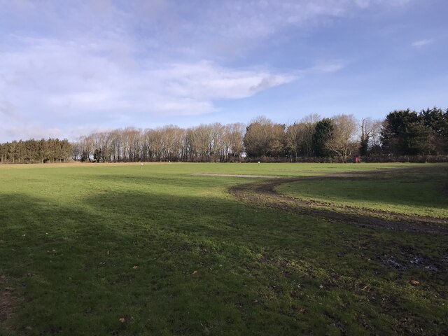
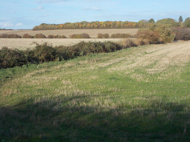
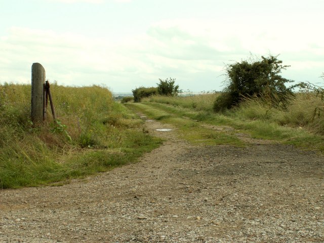
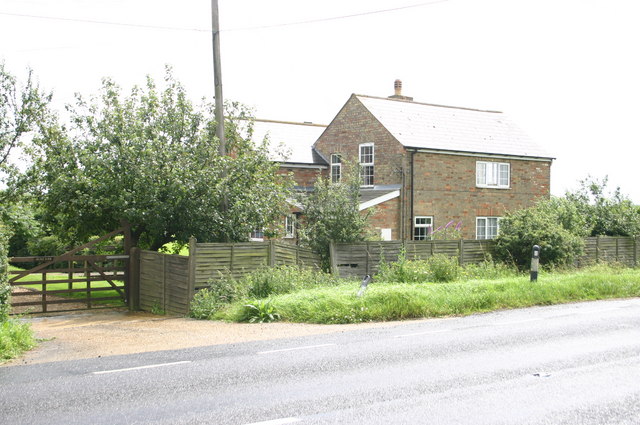
Cow Pastures, Huntingdonshire, also known as the Downs or Moorland, is a picturesque area located in Huntingdonshire, England. Spanning across a vast expanse of land, it is renowned for its lush green meadows and rolling hills that provide an idyllic backdrop for both residents and visitors alike.

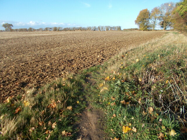
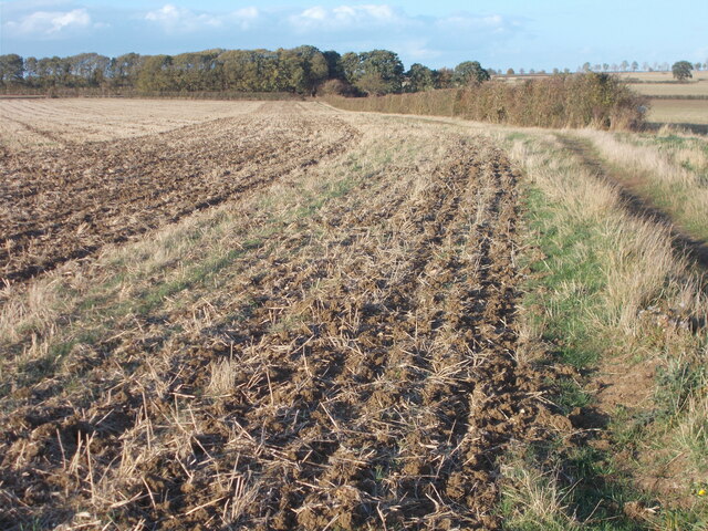
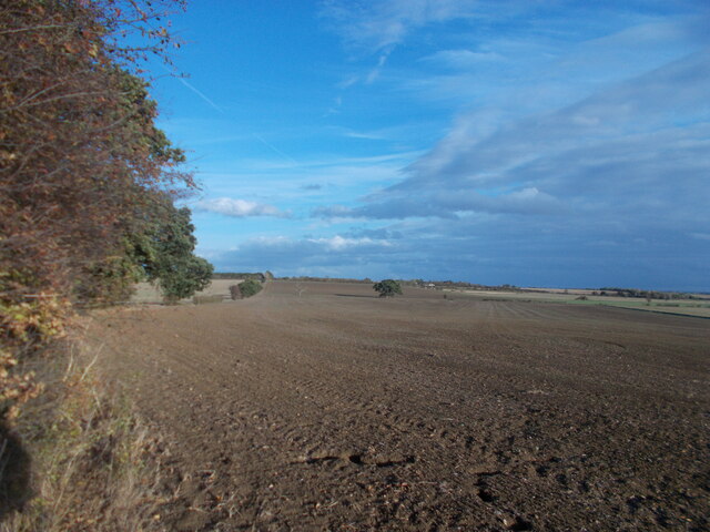
The Cow Pastures are primarily used for livestock grazing, particularly for cows, hence the name. The area is dotted with numerous farms and agricultural fields, showcasing the rich farming heritage of the region. The fertile soil, coupled with ample rainfall, ensures that the pastures remain verdant year-round.

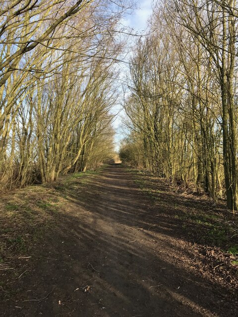
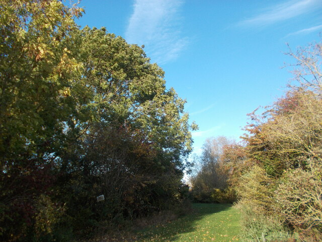
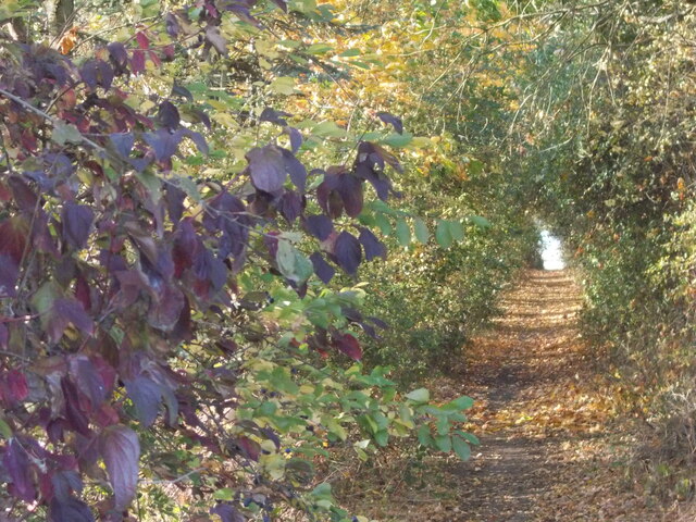
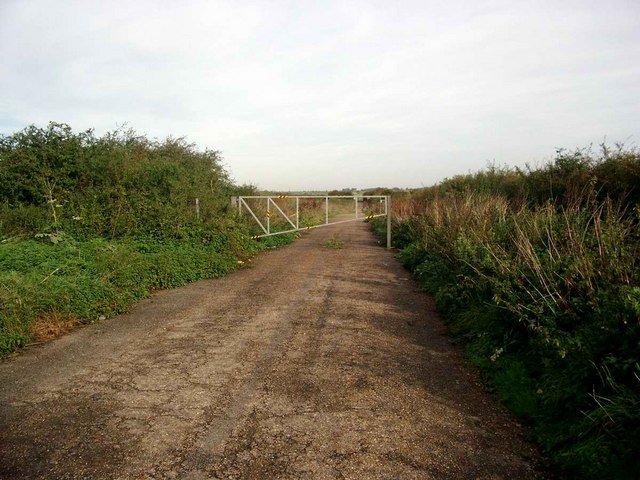
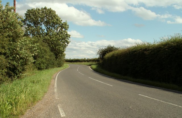
The landscape of the Downs is characterized by gentle slopes, providing a pleasing sight for nature enthusiasts and hikers. The area is crisscrossed with well-maintained footpaths and trails, offering opportunities for leisurely walks and exploration. The Downs also boast several viewpoints, allowing visitors to admire panoramic vistas of the surrounding countryside.

Wildlife thrives in the Cow Pastures, with a diverse range of species calling this area their home. Various bird species, including skylarks and lapwings, can be spotted soaring overhead, while small mammals like rabbits and hares scurry through the grass. The occasional sighting of a deer adds to the sense of tranquility and natural beauty.

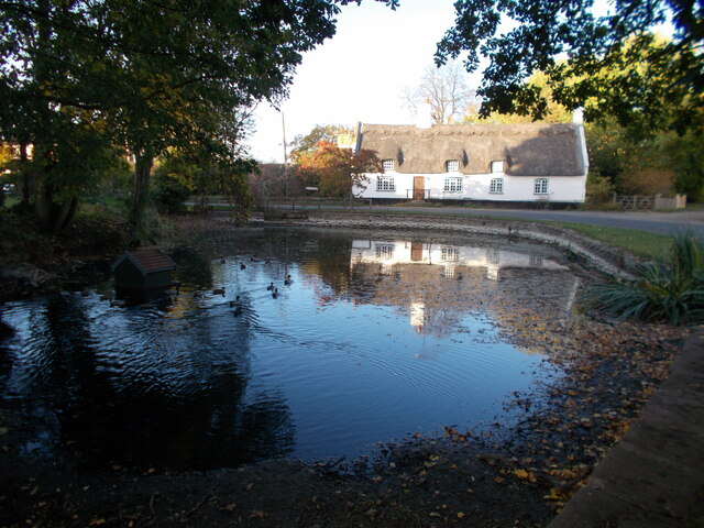
Visitors to the Cow Pastures can enjoy a peaceful escape from the hustle and bustle of urban life. The area offers ample space for picnics, as well as opportunities for photography, painting, and simply soaking in the serene atmosphere. Whether it is a leisurely stroll or a day spent exploring nature, the Cow Pastures in Huntingdonshire provide a remarkable experience for all who visit.

If you have any feedback on the listing, please let us know in the comments section below.
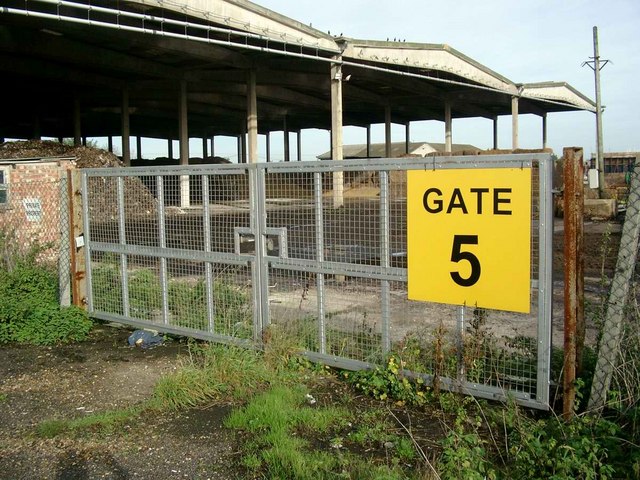
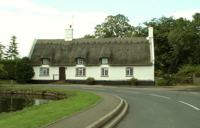
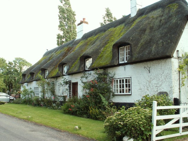
Cow Pastures Images

Images are sourced within 2km of 52.362973/-0.069689005 or Grid Reference TL3175. Thanks to Geograph Open Source API. All images are credited.

Burleigh Hill Farm Caravan site
Track to Woodhurst
Track to Woodhurst
Woodhurst village pond
Woodhurst parish church
Field path on the edge of St Ives From this point on the edge of the St Ives perimeter road, Marley Road, a public footpath leads to the ring village of Woodhurst a couple of miles away. The Via Beata walking route, leading to Woodhurst, passes through the autumnal-looking copse on the horizon in this photo.
Field path on the edge of St Ives
From this point on the edge of the St Ives perimeter road, Marley Road, a public footpath leads to the ring village of Woodhurst a couple of miles away. The Via Beata walking route, leading to Woodhurst, passes through the autumnal-looking copse on the horizon in this photo.
Grassy area near to Burleigh Farm The way ahead appears to lead invitingly on at this point but the Via Beata route, leading to the ring village of Woodhurst, takes a sharp left turn here through a copse.
Grassy area near to Burleigh Farm
The way ahead appears to lead invitingly on at this point but the Via Beata route, leading to the ring village of Woodhurst, takes a sharp left turn here through a copse.
Path through the copse south west of Burleigh Farm At the copse, the Via Beata switches sharp left before turning right at the end of the woods, thus bypassing the farm. This copse is clearly seen atop a rise from the St Ives perimeter road. The change of direction is not immediately obvious when approaching from the south as the way ahead appears to lead invitingly on but to do so only means retracing your steps back to this point as it leads to the farm and is not a continuation route with public access.
Path through the copse south west of Burleigh Farm
At the copse, the Via Beata switches sharp left before turning right at the end of the woods, thus bypassing the farm. This copse is clearly seen atop a rise from the St Ives perimeter road. The change of direction is not immediately obvious when approaching from the south as the way ahead appears to lead invitingly on but to do so only means retracing your steps back to this point as it leads to the farm and is not a continuation route with public access.
Field edge path leading towards Woodhurst
On the Via Beata between St Ives and Woodhurst This path between St Ives and Woodhurst borders a field edge before continuing ahead through deciduous woodland to the village of Woodhurst.
On the Via Beata between St Ives and Woodhurst
This path between St Ives and Woodhurst borders a field edge before continuing ahead through deciduous woodland to the village of Woodhurst.
Last view of the open landscape before entering woodland.
Woodhurst village This appears to be the usual shot of the village with the pond in the foreground. As this is a ring village, there is no excuse for getting lost since, by following the road ahead, you arrive back at the point where you started ! Hurst, as part of a place name, means a grove or wooded hillock and this is an appropriate name for the village.
Woodhurst village
This appears to be the usual shot of the village with the pond in the foreground. As this is a ring village, there is no excuse for getting lost since, by following the road ahead, you arrive back at the point where you started ! Hurst, as part of a place name, means a grove or wooded hillock and this is an appropriate name for the village.
The end of the road Continuing would mean straying onto Wyton Airfield - an RAF base.
The end of the road
Continuing would mean straying onto Wyton Airfield - an RAF base.
Mushroom compost plant
The road into Woodhurst from Oldhurst
Thatched cottage at Woodhurst This is known as Horseshoe Cottage and was once a public house called 'The Three Horseshoes'
Thatched cottage at Woodhurst
This is known as Horseshoe Cottage and was once a public house called 'The Three Horseshoes'
Cottages at Woodhurst, in South Street
Farm track, just east of Woodhurst
Bridge Farm Bridge Farm on Somersham Road
Bridge Farm
Bridge Farm on Somersham Road
Show me another place!

Cow Pastures is located at Grid Ref: TL3175 (Lat: 52.362973, Lng: -0.069689005)

Administrative County: Cambridgeshire

District: Huntingdonshire

Police Authority: Cambridgeshire

What 3 Words

///recorders.fluid.venturing. Near Warboys, Cambridgeshire

Nearby Locations

Cow Pastures Ridge's Pond

Related Wikis

St Ives Rural District

St Ives was a rural district in Huntingdonshire from 1894 to 1974, surrounding the urban area of St Ives. It was formed under the Local Government Act...

Woodhurst

Woodhurst is a village and civil parish in Cambridgeshire, England. Woodhurst lies approximately 5 miles (8 km) north-east of Huntingdon and just north...

Old Hurst

Old Hurst is a village and civil parish in Cambridgeshire, England, approximately 5 miles (8 km) north-east of Huntingdon. It is situated within Huntingdonshire...

Hurstingstone (hundred)

Hurstingstone was a hundred of Huntingdonshire, England that was mentioned in the Domesday Book of 1086. According to Victoria County History, the derivation...

Pidley

Pidley is a small village in Cambridgeshire, England. Pidley lies approximately 7 miles (11 km) north-east of Huntingdon. Together with the neighbouring...

RAF Wyton

Royal Air Force Wyton or more simply RAF Wyton (IATA: QUY, ICAO: EGUY) is a Royal Air Force station near St Ives, Cambridgeshire, England. The airfield...

St Ives, Cambridgeshire

St Ives is a medieval market town and civil parish in the Huntingdonshire district in Cambridgeshire, England, 5 miles (8 km) east of Huntingdon and 12...
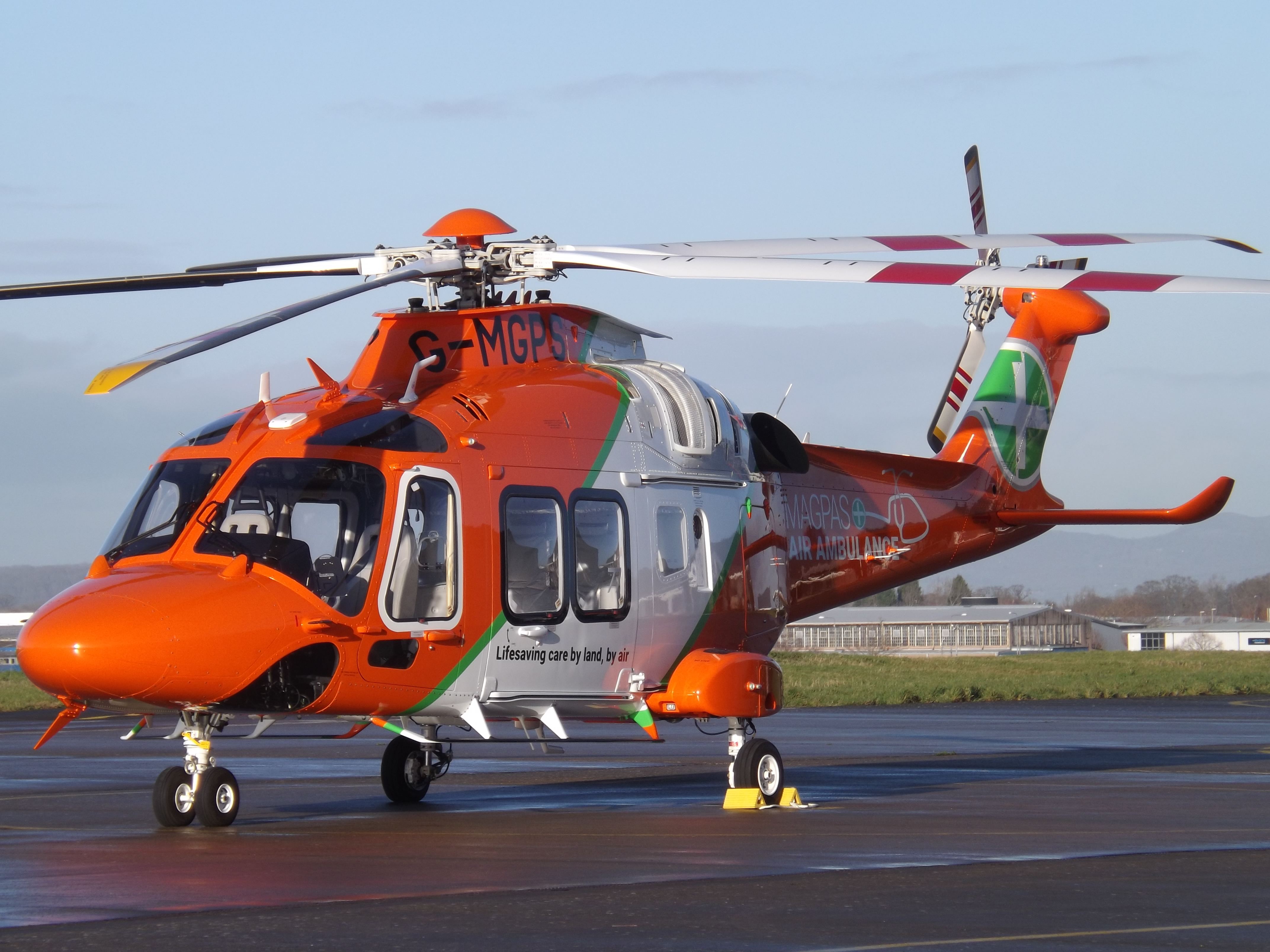
Magpas

Magpas Air Ambulance is a registered charity that operates a helicopter emergency medical service (HEMS) dedicated to the seriously ill and injured in...

Nearby Amenities

Located within 500m of 52.362973,-0.069689005
Woodhurst
Place: village
Source Name: local knowledge
Lat/Long: 52.3661068/-0.0719159
Created By: Merkaartor 0.12
Lat/Long: 52.3653804/-0.0704991
Created By: Merkaartor 0.12
Lat/Long: 52.3654393/-0.0688039
Created By: Merkaartor 0.12
Lat/Long: 52.3655507/-0.0677632
Created By: Merkaartor 0.12
Lat/Long: 52.3654219/-0.066278
Bus Stop
The Chapel
Naptan AtcoCode: 0500HWOOT003
Naptan Bearing: W
Naptan CommonName: The Chapel
Naptan Indicator: o/s
Naptan Landmark: St John's Close
Naptan NaptanCode: cmbgjajd
Naptan Street: Church Street
Naptan Verified: no
Source: naptan_import
Lat/Long: 52.367111/-0.0675141
Bus Stop
The Chapel
Naptan AtcoCode: 0500HWOOT004
Naptan Bearing: E
Naptan BusStopType: CUS
Naptan CommonName: The Chapel
Naptan Indicator: opp
Naptan Landmark: St John's Close
Naptan NaptanCode: cmbgjamj
Naptan Street: Church Street
Naptan Verified: no
Source: naptan_import
Lat/Long: 52.3671583/-0.0675134
Barrier: cycle_barrier
Fixme: Can wheelchair users transverse this barrier?
Foot: yes
Lat/Long: 52.3669498/-0.0685408
Community Centre
Woodhurst Village Hall
Community Centre: village_hall
Lat/Long: 52.366638/-0.0675965
Telephone
Defibrillator
Booth: K6
Colour: red
Defibrillator Location: inside red phone box, Church Street, Woodhurst
Emergency: defibrillator
Man Made: telephone_box
Lat/Long: 52.3670814/-0.0673937
Post Box
Post Box Type: wall
Royal Cypher: GR
Royal Cypher Wikidata: Q33102273
Lat/Long: 52.3670718/-0.0672765
Power: pole
Lat/Long: 52.3643707/-0.074387
Power: pole
Lat/Long: 52.3627304/-0.0756916
Power: pole
Lat/Long: 52.3619642/-0.0757901
Power: pole
Lat/Long: 52.3656722/-0.0751552
Power: pole
Lat/Long: 52.3644468/-0.0734228
Power: pole
Lat/Long: 52.364247/-0.0754035
Power: pole
Lat/Long: 52.3646368/-0.0727843
Power: pole
Lat/Long: 52.3642175/-0.0756328
Power: pole
Lat/Long: 52.3648497/-0.0718347
Power: pole
Lat/Long: 52.3649186/-0.0752786
Power: pole
Lat/Long: 52.3634807/-0.0755361
Power: pole
Lat/Long: 52.3612103/-0.0759439
Man Made: water_well
Lat/Long: 52.3669969/-0.0682588
The data included in this document is from www.openstreetmap.org. The data is made available under ODbL.

Have you been to Cow Pastures?

Leave your review of Cow Pastures below (or comments, questions and feedback).