Balgown

Settlement in Inverness-shire

Scotland

Balgown

Kilvaxter and Gaeilavore Island Group from the car park at iron-age farmstead and souterrain
Kilvaxter and Gaeilavore Island Group from the car park at iron-age farmstead and souterrain Credit: Jo and Steve Turner

The requested URL returned error: 429 Too Many Requests

If you have any feedback on the listing, please let us know in the comments section below.
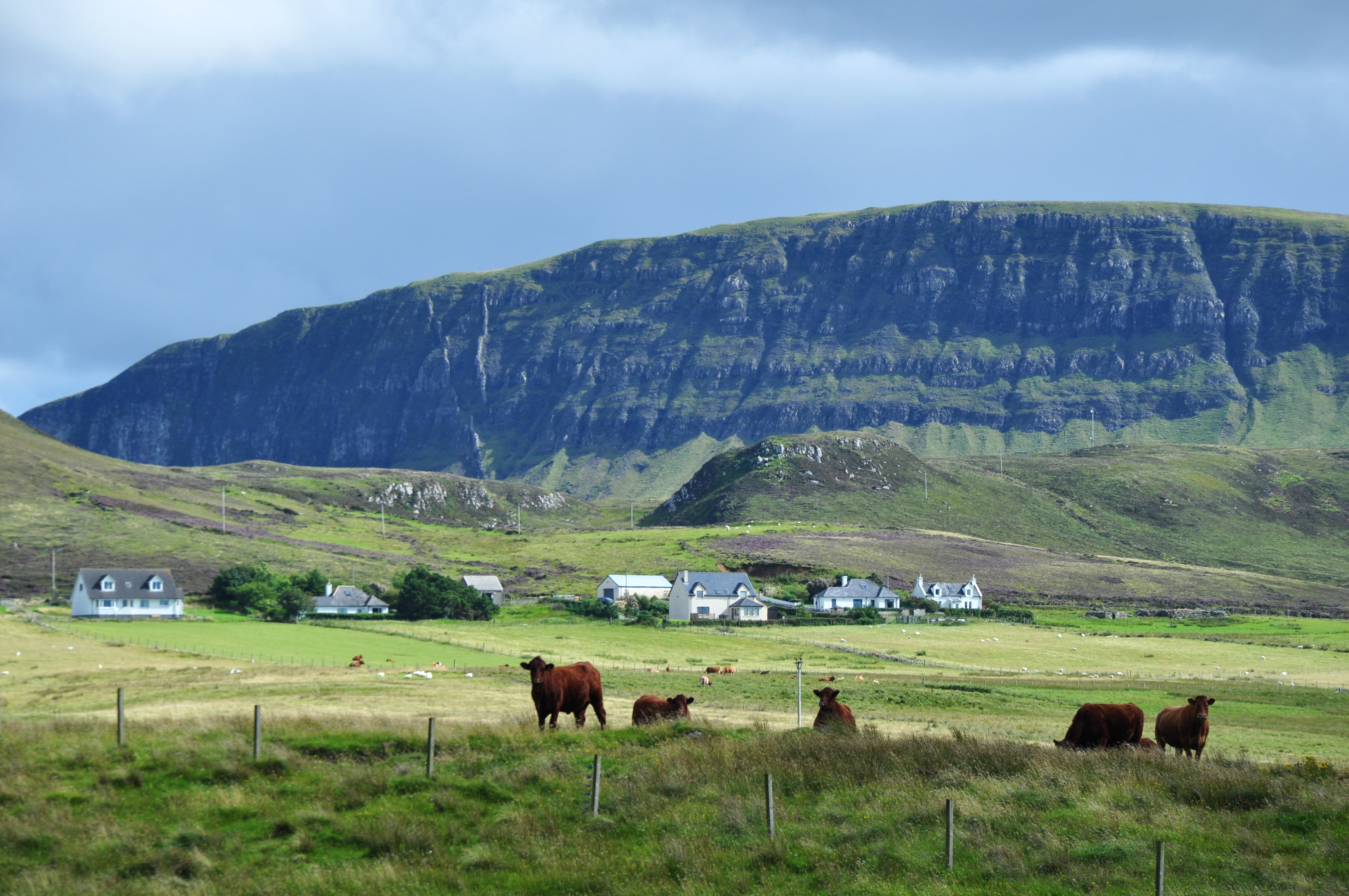
Balgown Images

Images are sourced within 2km of 57.635903/-6.3764664 or Grid Reference NG3869. Thanks to Geograph Open Source API. All images are credited.

Kilvaxter and Gaeilavore Island Group from the car park at iron-age farmstead and souterrain
Kilmuir Village Hall A community hub for the dispersed settlements north of Uig on the west coast of Trotternish.
Kilmuir Village Hall
A community hub for the dispersed settlements north of Uig on the west coast of Trotternish.
Unclassified road to Heribusta
Cattle grid on the A855 The main road north from Uig as it approaches Hungladder.
Cattle grid on the A855
The main road north from Uig as it approaches Hungladder.
Cattle grid on A855 at Kilmuir
The Heribusta Road A reciprocal view to <a href="https://www.geograph.org.uk/photo/748180">NG3970 : Road to Heribusta</a>, taken some 14 years earlier.
The Heribusta Road
A reciprocal view to NG3970 : Road to Heribusta, taken some 14 years earlier.
Beaton's Cottage, Bornesketaig No.40 Bornesketaig - a well maintained old croft house with a small area of garden ground. It is available for holiday lets through the NTS.
Beaton's Cottage, Bornesketaig
No.40 Bornesketaig - a well maintained old croft house with a small area of garden ground. It is available for holiday lets through the NTS.
Croft in Bornesketaig A working croft above Camas Mòr, seen from a different angle in <a title="https://www.geograph.org.uk/photo/1800649" href="https://www.geograph.org.uk/photo/1800649">Link</a>
Croft in Bornesketaig
A working croft above Camas Mòr, seen from a different angle in Link
Minor road to Heribusta
Shed in a field Looking towards the cliffs of Rubh' a' Chàirn Lèith and houses at Bornesketaig.
Shed in a field
Looking towards the cliffs of Rubh' a' Chàirn Lèith and houses at Bornesketaig.
Ruined church, Bornesketaig in 1967 With the headland of Sgeir Lang and the bay of Camas Mor in the distance.
Ruined church, Bornesketaig in 1967
With the headland of Sgeir Lang and the bay of Camas Mor in the distance.
Dilapidated croft house at Kilvaxter
Croft building in need of repair In the settlement of Kilvaxter.
Croft building in need of repair
In the settlement of Kilvaxter.
New build in Bornesketaig
Animal shelter at Bornesketaig A ruined croft building put to good use.
Animal shelter at Bornesketaig
A ruined croft building put to good use.
The road to Bornesketaig The building in the distance is a ruined chapel.
The road to Bornesketaig
The building in the distance is a ruined chapel.
Ruined chapel at Bornesketaig
Monkstadt House with An Dubh Sgeir and An t-Iasgair in the distance The Category B listed house was built around 1732 by the Macdonalds of Duntulm Castle after vacating the “haunted” castle as a place of residence.  The house was visited by Flora Macdonald and Prince Charles Edward, disguised as "Betty Burk" her maid, when they landed June 29th, 1746 from Benbecula. The interior was remodelled by James Gillespie Graham in 1803. Reputedly the first slated house in Skye it became a tacksman's house after the Macdonalds moved headquarters to Armadale in 1815. The 1841 Census shows Hugh Peter MacDonald Tacksman at Monkstadt but by the 1851 Census head of house is given as Donald Martin MD JP and Farmer, Tacksman of Monkstadt who gave up the farm after the 1861 Census when forced by Lord MacDonald to add evicted crofters land to his. The house fell into disrepair in the 1900s being described in 1938 as a roofless ruin with half the main block still inhabited. Only a ruinous shell remained once the rest of the roof was removed having been abandoned in 1956. Around 1993 the Clan MacQueen Trust acquired the building and later Ian MacQueen inherited the house from his father James around 2005 and built five houses to get connected to the main electricity grid. Ian eventually completed renovation of the house in 2013 but it stood empty and was put up for auction in July 2014 at £1.3m. (The MacQueens were once official armourers and blacksmiths to the Macdonalds.)
Monkstadt House with An Dubh Sgeir and An t-Iasgair in the distance
The Category B listed house was built around 1732 by the Macdonalds of Duntulm Castle after vacating the “haunted” castle as a place of residence. The house was visited by Flora Macdonald and Prince Charles Edward, disguised as "Betty Burk" her maid, when they landed June 29th, 1746 from Benbecula. The interior was remodelled by James Gillespie Graham in 1803. Reputedly the first slated house in Skye it became a tacksman's house after the Macdonalds moved headquarters to Armadale in 1815. The 1841 Census shows Hugh Peter MacDonald Tacksman at Monkstadt but by the 1851 Census head of house is given as Donald Martin MD JP and Farmer, Tacksman of Monkstadt who gave up the farm after the 1861 Census when forced by Lord MacDonald to add evicted crofters land to his. The house fell into disrepair in the 1900s being described in 1938 as a roofless ruin with half the main block still inhabited. Only a ruinous shell remained once the rest of the roof was removed having been abandoned in 1956. Around 1993 the Clan MacQueen Trust acquired the building and later Ian MacQueen inherited the house from his father James around 2005 and built five houses to get connected to the main electricity grid. Ian eventually completed renovation of the house in 2013 but it stood empty and was put up for auction in July 2014 at £1.3m. (The MacQueens were once official armourers and blacksmiths to the Macdonalds.)
Show me another place!

Balgown is located at Grid Ref: NG3869 (Lat: 57.635903, Lng: -6.3764664)

Unitary Authority: Highland

Police Authority: Highlands and Islands

What 3 Words

///facelift.clown.spelling. Near Uig, Highland

Nearby Locations

Balgown

Related Wikis

Kilvaxter

Kilvaxter (Scottish Gaelic: Cille Bhacastair) is a crofting township on the Trotternish peninsula of the Isle of Skye in the Highlands of Scotland. It...

Kilmuir, Skye

Kilmuir (Scottish Gaelic: Cille Mhoire) is a village on the west coast of the Trotternish peninsula in the north of the island of Skye. It is in the Scottish...

Beaton's Cottage

Beaton's Cottage (also known as Beaton's Croft) is a croft dwelling in Bornesketaig, Isle of Skye, Scotland, near the island's northern tip. A Category...

Heribusta

Heribusta (Scottish Gaelic: Hearabusta), (also Herbusta), is a small crofting township on the Trotternish peninsula of the Isle of Skye in the Highlands...

Nearby Amenities

Located within 500m of 57.635903,-6.3764664
Kilvaxter
Name Gd: Cille a' Bhacstair
Name Sco: Kilbaxter
Place: hamlet
Lat/Long: 57.6402135/-6.3762473
Bus Stop
Primary School
Bus: yes
Naptan AtcoCode: 6700713228
Naptan Bearing: S
Naptan CommonName: Primary School
Naptan Indicator: o/s
Naptan Landmark: Primary School
Naptan NaptanCode: 45328586
Naptan Street: A855
Naptan Verified: no
Public Transport: platform
Source: naptan_import
Lat/Long: 57.6357259/-6.3763318
Bus Stop
Primary School
Bus: yes
Naptan AtcoCode: 6700713228A
Naptan Bearing: N
Naptan CommonName: Primary School
Naptan Indicator: opp
Naptan Landmark: Primary School
Naptan NaptanCode: 45329546
Naptan Street: A855
Naptan Verified: no
Public Transport: platform
Source: naptan_import
Lat/Long: 57.6354844/-6.3765542
Post Box
Ref: IV51 93
Source: survey
Lat/Long: 57.6359631/-6.3763432
Power: pole
Lat/Long: 57.6398366/-6.3730252
Power: pole
Lat/Long: 57.6390786/-6.3727838
Power: pole
Lat/Long: 57.6384354/-6.3725102
Power: pole
Lat/Long: 57.6376917/-6.3722688
Power: pole
Lat/Long: 57.6368963/-6.3719711
Power: pole
Lat/Long: 57.6362747/-6.3717377
Power: pole
Lat/Long: 57.6357449/-6.3715312
Power: pole
Lat/Long: 57.6352753/-6.3713783
Power: pole
Lat/Long: 57.6346335/-6.3711315
Power: pole
Lat/Long: 57.634309/-6.3713032
Power: pole
Lat/Long: 57.6336485/-6.3716251
Power: pole
Lat/Long: 57.6329536/-6.371904
Power: pole
Lat/Long: 57.6322773/-6.3722286
The data included in this document is from www.openstreetmap.org. The data is made available under ODbL.

Have you been to Balgown?

Leave your review of Balgown below (or comments, questions and feedback).