Gosberton High Fen

Downs, Moorland in Lincolnshire South Holland

England

Gosberton High Fen

South Forty Foot Drain from Kingston's Bridge, Gosberton, Lincs between Gosberton Fen in Holland (right) and Aslackby Fen in Kesteven; the Twenty Foot Drain and the Division Drain join the South Forty Foot just north of the bridge with each fen as a catchment.
South Forty Foot Drain from Kingston's Bridge, Gosberton, Lincs Credit: Rodney Burton

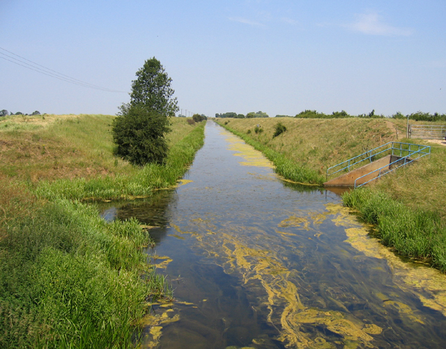
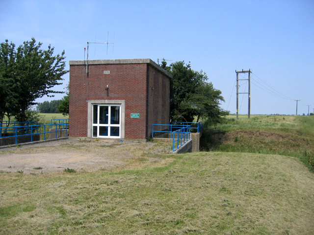
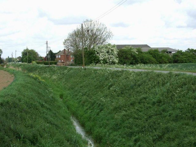
Gosberton High Fen is a designated Site of Special Scientific Interest located in Lincolnshire, England. The area is characterized by its unique landscape of fenland, which consists of low-lying marshes, peat bogs, and wet meadows. The fen is situated on a flat plain, with the surrounding area mainly consisting of agricultural land.

The high fen is home to a variety of plant and animal species, including rare and endangered birds such as the Eurasian bittern and the marsh harrier. The wetland habitat provides an important breeding ground for these species, as well as a range of insects, amphibians, and small mammals.

The fen is also rich in archaeological remains, with evidence of human activity dating back to the Bronze Age. The area has been the subject of various research projects and conservation efforts to protect its unique biodiversity and cultural heritage.

Visitors to Gosberton High Fen can enjoy walking and birdwatching in this peaceful and unspoiled natural environment. The fen is a valuable resource for education and research, providing insights into the history and ecology of this distinctive landscape in Lincolnshire.

If you have any feedback on the listing, please let us know in the comments section below.

Gosberton High Fen Images

Images are sourced within 2km of 52.851253/-0.25500626 or Grid Reference TF1729. Thanks to Geograph Open Source API. All images are credited.

South Forty Foot Drain from Kingston's Bridge, Gosberton, Lincs between Gosberton Fen in Holland (right) and Aslackby Fen in Kesteven; the Twenty Foot Drain and the Division Drain join the South Forty Foot just north of the bridge with each fen as a catchment.
South Forty Foot Drain from Kingston's Bridge, Gosberton, Lincs
between Gosberton Fen in Holland (right) and Aslackby Fen in Kesteven; the Twenty Foot Drain and the Division Drain join the South Forty Foot just north of the bridge with each fen as a catchment.
Dowsby Fen Pumping Station, Lincs where the Division Drain enters the South Forty Foot Drain; erected in 1964 by the Black Sluice IDB.
Dowsby Fen Pumping Station, Lincs
where the Division Drain enters the South Forty Foot Drain; erected in 1964 by the Black Sluice IDB.
Short Drove and bridge, Aslackby Fen, Lincs – view N from Fen Road.
Short Drove and bridge, Aslackby Fen, Lincs
– view N from Fen Road.
Twenty Foot Drain, Gosberton High Fen, Lincs beside the B1397 High Fen road to Gosberton Clough.
Twenty Foot Drain, Gosberton High Fen, Lincs
beside the B1397 High Fen road to Gosberton Clough.
Village entrance, Gosberton Risegate and Clough, Lincs – view E towards Gosberton Clough with the Twenty Foot Drain on the left and the B1397 High Fen road on the right.
Village entrance, Gosberton Risegate and Clough, Lincs
– view E towards Gosberton Clough with the Twenty Foot Drain on the left and the B1397 High Fen road on the right.
Long, straight Fenland road, Gosberton Clough, Lincs – view W along the B1397 High Fen.
Long, straight Fenland road, Gosberton Clough, Lincs
– view W along the B1397 High Fen.
Clough Bridge, Gosberton Clough, Lincs This concrete bridge over the Twenty Foot Drain was constructed by Holland County Council in 1938.
Clough Bridge, Gosberton Clough, Lincs
This concrete bridge over the Twenty Foot Drain was constructed by Holland County Council in 1938.
Gosberton Fen Bridge, Gosberton Clough, Lincs This concrete bridge carries the B1397 over the Hammond Beck and was constructed by Holland County Council in 1938.
Gosberton Fen Bridge, Gosberton Clough, Lincs
This concrete bridge carries the B1397 over the Hammond Beck and was constructed by Holland County Council in 1938.
Twenty Foot Drain Gosberton Fen Pumping Station and Twenty Foot Drain by Kingston's Bridge
Twenty Foot Drain
Gosberton Fen Pumping Station and Twenty Foot Drain by Kingston's Bridge
South Forty Foot Drain Looking north from Kingston's Bridge
South Forty Foot Drain
Looking north from Kingston's Bridge
Bottom Fen Farm, Dowsby Fen
Vicarage Farm, off Parson Drove
Parson Drove The track to Vicarage Farm leads off to the right.
Parson Drove
The track to Vicarage Farm leads off to the right.
Beck Farm View across Hammond Beck towards Beck Farm, Gosberton Clough.
Beck Farm
View across Hammond Beck towards Beck Farm, Gosberton Clough.
Poppies with Potatoes View Northwest from Fifth Drove, Gosberton Clough. Buildings at Bottom Fen Farm can be seen above the embankments of the South Forty Foot drainin the centre of the horizon. There are five drove roads between Gosberton Clough and the South Forty Foot Drain, they are imaginatively named First, Second, Third, Fourth and Fifth Drove progressing West along the B1397.
Poppies with Potatoes
View Northwest from Fifth Drove, Gosberton Clough. Buildings at Bottom Fen Farm can be seen above the embankments of the South Forty Foot drainin the centre of the horizon. There are five drove roads between Gosberton Clough and the South Forty Foot Drain, they are imaginatively named First, Second, Third, Fourth and Fifth Drove progressing West along the B1397.
Plaque on Kingstons Bridge, South Forty Foot Drain The Plaque reads:
Kingston's Bridge  Rebuilt jointly by the Holland and Kesteven county Councils 1934.
Plaque on Kingstons Bridge, South Forty Foot Drain
The Plaque reads: Kingston's Bridge Rebuilt jointly by the Holland and Kesteven county Councils 1934.
Bridge over Beck by Beck Bank
Drain west from Short Drove
Show me another place!

Gosberton High Fen is located at Grid Ref: TF1729 (Lat: 52.851253, Lng: -0.25500626)

Administrative County: Lincolnshire

District: South Holland

Police Authority: Lincolnshire

What 3 Words

///brotherly.rehearsed.either. Near Gosberton, Lincolnshire

Nearby Locations

Gosberton High Fen

Related Wikis

South Forty-Foot Drain

The South Forty-Foot Drain, also known as the Black Sluice Navigation, is the main channel for the land-drainage of the Black Sluice Level in the Lincolnshire...

Gosberton Clough

Gosberton Clough is a village in the civil parish of Gosberton and the South Holland district of Lincolnshire, England. It is 30 miles (50 km) south-east...

Quadring Fen

Quadring Fen is a hamlet in the South Holland district of Lincolnshire, England. It is situated 2 miles (3.2 km) south from the A52 road, 5 miles (8.0...

Risegate

Risegate is a village in the civil parish of Gosberton and the South Holland district of Lincolnshire, England. It is 30 miles (50 km) south-east from...

Nearby Amenities

Located within 500m of 52.851253,-0.25500626
Gosberton High Fen
Place: locality
Source: Bing
Lat/Long: 52.8511425/-0.259924
Power: pole
Lat/Long: 52.8488619/-0.2491639
Power: pole
Lat/Long: 52.8496878/-0.249518
Power: pole
Lat/Long: 52.8500163/-0.2609728
Power: pole
Lat/Long: 52.8500849/-0.2595936
Power: pole
Lat/Long: 52.8501815/-0.2578177
Power: pole
Lat/Long: 52.8502738/-0.2561264
Power: pole
Lat/Long: 52.8503626/-0.2543422
Power: pole
Lat/Long: 52.8504548/-0.2525471
Power: pole
Lat/Long: 52.8505222/-0.2511796
Power: pole
Lat/Long: 52.850588/-0.2498639
Power: pole
Lat/Long: 52.8506604/-0.2483249
Power: pole
Lat/Long: 52.8506995/-0.2498721
Power: pole
Lat/Long: 52.8522759/-0.2499192
Power: pole
Lat/Long: 52.8531425/-0.2499393
Power: pole
Lat/Long: 52.8540208/-0.2499597
The data included in this document is from www.openstreetmap.org. The data is made available under ODbL.

Have you been to Gosberton High Fen?

Leave your review of Gosberton High Fen below (or comments, questions and feedback).