Hall Meadow

Downs, Moorland in Lincolnshire South Kesteven

England

Hall Meadow

The Priory Church of Deeping St James Larger than your average Parish Church because it was a priory until the reformation. Norman arches, a graveside shelter and 12th C font to be found inside.
The Priory Church of Deeping St James Credit: Chris Stafford

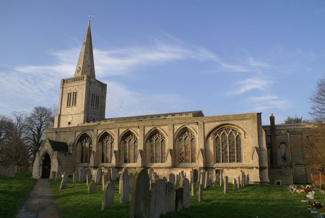
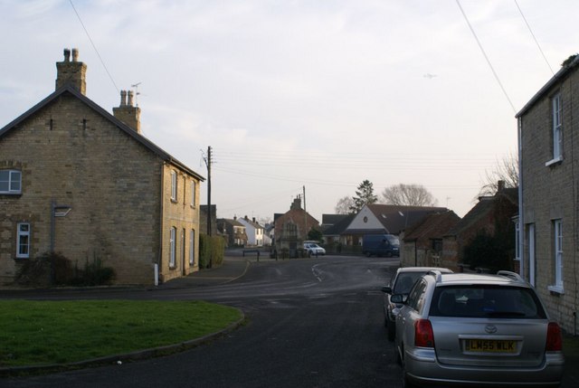
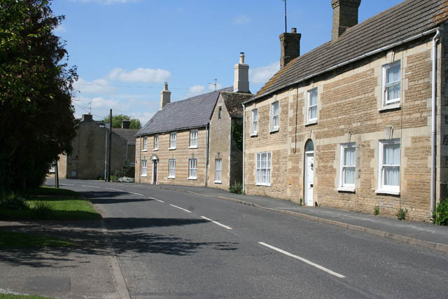
Hall Meadow is a picturesque area located in Lincolnshire, England, known for its diverse landscape consisting of downs and moorland. Spanning approximately 200 acres, it offers a tranquil and idyllic setting for nature enthusiasts and those seeking a peaceful escape from city life.

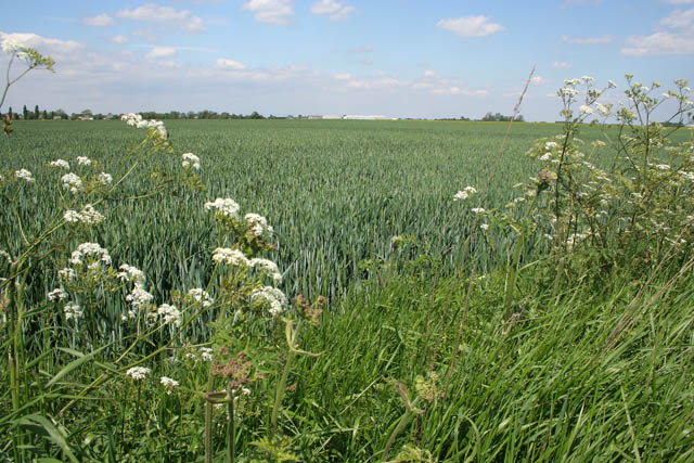
The downs, characterized by their gently rolling hills and open grasslands, showcase an array of native flora and fauna. Visitors can enjoy breathtaking views of the surrounding countryside, with the meandering streams and scattered woodlands providing a picturesque backdrop. The downs are home to a variety of plant species, including wildflowers such as cowslips and harebells, adding vibrant colors to the landscape.

On the other hand, the moorland area within Hall Meadow offers a stark contrast with its rugged terrain and heather-covered expanses. This unique habitat provides a haven for a range of bird species, including curlews, lapwings, and skylarks, making it a popular spot for birdwatching enthusiasts. The moorland is also home to several species of small mammals, such as voles and shrews, adding to the area's biodiversity.

Hall Meadow offers numerous walking trails and footpaths, allowing visitors to explore the diverse habitats at their own pace. Interpretive boards and guided tours are available, providing insightful information about the flora, fauna, and geological features of the area.

Overall, Hall Meadow in Lincolnshire is a remarkable destination for nature lovers, offering a unique combination of downs and moorland, and providing a serene environment perfect for relaxation and exploration.

If you have any feedback on the listing, please let us know in the comments section below.
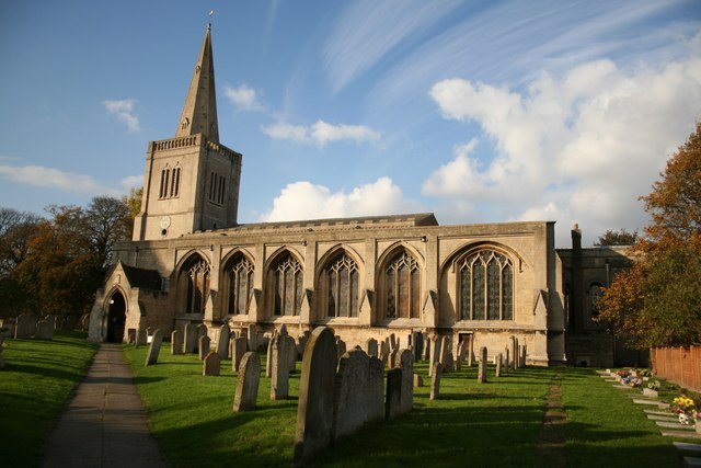
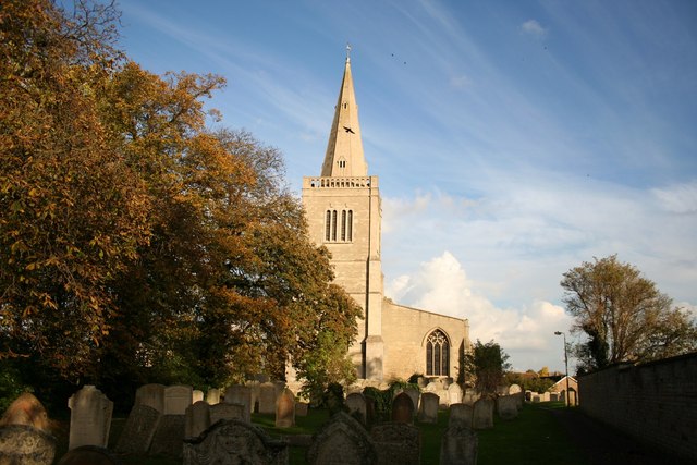
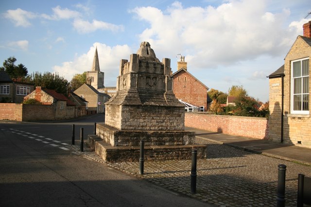
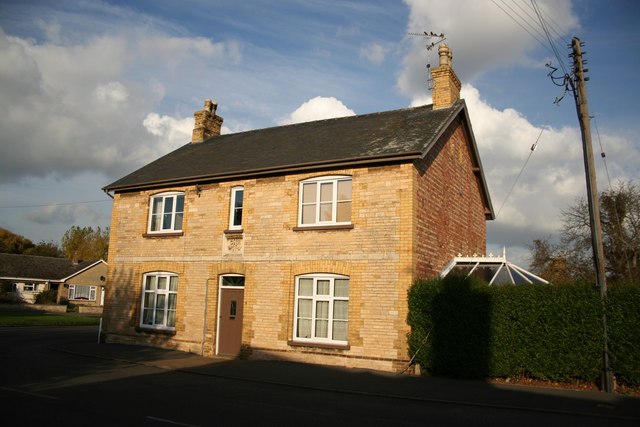
Hall Meadow Images

Images are sourced within 2km of 52.686323/-0.28043782 or Grid Reference TF1611. Thanks to Geograph Open Source API. All images are credited.

The Priory Church of Deeping St James Larger than your average Parish Church because it was a priory until the reformation. Norman arches, a graveside shelter and 12th C font to be found inside.
The Priory Church of Deeping St James
Larger than your average Parish Church because it was a priory until the reformation. Norman arches, a graveside shelter and 12th C font to be found inside.
Deeping St James village In the middle of the road area stands the old lock up. Notice the faint outline of an AWAC plane in the sky.
Deeping St James village
In the middle of the road area stands the old lock up. Notice the faint outline of an AWAC plane in the sky.
Eastgate, Deeping St James Deeping St. James is a village lying next to Market Deeping, along the banks of the River Welland. The village grew up around a Benedictine Priory and stones from the ruined Priory were used in several 17th century buildings. These cottages look younger than that, probably early 19th Century. They show some fine detailing in the stonework. Originally they would have faced the river but 20th century development has taken place between the road and the Welland.
Eastgate, Deeping St James
Deeping St. James is a village lying next to Market Deeping, along the banks of the River Welland. The village grew up around a Benedictine Priory and stones from the ruined Priory were used in several 17th century buildings. These cottages look younger than that, probably early 19th Century. They show some fine detailing in the stonework. Originally they would have faced the river but 20th century development has taken place between the road and the Welland.
Prior's Meadow, Deeping St James Off Stowgate Road, this large field must have originally attached to the Benedictine Priory. The Priory was founded at Deeping St James in 1139 by Baldwin Fitzgilbert, a junior member of the Clare family, much favoured by King Henry I.
See <span class="nowrap"><a title="http://www.users.zetnet.co.uk/mwarrick/history/index.htm" rel="nofollow ugc noopener" href="http://www.users.zetnet.co.uk/mwarrick/history/index.htm">Link</a><img style="margin-left:2px;" alt="External link" title="External link - shift click to open in new window" src="https://s1.geograph.org.uk/img/external.png" width="10" height="10"/></span> for information about the Priory and church.
Prior's Meadow, Deeping St James
Off Stowgate Road, this large field must have originally attached to the Benedictine Priory. The Priory was founded at Deeping St James in 1139 by Baldwin Fitzgilbert, a junior member of the Clare family, much favoured by King Henry I. See LinkExternal link for information about the Priory and church.
Priory church of Deeping St.James Originally founded in 1139 as part of a Benedictine Priory
Priory church of Deeping St.James
Originally founded in 1139 as part of a Benedictine Priory
Priory church of Deeping St.James West tower of the Priory church, though it looks medieval, it's actually c1730
Priory church of Deeping St.James
West tower of the Priory church, though it looks medieval, it's actually c1730
Deeping St.James cross 15th century market cross converted into a lockup in 1819
Deeping St.James cross
15th century market cross converted into a lockup in 1819
Eastgate house House on Eastgate near the church with a datestone of 1884
Eastgate house
House on Eastgate near the church with a datestone of 1884
Priory church font Circular Norman 12th century tub font with intersecting arches in the Priory church of Deeping St.James
Priory church font
Circular Norman 12th century tub font with intersecting arches in the Priory church of Deeping St.James
South Aisle Spacious south aisle in the Priory church of Deeping St.James
South Aisle
Spacious south aisle in the Priory church of Deeping St.James
Graveside shelter A rare 18th century curiosity in the Priory Church of Deeping St.James ..... a shelter for the parson during rainy or windy burials
Graveside shelter
A rare 18th century curiosity in the Priory Church of Deeping St.James ..... a shelter for the parson during rainy or windy burials
13th century knight Defaced and much worn tomb of an unknown 13th century knight in the chancel of the Priory church of Deeping St.James
13th century knight
Defaced and much worn tomb of an unknown 13th century knight in the chancel of the Priory church of Deeping St.James
Norman arcade Part of the marvellous late 12th century 7-bay south arcade in the Priory church of Deeping St.James.
Norman arcade
Part of the marvellous late 12th century 7-bay south arcade in the Priory church of Deeping St.James.
Norman Capital Late 12th century scallop capital with a round abacus in the south arcade of the Priory church of Deeping St.James
Norman Capital
Late 12th century scallop capital with a round abacus in the south arcade of the Priory church of Deeping St.James
Priory church chancel The ceiling was lowered in 1828 and the east window is mid-19th century despite its Early English appearance
Priory church chancel
The ceiling was lowered in 1828 and the east window is mid-19th century despite its Early English appearance
Lady Chapel 14th century Lady Chapel in the Priory church of Deeping St.James
Lady Chapel
14th century Lady Chapel in the Priory church of Deeping St.James
Priory church nave Glorious 7-bay late 12th century Norman arcade and 13-bay 13th century Early English triforium in the Priory church of Deeping St.James nave
Priory church nave
Glorious 7-bay late 12th century Norman arcade and 13-bay 13th century Early English triforium in the Priory church of Deeping St.James nave
In memory of the Reverends Cooper The pulpit was given in 1873 in memory of Reverend J. M. Cooper (Father of Rev. W. Cooper) and the window above it dates from 1904 in memory of Rev. W. H. Cooper.
In memory of the Reverends Cooper
The pulpit was given in 1873 in memory of Reverend J. M. Cooper (Father of Rev. W. Cooper) and the window above it dates from 1904 in memory of Rev. W. H. Cooper.
Show me another place!

Hall Meadow is located at Grid Ref: TF1611 (Lat: 52.686323, Lng: -0.28043782)

Administrative County: Lincolnshire

District: South Kesteven

Police Authority: Lincolnshire

What 3 Words

///crunches.jogging.raves. Near Market Deeping, Lincolnshire

Nearby Locations

Hall Meadow

Related Wikis

Frognall

Frognall is a small village in the South Kesteven district of Lincolnshire, England. It is situated just north-east of Deeping St James , to which it is...

A1175 road

The A1175 road is a road in south-west Lincolnshire, England. It runs between Stamford and Spalding, along the old A16 route. == History == It was previously...

The Deepings School

The Deepings School is a coeducational secondary school and sixth form with academy status, located on Park Road in Deeping St James (near Peterborough...

Deeping Rangers F.C.

Deeping Rangers F.C. is a football club based in Market Deeping, Lincolnshire, England. They were established in 1964 and originally played at Maxey Road...

Deeping St James Priory

Deeping St James Priory was a priory in Deeping St James, Lincolnshire, England. It was a dependency of Thorney Abbey. == History == In 1139 Baldwin Fitz...

Deeping St James

Deeping St James is a large village in the South Kesteven district of Lincolnshire, England. The population of the civil parish (including Frognall) was...

Deeping Gate

Deeping Gate is a village and civil parish, lying on the River Welland in Cambridgeshire. Traditionally, the area was part of the Soke of Peterborough...

The Deepings

The Deepings (grid reference TF150094) are a series of settlements close to the River Welland near the borders of southern Lincolnshire and north western...

Nearby Amenities

Located within 500m of 52.686323,-0.28043782
Hall Meadow
Place: locality
Source: Bing
Lat/Long: 52.6868464/-0.2787091
Power: pole
Lat/Long: 52.6901854/-0.279525
Power: pole
Lat/Long: 52.6892853/-0.2773781
Power: pole
Lat/Long: 52.6883916/-0.2752274
The data included in this document is from www.openstreetmap.org. The data is made available under ODbL.

Have you been to Hall Meadow?

Leave your review of Hall Meadow below (or comments, questions and feedback).