Bardney Common
Downs, Moorland in Lincolnshire West Lindsey
England
Bardney Common

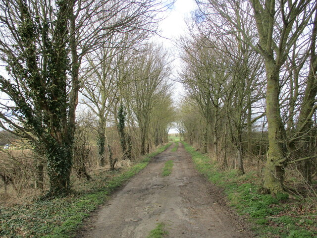
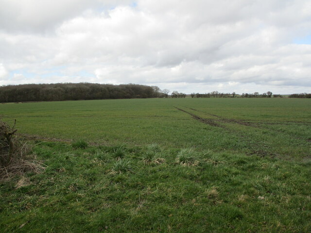
Bardney Common is a vast area of natural beauty located in the county of Lincolnshire, England. Covering an extensive expanse of downs and moorland, it is a haven for wildlife and a popular destination for nature enthusiasts and walkers alike.
The downs of Bardney Common are characterized by their rolling hills and expansive grasslands. The area is rich in diverse vegetation, with patches of vibrant wildflowers adding bursts of color to the landscape during the summer months. This undulating terrain provides breathtaking panoramic views of the surrounding countryside, making it a favored spot for photographers and artists.
In contrast, the moorland of Bardney Common is a more rugged and untamed landscape. Here, visitors can immerse themselves in the tranquility of the heather-covered hills and the vast stretches of open space. The moorland is home to a variety of bird species, including skylarks and curlews, which can be heard singing their melodic tunes as you explore the area.
Bardney Common is not only a picturesque location but also an important habitat for wildlife. The diverse range of flora and fauna found here includes rare species such as the silver-studded blue butterfly and the marsh fritillary butterfly. The common is also a sanctuary for reptiles, with adders and common lizards frequently spotted basking in the sun.
With its stunning natural landscapes and abundant wildlife, Bardney Common offers a unique opportunity to connect with nature and experience the beauty of Lincolnshire's countryside. Whether you are seeking a peaceful walk, a chance to spot rare wildlife, or simply a place to unwind, Bardney Common is a must-visit destination.
If you have any feedback on the listing, please let us know in the comments section below.
Bardney Common Images
Images are sourced within 2km of 53.207998/-0.30682206 or Grid Reference TF1369. Thanks to Geograph Open Source API. All images are credited.


Bardney Common is located at Grid Ref: TF1369 (Lat: 53.207998, Lng: -0.30682206)
Administrative County: Lincolnshire
District: West Lindsey
Police Authority: Lincolnshire
What 3 Words
///sponge.loudness.protect. Near Bardney, Lincolnshire
Nearby Locations
Related Wikis
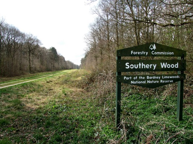
Southrey Wood
Southrey Wood is reserve near Bardney in the county of Lincolnshire, England. Butterfly Conservation manages this reserve. It is 22 acres (8.9 ha) in extent...
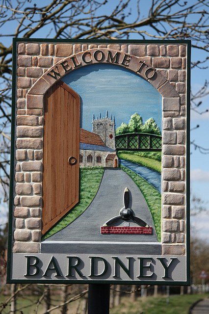
Bardney
Bardney is a village and civil parish in the West Lindsey district of Lincolnshire, England. The population of the civil parish was 1,643 at the 2001 census...
Tupholme
Tupholme is a village in the East Lindsey district of Lincolnshire, England. It is situated 11 miles (18 km) east from Lincoln, and is the site of the...

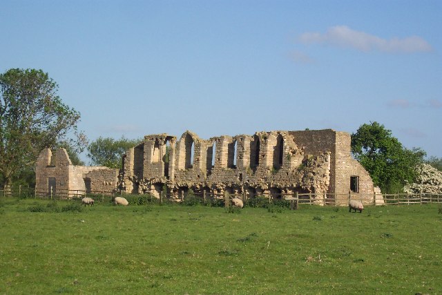
Tupholme Abbey
Tupholme Abbey was a Premonstratensian abbey close to the River Witham some 10.5 miles (16.9 km) east of the city of Lincoln, England and one of nine such...

Bardney railway station
Bardney railway station was a station in Bardney, Lincolnshire. North of the station the line split in two with one branch going to Lincoln and the other...

Burreth, Lincolnshire
Burreth (also occasionally Burgrede) is a now-deserted village in Lincolnshire. == Medieval village == In the late 13th century, the manor of Burreth was...

RAF Bardney
Royal Air Force Bardney or RAF Bardney is a former Royal Air Force station located 1.7 miles (2.7 km) north of Bardney, Lincolnshire, England and 10.2...
Witham Third District IDB
Witham Third District IDB is an English internal drainage board set up under the terms of the Land Drainage Act 1930. The Board inherited the responsibilities...
Nearby Amenities
Located within 500m of 53.207998,-0.30682206Have you been to Bardney Common?
Leave your review of Bardney Common below (or comments, questions and feedback).