Bourne South Fen

Downs, Moorland in Lincolnshire South Kesteven

England

Bourne South Fen

Fen fields
Fen fields Credit: Terry Butcher

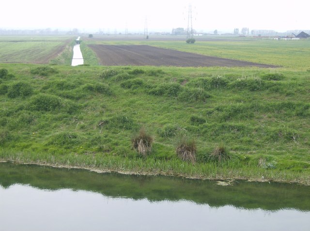
Bourne South Fen is a natural landscape located in Lincolnshire, England. It is characterized by its diverse mix of downs and moorland, providing a unique and picturesque environment.

The fen is situated south of the town of Bourne, covering a vast area of approximately 1,200 hectares. Its geographical features include rolling hills, open fields, and wetlands, which form a rich and varied landscape. The area is home to a wide range of plant and animal species, making it a haven for wildlife enthusiasts and nature lovers.

The downs in Bourne South Fen are characterized by their gently sloping hills, covered in a mix of grasses and shrubs. These hills provide stunning panoramic views of the surrounding countryside. The moorland, on the other hand, is characterized by its wet and boggy conditions. It is home to a variety of unique plant species, including heather and sphagnum mosses, which thrive in the moist environment.

Visitors to Bourne South Fen can enjoy various activities such as hiking, birdwatching, and photography. The fen is known for its diverse bird population, with species such as lapwings, curlews, and snipes being commonly spotted. The wetlands also attract a variety of waterfowl, including ducks and swans.

Overall, Bourne South Fen offers a tranquil and picturesque natural environment, where visitors can immerse themselves in the beauty of the Lincolnshire countryside.

If you have any feedback on the listing, please let us know in the comments section below.

Bourne South Fen Images

Images are sourced within 2km of 52.756569/-0.33150958 or Grid Reference TF1218. Thanks to Geograph Open Source API. All images are credited.

Fen fields
Fen fields
Fen fields near Bourne Rugby Club
Bog oaks near Bourne Rugby Club
Fen Fields close to Bourne Eau
Fen field next to Bourne Eau
Fen Farm near Bourne Eau
A farmer ridging up potatoes Lincolnshire fenland potatoes are renowned for their flavour and the crop grown on this dark peaty soil will be eagerly awaited. The farmer is ridging up the potatoes and the seagulls are following the machinery which has exposed worms  in the freshly turned earth.
A farmer ridging up potatoes
Lincolnshire fenland potatoes are renowned for their flavour and the crop grown on this dark peaty soil will be eagerly awaited. The farmer is ridging up the potatoes and the seagulls are following the machinery which has exposed worms in the freshly turned earth.
Bourne rugby club Car park and club buildings off Milking Nook Drove.
Bourne rugby club
Car park and club buildings off Milking Nook Drove.
Fen Drain near Bourne A Priestman excavator at rest. The glasshouses in the distance are part of the Lincolnshire Herbs business. You may well have consumed some of their products see the  <span class="nowrap"><a title="http://www.lincolnshire-herbs.co.uk/index.php" rel="nofollow ugc noopener" href="http://www.lincolnshire-herbs.co.uk/index.php">Link</a><img style="margin-left:2px;" alt="External link" title="External link - shift click to open in new window" src="https://s1.geograph.org.uk/img/external.png" width="10" height="10"/></span> to find out
Fen Drain near Bourne
A Priestman excavator at rest. The glasshouses in the distance are part of the Lincolnshire Herbs business. You may well have consumed some of their products see the LinkExternal link to find out
Roller and old railway wagon Storage and ground maintenance equipment at Bourne Rugby club.
Roller and old railway wagon
Storage and ground maintenance equipment at Bourne Rugby club.
Disc harrows on the field edge An old set of Petitt disc harrows that are unlikely to ever wear out on fen soil. The large buildings in the far distance are part of Bourne industrial estate.
Disc harrows on the field edge
An old set of Petitt disc harrows that are unlikely to ever wear out on fen soil. The large buildings in the far distance are part of Bourne industrial estate.
Milking Nook Drove The drove to Bourne Rugby club.
Milking Nook Drove
The drove to Bourne Rugby club.
New farm building adjacent to Bourne Rugby club The structural steelwork is up now the cladding can be added.
New farm building adjacent to Bourne Rugby club
The structural steelwork is up now the cladding can be added.
Railway wagon beside the Bourne to Spalding road Serving out its time as a shed or junk store. The distant glass houses are part of Lincolnshire Herbs and the taller building is on an industrial estate in Bourne.
Railway wagon beside the Bourne to Spalding road
Serving out its time as a shed or junk store. The distant glass houses are part of Lincolnshire Herbs and the taller building is on an industrial estate in Bourne.
Lincs and Notts air ambulance at Bourne rugby club The air ambulance was called in to attend a neck injury at a junior rugby game being played at Bourne rugby club. The casualty was air lifted to Boston hospital and was found not to be seriously injured.
Lincs and Notts air ambulance at Bourne rugby club
The air ambulance was called in to attend a neck injury at a junior rugby game being played at Bourne rugby club. The casualty was air lifted to Boston hospital and was found not to be seriously injured.
Milking Nook Drove A public road that comes to a dead-end at Bourne Eau to the south.
Milking Nook Drove
A public road that comes to a dead-end at Bourne Eau to the south.
Drain south of A151 A drain - recently slubbed out when photographed - running along the south side of the A151. Photographed from Fosters Drove.
Drain south of A151
A drain - recently slubbed out when photographed - running along the south side of the A151. Photographed from Fosters Drove.
New distribution depot A new distribution warehouse for the agricultural machinery companies of Horsch and Gregoire Besson, specialising in seed drills and cultivation equipment respectively.
New distribution depot
A new distribution warehouse for the agricultural machinery companies of Horsch and Gregoire Besson, specialising in seed drills and cultivation equipment respectively.
Show me another place!

Bourne South Fen is located at Grid Ref: TF1218 (Lat: 52.756569, Lng: -0.33150958)

Administrative County: Lincolnshire

District: South Kesteven

Police Authority: Lincolnshire

What 3 Words

///scout.caravans.hitters. Near Bourne, Lincolnshire

Related Wikis

Gilbert Heathcote's tunnel

Gilbert Heathcote's tunnel was an engineering project dating from the 1630s as one of the earliest modern attempts to drain The Fens in Lincolnshire....

Bourne Grammar School

Bourne Grammar School (BGS) is a co-educational grammar school with academy status on South Road (A15), in Bourne, Lincolnshire, England. The school was...

Bourne Town F.C.

Bourne Town Football Club is a football club based in Bourne, Lincolnshire, England. Affiliated to the Lincolnshire Football Association, they are currently...
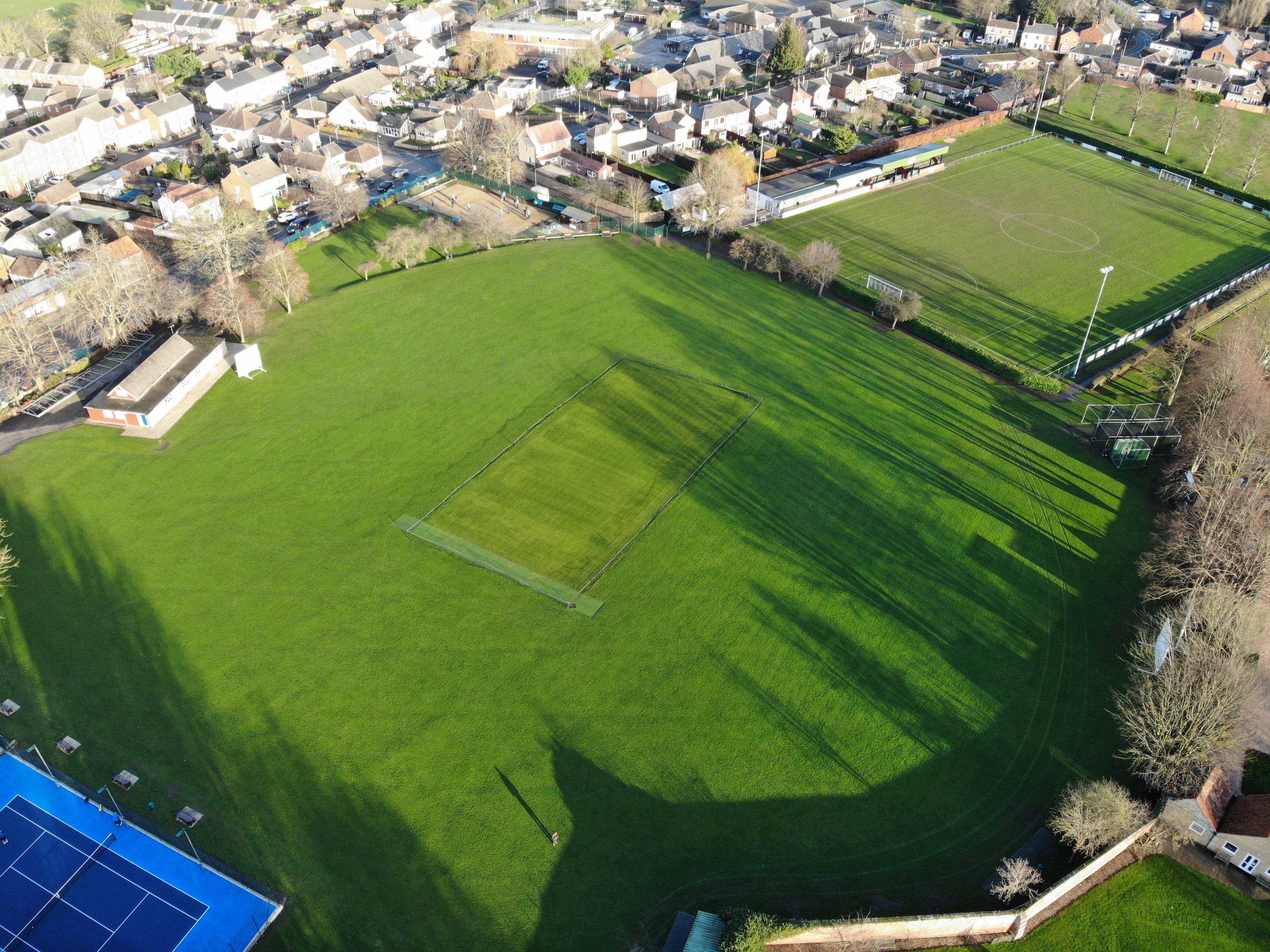
Abbey Lawn

The Abbey Lawn in Bourne, Lincolnshire, England, is a centrally located space used as the principal recreation ground in the town. The cricket, tennis...

Twenty railway station

Twenty railway station served the village of Twenty in Lincolnshire, England. It was on the route of the Spalding and Bourne Railway (opened 1866), later...

Bourne Abbey

Bourne Abbey and the Parish Church of St. Peter and St. Paul is a scheduled Grade I church in Bourne, Lincolnshire, England. The building remains in parochial...

Twenty, Lincolnshire

Twenty is a village in the South Kesteven district of Lincolnshire, England. It is situated approximately 3 miles (5 km) east of Bourne, and 5 miles (8...

Bourne Academy

Bourne Academy is an 11 to 18 mixed comprehensive school and a co-educational academy located in Bourne, Lincolnshire, England. It is one of two secondary...

Nearby Amenities

Located within 500m of 52.756569,-0.33150958
Power: tower
Lat/Long: 52.7562176/-0.3269074
Power: tower
Lat/Long: 52.7575746/-0.3383873
Power: tower
Lat/Long: 52.7566201/-0.3305982
Power: tower
Lat/Long: 52.7571006/-0.3346322
The data included in this document is from www.openstreetmap.org. The data is made available under ODbL.

Have you been to Bourne South Fen?

Leave your review of Bourne South Fen below (or comments, questions and feedback).