Digby Fen

Downs, Moorland in Lincolnshire North Kesteven

England

Digby Fen

Dorrington Dike Looking south.
Dorrington Dike Credit: JThomas

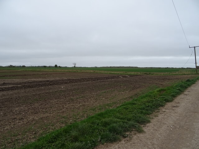
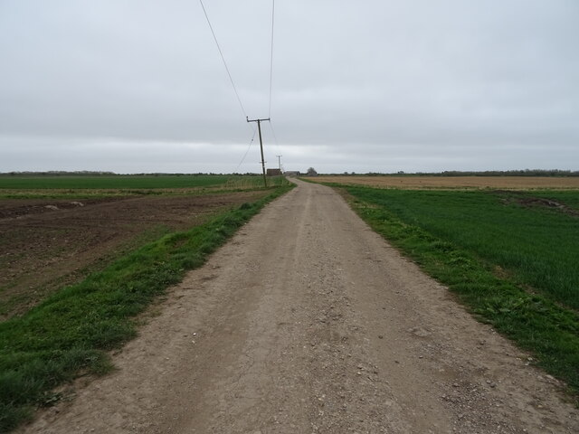
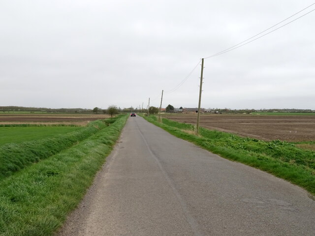
Digby Fen is a charming village located in the county of Lincolnshire, England. Situated amidst picturesque landscapes, it enjoys a tranquil setting with its unique combination of downs and moorland. The village is nestled within the district of North Kesteven, near the town of Lincoln.

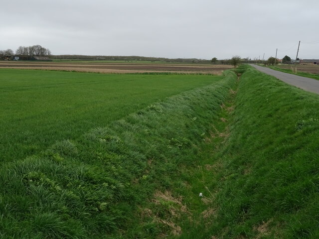
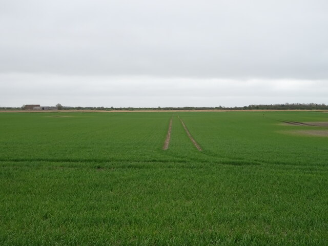
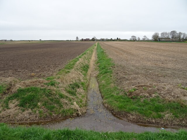
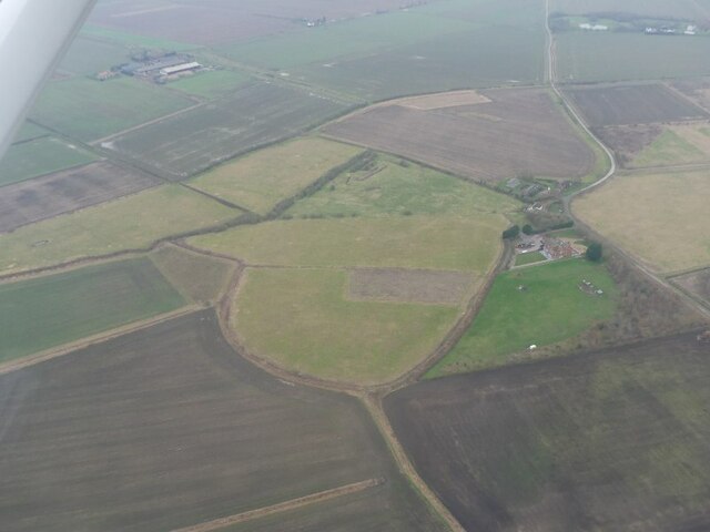
The area boasts breathtaking natural beauty, characterized by rolling hills, expansive meadows, and fertile fenland. Digby Fen is renowned for its diverse flora and fauna, providing a haven for nature enthusiasts and birdwatchers alike. The moorland areas are home to various species of birds, including skylarks, lapwings, and curlews.

Apart from its natural splendor, Digby Fen has a rich history dating back to the medieval era. The village is dotted with historical landmarks, such as St. Thomas' Church, a beautiful Grade II listed building with its distinctive architecture and stained glass windows. The church serves as a testament to the village's heritage and provides a glimpse into its past.

Digby Fen offers a peaceful and close-knit community, with a range of amenities to cater to its residents. The village has a primary school, a village hall, and a local pub, providing a hub for social gatherings and community events.

For those seeking outdoor activities, Digby Fen offers ample opportunities for walking, cycling, and exploring the surrounding countryside. The nearby Lincolnshire Wolds, an Area of Outstanding Natural Beauty, provides stunning vistas and scenic trails.

Overall, Digby Fen, Lincolnshire is a hidden gem that captivates visitors with its natural landscapes, rich history, and warm community spirit.

If you have any feedback on the listing, please let us know in the comments section below.

Digby Fen Images

Images are sourced within 2km of 53.076157/-0.32383756 or Grid Reference TF1254. Thanks to Geograph Open Source API. All images are credited.

Dorrington Dike Looking south.
Dorrington Dike
Looking south.
Minor road, Dorrington Fen Towards North Kyme.
Minor road, Dorrington Fen
Towards North Kyme.
Overgrown drain, Dorrington Fen
Flat field and woodland, Dorrington Fen
Drain, Dorrington Fen
Farm building, Dorrington Fen
Minor road, Dorrington Fen Towards North Kyme.
Minor road, Dorrington Fen
Towards North Kyme.
Overgrown drain, Gale Fen View over the roadside drain.
Overgrown drain, Gale Fen
View over the roadside drain.
Fenland road towards North Kyme
Field, Ruskington Dales
Farm road, Ruskington Dales
Roadside drain, Ruskington Fen
Crop field, Ruskington Fen
Minor road, Ruskington Fen Towards Ruskington.
A drain on both sides of the road.
Minor road, Ruskington Fen
Towards Ruskington. A drain on both sides of the road.
Drain junction, Ruskington Fen
Site of Catley Abbey (Ghilbertine): aerial 2022 (1) The Gilbertine Priory of St Mary at Catley was founded as a double house between 1148 and 1154 by Peter of Billinghay. It was dissolved in 1538. Traces remain of what appears to be the cloister garth with church to the north, with robber trenches outlining a smaller building to the west. In the south-western corner of the partly filled precinct moat is an irregular system of channels, one of which was probably a fishpond. 

The foundation proved locally popular, but the priory was never wealthy by comparison with other reformed monastic houses, and underwent economic decline from the 14th century. It was dissolved in 1538 and the site was later acquired by Robert Carre of Sleaford. Situated in the area formerly known as the Island of Catley, the monument is surrounded by low-lying, formerly waterlogged land. 

See: <span class="nowrap"><a title="https://www.heritagegateway.org.uk/Gateway/Results_Single.aspx?uid=MLI60709&resourceID=1006" rel="nofollow ugc noopener" href="https://www.heritagegateway.org.uk/Gateway/Results_Single.aspx?uid=MLI60709&resourceID=1006">Link</a><img style="margin-left:2px;" alt="External link" title="External link - shift click to open in new window" src="https://s1.geograph.org.uk/img/external.png" width="10" height="10"/></span>
Site of Catley Abbey (Ghilbertine): aerial 2022 (1)
The Gilbertine Priory of St Mary at Catley was founded as a double house between 1148 and 1154 by Peter of Billinghay. It was dissolved in 1538. Traces remain of what appears to be the cloister garth with church to the north, with robber trenches outlining a smaller building to the west. In the south-western corner of the partly filled precinct moat is an irregular system of channels, one of which was probably a fishpond. The foundation proved locally popular, but the priory was never wealthy by comparison with other reformed monastic houses, and underwent economic decline from the 14th century. It was dissolved in 1538 and the site was later acquired by Robert Carre of Sleaford. Situated in the area formerly known as the Island of Catley, the monument is surrounded by low-lying, formerly waterlogged land. See: LinkExternal link
Site of Catley Abbey (Ghilbertine): aerial 2022 (2) The Gilbertine Priory of St Mary at Catley was founded as a double house between 1148 and 1154 by Peter of Billinghay. It was dissolved in 1538. Traces remain of what appears to be the cloister garth with church to the north, with robber trenches outlining a smaller building to the west. In the south-western corner of the partly filled precinct moat is an irregular system of channels, one of which was probably a fishpond. 

The foundation proved locally popular, but the priory was never wealthy by comparison with other reformed monastic houses, and underwent economic decline from the 14th century. It was dissolved in 1538 and the site was later acquired by Robert Carre of Sleaford. Situated in the area formerly known as the Island of Catley, the monument is surrounded by low-lying, formerly waterlogged land. 

See: <span class="nowrap"><a title="https://www.heritagegateway.org.uk/Gateway/Results_Single.aspx?uid=MLI60709&resourceID=1006" rel="nofollow ugc noopener" href="https://www.heritagegateway.org.uk/Gateway/Results_Single.aspx?uid=MLI60709&resourceID=1006">Link</a><img style="margin-left:2px;" alt="External link" title="External link - shift click to open in new window" src="https://s1.geograph.org.uk/img/external.png" width="10" height="10"/></span>
Site of Catley Abbey (Ghilbertine): aerial 2022 (2)
The Gilbertine Priory of St Mary at Catley was founded as a double house between 1148 and 1154 by Peter of Billinghay. It was dissolved in 1538. Traces remain of what appears to be the cloister garth with church to the north, with robber trenches outlining a smaller building to the west. In the south-western corner of the partly filled precinct moat is an irregular system of channels, one of which was probably a fishpond. The foundation proved locally popular, but the priory was never wealthy by comparison with other reformed monastic houses, and underwent economic decline from the 14th century. It was dissolved in 1538 and the site was later acquired by Robert Carre of Sleaford. Situated in the area formerly known as the Island of Catley, the monument is surrounded by low-lying, formerly waterlogged land. See: LinkExternal link
Site of Catley Abbey (Ghilbertine): aerial 2022 (3) The Gilbertine Priory of St Mary at Catley was founded as a double house between 1148 and 1154 by Peter of Billinghay. It was dissolved in 1538. Traces remain of what appears to be the cloister garth with church to the north, with robber trenches outlining a smaller building to the west. In the south-western corner of the partly filled precinct moat is an irregular system of channels, one of which was probably a fishpond. 

The foundation proved locally popular, but the priory was never wealthy by comparison with other reformed monastic houses, and underwent economic decline from the 14th century. It was dissolved in 1538 and the site was later acquired by Robert Carre of Sleaford. Situated in the area formerly known as the Island of Catley, the monument is surrounded by low-lying, formerly waterlogged land. 

See: <span class="nowrap"><a title="https://www.heritagegateway.org.uk/Gateway/Results_Single.aspx?uid=MLI60709&resourceID=1006" rel="nofollow ugc noopener" href="https://www.heritagegateway.org.uk/Gateway/Results_Single.aspx?uid=MLI60709&resourceID=1006">Link</a><img style="margin-left:2px;" alt="External link" title="External link - shift click to open in new window" src="https://s1.geograph.org.uk/img/external.png" width="10" height="10"/></span>
Site of Catley Abbey (Ghilbertine): aerial 2022 (3)
The Gilbertine Priory of St Mary at Catley was founded as a double house between 1148 and 1154 by Peter of Billinghay. It was dissolved in 1538. Traces remain of what appears to be the cloister garth with church to the north, with robber trenches outlining a smaller building to the west. In the south-western corner of the partly filled precinct moat is an irregular system of channels, one of which was probably a fishpond. The foundation proved locally popular, but the priory was never wealthy by comparison with other reformed monastic houses, and underwent economic decline from the 14th century. It was dissolved in 1538 and the site was later acquired by Robert Carre of Sleaford. Situated in the area formerly known as the Island of Catley, the monument is surrounded by low-lying, formerly waterlogged land. See: LinkExternal link
Show me another place!

Digby Fen is located at Grid Ref: TF1254 (Lat: 53.076157, Lng: -0.32383756)

Administrative County: Lincolnshire

District: North Kesteven

Police Authority: Lincolnshire

What 3 Words

///tulip.legroom.slam. Near Billinghay, Lincolnshire

Nearby Locations

Digby Fen

Related Wikis

Catley Priory

Catley Priory was a monastic house in Walcott, Lincolnshire, England. The Gilbertine priory of Saint Mary, Catley, was founded as a double house for...

Walcott, Lincolnshire

Walcott is a small village and civil parish in the North Kesteven district of Lincolnshire, England. The population of the civil parish at the 2011 census...

Thorpe Tilney

Thorpe Tilney is a hamlet in the civil parish of Timberland, in the North Kesteven district, in the county of Lincolnshire, England. The hamlet is located...

Billinghay

Billinghay is a village and civil parish in the North Kesteven district of Lincolnshire, England. The village is situated approximately 7 miles (11 km...

Nearby Amenities

Located within 500m of 53.076157,-0.32383756
Digby Fen
Place: locality
Source: Bing
Lat/Long: 53.0795525/-0.3242775
Wellwood Farm
Place: farm
Source: Bing
Lat/Long: 53.0762488/-0.3217793
Willow Farm
Place: farm
Source: Bing
Lat/Long: 53.0770237/-0.32818
The data included in this document is from www.openstreetmap.org. The data is made available under ODbL.

Have you been to Digby Fen?

Leave your review of Digby Fen below (or comments, questions and feedback).