Garden of Remembrance

Downs, Moorland in Bedfordshire

England

Garden of Remembrance

Sloping striated field south east of Warden Hill
Sloping striated field south east of Warden Hill Credit: Peter S

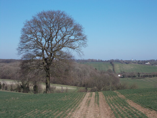
The Garden of Remembrance in Bedfordshire is a tranquil and peaceful area located on the Downs moorland. It serves as a place for visitors to remember and pay tribute to their loved ones who have passed away. The garden is beautifully landscaped with a variety of flowers, shrubs, and trees, creating a serene and calming atmosphere.

Visitors can take a leisurely stroll through the garden, admiring the natural beauty and reflecting on the memories of their loved ones. There are also benches scattered throughout the garden, providing a quiet place for contemplation and reflection.

The Garden of Remembrance is maintained by dedicated staff who ensure that it remains a well-kept and welcoming space for visitors. The garden is open to the public throughout the year, allowing people to visit and pay their respects at any time.

Overall, the Garden of Remembrance in Bedfordshire is a peaceful and comforting place for individuals to remember and honor their loved ones in a beautiful and natural setting.

If you have any feedback on the listing, please let us know in the comments section below.

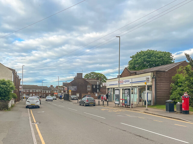
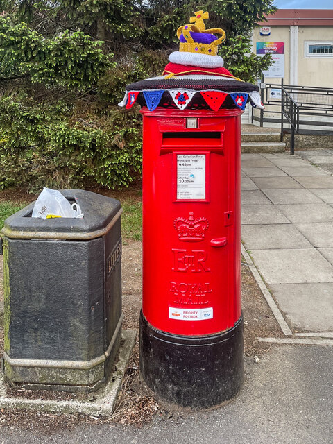
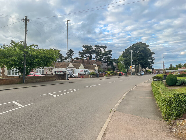
Garden of Remembrance Images

Images are sourced within 2km of 51.908715/-0.3911287 or Grid Reference TL1024. Thanks to Geograph Open Source API. All images are credited.

Sloping striated field south east of Warden Hill
Hedgerow path Nearing the top are three horse riders.  Once on the ridge a left turn leads to Warden and Galley Hills.
Hedgerow path
Nearing the top are three horse riders. Once on the ridge a left turn leads to Warden and Galley Hills.
Field path down towards Lilley from Whitehill Farm
Hitchin Road Section of the former Luton to Hitchin road through Stopsley, once a village in its own right but now a suburb of Luton.  On the far right of the photo is the postbox in <a href="https://www.geograph.org.uk/photo/7184357">TL1023 : Postbox, Hitchin Road</a>.
Hitchin Road
Section of the former Luton to Hitchin road through Stopsley, once a village in its own right but now a suburb of Luton. On the far right of the photo is the postbox in TL1023 : Postbox, Hitchin Road.
Postbox, Hitchin Road Postbox in Hitchin Road outside Stopsley Library adorned with a topper commemorating Queen Elizabeth II's Platinum Jubilee.  For a close up of the topper see <a href="https://www.geograph.org.uk/photo/7184358">TL1023 : Postbox topper, Hitchin Road</a> and for a wider view see <a href="https://www.geograph.org.uk/photo/7184354">TL1023 : Hitchin Road</a>.
Postbox, Hitchin Road
Postbox in Hitchin Road outside Stopsley Library adorned with a topper commemorating Queen Elizabeth II's Platinum Jubilee. For a close up of the topper see TL1023 : Postbox topper, Hitchin Road and for a wider view see TL1023 : Hitchin Road.
Postbox topper, Hitchin Road A knitted postbox topper on a postbox in Hitchin Road outside Stopsley Library adorned with a topper commemorating Queen Elizabeth II's Platinum Jubilee.  For a photo of the whole postbox see <a href="https://www.geograph.org.uk/photo/7184357">TL1023 : Postbox, Hitchin Road</a>.
Postbox topper, Hitchin Road
A knitted postbox topper on a postbox in Hitchin Road outside Stopsley Library adorned with a topper commemorating Queen Elizabeth II's Platinum Jubilee. For a photo of the whole postbox see TL1023 : Postbox, Hitchin Road.
St Thomas's Church, Stopsley Parish church for Stopsley, consecrated in 1862.
St Thomas's Church, Stopsley
Parish church for Stopsley, consecrated in 1862.
St Thomas's Church, Stopsley Parish church for Stopsley, consecrated in 1862.
St Thomas's Church, Stopsley
Parish church for Stopsley, consecrated in 1862.
Luton Conservative Club Social club and local party headquarters at 587 Hitchin Road in Stopsley.
Luton Conservative Club
Social club and local party headquarters at 587 Hitchin Road in Stopsley.
Hitchin Road Housing in Hitchin Road in Stopsley.
Hitchin Road
Housing in Hitchin Road in Stopsley.
553 - 561 Hitchin Road Pair of semi-detached houses in Hitchin Road in Stopsley, all with unusual stone detailing below the first floor bay windows.
553 - 561 Hitchin Road
Pair of semi-detached houses in Hitchin Road in Stopsley, all with unusual stone detailing below the first floor bay windows.
Stopsley Baptist Church Baptist church in St Thomas's Road in Stopsley, completed in 1994.
Stopsley Baptist Church
Baptist church in St Thomas's Road in Stopsley, completed in 1994.
St Thomas's Road Terraced cottages in St Thomas's Road in Stopsley, originally Bury Road.  The cottages have a name and date plaque "Marsom Place 1903", the name referring to Thomas Marsom, the first Baptist minister in Luton.
St Thomas's Road
Terraced cottages in St Thomas's Road in Stopsley, originally Bury Road. The cottages have a name and date plaque "Marsom Place 1903", the name referring to Thomas Marsom, the first Baptist minister in Luton.
The A505 Beech Hill before Stopsley By the Putteridge Bury entrance to Luton University.
The A505 Beech Hill before Stopsley
By the Putteridge Bury entrance to Luton University.
The Basepoint business park, Stopsley
Ashcroft Road, Stopsley The bungalow looked in perfect condition last year so may be being cleared for a new build.
Ashcroft Road, Stopsley
The bungalow looked in perfect condition last year so may be being cleared for a new build.
Bungalows on Ashcroft Road, Stopsley
Show me another place!

Garden of Remembrance is located at Grid Ref: TL1024 (Lat: 51.908715, Lng: -0.3911287)

Unitary Authority: Luton

Police Authority: Bedfordshire

What 3 Words

///pushy.exist.bets. Near Luton, Bedfordshire

Nearby Locations

Garden of Remembrance

Related Wikis

Butterfield Green

Butterfield Green is a hamlet in the north of Luton, Bedfordshire, England. It is the location for the new 85-acre (340,000 m2) Butterfield Business and...

Putteridge High School

Putteridge High School is a co-educational secondary school located in the Putteridge area of Luton, in the English county of Bedfordshire. == History... ==

Putteridge

Putteridge is a suburb at the north-eastern edge of Luton, in Bedfordshire, England. Putteridge is a little over 2 miles (3.2 km) from Luton town centre...

Stopsley

Stopsley is a suburb in the north-east of Luton, Bedfordshire, England. The area is roughly bounded by the edge of Luton to the north, Vauxhall Way and...

Nearby Amenities

Located within 500m of 51.908715,-0.3911287
Crossing
Bicycle: yes
Button Operated: yes
Crossing: traffic_signals
Crossing Island: no
Crossing Markings: dots
Crossing Ref: puffin
Kerb: lowered
Side: both
Tactile Paving: yes
Traffic Signals Sound: yes
Lat/Long: 51.9061343/-0.3925304
Source: npe
Lat/Long: 51.9110408/-0.3850822
Traffic Signals
Traffic Signals: signal
Lat/Long: 51.9064988/-0.3915873
Speed Camera
Colour: yellow
Direction: NE
Maxspeed: 40 mph
Lat/Long: 51.9068081/-0.3909765
Crossing
Bicycle: yes
Crossing: unmarked
Sloped Curb: both
Tactile Paving: yes
Lat/Long: 51.9116724/-0.3869344
Crossing
Bicycle: yes
Crossing: unmarked
Sloped Curb: both
Tactile Paving: yes
Lat/Long: 51.9116886/-0.3868064
Crossing
Bicycle: yes
Crossing Island: yes
Sloped Curb: both
Tactile Paving: yes
Lat/Long: 51.9122505/-0.3868248
Turning Circle
Lat/Long: 51.9071942/-0.3862355
Crossing
Bicycle: dismount
Button Operated: yes
Crossing: traffic_signals
Crossing Island: no
Crossing Markings: dots
Crossing Ref: pelican
Kerb: lowered
Side: both
Tactile Paving: yes
Lat/Long: 51.9100953/-0.3866272
Bus: yes
Direction: forward
Operator: Arriva;National Express
Public Transport: stop_position
Ref: 100;101;777;787
Lat/Long: 51.905693/-0.3930873
Barrier: kissing_gate
Foot: yes
Lat/Long: 51.911054/-0.3967616
Barrier: kissing_gate
Foot: yes
Lat/Long: 51.9078648/-0.39666
Crossing
Bicycle: dismount
Button Operated: yes
Crossing: traffic_signals
Crossing Island: no
Crossing Markings: dots
Crossing Ref: pelican
Kerb: lowered
Side: both
Tactile Paving: yes
Lat/Long: 51.9100758/-0.3868481
Traffic Signals
Traffic Signals: signal
Lat/Long: 51.9064497/-0.3919448
Crossing
Bicycle: yes
Button Operated: yes
Crossing: traffic_signals
Crossing Island: no
Crossing Markings: dots
Crossing Ref: puffin
Kerb: lowered
Side: both
Tactile Paving: yes
Traffic Signals Sound: yes
Lat/Long: 51.9061003/-0.3923528
Post Box
Collection Times: Mo-Fr 17:30; Sa 12:30
Operator: Royal Mail
Post Box Type: pillar
Ref: LU2 6
Royal Cypher: EIIR
Royal Cypher Wikidata: Q33102113
Source: survey
Lat/Long: 51.9064944/-0.3854864
Access: private
Barrier: block
Material: concrete
Vehicle: no
Lat/Long: 51.9120155/-0.3890269
Camera Mount: pole
Camera Type: dome
Man Made: surveillance
Surveillance: outdoor
Surveillance Type: camera
Lat/Long: 51.9121512/-0.3884402
Camera Mount: pole
Camera Type: dome
Man Made: surveillance
Surveillance: outdoor
Surveillance Type: camera
Lat/Long: 51.9119287/-0.388357
Camera Mount: pole
Camera Type: dome
Man Made: surveillance
Surveillance: outdoor
Surveillance Type: camera
Lat/Long: 51.9110087/-0.3867866
Access: private
Entrance: service
Lat/Long: 51.9124064/-0.3884453
Waste Basket
Covered: yes
Waste: trash
Lat/Long: 51.912437/-0.3882477
Grit Bin
Colour: green
Lat/Long: 51.9124221/-0.3884355
Bench: yes
Bin: yes
Bus: yes
Direction: forward
Operator: Arriva
Public Transport: stop_position
Ref: 101
Ref SMS: ltnajt
Shelter: yes
Lat/Long: 51.9118501/-0.3868537
Bus Stop
Butterfield Business Park
Bench: yes
Bin: yes
Bus: yes
Naptan AtcoCode: 02900021
Naptan NaptanCode: ltnajt
Network: Arriva
Network Wikidata: Q680991
Operator: Arriva
Public Transport: platform
Ref: 101
Ref SMS: ltnajt
Shelter: yes
Lat/Long: 51.9118564/-0.3867755
Camera Mount: pole
Camera Type: dome
Check Date: 2023-02-13
Man Made: surveillance
Surveillance: outdoor
Surveillance Type: camera
Lat/Long: 51.9116739/-0.3871138
Crossing
Bicycle: yes
Crossing Island: yes
Sloped Curb: both
Tactile Paving: yes
Lat/Long: 51.9123835/-0.3871889
Crossing
Bicycle: yes
Crossing Island: yes
Sloped Curb: both
Tactile Paving: yes
Lat/Long: 51.9121608/-0.3873927
Crossing
Bicycle: yes
Crossing: unmarked
Sloped Curb: both
Tactile Paving: yes
Lat/Long: 51.9121266/-0.3883206
Crossing
Bicycle: yes
Crossing: unmarked
Sloped Curb: both
Tactile Paving: yes
Lat/Long: 51.9120581/-0.3894849
Crossing
Bicycle: yes
Crossing: unmarked
Sloped Curb: both
Tactile Paving: yes
Lat/Long: 51.9120163/-0.3890036
Crossing
Bicycle: yes
Crossing: unmarked
Sloped Curb: both
Tactile Paving: yes
Lat/Long: 51.9119704/-0.3887244
Give Way
Direction: forward
Lat/Long: 51.9121007/-0.3883128
Crossing
Bicycle: yes
Crossing: unmarked
Sloped Curb: both
Tactile Paving: yes
Lat/Long: 51.9120825/-0.3880942
Give Way
Direction: forward
Lat/Long: 51.9119959/-0.38873
Give Way
Direction: forward
Lat/Long: 51.9100813/-0.3907529
Give Way
Direction: forward
Lat/Long: 51.9066768/-0.3927236
Access: customers
Barrier: swing_gate;height_restrictor
Description: Normally open. Includes a hinged 2m height restriction bar, open at time of visit.
Swing Gate Type: single
Lat/Long: 51.9064679/-0.3927638
Access: customers
Barrier: swing_gate;height_restrictor
Description: Normally open. Includes a hinged 2m height restriction bar, open at time of visit.
Swing Gate Type: single
Lat/Long: 51.9066881/-0.3927841
Give Way
Direction: forward
Lat/Long: 51.9061501/-0.3901225
Give Way
Direction: backward
Lat/Long: 51.905804/-0.3910833
Turning Circle
Lat/Long: 51.909618/-0.3840454
Give Way
Direction: backward
Lat/Long: 51.9065993/-0.3848349
Give Way
Direction: backward
Lat/Long: 51.9100175/-0.3929219
Give Way
Direction: forward
Lat/Long: 51.9099146/-0.3867343
Bus: yes
Operator: Arriva;National Express
Public Transport: stop_position
Ref: 100;101;777;787
Ref SMS: ltnamwt
Lat/Long: 51.9091911/-0.3877401
Give Way
Direction: backward
Lat/Long: 51.9093896/-0.3874303
Bus Stop
Mount Grace Road Adj
Bench: yes
Bin: no
Bus: yes
Operator: Arriva;National Express
Public Transport: platform
Ref: 100;101;777;787
Ref SMS: ltnamwt
Shelter: yes
Lat/Long: 51.9091588/-0.3876971
Bus: yes
Operator: Arriva;National Express
Public Transport: stop_position
Ref: 100;101;777;787
Ref SMS: ltnapad
Lat/Long: 51.9096821/-0.3873408
Bus Stop
Mount Grace Road Opp
Bench: yes
Bin: no
Operator: Arriva;National Express
Ref: 100;101;777;787
Ref SMS: ltnapad
Shelter: yes
Lat/Long: 51.9097065/-0.3874361
Waste Basket
Waste: trash
Lat/Long: 51.909909/-0.3915274
Bicycle Parking
Access: customers
Bicycle Parking: rack
Capacity: 4
Covered: no
Lit: yes
Opening Hours: Mo-Su 09:00-20:00
Operator: Luton Borough Council
Surface: concrete
Lat/Long: 51.9099023/-0.391527
Grit Bin
Colour: green
Direction: W
Lat/Long: 51.9098898/-0.3914932
Crossing
Bicycle: dismount
Crossing: unmarked
Sloped Curb: both
Tactile Paving: yes
Lat/Long: 51.908921/-0.3912934
Barrier: bollard
Foot: yes
Material: plastic
Lat/Long: 51.9067487/-0.3927337
Barrier: bollard
Foot: yes
Material: plastic
Lat/Long: 51.9067854/-0.3927349
Barrier: bollard
Foot: yes
Material: plastic
Lat/Long: 51.9068221/-0.392736
Barrier: bollard
Foot: yes
Material: plastic
Lat/Long: 51.9068588/-0.3927371
Give Way
Direction: forward
Lat/Long: 51.9100656/-0.391451
Noexit: yes
Lat/Long: 51.9080109/-0.3920162
Description: Plaque commemorating opening of sports centre.
Fixme: Needs confirming that it is as per description.
Historic: memorial
Memorial: plaque
Lat/Long: 51.9068902/-0.3928001
Give Way
Direction: forward
Lat/Long: 51.9070069/-0.3926392
Traffic Signals
Traffic Signals: signal
Lat/Long: 51.9061025/-0.3925869
Bus Stop
Inspire off
Bench: yes
Bin: no
Bus: yes
Naptan AtcoCode: 02901383
Naptan NaptanCode: ltnamwp
Operator: Arriva;National Express
Public Transport: platform
Ref: 100;101;777;787
Ref SMS: ltnamwp
Shelter: yes
Lat/Long: 51.9057788/-0.3926508
Barrier: bollard
Bicycle: dismount
Foot: yes
Material: concrete
Motor Vehicle: no
Motorcycle: no
Lat/Long: 51.9060342/-0.3928155
Barrier: bollard
Bicycle: dismount
Foot: yes
Material: concrete
Motor Vehicle: no
Motorcycle: no
Lat/Long: 51.9060224/-0.3928272
Barrier: bollard
Bicycle: dismount
Foot: yes
Material: concrete
Motor Vehicle: no
Motorcycle: no
Lat/Long: 51.9060113/-0.3928381
Barrier: bollard
Bicycle: dismount
Foot: yes
Material: concrete
Motor Vehicle: no
Motorcycle: no
Lat/Long: 51.9060003/-0.3928489
Bus: yes
Direction: forward
Operator: Arriva;National Express
Public Transport: stop_position
Ref: 100;101;777;787
Lat/Long: 51.9058136/-0.3927473
Bus Stop
Inspire o/s
Bench: yes
Bin: no
Bus: yes
Operator: Arriva;National Express
Public Transport: platform
Ref: 100;101;777;787
Ref SMS: ltnapag
Shelter: yes
Lat/Long: 51.9057467/-0.3931509
Grit Bin
Colour: yellow
Direction: SE
Lat/Long: 51.9063822/-0.3938757
Waste Basket
Waste: trash
Lat/Long: 51.9062796/-0.3939669
Access: customers
Entrance: main
Lat/Long: 51.9061623/-0.3940271
Grit Bin
Colour: yellow
Direction: SSW
Lat/Long: 51.9060802/-0.392894
Waste Basket
Waste: trash
Lat/Long: 51.9060736/-0.3929409
Crossing
Bicycle: dismount
Crossing: uncontrolled
Crossing Island: no
Crossing Markings: zebra
Kerb: flush
Tactile Paving: yes
Lat/Long: 51.9060961/-0.3930521
Access: private
Addr Flats: 1;2;3;4;5;6;7;8;9;10;11;12;13;14;15;16;17;18;19;20;21;22;23;24;25;26;27;28;29;30;31;32;33
Entrance: main
Lat/Long: 51.9063127/-0.3912377
Waste Basket
Waste: trash
Lat/Long: 51.9062316/-0.3919566
Camera Mount: pole
Camera Type: dome
Man Made: surveillance
Operator: Luton Borough Council
Surveillance: outdoor
Surveillance Type: camera
Lat/Long: 51.910047/-0.3915737
Give Way
Direction: backward
Lat/Long: 51.9070639/-0.3936571
Give Way
Direction: backward
Lat/Long: 51.906764/-0.3930524
Give Way
Direction: backward
Lat/Long: 51.9064503/-0.3936522
Give Way
Direction: forward
Lat/Long: 51.906846/-0.3932754
Give Way
Direction: backward
Lat/Long: 51.9065219/-0.3938459
Give Way
Direction: forward
Lat/Long: 51.9069168/-0.3934758
Give Way
Direction: forward
Lat/Long: 51.907011/-0.3937081
Give Way
Direction: forward
Lat/Long: 51.9069231/-0.3929456
Give Way
Direction: backward
Lat/Long: 51.9071428/-0.3935304
Give Way
Direction: forward
Lat/Long: 51.9072882/-0.3930366
Give Way
Direction: backward
Lat/Long: 51.9073848/-0.3933004
Give Way
Direction: forward
Lat/Long: 51.9070995/-0.3929758
Give Way
Direction: backward
Lat/Long: 51.9072615/-0.393422
Give Way
Direction: forward
Lat/Long: 51.9068008/-0.3929584
Give Way
Direction: forward
Lat/Long: 51.9063665/-0.3934412
Give Way
Direction: forward
Lat/Long: 51.9064174/-0.3933824
Give Way
Direction: forward
Lat/Long: 51.9064269/-0.3929128
Give Way
Direction: forward
Lat/Long: 51.9064468/-0.3930919
Clock
Sundial Garden
Display: sundial
Support: ground
Lat/Long: 51.9092174/-0.3920266
Camera Mount: pole
Camera Type: dome
Man Made: surveillance
Operator: Luton Borough Council
Surveillance: outdoor
Surveillance Type: camera
Lat/Long: 51.9102087/-0.3896526
Bench
Backrest: yes
Colour: black
Direction: SW
Material: wood;metal
Seats: 4
Lat/Long: 51.9097653/-0.3882766
Bench
Backrest: yes
Colour: black
Direction: SW
Material: wood;metal
Seats: 4
Lat/Long: 51.9096651/-0.3881988
Bench
Backrest: yes
Colour: black
Direction: NNE
Material: wood;metal
Seats: 4
Lat/Long: 51.9091141/-0.3886561
Waste Basket
Waste: trash
Lat/Long: 51.9091224/-0.3886186
Camera Mount: pole
Camera Type: dome
Man Made: surveillance
Operator: Luton Borough Council
Surveillance: outdoor
Surveillance Type: camera
Lat/Long: 51.9090877/-0.3897746
Camera Mount: pole
Camera Type: dome
Man Made: surveillance
Operator: Luton Borough Council
Surveillance: outdoor
Surveillance Type: camera
Lat/Long: 51.908258/-0.3909283
Bench
Backrest: yes
Colour: black
Direction: N
Material: wood;metal
Seats: 4
Lat/Long: 51.9101541/-0.3909735
Bench
Backrest: no
Material: concrete
Seats: 4
Lat/Long: 51.9124895/-0.3878722
Bench
Backrest: no
Material: concrete
Seats: 4
Lat/Long: 51.9125922/-0.3878065
Bench
Backrest: no
Material: concrete
Seats: 4
Lat/Long: 51.9125192/-0.3878447
Bench
Backrest: no
Material: concrete
Seats: 4
Lat/Long: 51.9125607/-0.3878166
Bench
Backrest: no
Material: concrete
Seats: 4
Lat/Long: 51.912624/-0.3877993
Bench
Backrest: no
Material: concrete
Seats: 4
Lat/Long: 51.912669/-0.3878067
Toilets
Access: customers
Entrance: yes
Fee: no
Female: yes
Male: yes
Operator: Luton Borough Council
Toilets Disposal: flush
Toilets Position: seated;urinal
Wheelchair: yes
Lat/Long: 51.9096122/-0.3910034
Bench
Backrest: yes
Colour: black
Covered: yes
Direction: E
Material: metal
Seats: 4
Lat/Long: 51.9097371/-0.3909507
Bench
Backrest: yes
Material: wood
Seats: 4
Lat/Long: 51.9095977/-0.3913618
Bench
Backrest: yes
Material: wood
Seats: 4
Lat/Long: 51.9095903/-0.391396
Waste Basket
Waste: trash
Lat/Long: 51.909599/-0.3913806
Waste Basket
Waste: trash
Lat/Long: 51.9118356/-0.3867992
Access: customers
Entrance: main
Lat/Long: 51.911362/-0.386104
Fire Hydrant
Emergency: fire_hydrant
Fire Hydrant Count: 1
Fire Hydrant Diameter: 64
Fire Hydrant Position: green
Fire Hydrant Type: underground
Operator: Affinity Water
Lat/Long: 51.9122228/-0.3865633
Direction: 150
Generator Method: photovoltaic
Generator Output Electricity: yes
Generator Solar Modules: 4
Generator Source: solar
Generator Type: solar_photovoltaic_panel
Location: roof
Power: generator
Lat/Long: 51.9068444/-0.3856408
Direction: 240
Fixme: survey for panel count
Generator Method: photovoltaic
Generator Output Electricity: yes
Generator Solar Modules: 4
Generator Source: solar
Generator Type: solar_photovoltaic_panel
Location: roof
Power: generator
Lat/Long: 51.9068447/-0.3856932
Traffic Calming: island
Lat/Long: 51.909363/-0.3873763
Generator Method: photovoltaic
Generator Output Electricity: yes
Generator Solar Modules: 10
Generator Source: solar
Generator Type: solar_photovoltaic_panel
Location: roof
Power: generator
Tilted: no
Lat/Long: 51.9059112/-0.3879145
Direction: 135
Generator Method: photovoltaic
Generator Output Electricity: yes
Generator Solar Modules: 10
Generator Source: solar
Generator Type: solar_photovoltaic_panel
Location: roof
Power: generator
Lat/Long: 51.9064937/-0.3905529
Direction: 70
Generator Method: photovoltaic
Generator Output Electricity: yes
Generator Solar Modules: 6
Generator Source: solar
Generator Type: solar_photovoltaic_panel
Location: roof
Power: generator
Lat/Long: 51.9080668/-0.3843591
Direction: 250
Fixme: survey for panel count
Generator Method: photovoltaic
Generator Output Electricity: yes
Generator Solar Modules: 10
Generator Source: solar
Generator Type: solar_photovoltaic_panel
Location: roof
Power: generator
Lat/Long: 51.9080701/-0.3844047
Direction: 150
Generator Method: photovoltaic
Generator Output Electricity: yes
Generator Solar Modules: 15
Generator Source: solar
Generator Type: solar_photovoltaic_panel
Location: roof
Power: generator
Lat/Long: 51.908493/-0.3843364
Generator Method: photovoltaic
Generator Output Electricity: yes
Generator Solar Modules: 4
Generator Source: solar
Generator Type: solar_photovoltaic_panel
Location: roof
Power: generator
Tilted: no
Lat/Long: 51.9084632/-0.3843185
Direction: 150
Generator Method: photovoltaic
Generator Output Electricity: yes
Generator Solar Modules: 12
Generator Source: solar
Generator Type: solar_photovoltaic_panel
Location: roof
Power: generator
Lat/Long: 51.9085362/-0.3842015
Traffic Signals
Traffic Signals: crossing
Lat/Long: 51.9100376/-0.3868959
Traffic Signals
Traffic Signals: crossing
Lat/Long: 51.9101386/-0.3865715
Traffic Signals
Traffic Signals: signal
Traffic Signals Direction: forward
Lat/Long: 51.9063532/-0.3924291
Traffic Signals
Traffic Signals: signal
Lat/Long: 51.9062425/-0.3920815
Traffic Signals
Traffic Signals: signal
Traffic Signals Direction: backward
Lat/Long: 51.9063435/-0.3916437
Crossing
Button Operated: yes
Crossing: traffic_signals
Crossing Island: no
Crossing Markings: dots
Tactile Paving: yes
Lat/Long: 51.9063749/-0.391678
The data included in this document is from www.openstreetmap.org. The data is made available under ODbL.

Have you been to Garden of Remembrance?

Leave your review of Garden of Remembrance below (or comments, questions and feedback).