Cow Pasture

Downs, Moorland in Lincolnshire South Kesteven

England

Cow Pasture

St. Margaret of Antioch Church, Braceborough Grade 1 Listed 

14th Century Church.  <span class="nowrap"><a title="https://historicengland.org.uk/listing/the-list/list-entry/1360151" rel="nofollow ugc noopener" href="https://historicengland.org.uk/listing/the-list/list-entry/1360151">Link</a><img style="margin-left:2px;" alt="External link" title="External link - shift click to open in new window" src="https://s1.geograph.org.uk/img/external.png" width="10" height="10"/></span>

Braceborough >> <span class="nowrap"><a title="https://en.wikipedia.org/wiki/Braceborough_and_Wilsthorpe" rel="nofollow ugc noopener" href="https://en.wikipedia.org/wiki/Braceborough_and_Wilsthorpe">Link</a><img style="margin-left:2px;" alt="External link" title="External link - shift click to open in new window" src="https://s1.geograph.org.uk/img/external.png" width="10" height="10"/></span>
St. Margaret of Antioch Church, Braceborough Credit: Brian Deegan

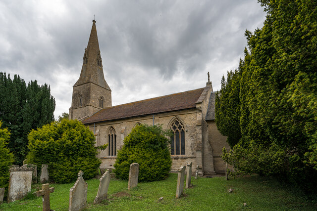
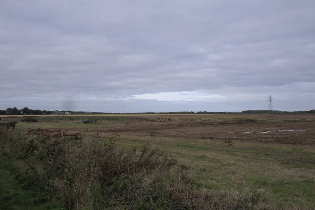
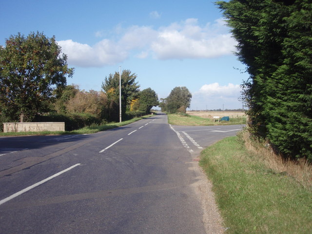
Cow Pasture, Lincolnshire is a picturesque and expansive landscape located in the county of Lincolnshire, England. Spanning over rolling hills and vast meadows, this area is predominantly used for grazing cattle, hence its name. The pasture is situated in close proximity to the town of Lincoln and is easily accessible for visitors.

The landscape of Cow Pasture is characterized by its lush greenery and open spaces, offering visitors a tranquil and peaceful environment. The area boasts a diverse ecosystem with a variety of flora and fauna. The grasslands are home to numerous species of wildflowers, creating a vibrant and colorful display during the summer months.

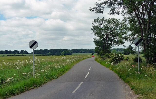
The undulating terrain of Cow Pasture consists of downs and moorland, adding to its natural beauty. These features provide visitors with stunning panoramic views of the surrounding countryside and beyond. The downs are gentle slopes, while the moorland offers a more rugged and wild terrain.

The pasture is not only a haven for cattle but also attracts a variety of bird species, making it a popular spot for birdwatching enthusiasts. Visitors can often spot birds such as skylarks, lapwings, and various species of owls in the area.

Cow Pasture, Lincolnshire offers a range of recreational activities for visitors to enjoy. Walking and hiking trails are available, allowing visitors to explore the scenic landscape at their own pace. Additionally, the vast open spaces make it an ideal location for picnics, outdoor games, and family outings.

Overall, Cow Pasture, Lincolnshire is a stunning natural landscape that showcases the beauty of the Lincolnshire countryside. Its rolling hills, green pastures, and diverse wildlife make it a must-visit destination for nature lovers and those seeking a peaceful retreat.

If you have any feedback on the listing, please let us know in the comments section below.

Cow Pasture Images

Images are sourced within 2km of 52.70637/-0.37066638 or Grid Reference TF1013. Thanks to Geograph Open Source API. All images are credited.

St. Margaret of Antioch Church, Braceborough Grade 1 Listed 

14th Century Church.  <span class="nowrap"><a title="https://historicengland.org.uk/listing/the-list/list-entry/1360151" rel="nofollow ugc noopener" href="https://historicengland.org.uk/listing/the-list/list-entry/1360151">Link</a><img style="margin-left:2px;" alt="External link" title="External link - shift click to open in new window" src="https://s1.geograph.org.uk/img/external.png" width="10" height="10"/></span>

Braceborough >> <span class="nowrap"><a title="https://en.wikipedia.org/wiki/Braceborough_and_Wilsthorpe" rel="nofollow ugc noopener" href="https://en.wikipedia.org/wiki/Braceborough_and_Wilsthorpe">Link</a><img style="margin-left:2px;" alt="External link" title="External link - shift click to open in new window" src="https://s1.geograph.org.uk/img/external.png" width="10" height="10"/></span>
St. Margaret of Antioch Church, Braceborough
Grade 1 Listed 14th Century Church. LinkExternal link Braceborough >> LinkExternal link
Old Hall Farmhouse A grade II listed building at the side of the Macmillan Way long distance path, which at this point runs along the road.

See <span class="nowrap"><a title="https://historicengland.org.uk/listing/the-list/list-entry/1062674" rel="nofollow ugc noopener" href="https://historicengland.org.uk/listing/the-list/list-entry/1062674">Link</a><img style="margin-left:2px;" alt="External link" title="External link - shift click to open in new window" src="https://s1.geograph.org.uk/img/external.png" width="10" height="10"/></span> for the house.
Old Hall Farmhouse
A grade II listed building at the side of the Macmillan Way long distance path, which at this point runs along the road. See LinkExternal link for the house.
Former phone box No longer in use for a payphone, this now belongs to the parish council who have put a defibrillator inside.
Former phone box
No longer in use for a payphone, this now belongs to the parish council who have put a defibrillator inside.
Defibrillator in phone box Inside <a href="https://www.geograph.org.uk/photo/6998599">TF0913 : Former phone box</a>.
Defibrillator in phone box
The Defib box Inside <a href="https://www.geograph.org.uk/photo/6998599">TF0913 : Former phone box</a>.
The Defib box
Life saving advice I have photographed many of these public access defibrillators, but this is the first I have seen with advice about the whole treatment of the victim.  I love this country.  A few well-meaning individuals have sat down and thought about when this device may be used, and taken their own actions to help.  This is why local voluntary action works so well.
Life saving advice
I have photographed many of these public access defibrillators, but this is the first I have seen with advice about the whole treatment of the victim. I love this country. A few well-meaning individuals have sat down and thought about when this device may be used, and taken their own actions to help. This is why local voluntary action works so well.
This made me smile A postbox with a sense of humour.
This made me smile
A postbox with a sense of humour.
Hydrant and Marker In the road at Wilsthorpe, a fire hydrant cover.

See <a href="https://www.geograph.org.uk/photo/6998745">TF0913 : Wilsthorpe cottages</a> for the context
Hydrant and Marker
In the road at Wilsthorpe, a fire hydrant cover. See TF0913 : Wilsthorpe cottages for the context
Wilsthorpe cottages Late 19th century workers cottages, extended at either end in the middle 20th century until the range is twice as long.

The fire hydrant is seen in <a href="https://www.geograph.org.uk/photo/6998740">TF0913 : Hydrant and Marker</a>
Wilsthorpe cottages
Late 19th century workers cottages, extended at either end in the middle 20th century until the range is twice as long. The fire hydrant is seen in TF0913 : Hydrant and Marker
Fingerpost All the tiny fen-edge villages south of Thurlby
Fingerpost
All the tiny fen-edge villages south of Thurlby
Field at Wilsthorpe
Field at Wilsthorpe
Fieldwork A lot of excavation going on
Fieldwork
A lot of excavation going on
Rival machines A Caterpillar D5KLGP mini bulldozer, and a JCB JS130LC excavator.
Rival machines
A Caterpillar D5KLGP mini bulldozer, and a JCB JS130LC excavator.
St Faith, Wilsthorpe The 1715 rebuild was subjected to "cruel alterations" by James Fowler in 1862, "showing the C19 contempt for the C18, paralleled in the mid-C20 contempt for the C19". Fowler added the spire and changed all the windows. Grade II* listed.
St Faith, Wilsthorpe
The 1715 rebuild was subjected to "cruel alterations" by James Fowler in 1862, "showing the C19 contempt for the C18, paralleled in the mid-C20 contempt for the C19". Fowler added the spire and changed all the windows. Grade II* listed.
Country road, Greatford Heading north-west out of the village to the open road.
Country road, Greatford
Heading north-west out of the village to the open road.
Country road near Obthorpe (1) Lined mostly with ash trees.
Country road near Obthorpe (1)
Lined mostly with ash trees.
Country road near Obthorpe (2) Most of the trees by the road are ashes.
Country road near Obthorpe (2)
Most of the trees by the road are ashes.
Country road near Wilsthorpe
Show me another place!

Cow Pasture is located at Grid Ref: TF1013 (Lat: 52.70637, Lng: -0.37066638)

Administrative County: Lincolnshire

District: South Kesteven

Police Authority: Lincolnshire

What 3 Words

///soon.irritable.vows. Near Baston, Lincolnshire

Nearby Locations

Cow Pasture Sheep Pasture

Related Wikis

Kirkstone House School

Kirkstone House School is an independent day school situated in the rural village of Baston in south Lincolnshire, England.The school provides education...

Wilsthorpe, Lincolnshire

Wilsthorpe is a village in the district of South Kesteven in the county of Lincolnshire, England. It is situated approximately 6 miles (10 km) north-east...

Braceborough and Wilsthorpe

Braceborough and Wilsthorpe is a civil parish in the South Kesteven district of Lincolnshire, England. Braceborough and Wilsthorpe are less than 1 mile...
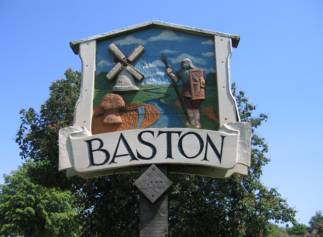
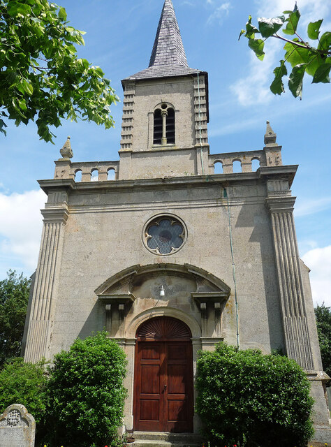
Baston

Baston is a village and parish on the edge of The Fens and in the administrative district of South Kesteven, Lincolnshire, England. The 2011 census reported...

Kates Bridge

Kates Bridge is a landmark settlement on the A15 road, in the parish of Thurlby. It is approximately 3 miles (5 km) south from Bourne, Lincolnshire, England...

King Street (Roman road)

King Street is the name of a modern road on the line of a Roman road. It runs on a straight course in eastern England, between the City of Peterborough...

Thetford, Lincolnshire

Thetford is a hamlet and farm in the civil parish of Baston in the South Kesteven district of Lincolnshire, England. Although Thetford has shrunken to...

Obthorpe

Obthorpe is a hamlet in the civil parish of Thurlby, in the South Kesteven district of Lincolnshire, England. It lies 3 miles (5 km) south from Bourne...

Nearby Amenities

Located within 500m of 52.70637,-0.37066638
Cow Pasture
Landuse: meadow
Source: Bing
Lat/Long: 52.7071312/-0.3717694
Meadow Field
Landuse: meadow
Source: Bing
Lat/Long: 52.7046431/-0.3714502
Sheep Pasture
Landuse: meadow
Source: Bing
Lat/Long: 52.7064737/-0.3643653
Meadow Field
Place: locality
Lat/Long: 52.7043969/-0.3719902
Sheep Pasture
Place: locality
Lat/Long: 52.704839/-0.3654242
The data included in this document is from www.openstreetmap.org. The data is made available under ODbL.

Have you been to Cow Pasture?

Leave your review of Cow Pasture below (or comments, questions and feedback).