Stainfield Fen
Downs, Moorland in Lincolnshire West Lindsey
England
Stainfield Fen

Stainfield Fen, located in Lincolnshire, is a picturesque area that encompasses a combination of downs and moorland. Known for its natural beauty and diverse ecosystem, this region offers a unique experience for visitors and nature enthusiasts alike.
The downs in Stainfield Fen are characterized by gently rolling hills covered in lush green grasses. These open spaces provide stunning panoramic views of the surrounding countryside and serve as a haven for various plant and animal species. Visitors can enjoy leisurely walks or hikes along the well-maintained trails that wind through the downs, taking in the tranquil atmosphere and observing the abundant wildlife.
On the other hand, the moorland in Stainfield Fen offers a stark contrast with its rugged terrain and heather-covered hills. This type of landscape is associated with acidic soils and peat bogs, creating a distinct habitat for unique flora and fauna. Moorland birds such as curlews, lapwings, and red grouse can often be spotted here, making it a popular destination for birdwatchers.
In addition to its natural beauty, Stainfield Fen also boasts historical significance. The remains of ancient settlements and burial sites have been discovered in the area, shedding light on the region's rich cultural heritage.
Overall, Stainfield Fen provides a captivating blend of downs and moorland, allowing visitors to immerse themselves in the beauty of nature while exploring its diverse ecosystems and appreciating its historical past.
If you have any feedback on the listing, please let us know in the comments section below.
Stainfield Fen Images
Images are sourced within 2km of 53.237161/-0.35627368 or Grid Reference TF0972. Thanks to Geograph Open Source API. All images are credited.


Stainfield Fen is located at Grid Ref: TF0972 (Lat: 53.237161, Lng: -0.35627368)
Administrative County: Lincolnshire
District: West Lindsey
Police Authority: Lincolnshire
What 3 Words
///fruits.buffoon.afford. Near Bardney, Lincolnshire
Nearby Locations
Related Wikis
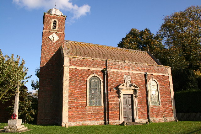
Stainfield
Stainfield is a village and civil parish about 10 miles (16 km) east of the city of Lincoln, in the West Lindsey district of Lincolnshire, England. The...
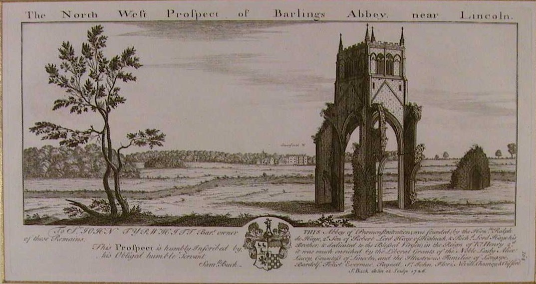
Barlings Abbey
Barlings Abbey was a one of nine Premonstratensian monasteries in the county of Lincolnshire, England. It was founded in 1154, as a daughter house of...

Stainfield Priory
Stainfield Priory was a Benedictine nunnery at Stainfield in the North of Lincolnshire, England, between Wragby and Fiskerton. The priory of St Mary at...

Snakeholme Pit
Snakeholme Pit is a nature reserve near Langworth in the county of Lincolnshire, England, managed and owned by Butterfly Conservation. It is 2 acres. Animals...
Nearby Amenities
Located within 500m of 53.237161,-0.35627368Have you been to Stainfield Fen?
Leave your review of Stainfield Fen below (or comments, questions and feedback).