Branston Fen
Downs, Moorland in Lincolnshire North Kesteven
England
Branston Fen

Branston Fen is a small village located in the county of Lincolnshire, England. Situated in the eastern part of the county, it lies approximately 4 miles southwest of the city of Lincoln. The village is known for its picturesque landscape, characterized by its downs and moorland.
The downs of Branston Fen offer stunning views of the surrounding countryside. These rolling hills are covered in lush green grass and dotted with wildflowers during the summer months. The area is a haven for wildlife enthusiasts, as it is home to a variety of bird species, including skylarks, meadow pipits, and yellowhammers.
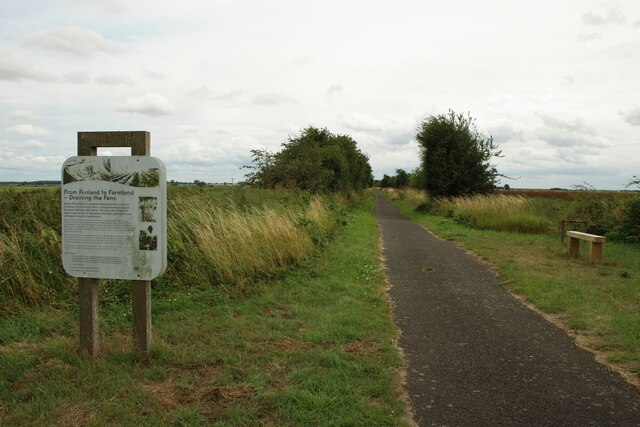
The moorland of Branston Fen is a unique feature of the village. This vast expanse of open land is covered in heather and gorse, giving it a distinctive purple and yellow hue. The moorland provides a habitat for a range of wildlife, including rabbits, foxes, and various species of birds. It is also a popular spot for walking and hiking, with several footpaths crisscrossing the area.
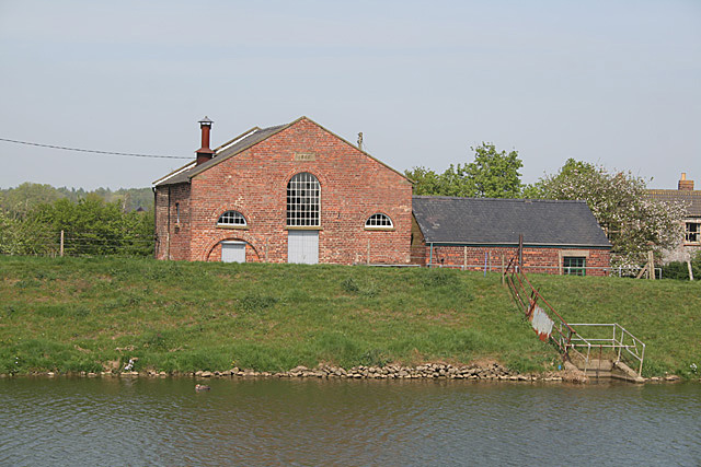
In addition to its natural beauty, Branston Fen has a rich history. The village is home to a number of historic buildings, including a medieval church and a manor house. These architectural treasures offer a glimpse into the village's past and are of great cultural significance to the local community.
Overall, Branston Fen is a charming village that offers a tranquil escape from the hustle and bustle of city life. With its downs and moorland, it is a paradise for nature lovers and history enthusiasts alike.
If you have any feedback on the listing, please let us know in the comments section below.
Branston Fen Images
Images are sourced within 2km of 53.210696/-0.37137841 or Grid Reference TF0869. Thanks to Geograph Open Source API. All images are credited.


Branston Fen is located at Grid Ref: TF0869 (Lat: 53.210696, Lng: -0.37137841)
Administrative County: Lincolnshire
District: North Kesteven
Police Authority: Lincolnshire
What 3 Words
///windpipe.softly.clocks. Near Bardney, Lincolnshire
Nearby Locations
Related Wikis
Witham Third District IDB
Witham Third District IDB is an English internal drainage board set up under the terms of the Land Drainage Act 1930. The Board inherited the responsibilities...

Potterhanworth Booths
Potterhanworth Booths is a hamlet in the North Kesteven district of Lincolnshire, England. It is situated 6 miles (10 km) south-east from Lincoln, and...

Bardney railway station
Bardney railway station was a station in Bardney, Lincolnshire. North of the station the line split in two with one branch going to Lincoln and the other...

Bardney Abbey
Bardney Abbey in Lincolnshire, England, was a Benedictine monastery founded in 697 by King Æthelred of Mercia, who was to become the first abbot. The monastery...
Nearby Amenities
Located within 500m of 53.210696,-0.37137841Have you been to Branston Fen?
Leave your review of Branston Fen below (or comments, questions and feedback).