West Field

Downs, Moorland in Yorkshire

England

West Field

Access  drive  to  Wold  House  on  Wold  Road Wold House was built in 1854 and the white cottage is called The Lodge so one can assume that this was the lodge and gateway
Access drive to Wold House on Wold Road Credit: Martin Dawes

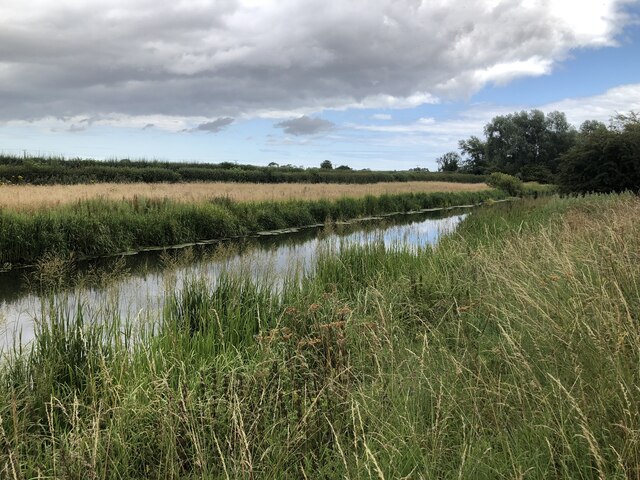
West Field is a picturesque area located in Yorkshire, England, known for its stunning landscapes encompassing both downs and moorland. Situated in the western part of the county, it offers visitors a unique blend of natural beauty and tranquility. The region is characterized by rolling hills, open fields, and vast expanses of heather-covered moorland, creating a breathtaking backdrop for outdoor enthusiasts and nature lovers alike.

The downs in West Field are characterized by their gently sloping hills, covered in lush grasses and dotted with vibrant wildflowers during the summer months. The undulating terrain provides a perfect setting for leisurely walks or picnics, offering panoramic views of the surrounding countryside.

In contrast, the moorland in West Field showcases a more rugged and untamed beauty. Heather dominates the landscape, painting the hills in shades of purple and providing a habitat for various wildlife species. Visitors can explore the moorland on foot, following well-marked trails that wind through the heath and offering opportunities to spot native birds, including grouse and curlews.

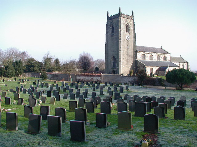
West Field is also home to several charming villages and small hamlets, where visitors can experience the traditional Yorkshire way of life. The locals are known for their warm hospitality and welcoming nature, often sharing stories and insights about the area's rich history and cultural heritage.

Overall, West Field in Yorkshire promises a peaceful retreat for those seeking to immerse themselves in the beauty of nature and discover the charm of rural England. Whether exploring the downs or venturing into the moorland, visitors are bound to be captivated by the area's natural wonders and the sense of serenity it offers.

If you have any feedback on the listing, please let us know in the comments section below.
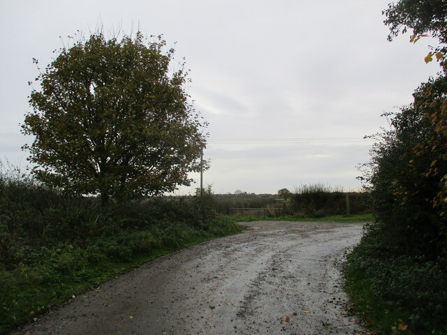
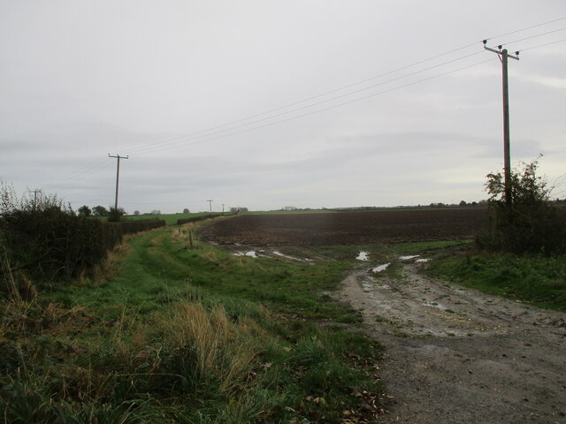
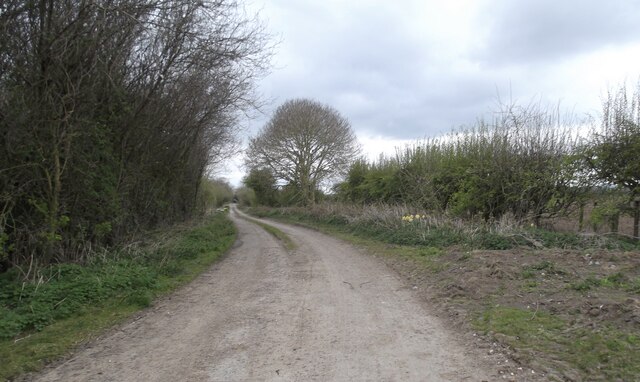
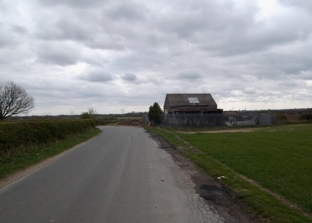
West Field Images

Images are sourced within 2km of 54.0149/-0.40176086 or Grid Reference TA0458. Thanks to Geograph Open Source API. All images are credited.

Access  drive  to  Wold  House  on  Wold  Road Wold House was built in 1854 and the white cottage is called The Lodge so one can assume that this was the lodge and gateway
Access drive to Wold House on Wold Road
Wold House was built in 1854 and the white cottage is called The Lodge so one can assume that this was the lodge and gateway
Former  section  of  Wold  Road  which  has  now  been  diverted The diverted section goes behind the trees on the left at the end of this old tarmac to join the large roundabout on the A614
Former section of Wold Road which has now been diverted
The diverted section goes behind the trees on the left at the end of this old tarmac to join the large roundabout on the A614
Corner  of  old  road  at  Whin  Hill There is a footpath finger post into the field at the corner but it is a path to nowhere as it shortly goes right down to the main road and there is no linkup footpath
Corner of old road at Whin Hill
There is a footpath finger post into the field at the corner but it is a path to nowhere as it shortly goes right down to the main road and there is no linkup footpath
Field  edge  track  at  Whin  Hill The footpath goes right past the telegraph pole
Field edge track at Whin Hill
The footpath goes right past the telegraph pole
Old Wansford Road
Old Wansford Road
Markman Lane
Markman Lane
A614 at Green Lane
A614 at Green Lane
Driffield canal near Whinhill Farm
Farmland south of Nafferton
Nafferton Mere Spring fed pond that was used as a millpond for surrounding mills, now surrounded by gardens. The mere is the source of Nafferton Beck which drains into the River Hull.
Nafferton Mere
Spring fed pond that was used as a millpond for surrounding mills, now surrounded by gardens. The mere is the source of Nafferton Beck which drains into the River Hull.
Nafferton Methodist Church
Footpath to Driffield
Farm track crossing railway
Driffield canal above Whinhill lock
All Saints' Church, Nafferton Parts of the church date from the 13th century.
All Saints' Church, Nafferton
Parts of the church date from the 13th century.
All  Saints  Parish  Church  Nafferton A Norman chancel arch and worked on ever since through the centuries. The nave roof was  "entirely new" in 1846, and the chancel roof was renewed in Temple Moore's restoration 1882-83
All Saints Parish Church Nafferton
A Norman chancel arch and worked on ever since through the centuries. The nave roof was "entirely new" in 1846, and the chancel roof was renewed in Temple Moore's restoration 1882-83
Nafferton  Pond.  Spring  fed  and  clear  water Taken from the higher Priestgate giving an excellent view of the weed coverage at the bottom of the pond.
Nafferton Pond. Spring fed and clear water
Taken from the higher Priestgate giving an excellent view of the weed coverage at the bottom of the pond.
Priestgate  Nafferton Village street scene
Priestgate Nafferton
Village street scene
Show me another place!

West Field is located at Grid Ref: TA0458 (Lat: 54.0149, Lng: -0.40176086)

Division: East Riding

Unitary Authority: East Riding of Yorkshire

Police Authority: Humberside

What 3 Words

///topples.lordship.bowls. Near Nafferton, East Yorkshire

Nearby Locations

West Field

Related Wikis

Nafferton

Nafferton is a village and civil parish in the East Riding of Yorkshire, England. It is situated approximately 2 miles (3.2 km) north-east of Driffield...

Nafferton railway station

Nafferton railway station serves the village of Nafferton in the East Riding of Yorkshire, England. It is located on the Yorkshire Coast Line and is operated...

Alfred Bean Hospital

Alfred Bean Hospital is a health facility in Bridlington Road, Driffield, East Riding of Yorkshire, England. == History == The facility has its origins...

East Riding General Hospital

East Riding General Hospital was a health facility in Bridlington Road, Driffield, East Riding of Yorkshire, England. == History == The facility had its...

Nearby Amenities

Located within 500m of 54.0149,-0.40176086
Power: pole
Lat/Long: 54.0113116/-0.4047182
Power: pole
Lat/Long: 54.0126346/-0.4033613
Power: pole
Lat/Long: 54.0139183/-0.4020479
Power: pole
Lat/Long: 54.0149538/-0.4009259
Power: pole
Lat/Long: 54.0162268/-0.3996127
Power: pole
Lat/Long: 54.0171385/-0.3986828
Power: pole
Lat/Long: 54.0182079/-0.3982397
The data included in this document is from www.openstreetmap.org. The data is made available under ODbL.

Have you been to West Field?

Leave your review of West Field below (or comments, questions and feedback).