Branston Moor

Downs, Moorland in Lincolnshire North Kesteven

England

Branston Moor

Brinkle Spring Lane near Washingborough Heading south-east to nowhere in particular.
Brinkle Spring Lane near Washingborough Credit: Stephen Richards

Branston Moor is a picturesque area located in the county of Lincolnshire, England. It is a combination of downs and moorland, offering a diverse landscape that attracts visitors from near and far.

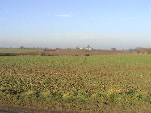
The moorland portion of Branston Moor is characterized by its vast expanses of open, undulating terrain covered in heather, grasses, and scattered patches of woodland. This type of landscape provides a unique habitat for a variety of flora and fauna, including species such as curlews, lapwings, and adders. The moorland also offers breathtaking panoramic views of the surrounding countryside, making it a popular spot for photographers and nature enthusiasts.

In contrast, the downs of Branston Moor are characterized by their gently rolling hills and fertile soil. The downs are primarily used for agricultural purposes, with fields of crops such as wheat, barley, and potatoes. The agricultural activity adds to the charm of the area, with traditional farm buildings and livestock dotting the landscape.

Branston Moor is a haven for outdoor activities, with numerous walking and cycling trails crisscrossing the area. These trails allow visitors to explore the diverse landscape and take in the natural beauty of the surroundings. Additionally, the moorland is a designated Site of Special Scientific Interest (SSSI), highlighting its importance for both conservation and recreational purposes.

Overall, Branston Moor in Lincolnshire is a captivating blend of downs and moorland, providing visitors with a unique and scenic experience in the heart of the English countryside.

If you have any feedback on the listing, please let us know in the comments section below.

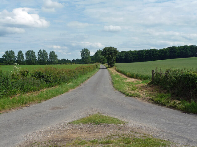
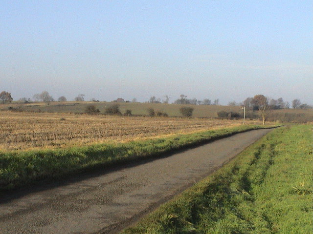
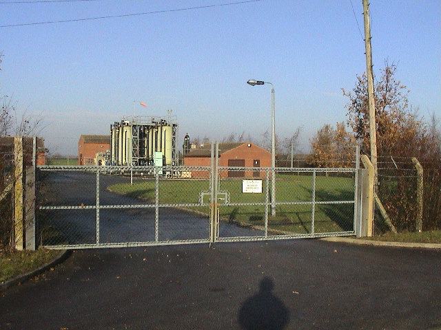
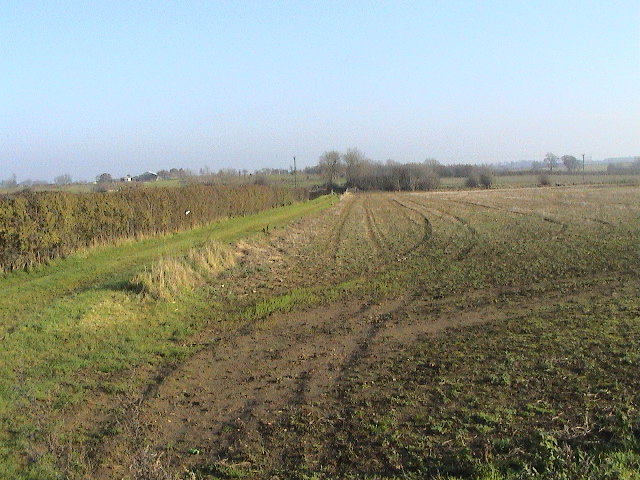
Branston Moor Images

Images are sourced within 2km of 53.19651/-0.43511979 or Grid Reference TF0467. Thanks to Geograph Open Source API. All images are credited.

Brinkle Spring Lane near Washingborough Heading south-east to nowhere in particular.
Brinkle Spring Lane near Washingborough
Heading south-east to nowhere in particular.
Country road near Branston (1) The bridge ahead carries the railway between Lincoln (left) and Sleaford (right).
Country road near Branston (1)
The bridge ahead carries the railway between Lincoln (left) and Sleaford (right).
Country road near Branston (2) Same as this one <a href="https://www.geograph.org.uk/photo/380495">TF0467 : Branston Moor</a>.
Country road near Branston (2)
Same as this one TF0467 : Branston Moor.
Interior, St Andrew's church, Potterhanworth A cake sale was in progress.
Interior, St Andrew's church, Potterhanworth
A cake sale was in progress.
East window, St Andrew's church, Potterhanworth Four light window by Wailes.
East window, St Andrew's church, Potterhanworth
Four light window by Wailes.
Stained glass window, St Andrew's church, Potterhanworth South chancel window featuring Moses.
Stained glass window, St Andrew's church, Potterhanworth
South chancel window featuring Moses.
Stained glass window, St Andrew's church, Potterhanworth Featuring St George and St Martin.

In memory of Arthur Newsum Battle, 2nd Lieutenant, Lincolnshire Regiment, who fell in Gallipoli in 1915, aged 21.
Stained glass window, St Andrew's church, Potterhanworth
Featuring St George and St Martin. In memory of Arthur Newsum Battle, 2nd Lieutenant, Lincolnshire Regiment, who fell in Gallipoli in 1915, aged 21.
St Andrew's church, Potterhanworth From the north.
St Andrew's church, Potterhanworth
From the north.
West Lodge to Longhills Main house attributed to Basevi (1838).
West Lodge to Longhills
Main house attributed to Basevi (1838).
Brinkle Spring Lane Looking NW. The signpost marks the footpath.
Brinkle Spring Lane
Looking NW. The signpost marks the footpath.
Brinkle Spring Lane Looking E. Numerous drainage ditches are required to enable the intensive farming of this fertile but low-lying area where former fenland meets (very slightly) more elevated ground.
Brinkle Spring Lane
Looking E. Numerous drainage ditches are required to enable the intensive farming of this fertile but low-lying area where former fenland meets (very slightly) more elevated ground.
Road and Dyke Looking NW from opposite the pumping station. Both the B1190 and the drainage dyke run on the line of the Car Dyke roman canal at this point - the route follows the boundary between what would then have been marshy fen and slightly raised and firmer ground. See also <a href="https://www.geograph.org.uk/gridref/TL4964">TL4964</a>for a better preserved part of the same canal system far to the south near Waterbeach. Car Dyke link: <span class="nowrap"><a title="http://www.eng-h.gov.uk/archcom/projects/summarys/html96_7/1814anl.htm" rel="nofollow ugc noopener" href="http://www.eng-h.gov.uk/archcom/projects/summarys/html96_7/1814anl.htm">Link</a><img style="margin-left:2px;" alt="External link" title="External link - shift click to open in new window" src="https://s1.geograph.org.uk/img/external.png" width="10" height="10"/></span>
Road and Dyke
Looking NW from opposite the pumping station. Both the B1190 and the drainage dyke run on the line of the Car Dyke roman canal at this point - the route follows the boundary between what would then have been marshy fen and slightly raised and firmer ground. See also TL4964for a better preserved part of the same canal system far to the south near Waterbeach. Car Dyke link: LinkExternal link
Pumping Station Anglian Water pumping station on the raised B1190 near Branston Booths.
Pumping Station
Anglian Water pumping station on the raised B1190 near Branston Booths.
Track & Field Looking E from the Potterhanworth Road. A cutting hides the Lincoln - Sleaford railway among the bushes in the middle distance.
Track & Field
Looking E from the Potterhanworth Road. A cutting hides the Lincoln - Sleaford railway among the bushes in the middle distance.
Nr Heighington Looking NW on the Potterhanworth Road
Nr Heighington
Looking NW on the Potterhanworth Road
Winter Farmland Looking NW from Moor Lane at Stone House Farm. Third Hill Farm is on the horizon.
Winter Farmland
Looking NW from Moor Lane at Stone House Farm. Third Hill Farm is on the horizon.
Branston Moor Looking W from Moor Lane at Stone House Farm.
Branston Moor
Looking W from Moor Lane at Stone House Farm.
Railway Bridge Looking W to the Lincoln - Sleaford railway line crossing Moor Lane.
Railway Bridge
Looking W to the Lincoln - Sleaford railway line crossing Moor Lane.
Show me another place!

Branston Moor is located at Grid Ref: TF0467 (Lat: 53.19651, Lng: -0.43511979)

Administrative County: Lincolnshire

District: North Kesteven

Police Authority: Lincolnshire

What 3 Words

///horn.hampers.banquets. Near Heighington, Lincolnshire

Nearby Locations

Branston Moor

Related Wikis

Potterhanworth railway station

Potterhanworth railway station is a former railway station in Potterhanworth, Lincolnshire. It was on the still-open line between Lincoln and Sleaford...

Potterhanworth

Potterhanworth is a village and civil parish in the North Kesteven district of Lincolnshire, England. The population of the civil parish at the 2011 census...

Branston Booths

Branston Booths is a small village in the North Kesteven district of Lincolnshire, England. The village is situated approximately 5 miles (8 km) east from...

Branston and Mere

Branston and Mere is a civil parish in the North Kesteven district of Lincolnshire, England, about 4 miles (6 km) roughly south-east of Lincoln. The parish...

Nearby Amenities

Located within 500m of 53.19651,-0.43511979
Branston Moor
Place: farm
Source: Bing
Lat/Long: 53.1984937/-0.4332616
Moorlands
Place: isolated_dwelling
Source: Bing
Lat/Long: 53.1948579/-0.4411613
The data included in this document is from www.openstreetmap.org. The data is made available under ODbL.

Have you been to Branston Moor?

Leave your review of Branston Moor below (or comments, questions and feedback).