Nocton Heath

Downs, Moorland in Lincolnshire North Kesteven

England

Nocton Heath

Harvested field, Potterhanworth Heath
Harvested field, Potterhanworth Heath Credit: Jonathan Thacker

The requested URL returned error: 429 Too Many Requests

If you have any feedback on the listing, please let us know in the comments section below.

Nocton Heath Images

Images are sourced within 2km of 53.158167/-0.46128277 or Grid Reference TF0263. Thanks to Geograph Open Source API. All images are credited.

Harvested field, Potterhanworth Heath
Farm track and footpath, Potterhanworth Heath
Farm track and footpath, Potterhanworth Heath A field of poppies on the left.
Farm track and footpath, Potterhanworth Heath
A field of poppies on the left.
Dunston Heath Lane near Dunston (1) Heading south-west to meet the A15.
Dunston Heath Lane near Dunston (1)
Heading south-west to meet the A15.
Dunston Heath Lane near Dunston (2) Heading south-west to meet the A15.
Dunston Heath Lane near Dunston (2)
Heading south-west to meet the A15.
Daffodils and Trees This field of daffodils cover a good proportion of this square.
Daffodils and Trees
This field of daffodils cover a good proportion of this square.
Nocton Heath This field forms part of Nocton Heath.
Nocton Heath
This field forms part of Nocton Heath.
Track and Gas Box This farm track also gives access to the gas pipeline point in the corner of this field.
Track and Gas Box
This farm track also gives access to the gas pipeline point in the corner of this field.
Bridleway and Cycle Track This bridleway also doubles as part of the Lincolnshire Cycle Trail.
Bridleway and Cycle Track
This bridleway also doubles as part of the Lincolnshire Cycle Trail.
Nocton Heath Footpath heading north from Grange Lane on Nocton Heath
Nocton Heath
Footpath heading north from Grange Lane on Nocton Heath
Bloxholm Lane Looking south on Nocton Heath
Bloxholm Lane
Looking south on Nocton Heath
Footpath to Glebe Farm
To Dunstan Pillar Footpath from Bloxholm lane to Dunstan Pillar <a title="https://www.geograph.org.uk/photo/132815" href="https://www.geograph.org.uk/photo/132815">Link</a>
To Dunstan Pillar
Footpath from Bloxholm lane to Dunstan Pillar Link
Nocton Rise A field of daffodils and Nocton Rise
Nocton Rise
A field of daffodils and Nocton Rise
Daffodils on Nocton Heath
Trig pillar - well hidden at side of farm track
Too late - daffodils past their best A field of daffodils from the footpath. Grange Farm in the distance. They must have been busy picking a few weeks ago, there were small elastic bands strewn on the footpath.
Too late - daffodils past their best
A field of daffodils from the footpath. Grange Farm in the distance. They must have been busy picking a few weeks ago, there were small elastic bands strewn on the footpath.
Corner of the footpath near Nocton Heath
Show me another place!

Nocton Heath is located at Grid Ref: TF0263 (Lat: 53.158167, Lng: -0.46128277)

Administrative County: Lincolnshire

District: North Kesteven

Police Authority: Lincolnshire

What 3 Words

///crabmeat.cried.hologram. Near Branston, Lincolnshire

Nearby Locations

Nocton Heath

Related Wikis

Nocton Dairies controversy

Nocton Dairies is a British company which was formed by Devon farmer and cheese-maker Peter Willes and Lancashire milk producer David Barnes in order to...

Nocton rail crash

The Nocton rail crash was a rail accident that happened on 28 February 2002 near Nocton, Lincolnshire, England, after a vehicle smashed through a wall...
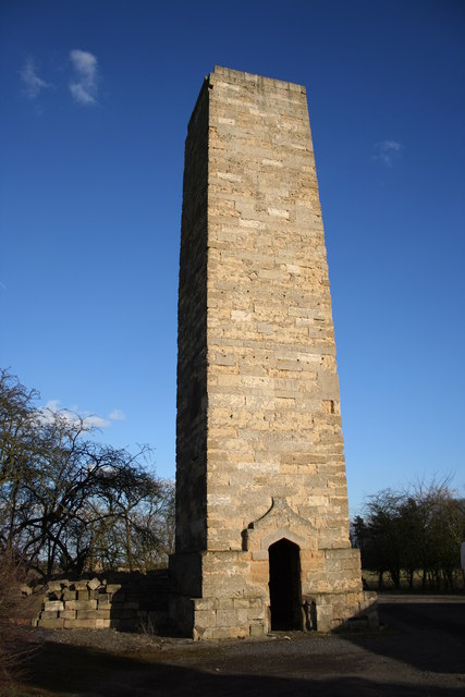
Dunston Pillar

Dunston Pillar is a Grade II listed stone tower in Lincolnshire, England and a former 'land lighthouse'. It stands beside the A15 road approximately 6...

Nocton and Dunston railway station

Nocton and Dunston railway station served Nocton and Dunston in Lincolnshire which shared a GNR/GER Joint railway station until it was closed for passengers...

Nearby Amenities

Located within 500m of 53.158167,-0.46128277
Power: tower
Source: NPE
Lat/Long: 53.1546404/-0.4608942
Power: tower
Source: NPE
Lat/Long: 53.1568684/-0.4622475
Power: tower
Source: NPE
Lat/Long: 53.1593399/-0.4638434
Power: tower
Source: NPE
Lat/Long: 53.1617632/-0.4653747
The data included in this document is from www.openstreetmap.org. The data is made available under ODbL.

Have you been to Nocton Heath?

Leave your review of Nocton Heath below (or comments, questions and feedback).