Goose Green

Downs, Moorland in Surrey Waverley

England

Goose Green

Woodland debris - Creek Copse Some of those look like beech mast - but I'm not an expert on seeds and fruit.
Woodland debris - Creek Copse Credit: Ian Cunliffe

Goose Green is a small village located in the county of Surrey, England. It is situated on the edge of the Surrey Hills, an Area of Outstanding Natural Beauty, and is surrounded by picturesque countryside, including downs and moorland. The village itself is characterized by its rural charm and tranquility.

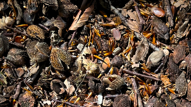
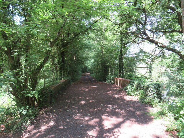
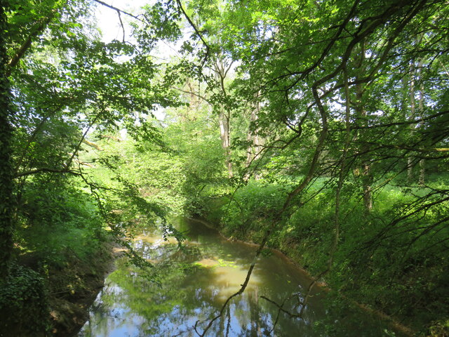
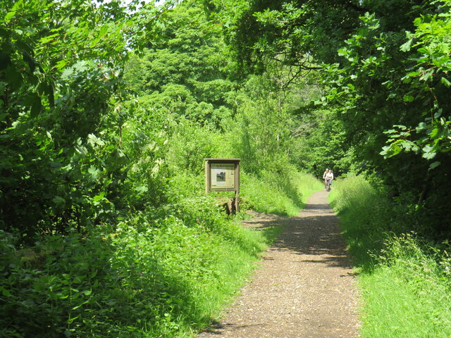
The downs in the area offer stunning views of the surrounding landscape, with rolling hills and grassy slopes. These downs are often used for recreational activities such as walking, jogging, and picnicking. The moorland, on the other hand, provides a unique habitat for a variety of wildlife, including birds, reptiles, and small mammals.

Goose Green has a small population, with a close-knit community that prides itself on its strong sense of community spirit. The village is home to a handful of traditional cottages and farmhouses, giving it a timeless and idyllic feel. There is also a small village green, which serves as a gathering place for locals to relax and enjoy the peaceful surroundings.

Despite its rural location, Goose Green is within easy reach of larger towns and cities. The nearby town of Dorking offers a range of amenities, including shops, restaurants, and leisure facilities. The village is also well-connected by public transport, with regular bus services to surrounding areas.

In conclusion, Goose Green, Surrey, with its downs and moorland, offers a picturesque and peaceful setting for those seeking a rural lifestyle. It provides a close-knit community, stunning natural beauty, and easy access to nearby amenities.

If you have any feedback on the listing, please let us know in the comments section below.
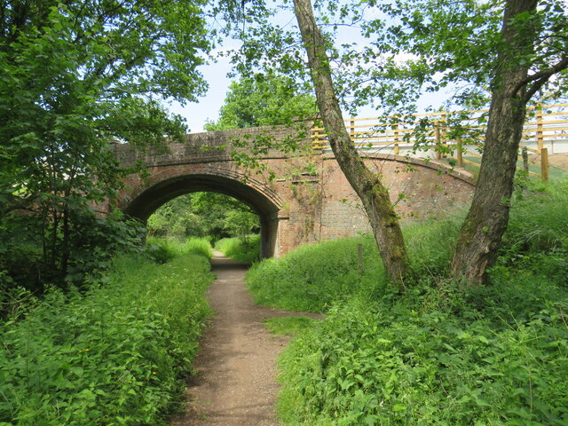
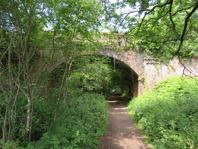
Goose Green Images

Images are sourced within 2km of 51.156542/-0.54043806 or Grid Reference TQ0240. Thanks to Geograph Open Source API. All images are credited.

Woodland debris - Creek Copse Some of those look like beech mast - but I'm not an expert on seeds and fruit.
Woodland debris - Creek Copse
Some of those look like beech mast - but I'm not an expert on seeds and fruit.
Path, Hascombe Hill
Path, Hascombe Hill
Conifer plantation, Hascombe Hill
Downs Link near Cranleigh The Downs Link path follows a dismantled railway line for most of its length.  It also forms part of route 223 of the National Cycle Network.

Here, a bridge takes the route across Cranleigh Waters, a tributary of the River Wey.
Downs Link near Cranleigh
The Downs Link path follows a dismantled railway line for most of its length. It also forms part of route 223 of the National Cycle Network. Here, a bridge takes the route across Cranleigh Waters, a tributary of the River Wey.
Cranleigh Waters, near Cranleigh Cranleigh Waters, also known as Bramley Way, is a tributary of the River Wey in Surrey.
Cranleigh Waters, near Cranleigh
Cranleigh Waters, also known as Bramley Way, is a tributary of the River Wey in Surrey.
Downs Link near Cranleigh The Downs Link path follows a dismantled railway line for most of its length.  It also forms part of route 223 of the National Cycle Network.

An information board alongside the path gives information about the Wey & Arun Canal, which passes beneath the path here.  The canal, opened in 1816, linked the Wey and Arun Navigations to provided a navigable route for barges between London and Portsmouth.
Downs Link near Cranleigh
The Downs Link path follows a dismantled railway line for most of its length. It also forms part of route 223 of the National Cycle Network. An information board alongside the path gives information about the Wey & Arun Canal, which passes beneath the path here. The canal, opened in 1816, linked the Wey and Arun Navigations to provided a navigable route for barges between London and Portsmouth.
Downs Link near Cranleigh The Downs Link path follows a dismantled railway line for most of its length.  It also forms part of route 223 of the National Cycle Network.

Here, a bridge carries a road across the former railway.
Downs Link near Cranleigh
The Downs Link path follows a dismantled railway line for most of its length. It also forms part of route 223 of the National Cycle Network. Here, a bridge carries a road across the former railway.
Downs Link near Cranleigh The Downs Link path follows a dismantled railway line for most of its length.  It also forms part of route 223 of the National Cycle Network.

Here, a bridge carries the path over a farm track.
Downs Link near Cranleigh
The Downs Link path follows a dismantled railway line for most of its length. It also forms part of route 223 of the National Cycle Network. Here, a bridge carries the path over a farm track.
Farm track near Cranleigh A farm track in Surrey countryside, near Cranleigh.
Farm track near Cranleigh
A farm track in Surrey countryside, near Cranleigh.
Downs Link near Cranleigh The Downs Link path follows a dismantled railway line for most of its length.  It also forms part of route 223 of the National Cycle Network.

The bridge ahead carries a farm track over the former railway route.
Downs Link near Cranleigh
The Downs Link path follows a dismantled railway line for most of its length. It also forms part of route 223 of the National Cycle Network. The bridge ahead carries a farm track over the former railway route.
Hascombe Bridleway to the east of the village. By this location, the soil had changed to sand.
Hascombe
Bridleway to the east of the village. By this location, the soil had changed to sand.
View Towards Hascombe Looking down to the fields adjoining Hascombe Place Farm.
View Towards Hascombe
Looking down to the fields adjoining Hascombe Place Farm.
Bridleway on Nore Hanger Creek Copse is to the right of the path. 

The bridleway, initially, is easy walking; however, on the far side of the hill, the centre of the path appears to have been excavated to enable better drainage. As the channel is well over two feet deep, and not overly wide, I would have thought that riding a horse might be 'interesting'.
Bridleway on Nore Hanger
Creek Copse is to the right of the path. The bridleway, initially, is easy walking; however, on the far side of the hill, the centre of the path appears to have been excavated to enable better drainage. As the channel is well over two feet deep, and not overly wide, I would have thought that riding a horse might be 'interesting'.
Bridleway on Nore Hanger This bridleway runs along the ridge, before dropping off to the north.
Bridleway on Nore Hanger
This bridleway runs along the ridge, before dropping off to the north.
Bridleway on Nore Hanger The bridleway, at this location, is easy walking; however, further down the hill, the centre of the path appears to have been excavated to enable better drainage. As the channel is well over two feet deep, and not overly wide, I would have thought that riding a horse might be 'interesting'.
Bridleway on Nore Hanger
The bridleway, at this location, is easy walking; however, further down the hill, the centre of the path appears to have been excavated to enable better drainage. As the channel is well over two feet deep, and not overly wide, I would have thought that riding a horse might be 'interesting'.
Bridleway on Nore Hanger The bridleway, at this location, appears to have been excavated to enable better drainage. The channel is well over two feet deep.
Bridleway on Nore Hanger
The bridleway, at this location, appears to have been excavated to enable better drainage. The channel is well over two feet deep.
Nore Hanger Early evening sun, through the trees.
Nore Hanger
Early evening sun, through the trees.
Nore Hanger Early evening sun, through the trees.
Nore Hanger
Early evening sun, through the trees.
Show me another place!

Goose Green is located at Grid Ref: TQ0240 (Lat: 51.156542, Lng: -0.54043806)

Administrative County: Surrey

District: Waverley

Police Authority: Surrey

What 3 Words

///decimal.washing.cushy. Near Cranleigh, Surrey

Nearby Locations

Palmers Cross Goose Green

Related Wikis

Hascombe

Hascombe is a village and civil parish in Surrey, England. It is around 3 miles (4.8 km) southeast of Godalming in the Borough of Waverley. The settlement...

Hascombe Hill

Hascombe Hill or Hascombe Camp is the site of an Iron Age multivallate hill fort close to the village of Hascombe in Surrey, England. == History == The...

Winkworth Arboretum

Winkworth Arboretum is a National Trust-owned arboretum in the spread-out civil parish of Busbridge between Godalming and Hascombe, south-west Surrey,...

Christ Church, Shamley Green

Christ Church is a Church of England parish church in Shamley Green, Surrey, England. It was constructed in 1863 as a chapel of ease and became a parish...

Hascombe Court

Hascombe Court is a 172-acre (70 ha) estate in Hascombe, Surrey, best known for its vast garden designed by Gertrude Jekyll. Hascombe Court is listed Grade...

Cucknell's Wood

Cucknell's Wood is a 11-hectare (27-acre) nature reserve south-east of Shamley Green in Surrey. It is managed by the Surrey Wildlife Trust.Birds in this...

Cranleigh School

Cranleigh School is a public school (English fee-charging boarding and day school) in the village of Cranleigh, Surrey. == History == It was opened on...

Cranleigh railway station

Cranleigh was a railway station on the Cranleigh Line between Guildford and Horsham. It served the village of Cranleigh, Surrey in southern England....

Nearby Amenities

Located within 500m of 51.156542,-0.54043806
Shelhurst Common
Place: locality
Lat/Long: 51.1593966/-0.5446347
Palmers Cross
Place: hamlet
Source: npe
Lat/Long: 51.1570521/-0.5336657
Barrier: stile
Lat/Long: 51.1550783/-0.5393506
Barrier: stile
Lat/Long: 51.1552466/-0.539415
Barrier: stile
Lat/Long: 51.1560398/-0.5404179
Post Box
Brand: Royal Mail
Brand Wikidata: Q638098
Collection Times: Mo-Fr 16:30; Sa 07:30
Operator: Royal Mail
Operator Wikidata: Q638098
Post Box Mounting: pier
Post Box Type: lamp
Ref: GU5 13
Royal Cypher: EIIR
Royal Cypher Wikidata: Q33102113
Lat/Long: 51.1574337/-0.5336448
Bus Stop
Bus: yes
Bus Bay: yes
Public Transport: platform
Lat/Long: 51.1573451/-0.5336438
Tisley Farm
Place: farm
Lat/Long: 51.1524977/-0.5385994
The data included in this document is from www.openstreetmap.org. The data is made available under ODbL.

Have you been to Goose Green?

Leave your review of Goose Green below (or comments, questions and feedback).