Irnham Park
Downs, Moorland in Lincolnshire South Kesteven
England
Irnham Park

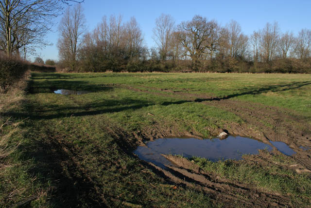
Irnham Park is a sprawling estate located in Lincolnshire, England. Nestled amidst the picturesque Lincolnshire Downs and Moorland, the park spans over hundreds of acres of lush greenery, offering visitors a serene and tranquil environment.
The park boasts a diverse landscape, characterized by rolling hills, verdant meadows, and picturesque woodlands, making it a haven for nature enthusiasts. The Lincolnshire Downs, with their undulating slopes, provide breathtaking panoramic views of the surrounding countryside. Visitors can enjoy leisurely walks or invigorating hikes along the numerous trails that wind through the park, immersing themselves in the beauty of nature.
The park's Moorland area adds to its allure, with its vast expanses of heather-clad hills and open spaces. This unique ecosystem is home to a wide array of flora and fauna, including rare bird species such as the merlin and short-eared owl. Nature lovers can indulge in birdwatching or simply revel in the tranquility that the Moorland offers.
Irnham Park is not only a natural oasis but also steeped in history. The park is home to Irnham Hall, a magnificent country house that dates back to the 14th century. The hall, with its stunning architecture and manicured gardens, offers visitors a glimpse into the region's rich heritage.
Whether seeking a peaceful retreat in nature, a historical exploration, or an opportunity to observe wildlife, Irnham Park in Lincolnshire offers a captivating experience for all who visit.
If you have any feedback on the listing, please let us know in the comments section below.
Irnham Park Images
Images are sourced within 2km of 52.826542/-0.49281009 or Grid Reference TF0126. Thanks to Geograph Open Source API. All images are credited.


Irnham Park is located at Grid Ref: TF0126 (Lat: 52.826542, Lng: -0.49281009)
Administrative County: Lincolnshire
District: South Kesteven
Police Authority: Lincolnshire
What 3 Words
///depending.saucepan.meanwhile. Near Corby Glen, Lincolnshire
Nearby Locations
Related Wikis

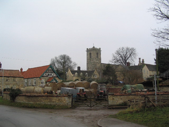
Irnham
Irnham is a village and civil parish in South Kesteven, Lincolnshire, England. It is situated approximately 10 miles (16 km) south-east from Grantham...

Northampton Sand Formation
The Northampton Sand Formation, sometimes called the Northamptonshire Sand, is a Middle Jurassic geological formation which is placed within the Inferior...

St John the Evangelist's Church, Corby Glen
The Church of St John the Evangelist is a Grade I listed Church of England parish church dedicated to John the Evangelist, in Corby Glen, Lincolnshire...
Corby Glen
Corby Glen is a village and civil parish in the South Kesteven district of Lincolnshire, England. It is approximately 9 miles (14 km) south-east of the...

Charles Read Academy
Charles Read Academy is a co-educational secondary school located in Corby Glen, Lincolnshire, England. It serves the villages between Stamford, Bourne...

Keisby
Keisby is a small hamlet in the district of South Kesteven, in Lincolnshire, England. It is situated 6 miles (10 km) north-west from Bourne and 9 miles...
South Kesteven
South Kesteven is a local government district in Lincolnshire, England, forming part of the traditional Kesteven division of the county. Its council is...

Grantham and Stamford (UK Parliament constituency)
Grantham and Stamford is a constituency in Lincolnshire represented in the House of Commons of the UK Parliament since 2019 by Gareth Davies, a Conservative...
Nearby Amenities
Located within 500m of 52.826542,-0.49281009Have you been to Irnham Park?
Leave your review of Irnham Park below (or comments, questions and feedback).