Leadenham Low Fields

Downs, Moorland in Lincolnshire North Kesteven

England

Leadenham Low Fields

Gauging station on the River Brant
Gauging station on the River Brant Credit: Jonathan Thacker

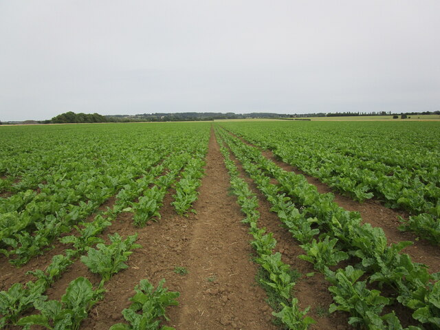
Leadenham Low Fields is a picturesque area located in the county of Lincolnshire, England. Covering a vast expanse of downs and moorland, it offers visitors a serene and tranquil environment to immerse themselves in nature.

The downs in Leadenham Low Fields are characterized by gently rolling hills, covered in lush green grass and dotted with vibrant wildflowers during the warmer months. The open landscape provides breathtaking panoramic views of the surrounding countryside, making it a popular destination for hikers and nature enthusiasts. The gentle slopes make it an accessible location for all ages and fitness levels.

The moorland in Leadenham Low Fields is a unique ecosystem, with its heather-covered hills and peat bogs. This diverse habitat supports a variety of wildlife, including birds such as curlews and lapwings, as well as small mammals like voles and stoats. The moorland is also home to a number of rare plant species, adding to its ecological significance.

Visitors to Leadenham Low Fields can enjoy a range of activities, from leisurely walks and picnics to birdwatching and photography. The area is well-maintained, with designated paths and trails for visitors to explore. There are also information boards and signs providing educational insights into the flora and fauna found in the area.

Overall, Leadenham Low Fields in Lincolnshire offers a peaceful retreat for those seeking solace in nature. Its downs and moorland provide a diverse and beautiful landscape, making it a must-visit destination for anyone looking to reconnect with the great outdoors.

If you have any feedback on the listing, please let us know in the comments section below.

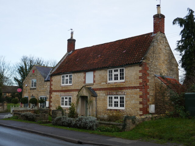
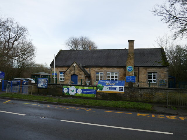
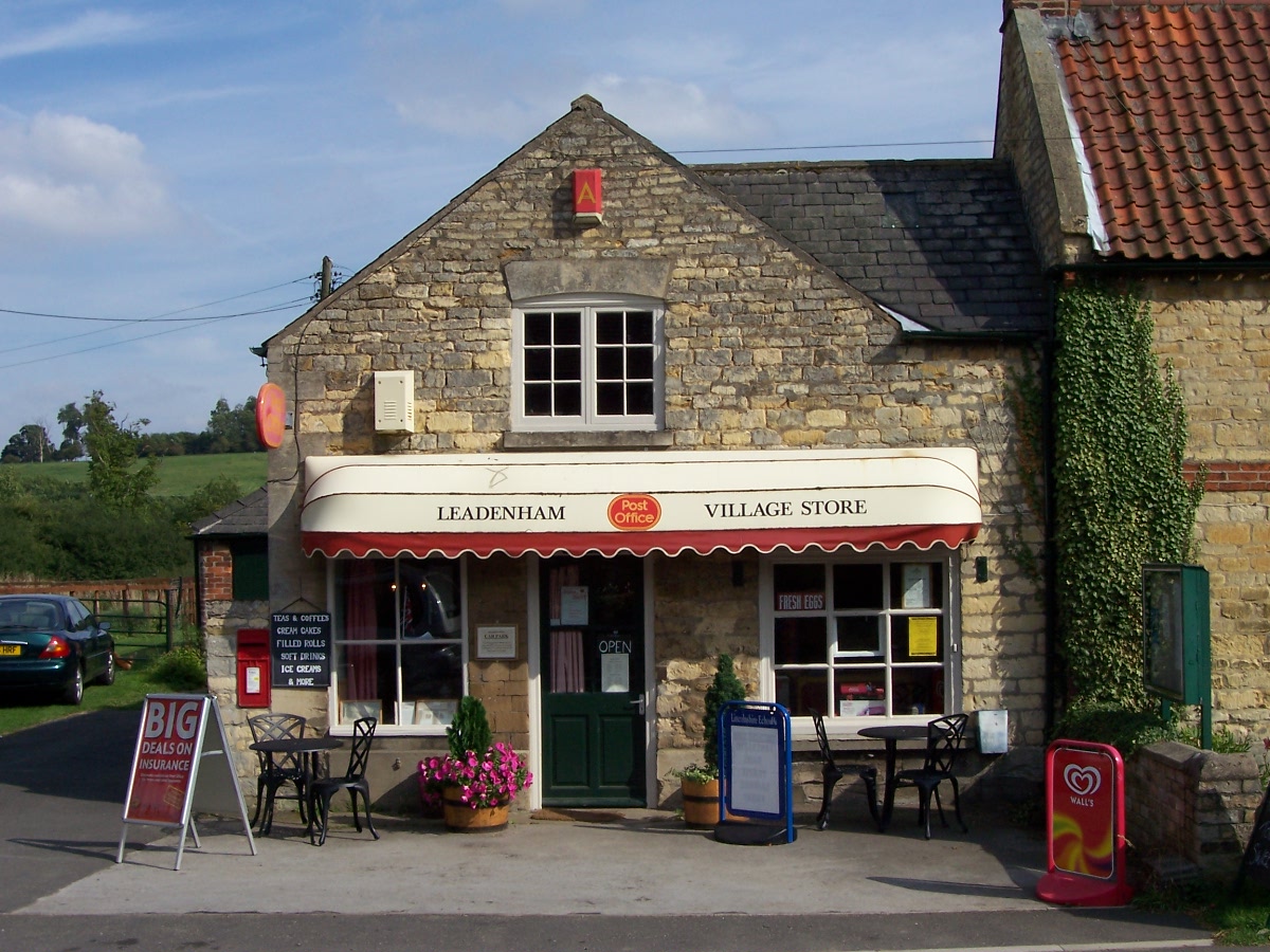
Leadenham Low Fields Images

Images are sourced within 2km of 53.066605/-0.60721342 or Grid Reference SK9353. Thanks to Geograph Open Source API. All images are credited.

Gauging station on the River Brant
Footpath to Welbourn
Bridleway to Leadenham Passing through a field of sugar beet.
Bridleway to Leadenham
Passing through a field of sugar beet.
Footpath through miscanthus, Brant Broughton
Footpath at Brant Broughton
The River Brant While high water levels in the River Brant are nothing like those in the nearby River Witham where there is extensive flooding. Compare with <a href="https://www.geograph.org.uk/photo/7531814">SK9254 : Gauging station on the River Brant</a>
The River Brant
While high water levels in the River Brant are nothing like those in the nearby River Witham where there is extensive flooding. Compare with SK9254 : Gauging station on the River Brant
House, Main Road, Leadenham
The Post Office, Leadenham
Gateway to Leadenham House Dates from about 1900 <span class="nowrap"><a title="https://historicengland.org.uk/listing/the-list/list-entry/1147415?section=official-list-entry" rel="nofollow ugc noopener" href="https://historicengland.org.uk/listing/the-list/list-entry/1147415?section=official-list-entry">Link</a><img style="margin-left:2px;" alt="External link" title="External link - shift click to open in new window" src="https://s1.geograph.org.uk/img/external.png" width="10" height="10"/></span>
Gateway to Leadenham House
Dates from about 1900 LinkExternal link
Gospel Lane, Leadenham
Back Lane, Leadenham
Collapsed retaining wall, Gospel Lane, Leadenham
Three Feathers, Leadenham Former public house with part built in the seventeenth century <span class="nowrap"><a title="https://historicengland.org.uk/listing/the-list/list-entry/1360578?section=official-list-entry" rel="nofollow ugc noopener" href="https://historicengland.org.uk/listing/the-list/list-entry/1360578?section=official-list-entry">Link</a><img style="margin-left:2px;" alt="External link" title="External link - shift click to open in new window" src="https://s1.geograph.org.uk/img/external.png" width="10" height="10"/></span>
Three Feathers, Leadenham
Former public house with part built in the seventeenth century LinkExternal link
Grass field in the centre of Leadenham Looking towards the wellhead.
Grass field in the centre of Leadenham
Looking towards the wellhead.
Well head, Leadenham Dated 1867 <span class="nowrap"><a title="https://historicengland.org.uk/listing/the-list/list-entry/1061873?section=official-list-entry" rel="nofollow ugc noopener" href="https://historicengland.org.uk/listing/the-list/list-entry/1061873?section=official-list-entry">Link</a><img style="margin-left:2px;" alt="External link" title="External link - shift click to open in new window" src="https://s1.geograph.org.uk/img/external.png" width="10" height="10"/></span>
Well head, Leadenham
Dated 1867 LinkExternal link
Leadenham Church of England Primary Academy
Poor Row, Leadenham
Poor Row, Leadenham
Show me another place!

Leadenham Low Fields is located at Grid Ref: SK9353 (Lat: 53.066605, Lng: -0.60721342)

Administrative County: Lincolnshire

District: North Kesteven

Police Authority: Lincolnshire

What 3 Words

///buck.firming.revolting. Near Caythorpe, Lincolnshire

Nearby Locations

Leadenham Low Fields

Related Wikis

Leadenham

Leadenham is a village and civil parish in North Kesteven district of Lincolnshire, England. The population of the civil parish at the 2011 census was...

Leadenham House

Leadenham House is a Grade II* listed Georgian country house in Leadenham, Lincolnshire, England.The house is constructed in '2½ storeys' of ashlar and...

St Helen's Church, Brant Broughton

St Helen's Church is an Anglican church in Brant Broughton, Lincolnshire, England. It is a Grade I listed building. == History == St Helen's Church a medieval...

Brant Broughton

Brant Broughton (pronounced Brew-ton) is a small village in the civil parish of Brant Broughton and Stragglethorpe, in the North Kesteven district of Lincolnshire...

Nearby Amenities

Located within 500m of 53.066605,-0.60721342
Parking
Access: yes
Ele: 16.2279053
Fee: no
Parking: layby
Lat/Long: 53.0631878/-0.6059597
The data included in this document is from www.openstreetmap.org. The data is made available under ODbL.

Have you been to Leadenham Low Fields?

Leave your review of Leadenham Low Fields below (or comments, questions and feedback).