Astead Down
Downs, Moorland in Sussex Chichester
England
Astead Down

Astead Down is a picturesque rural area located in Sussex, England. Known for its stunning natural beauty, the region is primarily characterized by its expansive downs, moorlands, and rolling hills. It is a popular destination for nature enthusiasts, hikers, and birdwatchers.
The downs of Astead Down offer breathtaking panoramic views of the surrounding countryside. These ancient chalk grasslands are home to a diverse range of flora and fauna, including rare wildflowers and butterflies. The area is also renowned for its rich birdlife, with numerous species of birds, such as skylarks and meadow pipits, making it their home.
Moorland areas in Astead Down provide a unique landscape, with vast stretches of heather and gorse dominating the scenery. The purple hues of the blooming heather in late summer create a stunning visual display. These moorlands are also home to various wildlife species, including rabbits, foxes, and even the occasional deer.
The region offers several walking and hiking trails, allowing visitors to explore its natural wonders. The South Downs Way, a long-distance footpath, passes through Astead Down, offering breathtaking views as it winds through the hills and valleys. Additionally, the area is dotted with charming villages and historic sites, such as ancient burial mounds and Iron Age hillforts, adding to its cultural significance.
Overall, Astead Down, Sussex is a haven for those seeking tranquility amidst nature's splendor. Its downs, moorlands, and picturesque landscapes make it a must-visit destination for anyone looking to escape the hustle and bustle of city life and immerse themselves in the beauty of the English countryside.
If you have any feedback on the listing, please let us know in the comments section below.
Astead Down Images
Images are sourced within 2km of 50.904882/-0.69253791 or Grid Reference SU9212. Thanks to Geograph Open Source API. All images are credited.


Astead Down is located at Grid Ref: SU9212 (Lat: 50.904882, Lng: -0.69253791)
Administrative County: West Sussex
District: Chichester
Police Authority: Sussex
What 3 Words
///hiking.bump.astounded. Near Boxgrove, West Sussex
Nearby Locations
Related Wikis

East Dean, West Sussex
East Dean is a village and civil parish in the District of Chichester in West Sussex, England. The village is in a valley in the South Downs, 5+1⁄2 miles...

East Dean Park Wood
East Dean Park Wood is a 17.8-hectare (44-acre) biological Site of Special Scientific Interest south of East Dean in West Sussex.Dry sheltered woods on...

Upwaltham
Upwaltham is a scattered settlement and civil parish in the South Downs, in the District of Chichester of West Sussex, England. It surrounds a parish church...

Goodwood Country Park
Goodwood Country Park is a Country Park in West Sussex in southern England. It is within the estate of Goodwood House near Chichester, and next to Goodwood...
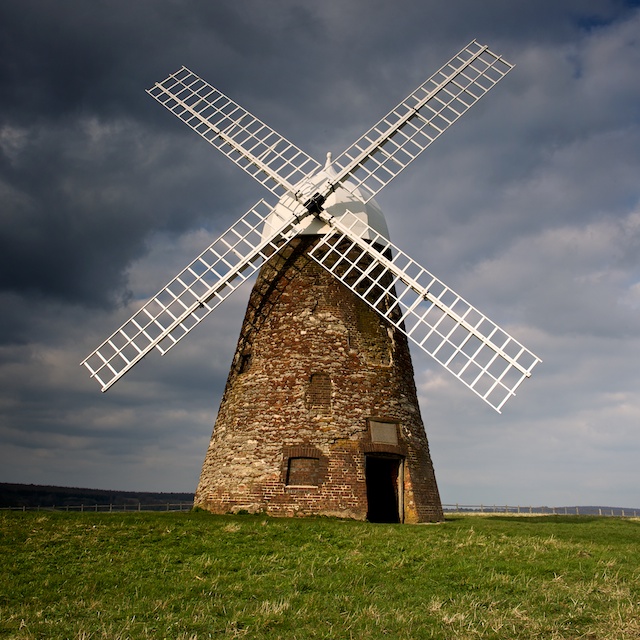
Halnaker Windmill
Halnaker Windmill is a tower mill which stands on Halnaker Hill, northeast of Chichester, Sussex, England. The mill is reached by a public footpath from...

Charlton, West Sussex
Charlton is a hamlet in the Chichester district of West Sussex, England. It lies on the Singleton to East Dean road 5.3 miles (8.6 km) north of Chichester...

The Fox Goes Free
The Fox Goes Free is a grade II listed pub in Charlton, West Sussex, England. It is a 17th-century flint building.On 9 November 1915 the inn was the venue...
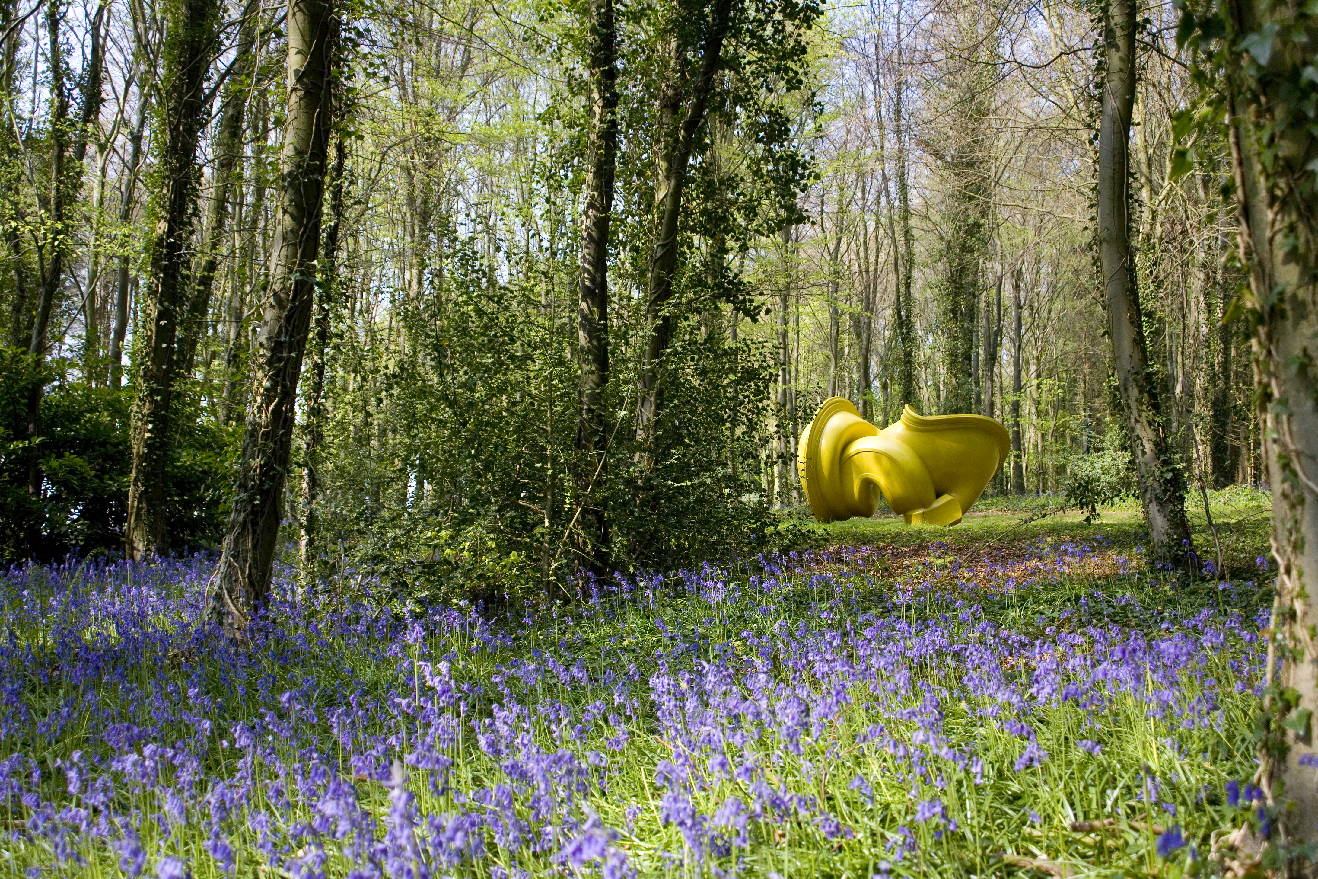
Cass Sculpture Foundation
The Cass Sculpture Foundation was a charitable commissioning body based in Goodwood, Sussex, England. The Foundation's 26-acre grounds were home to an...
Nearby Amenities
Located within 500m of 50.904882,-0.69253791Have you been to Astead Down?
Leave your review of Astead Down below (or comments, questions and feedback).