Allerston High Moor
Downs, Moorland in Yorkshire Ryedale
England
Allerston High Moor

Allerston High Moor is a picturesque area located in the county of Yorkshire, England. Situated amidst the stunning Downs and Moorland landscape, it spans a considerable area of land, covering rolling hills, heathlands, and sprawling moors. The moor is located near the village of Allerston, which adds to its charm and accessibility.
The moorland of Allerston High Moor is renowned for its natural beauty and biodiversity. It is home to a diverse range of plant and animal species, making it an important conservation area. Visitors can witness the vibrant display of heather in bloom, creating a stunning purple carpet across the landscape during the summer months.
The moorland also offers a haven for various bird species, including grouse, curlews, and lapwings. Birdwatchers flock to the area to observe these fascinating creatures in their natural habitat. Additionally, the moorland is populated by a variety of grazing animals, such as sheep and ponies, adding to the rural charm of the area.
Allerston High Moor provides an ideal setting for outdoor enthusiasts. It offers numerous walking trails, allowing visitors to explore the vast expanse of the moorland and take in the breathtaking views. The rugged terrain provides a challenge for hikers, while also offering opportunities for photography and wildlife spotting.
Overall, Allerston High Moor is a captivating destination that showcases the natural beauty and diversity of the Yorkshire Downs and Moorland. Whether it's for a leisurely stroll, birdwatching, or simply admiring the scenic landscape, this area offers an unforgettable experience for all who visit.
If you have any feedback on the listing, please let us know in the comments section below.
Allerston High Moor Images
Images are sourced within 2km of 54.348234/-0.63982244 or Grid Reference SE8895. Thanks to Geograph Open Source API. All images are credited.


Allerston High Moor is located at Grid Ref: SE8895 (Lat: 54.348234, Lng: -0.63982244)
Division: North Riding
Administrative County: North Yorkshire
District: Ryedale
Police Authority: North Yorkshire
What 3 Words
///skills.deeds.swims. Near Sleights, North Yorkshire
Nearby Locations
Related Wikis
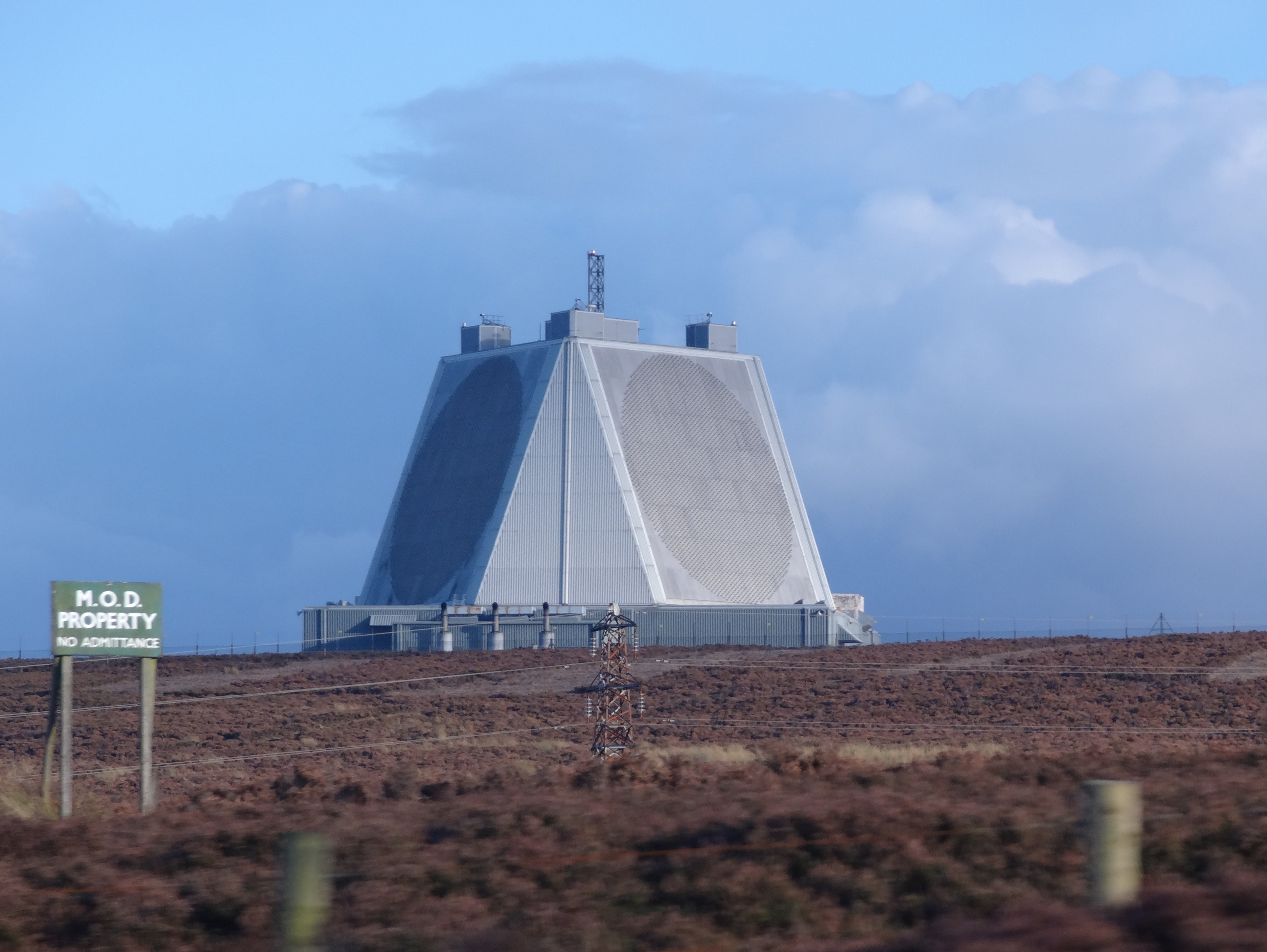
RAF Fylingdales
Royal Air Force Fylingdales or more simply RAF Fylingdales is a Royal Air Force station on Snod Hill in the North York Moors, England. Its motto is "Vigilamus...

Blakey Topping standing stones
Blakey Topping standing stones is a small group of standing stones near the Hole of Horcum in the North York Moors. It sits at the foot of Blakey Topping...
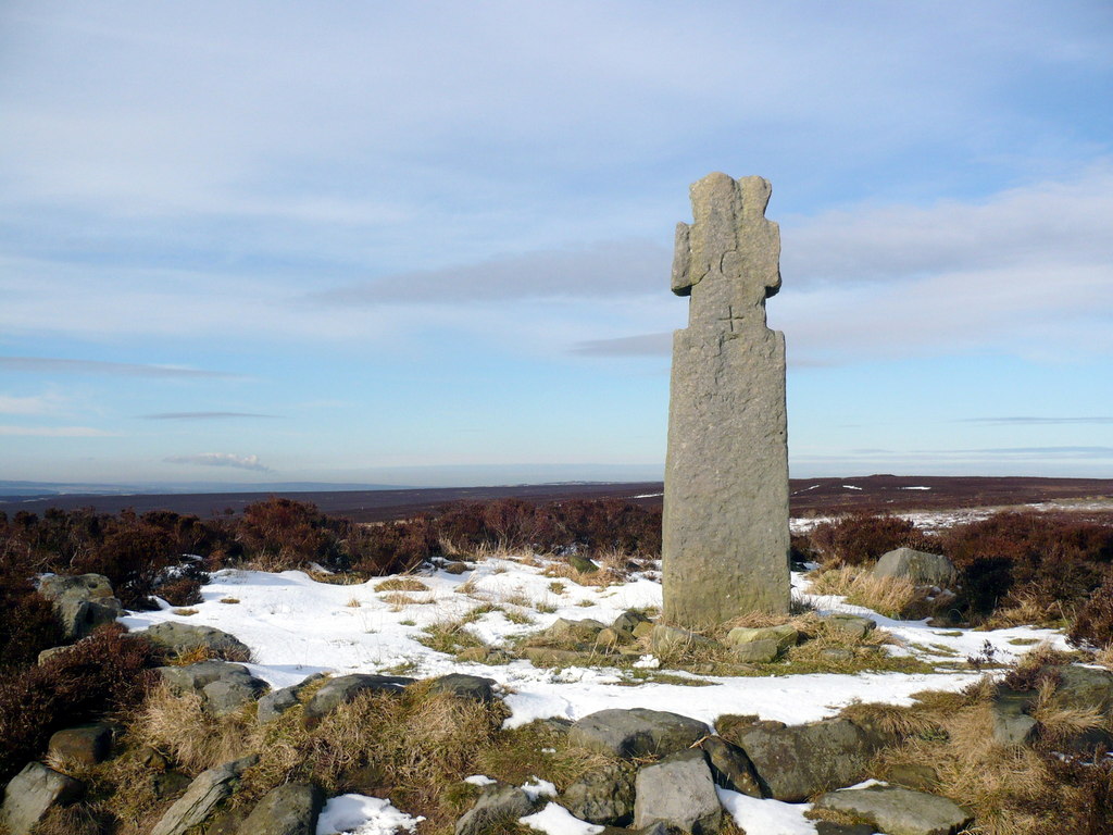
Lilla Cross
Lilla Cross is a marker on Lilla's Howe, Fylingdales Moor, in North Yorkshire, England. A story relates how King Edwin of Northumbria placed the cross...

Hole of Horcum
The Hole of Horcum is a section of the valley of the Levisham Beck, upstream of Levisham and Lockton, in the Tabular Hills of the North York Moors National...

Newton Dale
Newton Dale is a narrow dale within the North York Moors National Park in North Yorkshire, England. It was created by meltwater from a glacier carving...

Newton Dale Halt railway station
Newton Dale Halt railway station is a request stop on the North Yorkshire Moors Railway and serves as a stopping off point for walkers around Newton Dale...

Darncombe-cum-Langdale End
Darncombe-cum-Langdale End is a civil parish in the Scarborough district of North Yorkshire, England. According to the 2001 UK census, Darncombe-cum-Langdale...

Lockton
Lockton is a small village and civil parish in North Yorkshire, England. It is situated in the North York Moors about 4 miles (6.4 km) north-east of Pickering...
Nearby Amenities
Located within 500m of 54.348234,-0.63982244Have you been to Allerston High Moor?
Leave your review of Allerston High Moor below (or comments, questions and feedback).