Balephuil

Settlement in Argyllshire

Scotland

Balephuil

Old CEL Roller at West Hynish
Old CEL Roller at West Hynish Credit: Mike Shields

Balephuil is a small village located in the region of Argyllshire, Scotland. Situated on the picturesque Isle of Tiree, Balephuil is known for its stunning natural beauty, rich history, and tranquil atmosphere.

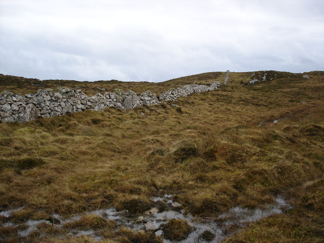
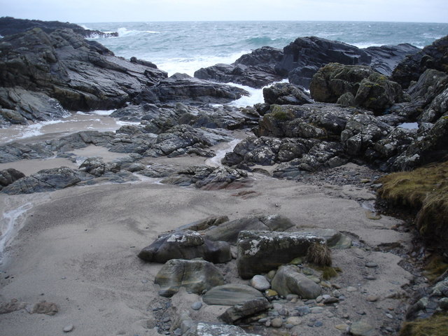
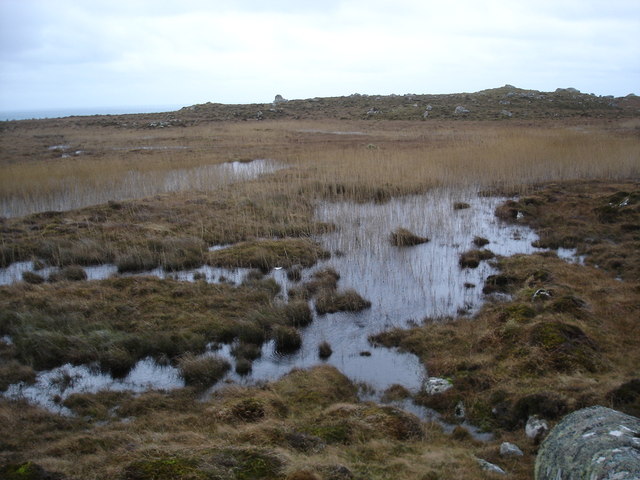
The village is nestled on the western coast of the island, offering breathtaking views of the Atlantic Ocean and the nearby isles. The landscape of Balephuil is characterized by expansive sandy beaches, rolling green hills, and scattered crofts, giving it a truly idyllic charm.

The history of Balephuil dates back centuries, with evidence of early settlements and ancient ruins in the area. The village is home to several historic sites, including the ruins of the medieval St. Columba's Chapel, which stands as a testament to the island's religious past.

Today, Balephuil is primarily a rural community, with a small population of residents who mainly engage in farming and fishing activities. The village offers a peaceful retreat for those seeking a slower pace of life and a chance to connect with nature. Visitors to Balephuil can enjoy leisurely walks along the pristine beaches, indulge in water sports like surfing and windsurfing, or simply take in the stunning sunsets over the ocean.

In addition to its natural beauty, Balephuil also hosts a variety of events and festivals throughout the year, showcasing the island's vibrant culture and traditions. Whether it's exploring the historic sites, immersing oneself in nature, or experiencing the warmth of the local community, Balephuil offers a truly authentic and serene Scottish experience.

If you have any feedback on the listing, please let us know in the comments section below.

Balephuil Images

Images are sourced within 2km of 56.457567/-6.938572 or Grid Reference NL9540. Thanks to Geograph Open Source API. All images are credited.

Old CEL Roller at West Hynish
Coast near West Hynish Nice deep layer of rather pungent seaweed washed ashore here.
Coast near West Hynish
Nice deep layer of rather pungent seaweed washed ashore here.
Dry stone dyke on Beinn Hynish A very popular location for wall is along the ridge line of hills, and in terms of Tiree this is a big as it gets.
Dry stone dyke on Beinn Hynish
A very popular location for wall is along the ridge line of hills, and in terms of Tiree this is a big as it gets.
Port Snoig This is typical of this section of coastline.  Small sandy beaches and lots of rocks.
Port Snoig
This is typical of this section of coastline. Small sandy beaches and lots of rocks.
Pebble Quarry The pebbles are crushed and used as aggregate.
Pebble Quarry
The pebbles are crushed and used as aggregate.
Eilean Mòr Although give the name "big island" it is a bit of a misnomer, a skerry would be a better classification.
Eilean Mòr
Although give the name "big island" it is a bit of a misnomer, a skerry would be a better classification.
Linne Thorramhuill A very heavily reeded lochan, or maybe just very wet bog.  The whole area is rather damp as it seems to be the source of several rivers.
Linne Thorramhuill
A very heavily reeded lochan, or maybe just very wet bog. The whole area is rather damp as it seems to be the source of several rivers.
Road to the radar The access road to the NAT radar on the summit of Carnan Mòr.
Road to the radar
The access road to the NAT radar on the summit of Carnan Mòr.
There's never a gate when you really need one
Little gulley leading to a pebble beach
Moorland below Beinn Hynish
View across the moorland to Beinn Hynish A few rocky outcrops in this area.
View across the moorland to Beinn Hynish
A few rocky outcrops in this area.
NATS road Not as in the political Scot Nats, but rather the National Air Traffic Services and their road to the radar station.
NATS road
Not as in the political Scot Nats, but rather the National Air Traffic Services and their road to the radar station.
Sheds below the radar station
Giant Hogweed bud This enormous bud was growing in rocks by the Hynish shore.  I'm no expert so could not identify it.  BUT - I am now informed (May 2010) by a fellow geographer that this "shows Giant Hogweed (Heracleum mantegazzianum) a very unpleasant invasive species which can cause serious skin burns."
Giant Hogweed bud
This enormous bud was growing in rocks by the Hynish shore. I'm no expert so could not identify it. BUT - I am now informed (May 2010) by a fellow geographer that this "shows Giant Hogweed (Heracleum mantegazzianum) a very unpleasant invasive species which can cause serious skin burns."
Coastal colour below Ben Hynish Thrift and lichen on the rocks in the foreground contrast with the deep blue of the sea on a typically breezy Tiree day.  Looking south, the next land is the Irish coast.
Coastal colour below Ben Hynish
Thrift and lichen on the rocks in the foreground contrast with the deep blue of the sea on a typically breezy Tiree day. Looking south, the next land is the Irish coast.
Road up Carnan Mòr This road goes up to the NATS radar station on the summit of Carnan Mòr.
It is a tarmac road with several hairpin bends as it climbs, and is signposted as "Authorised vehicles only".
Road up Carnan Mòr
This road goes up to the NATS radar station on the summit of Carnan Mòr. It is a tarmac road with several hairpin bends as it climbs, and is signposted as "Authorised vehicles only".
West Hynish: hairpin in the road to the radar station A splendid view across Balephuil Bay from a good way up the tarmac road to Ben Hynish, Tiree's highest point and home to the radar station that is visible from all over the island.
West Hynish: hairpin in the road to the radar station
A splendid view across Balephuil Bay from a good way up the tarmac road to Ben Hynish, Tiree's highest point and home to the radar station that is visible from all over the island.
Show me another place!

Balephuil is located at Grid Ref: NL9540 (Lat: 56.457567, Lng: -6.938572)

Unitary Authority: Argyll and Bute

Police Authority: Argyll and West Dunbartonshire

What 3 Words

///frocks.file.tastes. Near Scarinish, Argyll & Bute

Nearby Locations

Balephuil Tràigh Bhì

Related Wikis

Mannal

Mannal is a coastal hamlet on the west side of Hynish Bay, on the island of Tiree, Scotland. The township of Mannal lies on the southwest corner of Tiree...

Tiree Music Festival

Tiree Music Festival is a Scottish folk music festival held annually on the Island of Tiree in the Inner Hebrides. The festival was founded in 2010 by...

Tiree Airport

Tiree Airport (Scottish Gaelic: Port-adhair Thiriodh) (IATA: TRE, ICAO: EGPU) is located 2.5 nautical miles (4.6 km; 2.9 mi) north northeast of Balemartine...

Scarinish

Scarinish (Scottish Gaelic: Sgairinis [ˈs̪kaɾʲɪnɪʃ]) is the main village on the island of Tiree, in the Inner Hebrides of Scotland. It is located on the...

Nearby Amenities

Located within 500m of 56.457567,-6.938572
Telephone
Booth: K6
Covered: booth
Man Made: telephone_box
Lat/Long: 56.4576407/-6.9382417
Post Box
Collection Times: Mo-Sa 08:00
Post Box Type: lamp
Ref: PA77 136
Royal Cypher: scottish_crown
Lat/Long: 56.4576355/-6.93829
Balephuil
Name Gd: Baile a' Phuill
Place: village
Lat/Long: 56.4582653/-6.9371819
Newton
Name Gd: Baile Ùr
Place: locality
Lat/Long: 56.4563818/-6.9400625
Power: pole
Lat/Long: 56.4602157/-6.9320995
Power: pole
Lat/Long: 56.4590939/-6.9339985
Power: pole
Lat/Long: 56.459657/-6.933049
Power: pole
Lat/Long: 56.4601076/-6.9334942
Power: pole
Lat/Long: 56.4604291/-6.9341835
Power: pole
Lat/Long: 56.4610931/-6.9356185
Power: pole
Lat/Long: 56.4615806/-6.9366565
Power: pole
Lat/Long: 56.4584266/-6.9351786
Power: pole
Lat/Long: 56.4581769/-6.9355798
Power: pole
Lat/Long: 56.4576005/-6.9364963
Power: pole
Lat/Long: 56.4571198/-6.9372776
Power: pole
Lat/Long: 56.4566857/-6.9383166
Power: pole
Lat/Long: 56.4562283/-6.9392879
Power: pole
Lat/Long: 56.4557545/-6.9402677
Power: pole
Lat/Long: 56.4558152/-6.9409308
Power: pole
Lat/Long: 56.4558712/-6.9415326
Power: pole
Lat/Long: 56.4561069/-6.9423329
Power: pole
Lat/Long: 56.4559401/-6.9404451
Power: pole
Lat/Long: 56.4562143/-6.9404894
Power: pole
Lat/Long: 56.4538128/-6.9364541
Power: pole
Lat/Long: 56.4548625/-6.9371192
Power: pole
Lat/Long: 56.4553281/-6.9374318
Power: pole
Lat/Long: 56.4559465/-6.9378224
Isle of Tiree Distillery
Craft: distillery
Lat/Long: 56.4539272/-6.9394608
Barrier: cattle_grid
Lat/Long: 56.4539165/-6.9399443
Defibrillator
Defibrillator Location: on a low wall outside the distillery
Emergency: defibrillator
Opening Hours: 24/7
Lat/Long: 56.4538433/-6.9395265
The data included in this document is from www.openstreetmap.org. The data is made available under ODbL.

Have you been to Balephuil?

Leave your review of Balephuil below (or comments, questions and feedback).