Aislaby Moor

Downs, Moorland in Yorkshire Scarborough

England

Aislaby Moor

The A169 We are over the bridge that vrosses the river and, to the south, the railway line.
The A169 Credit: Malcolm Neal

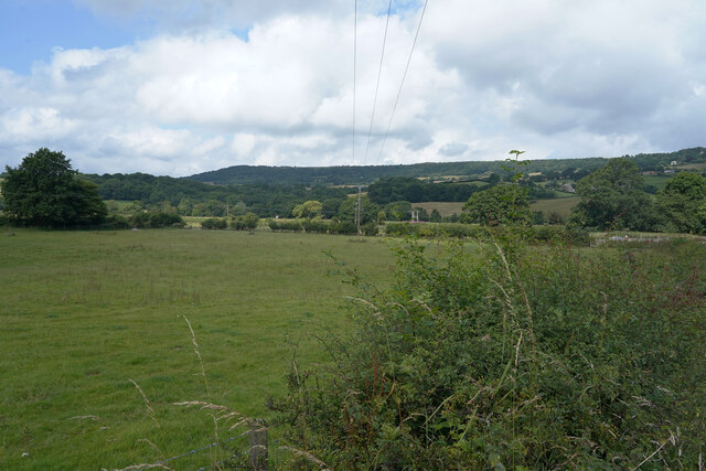
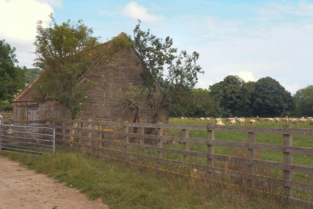
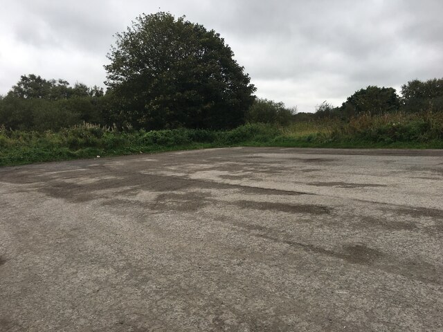
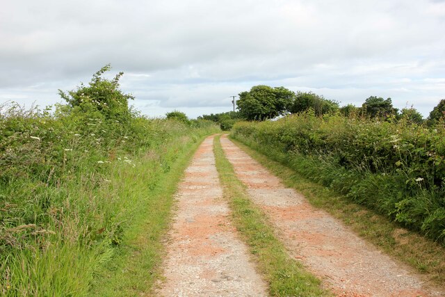
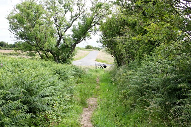
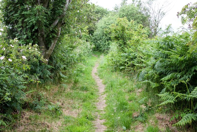
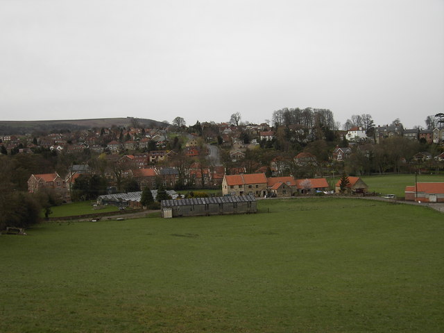
Aislaby Moor is a picturesque area situated in the county of Yorkshire, England. Known for its stunning landscape, it is a combination of downs and moorland, offering a diverse and unique environment. The moor stretches across an expansive area, encompassing rolling hills, open grasslands, and heather-covered moorland.

The terrain of Aislaby Moor is characterized by its undulating hills, which provide breathtaking views of the surrounding countryside. The area is rich in flora and fauna, with a variety of plant species thriving in the moorland habitat. Heather dominates the landscape, creating a vibrant purple hue during the blooming season.

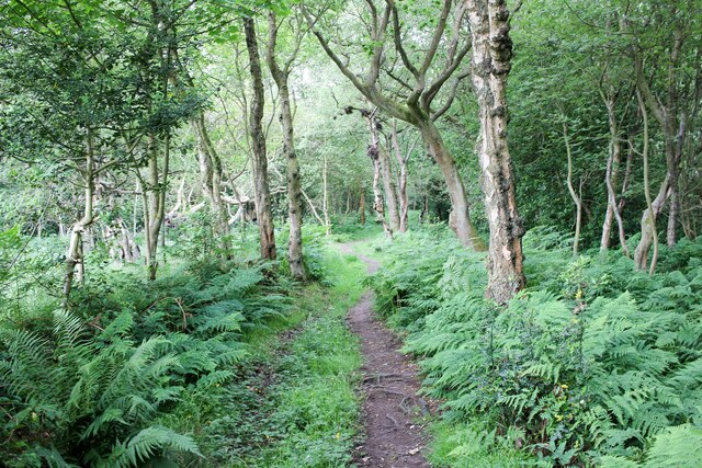
Visitors to Aislaby Moor can enjoy long walks or hikes, exploring the numerous footpaths that crisscross the area. These trails offer an opportunity to encounter the diverse wildlife that calls the moor home, such as red grouse, curlews, and hares.

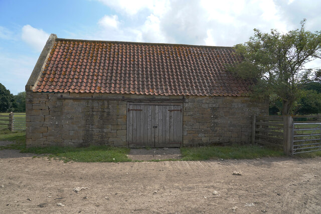
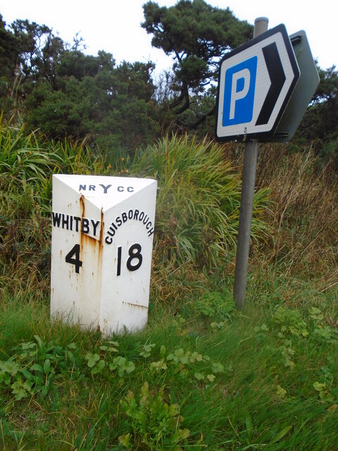
The tranquil atmosphere of Aislaby Moor provides a peaceful retreat from the bustle of city life. It is a popular destination for nature lovers, photographers, and those seeking a peaceful escape. The moorland also holds historical significance, with ancient archaeological sites scattered throughout the area, including burial mounds and stone circles.

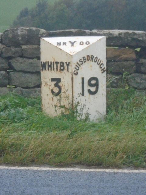
Aislaby Moor is easily accessible, with nearby villages providing amenities and accommodations for visitors. Its natural beauty and peaceful ambiance make it a must-visit destination for those looking to immerse themselves in the enchanting Yorkshire countryside.

If you have any feedback on the listing, please let us know in the comments section below.

Aislaby Moor Images

Images are sourced within 2km of 54.465418/-0.69274921 or Grid Reference NZ8408. Thanks to Geograph Open Source API. All images are credited.

The A169 We are over the bridge that vrosses the river and, to the south, the railway line.
The A169
We are over the bridge that vrosses the river and, to the south, the railway line.
A footpath to the railway line The rail line runs deep in the Esk valley and the trains can be heard but hardly seen from the footpath.
A footpath to the railway line
The rail line runs deep in the Esk valley and the trains can be heard but hardly seen from the footpath.
A footpath with a concrete surface The footpath eventually leads to a railway line in the Esk valley.
A footpath with a concrete surface
The footpath eventually leads to a railway line in the Esk valley.
A new pipe has been put in the ground Not sure if this is a new pipe line running across the field but I cannot think of another reason for a covered trench across a field.
A new pipe has been put in the ground
Not sure if this is a new pipe line running across the field but I cannot think of another reason for a covered trench across a field.
A few sheep in the meadow Yesterday the sheep were in a field further up the hill.
A few sheep in the meadow
Yesterday the sheep were in a field further up the hill.
An empty field Looking over the hedge across an empty field used for grazing animals.
An empty field
Looking over the hedge across an empty field used for grazing animals.
A barn in a field There are many sheep in the field behind the barn and other fields are empty of stock.
A barn in a field
There are many sheep in the field behind the barn and other fields are empty of stock.
Looks like a new roof Compared to many barns this one looks well looked after with a fairly new roof and sturdy doors.
Looks like a new roof
Compared to many barns this one looks well looked after with a fairly new roof and sturdy doors.
The remains of St. John's chapel This is all that remains of the old sandstone chapel in Esk Dale.
The remains of St. John's chapel
This is all that remains of the old sandstone chapel in Esk Dale.
Approaching Skelder Plantation Heading towards Skelder Plantation from the north.
Approaching Skelder Plantation
Heading towards Skelder Plantation from the north.
Parking area beside the A171
Old milestone This milepost on the A171 is just west of a parking area on the other side of the road.   The previous picture, <a href="https://www.geograph.org.uk/photo/6738859">NZ8408 : Old Milestone, on the A171, near Bends sign</a>, was not taken by me but by another Milestone Society member in 2002 before the mileposts on this road were professionally repainted.  This is one of the original castings by F Mattison and Co. Bedale for the North Riding CC in the late 19C/early 20c.   The foundry name is cast inside the right-hand side.
Old milestone
This milepost on the A171 is just west of a parking area on the other side of the road. The previous picture, NZ8408 : Old Milestone, on the A171, near Bends sign, was not taken by me but by another Milestone Society member in 2002 before the mileposts on this road were professionally repainted. This is one of the original castings by F Mattison and Co. Bedale for the North Riding CC in the late 19C/early 20c. The foundry name is cast inside the right-hand side.
Old milepost Inside the back of this milepost are the details of the company who refurbished all the remaining NRYCC mileposts on this route along the A171.
Old milepost
Inside the back of this milepost are the details of the company who refurbished all the remaining NRYCC mileposts on this route along the A171.
Old milepost The previous submission, 6049673, was not taken by me but by a fellow Milestone Society member in 2002 before the mileposts on this route were refurbished by Cleveland Corrosion Control.  This one in front of a low stone wall is on Guisborough Road opposite a track to a farm.
Old milepost
The previous submission, 6049673, was not taken by me but by a fellow Milestone Society member in 2002 before the mileposts on this route were refurbished by Cleveland Corrosion Control. This one in front of a low stone wall is on Guisborough Road opposite a track to a farm.
Old milepost Travelling towards Whitby the position of this milepost can be seen in the context of the road, verge and pleasant stone wall.    When these posts were refurbished they were taken up, dealt with inside the workshop and then reset at the correct height.
Old milepost
Travelling towards Whitby the position of this milepost can be seen in the context of the road, verge and pleasant stone wall. When these posts were refurbished they were taken up, dealt with inside the workshop and then reset at the correct height.
Public Footpath to Moor Leas To the north of Skelder Plantation.
Public Footpath to Moor Leas
To the north of Skelder Plantation.
Approaching Skelder Road
Footpath to Skelder Plantation Footpath to Skelder Plantation from Skelder Road.
Footpath to Skelder Plantation
Footpath to Skelder Plantation from Skelder Road.
Show me another place!

Aislaby Moor is located at Grid Ref: NZ8408 (Lat: 54.465418, Lng: -0.69274921)

Division: North Riding

Administrative County: North Yorkshire

District: Scarborough

Police Authority: North Yorkshire

What 3 Words

///juggles.procured.renews. Near Sleights, North Yorkshire

Nearby Locations

Aislaby Moor

Related Wikis

Aislaby Quarry

Aislaby Quarry is a sandstone quarry in the village of Aislaby, near to Whitby in North Yorkshire, England. The quarry produces sandstone which has been...

Aislaby, Scarborough

Aislaby ( AYZ-əl-bi) is a village and civil parish in the Scarborough district of North Yorkshire, England. It is situated near the town of Whitby on the...

Briggswath

Briggswath is a village in the Scarborough district of North Yorkshire, England. the settlement is on the north bank of the River Esk, upstream of Ruswarp...

Hutton Mulgrave

Hutton Mulgrave is a village and civil parish in the Scarborough district of North Yorkshire, England. According to the 2001 UK census, Hutton Mulgrave...

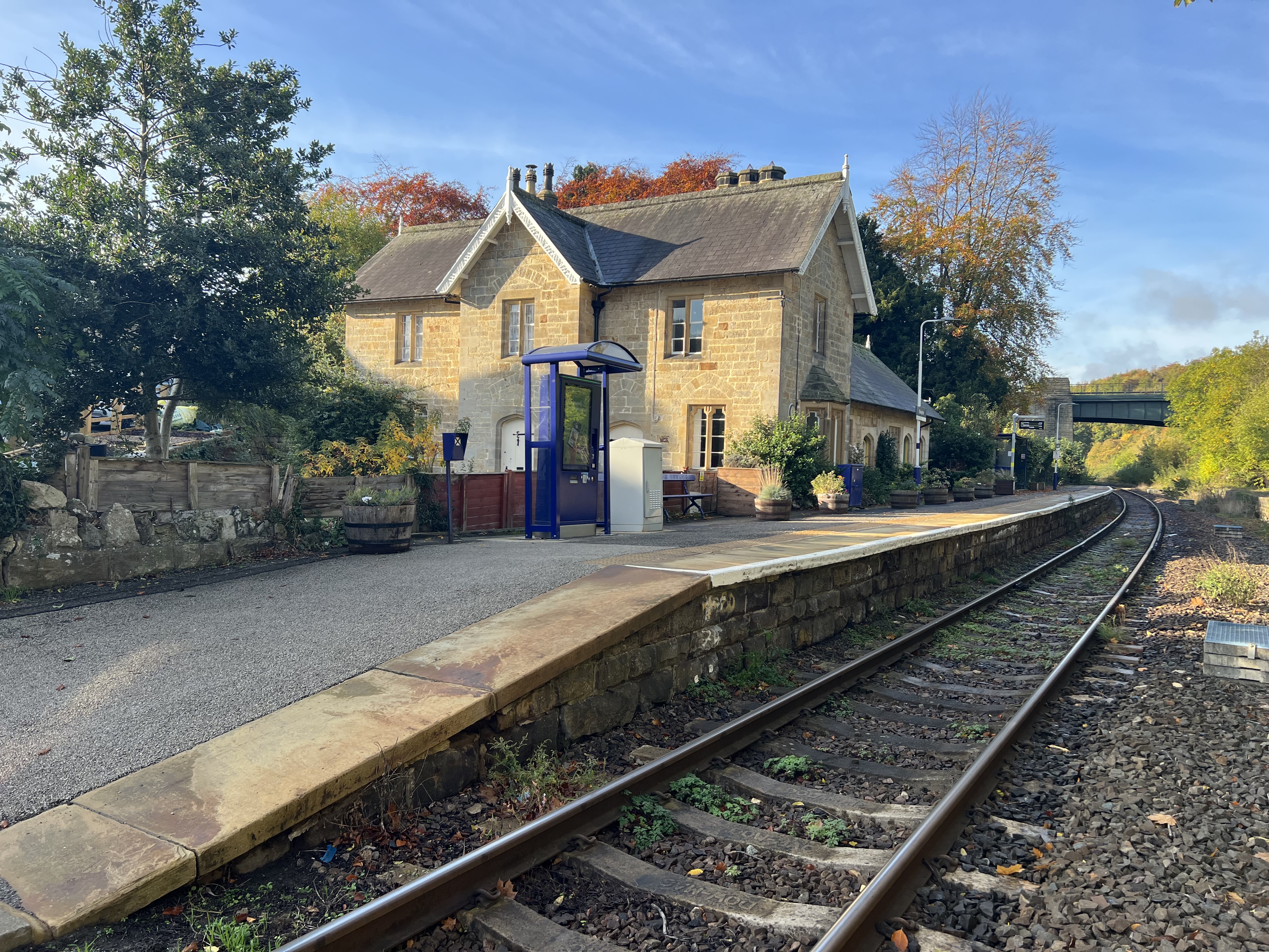
Sleights railway station

Sleights is a railway station on the Esk Valley Line, which runs between Middlesbrough and Whitby via Nunthorpe. The station, situated 2 miles 78 chains...

Newholm-cum-Dunsley

Newholm-cum-Dunsley is a civil parish in the Scarborough district of North Yorkshire, England. According to the 2011 UK census, Newholm-cum-Dunsley parish...

Sleights

Sleights is a village in North Yorkshire, England. Located in the Esk Valley in the postal region of Whitby, the village is part of the civil parish of...

Ruswarp

Ruswarp village lies within the Scarborough borough of North Yorkshire, England. It is around 1.8 miles (2.9 km) from Whitby, at the junction of the B1410...

Related Videos

Coast to Coast - Day 13 - Blakey Ridge to Grosmont

Coast to Coast - Day 13 - Blakey Ridge to Grosmont #coast2coast #ukhiking #c2c.

C2C Day 14 Blakey Ridge to Grosmont

Ace and Alan take on Wainwright's Coast to Coast walk across northern England from St. Bees on the Irish Sea to Robin Hood's ...

C2C Day 15 Grosmont to Robin Hood's Bay

Ace and Alan take on Wainwright's Coast to Coast walk across northern England from St. Bees on the Irish Sea to Robin Hood's ...

Nearby Amenities

Located within 500m of 54.465418,-0.69274921
Red House
Place: farm
Lat/Long: 54.4615839/-0.6928759
Hiking: yes
Information: guidepost
Tourism: information
Lat/Long: 54.4684009/-0.6970337
The data included in this document is from www.openstreetmap.org. The data is made available under ODbL.

Have you been to Aislaby Moor?

Leave your review of Aislaby Moor below (or comments, questions and feedback).