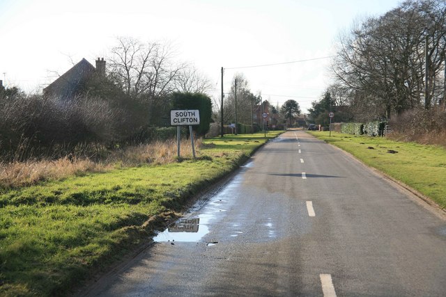
South Clifton Moor

Downs, Moorland in Nottinghamshire Newark and Sherwood

England

South Clifton Moor

Wigsley wind turbine Dramatic sunset silhouetting the wind turbine on the former Wigsley airfield <a title="https://www.geograph.org.uk/photo/4514102" href="https://www.geograph.org.uk/photo/4514102">Link</a>
Wigsley wind turbine Credit: Richard Croft

South Clifton Moor is a small village located in the county of Nottinghamshire, England. Situated on the eastern side of the River Trent, it is part of the larger civil parish of North Clifton and South Clifton. The village is nestled within an area known for its picturesque downs and moorland landscapes, offering residents and visitors breathtaking views of the surrounding countryside.

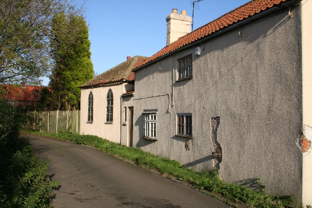
The village itself is characterized by its charming and traditional architecture, with many of the buildings dating back several centuries. The community is tight-knit and friendly, with a population of around 300 residents. Despite its small size, South Clifton Moor boasts a range of amenities, including a village hall, a primary school, and a church.

The downs and moorland that surround the village provide ample opportunities for outdoor activities such as hiking, cycling, and bird-watching. The area is known for its rich biodiversity, with several rare and protected species of flora and fauna calling it home. The moorland also serves as an important habitat for various bird species, making it a popular destination for bird enthusiasts.

South Clifton Moor is well-connected to nearby towns and cities, with the A57 road passing through the village, providing easy access to Nottingham, Lincoln, and Sheffield. The village is also served by regular bus services, ensuring convenient transportation options for residents.

Overall, South Clifton Moor offers a tranquil and idyllic setting for those seeking a rural lifestyle surrounded by natural beauty.

If you have any feedback on the listing, please let us know in the comments section below.

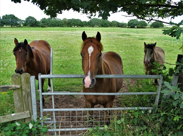
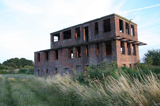
South Clifton Moor Images

Images are sourced within 2km of 53.226629/-0.74550568 or Grid Reference SK8370. Thanks to Geograph Open Source API. All images are credited.

Wigsley wind turbine Dramatic sunset silhouetting the wind turbine on the former Wigsley airfield <a title="https://www.geograph.org.uk/photo/4514102" href="https://www.geograph.org.uk/photo/4514102">Link</a>
Wigsley wind turbine
Dramatic sunset silhouetting the wind turbine on the former Wigsley airfield Link
Former Wigsley airfield, and wind turbine: aerial 2015 Reminiscent, as I flew past, of a cake with a white fairy in the middle!
Former Wigsley airfield, and wind turbine: aerial 2015
Reminiscent, as I flew past, of a cake with a white fairy in the middle!
Cow bar Or just another piped in bath in a field.
Cow bar
Or just another piped in bath in a field.
Rabbithill Lane, Spalford
What a pig sty! In a corner of wartime RAF Wigsley is this pile of old pig sties. Beyond is a controversial wind turbine, opposed by nearby residents but now built. Out of sight is a vast open area of the former airfield now devoted to pigs.
What a pig sty!
In a corner of wartime RAF Wigsley is this pile of old pig sties. Beyond is a controversial wind turbine, opposed by nearby residents but now built. Out of sight is a vast open area of the former airfield now devoted to pigs.
Heading for Wigsley Wood
The driveway to Field Farm
Clifton Hill trig point Overlooking the Old River Trent
Clifton Hill trig point
Overlooking the Old River Trent
Eagle Road, Spalford
Trig point at Clifton Hill, S Clifton
RAF Wigsley Airfield RAF Wigsley was active from 1942 to 1958. Here you can see part of the runway and a pile of rubble that probably came from some demolished wartime facility.
RAF Wigsley Airfield
RAF Wigsley was active from 1942 to 1958. Here you can see part of the runway and a pile of rubble that probably came from some demolished wartime facility.
Wind turbine beyond the wheat In World War II this landscape would have hummed to the sound of aircraft but RAF Wigsley has now been reclaimed by farmers.
Wind turbine beyond the wheat
In World War II this landscape would have hummed to the sound of aircraft but RAF Wigsley has now been reclaimed by farmers.
Forlorn horses by Eagle Road, Spalford They were doing a fine job of guarding the public footpath gate.
Forlorn horses by Eagle Road, Spalford
They were doing a fine job of guarding the public footpath gate.
The old telephone box in Spalford Like virtually all other phone boxes in the land, now very much redundant.
The old telephone box in Spalford
Like virtually all other phone boxes in the land, now very much redundant.
Detail of the neglected phone box in Spalford Another sad monument to past times. No village library, defibrillator nor any other use for this dilapidated telephone kiosk.
Detail of the neglected phone box in Spalford
Another sad monument to past times. No village library, defibrillator nor any other use for this dilapidated telephone kiosk.
Spalford Chapel In the sleepy village of Spalford, currently undergoing restoration.
Spalford Chapel
In the sleepy village of Spalford, currently undergoing restoration.
Clifton Hill Clifton Hill and the redundant power station of High Marnham on the horizon
Clifton Hill
Clifton Hill and the redundant power station of High Marnham on the horizon
Wigsley Airfield Looking east down what was the main runway of wartime bomber station RAF Wigsley. Now home to thousands of pigs !
Wigsley Airfield
Looking east down what was the main runway of wartime bomber station RAF Wigsley. Now home to thousands of pigs !
Show me another place!

South Clifton Moor is located at Grid Ref: SK8370 (Lat: 53.226629, Lng: -0.74550568)

Administrative County: Nottinghamshire

District: Newark and Sherwood

Police Authority: Nottinghamshire

What 3 Words

///fronted.forensic.clasps. Near Sutton on Trent, Nottinghamshire

Nearby Locations

South Clifton Moor

Related Wikis

Clifton-on-Trent railway station

Clifton-on-Trent railway station is a former railway station between North Clifton and South Clifton in eastern Nottinghamshire, England. == Context... ==

Spalford

Spalford is a hamlet and civil parish in the Newark and Sherwood district of Nottinghamshire, England. Spalford was listed in the Domesday Book (1086)...

South Clifton

South Clifton is a village and civil parish in the Newark and Sherwood district of Nottinghamshire, England. It is 11 miles north of Newark-on-Trent. In...

RAF Wigsley

Royal Air Force Wigsley, also known as RAF Wigsley, is a former Royal Air Force satellite station located 7.3 miles (11.7 km) east of Tuxford, Nottinghamshire...

Nearby Amenities

Located within 500m of 53.226629,-0.74550568
Amblerod Farm
Place: farm
Source: Bing
Lat/Long: 53.2273717/-0.7423072
Birkland Barn
Fixme: Looks unlikely to be a farm. If there is public access, needs survey.
Place: farm
Source: Bing
Lat/Long: 53.22376/-0.7484503
Moor Farm
Place: farm
Source: Bing
Lat/Long: 53.2283026/-0.7445576
South Clifton Moor
Place: locality
Source: Bing
Lat/Long: 53.2276775/-0.7438537
The Grange
Alt Name: Rome Farm
Place: farm
Source: Bing
Lat/Long: 53.2244627/-0.7411367
Generator Method: photovoltaic
Generator Output Electricity: yes
Generator Source: solar
Generator Type: solar_photovoltaic_panel
Location: roof
Power: generator
Lat/Long: 53.2235942/-0.7487333
Generator Method: photovoltaic
Generator Output Electricity: yes
Generator Source: solar
Generator Type: solar_photovoltaic_panel
Location: roof
Power: generator
Lat/Long: 53.2235958/-0.7486126
The data included in this document is from www.openstreetmap.org. The data is made available under ODbL.

Have you been to South Clifton Moor?

Leave your review of South Clifton Moor below (or comments, questions and feedback).