The Carr

Downs, Moorland in Yorkshire

England

The Carr

The crossroads of Howden Road (A614) and Bursea Lane
The crossroads of Howden Road (A614) and Bursea Lane Credit: Ian S

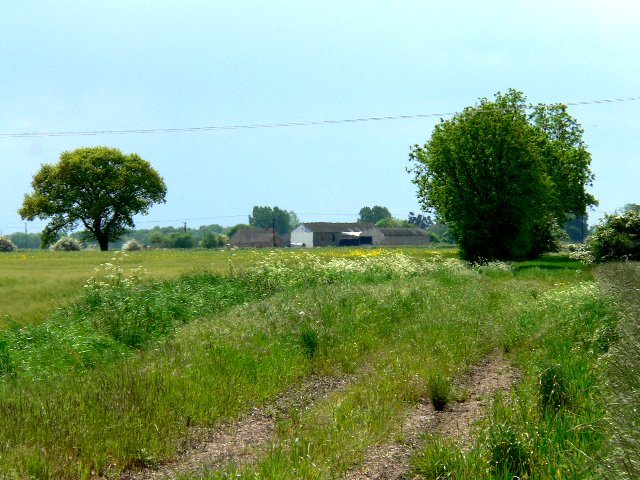
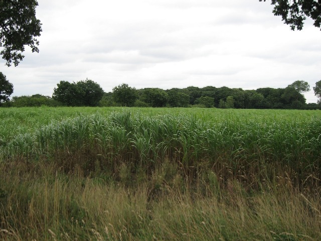
The Carr is a distinct landscape feature found in Yorkshire, characterized by low-lying, marshy areas that are often located in valleys or depressions. These wetlands are typically found on the edges of moorland and downs, providing a unique habitat for a variety of plant and animal species.

The Carr is known for its rich biodiversity, with a mix of grasses, sedges, and other wetland plants thriving in the damp conditions. This habitat also attracts a range of bird species, including wading birds like snipe and lapwing, as well as waterfowl such as ducks and geese.

The Carr plays an important role in the local ecosystem, acting as a natural water filtration system and providing a breeding ground for many species. However, due to their sensitive nature, these wetlands are at risk from human activities such as drainage and development.

Conservation efforts are underway to protect and preserve The Carr in Yorkshire, ensuring that this unique landscape continues to support a diverse range of flora and fauna for future generations to enjoy.

If you have any feedback on the listing, please let us know in the comments section below.

The Carr Images

Images are sourced within 2km of 53.79367/-0.78794725 or Grid Reference SE7933. Thanks to Geograph Open Source API. All images are credited.

The crossroads of Howden Road (A614) and Bursea Lane
The A614 at Welhambridge
New Carr Lane Lit by low early evening autumn sun.
New Carr Lane
Lit by low early evening autumn sun.
Common Farm off Bursea Lane
Hard standing for a speed camera van On Howden Road, East Yorkshire.
Hard standing for a speed camera van
On Howden Road, East Yorkshire.
The new Welham Bridge seen from the old Welham Bridge Both cross the River Foulness.
The new Welham Bridge seen from the old Welham Bridge
Both cross the River Foulness.
Barn at Bursea Lane End
Field entrance off Bursea Lane
Crop field east of Carr Lane A convenient entrance allows one to venture into this square without treading on any crops
Crop field east of Carr Lane
A convenient entrance allows one to venture into this square without treading on any crops
Spaldington,  Water Tower Beside the A614 Between Howden and Welhambridge
Spaldington, Water Tower Beside the A614 Between Howden and Welhambridge
Ivy House Farm It's all farmland in this area, this view looking NE.
Ivy House Farm
It's all farmland in this area, this view looking NE.
Arglam Lane from Bursea Lane Ends At the Junction with the A614
Arglam Lane from Bursea Lane Ends
At the Junction with the A614
A614 at Bursea Lane Ends
Arglam Lane
Arglam Lane
Shed on Arglam Lane
Shed on Arglam Lane
Arglam Lane Farm
Arglam Lane Farm
An Electricity Sub-Station The sub-station in the photograph is just off the A614 near Welham Bridge.
An Electricity Sub-Station
The sub-station in the photograph is just off the A614 near Welham Bridge.
Moore's Farm Morre's Farm is on the A614 between Howden and Holme-on-Spalding-Moor.
Moore's Farm
Morre's Farm is on the A614 between Howden and Holme-on-Spalding-Moor.
Show me another place!

The Carr is located at Grid Ref: SE7933 (Lat: 53.79367, Lng: -0.78794725)

Division: East Riding

Unitary Authority: East Riding of Yorkshire

Police Authority: Humberside

What 3 Words

///reserving.grazed.lowest. Near Eastrington, East Yorkshire

Nearby Locations

The Carr

Related Wikis

Bursea

Bursea is a hamlet in the East Riding of Yorkshire, England. It is situated approximately 3 miles (5 km) south of the village of Holme-on-Spalding-Moor...

Welhambridge

Welhambridge is a hamlet in the East Riding of Yorkshire, England. It is situated approximately 3 miles (4.8 km) south-west of the village of Holme-on...

Hasholme

Hasholme is a hamlet in the East Riding of Yorkshire, England. It is situated approximately 3.5 miles (5.6 km) south of the village of Holme-on-Spalding...

Owsthorpe

Owsthorpe is a small hamlet in the East Riding of Yorkshire, England. It is situated approximately 6 miles (9.7 km) north-east of Goole and lies 1 mile...

Nearby Amenities

Located within 500m of 53.79367,-0.78794725
Barrier: stile
Foot: yes
Lat/Long: 53.7894723/-0.7852514
Power: pole
Lat/Long: 53.7939831/-0.7817067
Power: pole
Lat/Long: 53.7944875/-0.7826622
Power: pole
Lat/Long: 53.7949958/-0.7836041
Power: pole
Lat/Long: 53.7954281/-0.7845257
Power: pole
Lat/Long: 53.7958924/-0.7854947
Power: pole
Lat/Long: 53.7964061/-0.7865113
Power: pole
Lat/Long: 53.7968731/-0.7874632
Power: pole
Lat/Long: 53.7975039/-0.7886341
Power: pole
Lat/Long: 53.7980346/-0.7897011
The data included in this document is from www.openstreetmap.org. The data is made available under ODbL.

Have you been to The Carr?

Leave your review of The Carr below (or comments, questions and feedback).