Aldsworth Common

Downs, Moorland in Sussex Chichester

England

Aldsworth Common

Path on Mill Lane Millstream by path on Mill Lane
Path on Mill Lane Credit: Shaun Ferguson

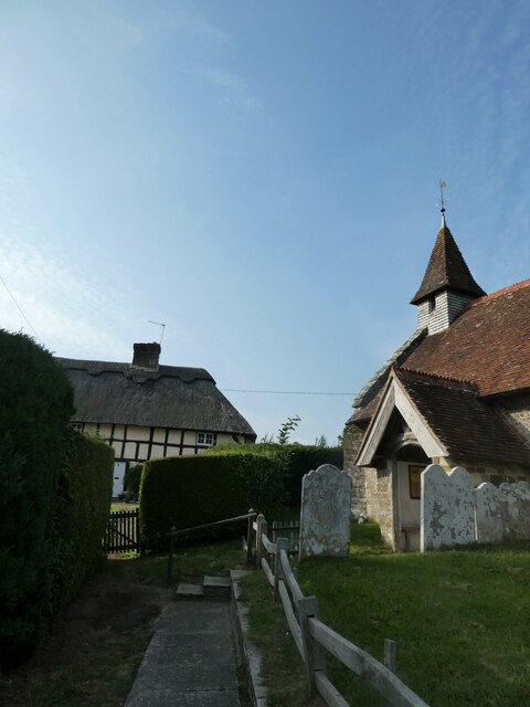
Aldsworth Common, located in Sussex, England, is a picturesque area that encompasses a diverse landscape of downs and moorland. Spread across a vast expanse, the common offers a variety of natural features and habitats, making it a haven for wildlife and a popular destination for nature enthusiasts.

The downs of Aldsworth Common are characterized by rolling hills, covered in lush green grass and scattered with vibrant wildflowers. These slopes provide breathtaking panoramic views of the surrounding countryside, offering visitors a tranquil and idyllic setting for leisurely walks and picnics. The downs are also home to several species of birds, including skylarks and meadow pipits, which can be seen and heard soaring through the clear blue skies.

The moorland area of Aldsworth Common is a unique ecosystem, with its distinctive vegetation and wildlife. Here, visitors can explore vast expanses of heather, interspersed with gorse and bracken. This habitat supports a variety of animals, such as rabbits, foxes, and deer, as well as an array of bird species, including stonechats and red grouse.

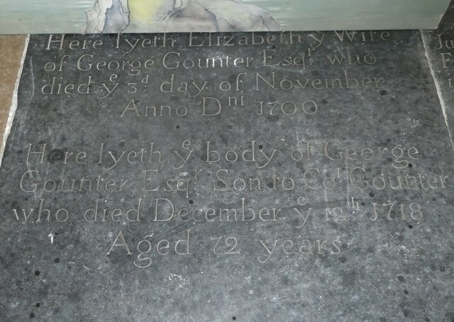
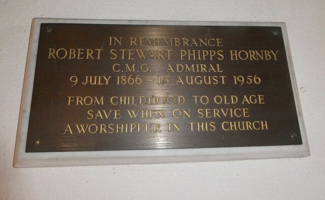
In addition to its natural beauty, Aldsworth Common boasts a rich history. Ancient burial mounds and standing stones can be found scattered throughout the area, providing evidence of human occupation dating back thousands of years. These archaeological sites add an extra layer of intrigue and fascination to the common, attracting history enthusiasts and archaeologists alike.

Overall, Aldsworth Common in Sussex offers a captivating blend of downs and moorland, providing visitors with a unique opportunity to immerse themselves in the beauty of nature while exploring its rich history.

If you have any feedback on the listing, please let us know in the comments section below.

Aldsworth Common Images

Images are sourced within 2km of 50.870807/-0.9134642 or Grid Reference SU7608. Thanks to Geograph Open Source API. All images are credited.

Path on Mill Lane Millstream by path on Mill Lane
Path on Mill Lane
Millstream by path on Mill Lane
Cemetery Lane Cemetery Lane heading to South Lane
Cemetery Lane
Cemetery Lane heading to South Lane
King's Cottage, Racton: early September 2021 Also see <span class="nowrap"><a title="http://www.pastfinders.com/sussexhistory/charles_ii.htm" rel="nofollow ugc noopener" href="http://www.pastfinders.com/sussexhistory/charles_ii.htm">Link</a><img style="margin-left:2px;" alt="External link" title="External link - shift click to open in new window" src="https://s1.geograph.org.uk/img/external.png" width="10" height="10"/></span>
King's Cottage, Racton: early September 2021
Also see LinkExternal link
Ledger slab: Elizabeth Gounter A ledger slab is an inscribed stone slab laid into the floor of a church to commemorate or mark the place of the burial of a wealthy deceased person. The term derives  from the Old English liċġan, meaning to lie down. They may be made of  Tournai marble, Sussex Marble, Nottingham alabaster or Swithland Slate.
Ledger slab: Elizabeth Gounter
A ledger slab is an inscribed stone slab laid into the floor of a church to commemorate or mark the place of the burial of a wealthy deceased person. The term derives from the Old English liċġan, meaning to lie down. They may be made of Tournai marble, Sussex Marble, Nottingham alabaster or Swithland Slate.
Racton Church: memorial to an admiral For more information see <span class="nowrap"><a title="https://en.wikipedia.org/wiki/Robert_Hornby" rel="nofollow ugc noopener" href="https://en.wikipedia.org/wiki/Robert_Hornby">Link</a><img style="margin-left:2px;" alt="External link" title="External link - shift click to open in new window" src="https://s1.geograph.org.uk/img/external.png" width="10" height="10"/></span>
Racton Church: memorial to an admiral
For more information see LinkExternal link
Racton Church: flowers by the altar
Racton Church: a wife's memorial for her husband His wife Ethel was the daughter of Admiral of the Fleet Geoffrey Hornby <span class="nowrap"><a title="https://en.wikipedia.org/wiki/Geoffrey_Hornby" rel="nofollow ugc noopener" href="https://en.wikipedia.org/wiki/Geoffrey_Hornby">Link</a><img style="margin-left:2px;" alt="External link" title="External link - shift click to open in new window" src="https://s1.geograph.org.uk/img/external.png" width="10" height="10"/></span> and the sibling of Admiral Robert Hornby <span class="nowrap"><a title="https://en.wikipedia.org/wiki/Robert_Hornby" rel="nofollow ugc noopener" href="https://en.wikipedia.org/wiki/Robert_Hornby">Link</a><img style="margin-left:2px;" alt="External link" title="External link - shift click to open in new window" src="https://s1.geograph.org.uk/img/external.png" width="10" height="10"/></span> and Brigadier-General Edmund Hornby VC <span class="nowrap"><a title="https://en.wikipedia.org/wiki/Robert_Hornby" rel="nofollow ugc noopener" href="https://en.wikipedia.org/wiki/Robert_Hornby">Link</a><img style="margin-left:2px;" alt="External link" title="External link - shift click to open in new window" src="https://s1.geograph.org.uk/img/external.png" width="10" height="10"/></span>
Racton Church: a wife's memorial for her husband
His wife Ethel was the daughter of Admiral of the Fleet Geoffrey Hornby LinkExternal link and the sibling of Admiral Robert Hornby LinkExternal link and Brigadier-General Edmund Hornby VC LinkExternal link
Racton Church: memorial to a former rector Frederick Henry Arnold, LL.D (19 October 1830 - 4 May 1906) was born in Sussex and educated at Trinity College, Dublin. He was ordained in 1860. After a curacy at Barlavington he was the incumbent of Appledram from 1861 to 1865 when he was appointed Rector of Racton with Lordington.
Racton Church: memorial to a former rector
Frederick Henry Arnold, LL.D (19 October 1830 - 4 May 1906) was born in Sussex and educated at Trinity College, Dublin. He was ordained in 1860. After a curacy at Barlavington he was the incumbent of Appledram from 1861 to 1865 when he was appointed Rector of Racton with Lordington.
Racton Church: floor memorial I also found this <span class="nowrap"><a title="https://ancestors.familysearch.org/en/KZFM-FLQ/colonel-george-gounter-of-racton-1620" rel="nofollow ugc noopener" href="https://ancestors.familysearch.org/en/KZFM-FLQ/colonel-george-gounter-of-racton-1620">Link</a><img style="margin-left:2px;" alt="External link" title="External link - shift click to open in new window" src="https://s1.geograph.org.uk/img/external.png" width="10" height="10"/></span>
Racton Church: floor memorial
I also found this LinkExternal link
Racton Church: incumbency board
Racton Church: always look up These knightly symbols are quite a rarity
Racton Church: always look up
These knightly symbols are quite a rarity
Racton Church: a politician's gravestone For more about Sir Michael Hamilton see <span class="nowrap"><a title="https://en.wikipedia.org/wiki/Michael_Hamilton_(politician)" rel="nofollow ugc noopener" href="https://en.wikipedia.org/wiki/Michael_Hamilton_(politician)">Link</a><img style="margin-left:2px;" alt="External link" title="External link - shift click to open in new window" src="https://s1.geograph.org.uk/img/external.png" width="10" height="10"/></span>
Racton Church: a politician's gravestone
For more about Sir Michael Hamilton see LinkExternal link
St. Paul's Chapel, Stansted Park
Stansted House, Stansted Park
Stansted House
Stansted House
Stansted Park: the South Lawn and southern side of the mansion The people are part of the audience for an open air theatre production of 'Round The World in 80 Days' by Boxtree Productions.  Unfortunately it rained throughout the performance.
Stansted Park: the South Lawn and southern side of the mansion
The people are part of the audience for an open air theatre production of 'Round The World in 80 Days' by Boxtree Productions. Unfortunately it rained throughout the performance.
2016: a year on Geograph (Day 350) Racton Church, looking towards the ruin
2016: a year on Geograph (Day 350)
Racton Church, looking towards the ruin
Breach Avenue, Southbourne Looking towards Stein Road.
Breach Avenue, Southbourne
Looking towards Stein Road.
Show me another place!

Aldsworth Common is located at Grid Ref: SU7608 (Lat: 50.870807, Lng: -0.9134642)

Administrative County: West Sussex

District: Chichester

Police Authority: Sussex

What 3 Words

///humidity.reforming.amount. Near Emsworth, Hampshire

Related Wikis

Bourne (electoral division)

Bourne is an electoral division of West Sussex in the United Kingdom, and returns one member to sit on West Sussex County Council. The former County Councillor...

Woodmancote, Chichester District

Woodmancote is a village in the Chichester district of West Sussex, England. It lies just off the B2147 road 2 miles (3.2 km) northeast of Emsworth. It...

Westbourne, West Sussex

Westbourne is a village, civil parish and electoral ward in the Chichester District of West Sussex, England. It is located 0.5 miles (0.80 km) north east...

Racton Monument

Racton Monument (known locally as Racton Ruin) is a folly on a hill in Racton, West Sussex, England with views over Chichester Harbour and to the Isle...

Racton

Racton is a hamlet in the Chichester district of West Sussex, England. It lies on the B2147 road 2.1 miles (3.4 km) northeast of Emsworth and within the...

Stansted Park

Stansted Park (including Stansted House) is an Edwardian country house in the parish of Stoughton, West Sussex, England. It is near the city of Chichester...

Hollybank House, Emsworth

Hollybank House near Emsworth in Hampshire, England, is a building of historical significance and is Grade II listed on the English Heritage Register....
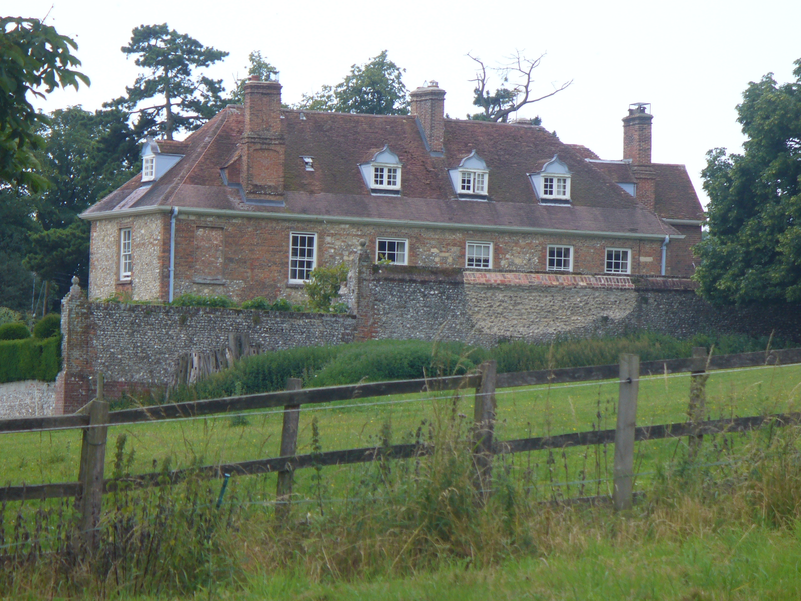
Lordington House

Lordington House is a manor house near Walderton in West Sussex. It is a Grade II* listed building. == History == Lordington House was built around 1500...

Nearby Amenities

Located within 500m of 50.870807,-0.9134642
Barrier: stile
Lat/Long: 50.874466/-0.9123909
Power: tower
Lat/Long: 50.8678768/-0.9186562
Aldsworth
Place: hamlet
Lat/Long: 50.8731629/-0.9135795
Barrier: stile
Lat/Long: 50.8704308/-0.9189677
Barrier: stile
Lat/Long: 50.8714345/-0.916214
Barrier: stile
Lat/Long: 50.8719859/-0.9141805
Barrier: kissing_gate
Lat/Long: 50.8726776/-0.9123771
Barrier: kissing_gate
Lat/Long: 50.8734662/-0.9119235
Post Box
Collection Plate: CP7
Collection Times: Mo-Fr 16:30; Sa 07:15
Post Box Type: lamp
Ref: PO10 129
Royal Cypher: EIIR
Royal Cypher Wikidata: Q33102113
Lat/Long: 50.8736022/-0.9147708
Barrier: bollard
Lat/Long: 50.8736431/-0.9148421
Power: substation
Lat/Long: 50.8732716/-0.9119161
The data included in this document is from www.openstreetmap.org. The data is made available under ODbL.

Have you been to Aldsworth Common?

Leave your review of Aldsworth Common below (or comments, questions and feedback).