West Field

Downs, Moorland in Nottinghamshire Newark and Sherwood

England

West Field

The Church of St Michael the Archangel. Church in Laxton.
The Church of St Michael the Archangel. Credit: steven ruffles

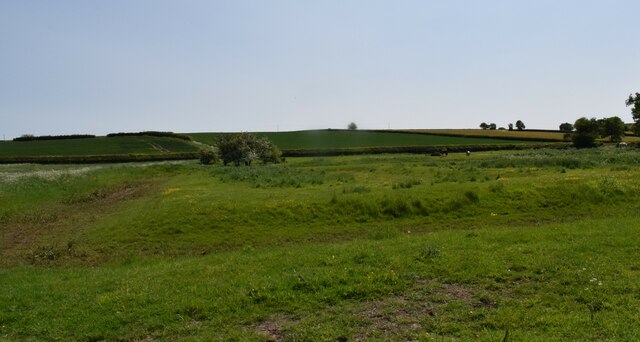
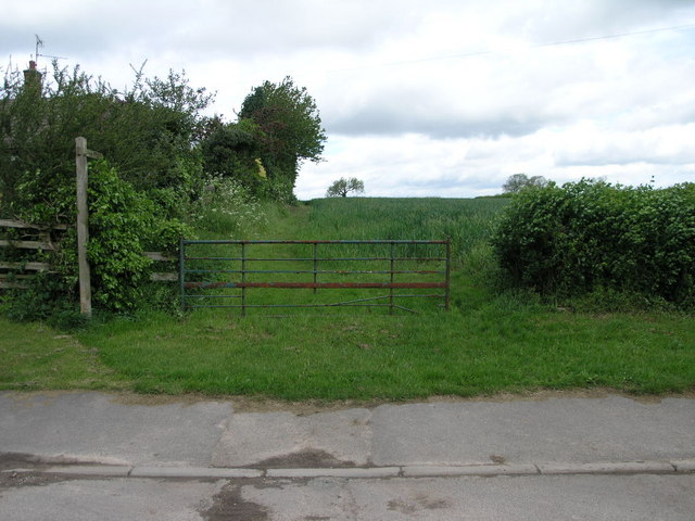
West Field is a region located in Nottinghamshire, England, known for its picturesque downs and moorland landscapes. Situated in the western part of the county, it covers a vast area of rolling hills and open grasslands, providing a haven for nature enthusiasts and hikers alike.

The downs of West Field offer panoramic views of the surrounding countryside. With their gently sloping hills and lush greenery, they provide a serene setting for outdoor activities such as picnicking, walking, and horse riding. The downs are home to a variety of plant and animal species, including wildflowers and grazing livestock, adding to the area's natural charm.

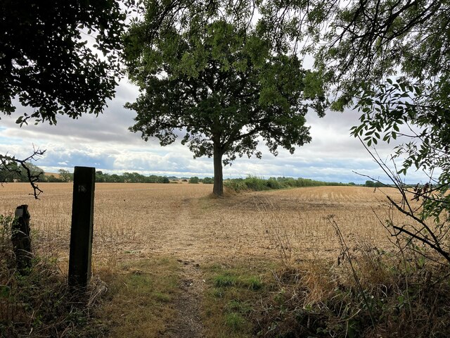
In contrast, the moorland in West Field presents a different landscape altogether. Characterized by its rugged terrain and heather-covered expanses, the moors offer a unique environment for exploration. This wilder landscape is dotted with rocky outcrops and peat bogs, providing habitats for a range of bird species, including the elusive red grouse.

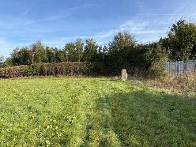
West Field is also known for its historical significance. The region is home to several ancient sites, such as burial mounds and standing stones, that provide insights into its rich past. Visitors can explore these archaeological treasures and learn about the area's historical and cultural heritage.

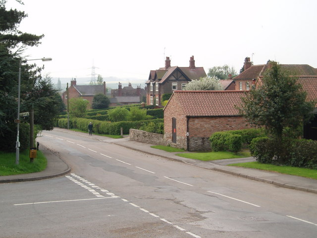
Overall, West Field in Nottinghamshire offers a delightful blend of natural beauty, recreational opportunities, and historical significance. Whether one seeks a peaceful stroll through the downs or a challenging hike across the moorland, this region provides a captivating experience for all who visit.

If you have any feedback on the listing, please let us know in the comments section below.
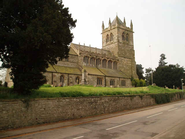
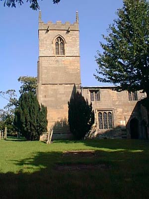
West Field Images

Images are sourced within 2km of 53.200535/-0.93819202 or Grid Reference SK7167. Thanks to Geograph Open Source API. All images are credited.

The Church of St Michael the Archangel. Church in Laxton.
The Church of St Michael the Archangel.
Church in Laxton.
Site of old Fishponds. A few humps and bumps in the ground is all that is left today.
Site of old Fishponds.
A few humps and bumps in the ground is all that is left today.
Field edge footpath. Nicely mown footpath.
Field edge footpath.
Nicely mown footpath.
Path alongside the edge of Kirton wood. Overgrown at this time of year.
Path alongside the edge of Kirton wood.
Overgrown at this time of year.
Footpath to Laxton, across Arable land Almost back to the village.
Footpath to Laxton, across Arable land
Almost back to the village.
Cut Mark on Church of St Michael, Laxton Benchmark on the corner of St Michael's Church, Laxton
Cut Mark on Church of St Michael, Laxton
Benchmark on the corner of St Michael's Church, Laxton
Laxton Trig Point Flush Bracket S1567
Cocking Moor Woodland Fringe Pictured from a bridleway and footpath crossroads at the edge of Wellow Park woods.
Cocking Moor Woodland Fringe
Pictured from a bridleway and footpath crossroads at the edge of Wellow Park woods.
Bridleway Crossing Laxton Common
Laxton village looking west Laxton is the Nottinghamshire village famous for still working to the medieval three open field strip system. The view is from the Dovecote Inn.
Laxton village looking west
Laxton is the Nottinghamshire village famous for still working to the medieval three open field strip system. The view is from the Dovecote Inn.
Laxton village looking south from the Dovecote Inn Photo taken from under the large tree at the centre of the road fork, outside the Dovecote Inn
Laxton village looking south from the Dovecote Inn
Photo taken from under the large tree at the centre of the road fork, outside the Dovecote Inn
Laxton Church Dedicated to St Michael the Archangel, Laxton Church dates back to the 12th century.
Laxton Church
Dedicated to St Michael the Archangel, Laxton Church dates back to the 12th century.
Castle mound at Laxton, Nottinghamshire The mound is the site of a 11th century castle which consisted of motte with inner and outer baileys. A manor house was built here in the 17th century which utilised fish ponds said to pre-date it.
Castle mound at Laxton, Nottinghamshire
The mound is the site of a 11th century castle which consisted of motte with inner and outer baileys. A manor house was built here in the 17th century which utilised fish ponds said to pre-date it.
Laxton - Dovecote Inn The Dovecote Inn at Laxton, Nottinghamshire. An outbuilding in the yard houses a visitors centre which gives information about the unique agricultural history of this unassuming village.
Laxton - Dovecote Inn
The Dovecote Inn at Laxton, Nottinghamshire. An outbuilding in the yard houses a visitors centre which gives information about the unique agricultural history of this unassuming village.
The Holocaust Centre Situated in a former farm house on the outskirts of Laxton is the Holocaust Memorial Centre. <span class="nowrap"><a title="http://www.holocaustcentre.net/" rel="nofollow ugc noopener" href="http://www.holocaustcentre.net/">Link</a><img style="margin-left:2px;" alt="External link" title="External link - shift click to open in new window" src="https://s1.geograph.org.uk/img/external.png" width="10" height="10"/></span>
The Holocaust Centre
Situated in a former farm house on the outskirts of Laxton is the Holocaust Memorial Centre. LinkExternal link
Hedgerow and Field This rough field west of Laxton appears to be growing a crop of grass.  The village of Kneesall is in the distance.
Hedgerow and Field
This rough field west of Laxton appears to be growing a crop of grass. The village of Kneesall is in the distance.
Footpath to Kneesall This footpath crosses Mill Field (one of the three fields of Laxton's mediaeval field system, <span class="nowrap"><a title="http://www.nottshistory.org.uk/articles/tts/tts1902/autumn/laxton1.htm" rel="nofollow ugc noopener" href="http://www.nottshistory.org.uk/articles/tts/tts1902/autumn/laxton1.htm">Link</a><img style="margin-left:2px;" alt="External link" title="External link - shift click to open in new window" src="https://s1.geograph.org.uk/img/external.png" width="10" height="10"/></span> ) on its way to Kneesall.
Footpath to Kneesall
This footpath crosses Mill Field (one of the three fields of Laxton's mediaeval field system, LinkExternal link ) on its way to Kneesall.
Footpath and Gate This footpath leads from Laxton to Winson Hill near Kirton.
Footpath and Gate
This footpath leads from Laxton to Winson Hill near Kirton.
Show me another place!

West Field is located at Grid Ref: SK7167 (Lat: 53.200535, Lng: -0.93819202)

Administrative County: Nottinghamshire

District: Newark and Sherwood

Police Authority: Nottinghamshire

What 3 Words

///sandbags.breath.divisible. Near Boughton, Nottinghamshire

Nearby Locations

West Field

Related Wikis

Laxton Castle

Laxton Castle is a late 11th- or early 12th-century medieval castle located north of the village of Laxton in Nottinghamshire, England. According to an...

Beth Shalom Holocaust Centre

Beth Shalom (lit. "House of Peace"), also named the National Holocaust Centre and Museum, is a Holocaust memorial centre near Laxton in Nottinghamshire...

St Michael the Archangel's Church, Laxton

St Michael the Archangel’s Church, Laxton is a Grade I listed Church of England parish in the Diocese of Southwell and Nottingham in Laxton, Nottinghamshire...

Laxton, Nottinghamshire

Laxton is a small village in the civil parish of Laxton and Moorhouse in the English county of Nottinghamshire, situated about 25 miles northeast of Nottingham...

Boughton railway station (Nottinghamshire)

Boughton railway station served the village of Boughton in Nottinghamshire, England from 1897 to 1955 when it was closed. It has since been razed to the...

Holy Trinity Church, Kirton

Holy Trinity Church, Kirton is a Grade II* listed parish church in the Church of England in Kirton, Nottinghamshire. == History == The church dates from...

Egmanton

Egmanton is a small village and civil parish in Nottinghamshire, England, and is located one mile south of Tuxford and one mile north of Laxton. The population...

Church of Our Lady of Egmanton

The Church of Our Lady of Egmanton (St. Mary's Church) is a Church of England parish church in Egmanton, Nottinghamshire, and the location of the Shrine...

Nearby Amenities

Located within 500m of 53.200535,-0.93819202
Barrier: stile
Steps: 2
Stile: stepover
Lat/Long: 53.2049069/-0.9381931
The data included in this document is from www.openstreetmap.org. The data is made available under ODbL.

Have you been to West Field?

Leave your review of West Field below (or comments, questions and feedback).