Hayes

Settlement in Staffordshire Staffordshire Moorlands

England

Hayes

The Church of St Lawrence in Warslow The church of St Lawrence has William Morris windows, a wide chancel and both Georgian and Victorian features; there were once two chapels in Warslow but both have now been converted into dwellings.
The Church of St Lawrence in Warslow Credit: Neil Theasby

Hayes is a small village located in the county of Staffordshire, England. It is situated in the West Midlands region, about 4 miles east of the town of Cannock. With a population of around 2,000 residents, Hayes is known for its peaceful and rural atmosphere.

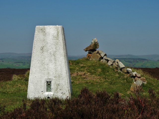
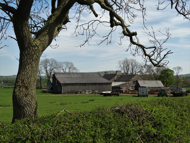
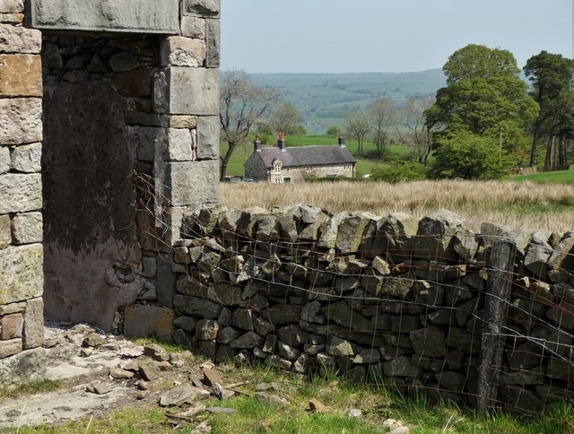
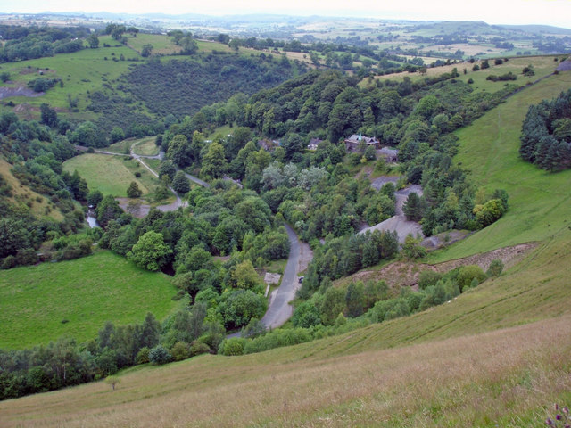
The village is surrounded by picturesque countryside, including fields, meadows, and woodlands, making it an ideal location for those seeking a tranquil and scenic environment. The nearby Cannock Chase, an Area of Outstanding Natural Beauty, offers stunning landscapes and opportunities for outdoor activities such as walking, cycling, and horse riding.

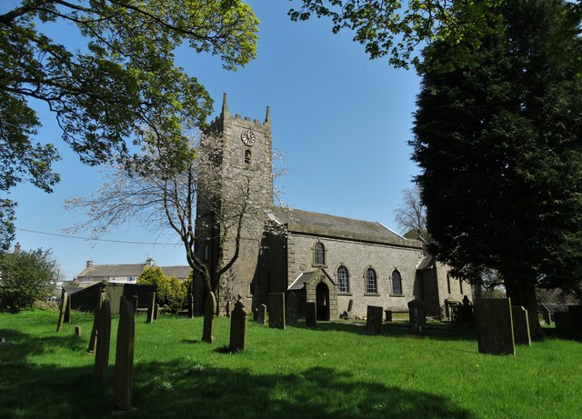
Although small in size, Hayes has a close-knit community that takes pride in preserving its heritage. The village is home to St. Mary's Church, a Grade II listed building dating back to the 12th century. This historic church attracts visitors interested in its architectural beauty and rich history.

Hayes benefits from good transportation links, with the A460 road running through the village, connecting it to nearby towns and cities. The nearest railway station is Cannock, providing easy access to Birmingham and other major cities in the region.

The village has limited amenities, including a few local shops, a primary school, and a pub. However, residents can easily access a wider range of services and amenities in nearby towns such as Cannock and Stafford.

Overall, Hayes offers a peaceful and idyllic setting for those seeking a rural lifestyle while still being within reach of larger urban centers.

If you have any feedback on the listing, please let us know in the comments section below.
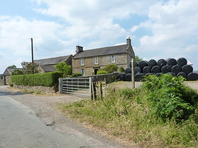
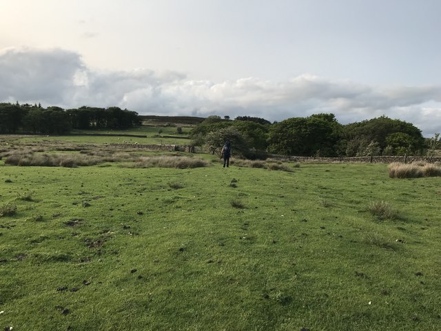
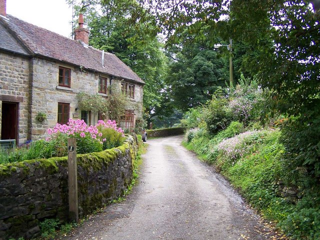
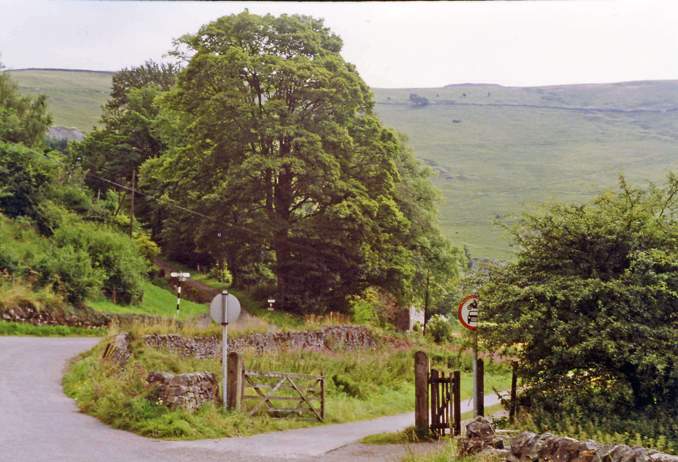
Hayes Images

Images are sourced within 2km of 53.137096/-1.8818721 or Grid Reference SK0860. Thanks to Geograph Open Source API. All images are credited.

The Church of St Lawrence in Warslow The church of St Lawrence has William Morris windows, a wide chancel and both Georgian and Victorian features; there were once two chapels in Warslow but both have now been converted into dwellings.
The Church of St Lawrence in Warslow
The church of St Lawrence has William Morris windows, a wide chancel and both Georgian and Victorian features; there were once two chapels in Warslow but both have now been converted into dwellings.
Ruin of a farm building at Clough Head
The triangulation pillar on Revidge Moor Just beyond it someone has created the shape of a creature - perhaps a dog or a dragon - using rocks found nearby.
The triangulation pillar on Revidge Moor
Just beyond it someone has created the shape of a creature - perhaps a dog or a dragon - using rocks found nearby.
Manor Farm at Haysgate
Jersey cow peeping over a wall at Clough Head
View from a ruined farm building at Clough Head
In a small plantation above Clough Head
"The Greyhound Inn" in Warslow
Manor Farmhouse A large farmhouse just outside Hayesgate, complete with a pile of silage bales ready for winter feed.
Manor Farmhouse
A large farmhouse just outside Hayesgate, complete with a pile of silage bales ready for winter feed.
At the entrance to Hayes Gate Farm On the road just NW of Hayesgate, the track on the right here leads to Hayes Gate Farm
At the entrance to Hayes Gate Farm
On the road just NW of Hayesgate, the track on the right here leads to Hayes Gate Farm
Footpath to Revidge Wood Farmland to the north west of Warslow village. Revidge access moorland rises in the middle distance between the plantations.
Footpath to Revidge Wood
Farmland to the north west of Warslow village. Revidge access moorland rises in the middle distance between the plantations.
Road to Warslow Village This road cuts across the south west corner of the grid square here. Warslow village is less than a mile distant.
Road to Warslow Village
This road cuts across the south west corner of the grid square here. Warslow village is less than a mile distant.
The Primitive Methodist Chapel in Warslow Converted to residential use. Dated 1848, these words are carved into a stone plaque; "Prepare To Meet Thy God". Presumably, that is what the lost congregation did.
The Primitive Methodist Chapel in Warslow
Converted to residential use. Dated 1848, these words are carved into a stone plaque; "Prepare To Meet Thy God". Presumably, that is what the lost congregation did.
Under a cloud - view of a barn at Clough Head
Track through a wood east of Revidge Moor
Stoneyfold Lane
Stoneyfold Lane
Farm ruin at Moorside with sheep I put "ruin" rather than "barn" in the title as barns do not normally have chimneys.
Farm ruin at Moorside with sheep
I put "ruin" rather than "barn" in the title as barns do not normally have chimneys.
The path to Warslow from Cowhay Head
Show me another place!

Hayes is located at Grid Ref: SK0860 (Lat: 53.137096, Lng: -1.8818721)

Administrative County: Staffordshire

District: Staffordshire Moorlands

Police Authority: Staffordshire

What 3 Words

///hillside.timer.plugs. Near Newhaven, Derbyshire

Nearby Locations

Hayes

Related Wikis

Warslow

Warslow is a small village in Staffordshire, England. It is located in the Peak District National Park about 10 miles (16 km) north of Ashbourne. Although...

Warslow and Elkstones

Warslow and Elkstones is a civil parish in the district of Staffordshire Moorlands in north-east Staffordshire, England. It includes the village of Warslow...

Ecton railway station

Ecton railway station was a station on the Leek and Manifold Light Railway. It served the hamlet of Ecton, Staffordshire. Today, the site is now part of...

Ecton, Staffordshire

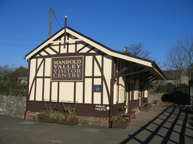
Ecton is a hamlet in the Staffordshire Peak District (grid reference SK096584). It is on the Manifold Way, an 8-mile (13 km) walk and cycle path that follows...

Hulme End railway station

Hulme End railway station is a disused railway station in Staffordshire, England. The station was the terminus of the 2 ft 6 in (762 mm) Leek and Manifold...

Butterton railway station

Butterton railway station was a station on the Leek and Manifold Light Railway. It served the village of Butterton in Staffordshire. The site is now part...
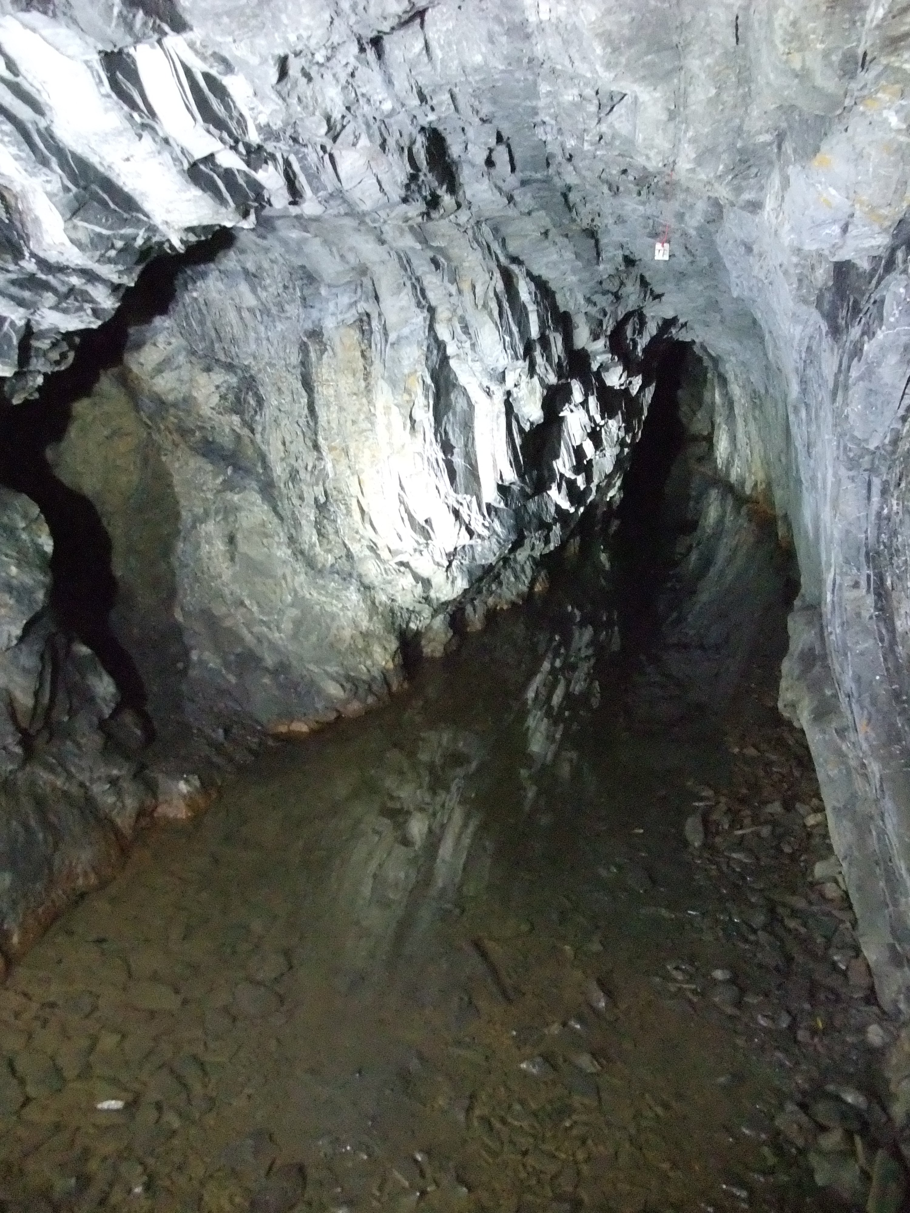
Ecton Mines

A group of mines on Ecton Hill, Staffordshire, are unusual for the Peak District in producing predominantly copper rather than lead and zinc. The most...

Hulme End

Hulme End () is a small hamlet in Staffordshire, England. It is located in the Peak District National Park about 10 miles north of Ashbourne. A natural...

Nearby Amenities

Located within 500m of 53.137096,-1.8818721
Barrier: stile
Ele: 322.0000000
Material: stone
Source: survey;gps
Stile: squeezer
Lat/Long: 53.1338538/-1.8770812
Ele: 323.0000000
Lat/Long: 53.1340179/-1.8771994
Barrier: stile
Ele: 323.0000000
Stile: squeezer
Lat/Long: 53.1340755/-1.8772563
Barrier: stile
Ele: 323.0000000
Lat/Long: 53.1347634/-1.8776524
Barrier: stile
Ele: 323.0000000
Steps: 1
Stile: stepover
Lat/Long: 53.1361328/-1.8777212
Barrier: stile
Ele: 323.0000000
Stile: squeezer
Lat/Long: 53.1382136/-1.8772665
Ele: 323.0000000
Lat/Long: 53.1382573/-1.8772846
Barrier: stile
Ele: 325.0000000
Material: stone
Source: survey;gps
Stile: stepover
Lat/Long: 53.1382329/-1.8776839
Barrier: stile
Ele: 333.0000000
Material: wood
Steps: 1
Stile: stepover
Lat/Long: 53.1387262/-1.878924
Ele: 333.0000000
Lat/Long: 53.1387479/-1.8789599
Ele: 333.0000000
Lat/Long: 53.1388818/-1.8788917
Ele: 335.0000000
Lat/Long: 53.1389091/-1.8792771
Ele: 351.0000000
Lat/Long: 53.1412931/-1.8837814
Barrier: cattle_grid
Ele: 349.0000000
Lat/Long: 53.1413598/-1.8838638
Barrier: stile
Material: wood
Source: survey;gps
Stile: stepover
Lat/Long: 53.1338035/-1.8847845
Barrier: entrance
Source: survey;gps
Lat/Long: 53.136051/-1.8798525
Barrier: stile
Material: stone
Source: survey;gps
Stile: squeezer
Lat/Long: 53.1360695/-1.8810079
Barrier: kissing_gate
Source: survey;gps
Lat/Long: 53.1361073/-1.8804188
Barrier: stile
Source: survey;gps
Stile: squeezer
Lat/Long: 53.1380718/-1.8792778
Barrier: stile
Ele: 334.0000000
Material: wood
Source: survey;gps
Steps: 1
Stile: stepover
Lat/Long: 53.1387641/-1.8789758
Barrier: stile
Material: stone
Source: survey;gps
Stile: stepover
Lat/Long: 53.1389334/-1.8792875
Barrier: stile
Material: wood
Source: survey;gps
Stile: stepover
Lat/Long: 53.1327417/-1.8806889
Barrier: stile
Material: stone
Source: survey;gps
Stile: squeezer
Lat/Long: 53.1338276/-1.881296
Barrier: stile
Material: stone
Source: survey;gps
Stile: squeezer
Lat/Long: 53.1339949/-1.8814658
Barrier: stile
Material: stone
Source: survey;gps
Stile: squeezer
Lat/Long: 53.1347966/-1.8816634
Barrier: stile
Material: stone
Source: survey;gps
Stile: stepover
Lat/Long: 53.1362634/-1.8775982
Barrier: stile
Material: wood
Source: survey;gps
Stile: stepover
Lat/Long: 53.1362957/-1.8751859
Revidge
Ele: 400
Man Made: survey_point
Natural: peak
Lat/Long: 53.1362996/-1.8857569
Material: stone
Tourism: artwork
Lat/Long: 53.1363354/-1.8857629
Revidge
Ele: 401
Natural: peak
Source: https://www.hill-bagging.co.uk/mountaindetails.php?qu=S&rf=16546
Lat/Long: 53.1363321/-1.8857289
The data included in this document is from www.openstreetmap.org. The data is made available under ODbL.

Have you been to Hayes?

Leave your review of Hayes below (or comments, questions and feedback).