Burghfield Slade

Downs, Moorland in Berkshire

England

Burghfield Slade

Woodland path, Mortimer, Berkshire
Woodland path, Mortimer, Berkshire Credit: Oswald Bertram

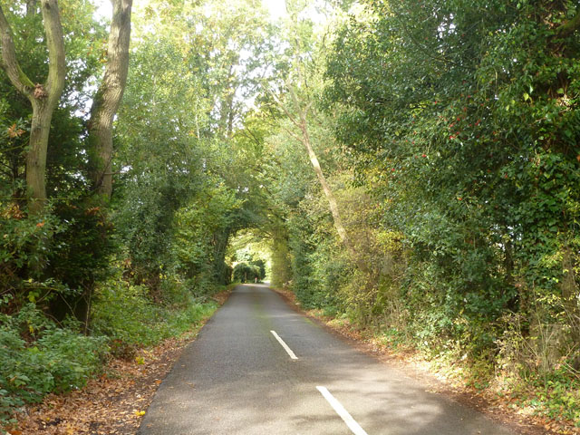
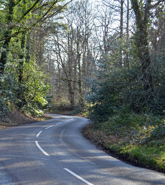
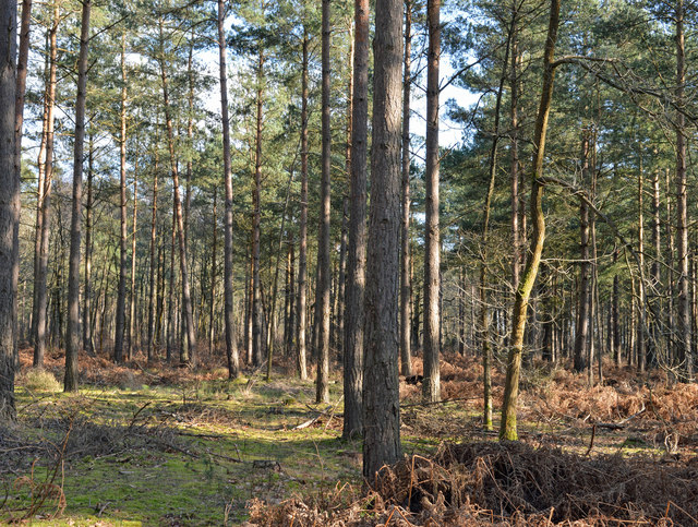
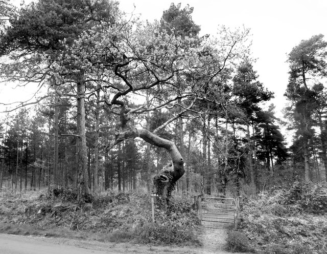
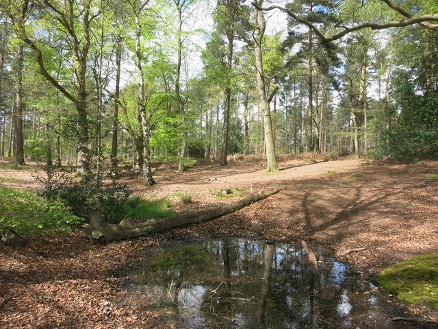
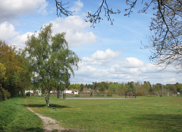
Burghfield Slade is a picturesque area located in Berkshire, England. Situated amongst the beautiful Downs and Moorland, it offers a stunning natural landscape for visitors to enjoy. The area is known for its rolling hills, open fields, and breathtaking views, making it a popular destination for outdoor enthusiasts and nature lovers.

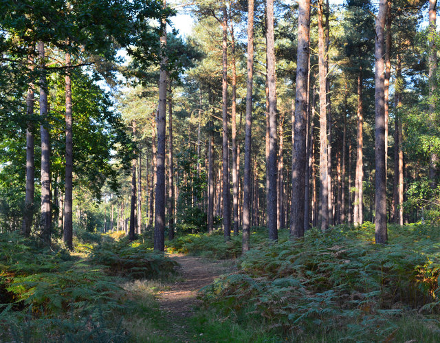
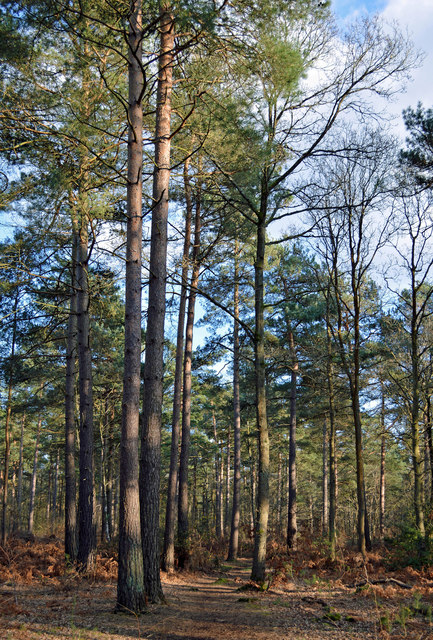
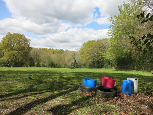
The Downs of Burghfield Slade are characterized by their gentle slopes and lush greenery. They provide a perfect setting for activities such as hiking, cycling, and horseback riding. The extensive network of trails and paths allows visitors to explore the area at their own pace, taking in the stunning views and spotting local wildlife along the way.

The Moorland in Burghfield Slade offers a completely different landscape, with its vast stretches of heather-covered hills and peat bogs. This unique environment is home to a variety of plant and animal species, making it an ideal place for nature enthusiasts and birdwatchers.

Burghfield Slade also boasts a rich history, with ancient landmarks and archaeological sites scattered throughout the area. These include burial mounds, prehistoric settlements, and remnants of medieval structures, providing visitors with a glimpse into the region's past.

In addition to its natural and historical attractions, Burghfield Slade offers a range of amenities for visitors. There are picnic areas, visitor centers, and facilities for outdoor sports and recreational activities. The area is easily accessible by car or public transportation, making it a convenient destination for day trips or longer stays.

Overall, Burghfield Slade in Berkshire is a captivating location that combines natural beauty, historical significance, and recreational opportunities, making it a must-visit destination for both locals and tourists alike.

If you have any feedback on the listing, please let us know in the comments section below.

Burghfield Slade Images

Images are sourced within 2km of 51.393634/-1.0513129 or Grid Reference SU6666. Thanks to Geograph Open Source API. All images are credited.

Woodland path, Mortimer, Berkshire
Island Farm Road There is an Island Farm up the road, but the Island bit is far from apparent.
Island Farm Road
There is an Island Farm up the road, but the Island bit is far from apparent.
Maple leaves in Burghfield Common, Berkshire Autumn colour and a sliver of sunshine.
Maple leaves in Burghfield Common, Berkshire
Autumn colour and a sliver of sunshine.
Rural houses, Wokefield, Berkshire
Cottage at Christmas, Wokefield, Berkshire
Modern house, Burghfield Common, Berkshire
Woodland path, Wokefield, Berkshire
Country road, Mortimer, Berkshire
Woodland, Wokefield, Berkshire
Patriotic Plastic Red white and blue containers in a field north of Mortimer.
Patriotic Plastic
Red white and blue containers in a field north of Mortimer.
Gnarled tree by the gate A fine specimen of gnarlyness. The footpath is one of the mysterious Berkshire Circular Routes which still appear as LDPs on some Ordnance Survey maps but have no other info or way marking.
The theory is that these routes were an initiative by the old Berkshire County Council which never got progressed after that council was wound up in 1998.
Gnarled tree by the gate
A fine specimen of gnarlyness. The footpath is one of the mysterious Berkshire Circular Routes which still appear as LDPs on some Ordnance Survey maps but have no other info or way marking. The theory is that these routes were an initiative by the old Berkshire County Council which never got progressed after that council was wound up in 1998.
Small Pond on the Footpath It's been wet recently, and this pool has formed in a dip where the path crosses. Fortunately, that handy fallen log makes a dry way across.
Small Pond on the Footpath
It's been wet recently, and this pool has formed in a dip where the path crosses. Fortunately, that handy fallen log makes a dry way across.
Mortimer Green A park, playground and sports field in the centre of Mortimer.
Mortimer Green
A park, playground and sports field in the centre of Mortimer.
Windmill Road, Mortimer
Wind Vane at Wheat's Farm So many variations.
This one's quite intricate.
Wind Vane at Wheat's Farm
So many variations. This one's quite intricate.
Footpath at Wheat's Farm The people at the farm must be used to strangers wandering about, with a right of way up the drive and another through the farmyard.
Footpath at Wheat's Farm
The people at the farm must be used to strangers wandering about, with a right of way up the drive and another through the farmyard.
Double roundabout on Goring Lane, Burghfield
Houses on Goring Lane, Burghfield
Show me another place!

Burghfield Slade is located at Grid Ref: SU6666 (Lat: 51.393634, Lng: -1.0513129)

Unitary Authority: West Berkshire

Police Authority: Thames Valley

What 3 Words

///happy.less.cars. Near Stratfield Mortimer, Berkshire

Related Wikis

Great Auclum National Speed Hill Climb

Great Auclum National Speed Hill Climb was a motorcar course close to Burghfield Common in the English county of Berkshire. It was based in the grounds...

Goddard's Green, Berkshire

Goddard's Green is a hamlet and part of the civil parish of Wokefield in Berkshire, England. The settlement lies between the villages of Burghfield Common...

The Willink School

The Willink School is a comprehensive community school in Burghfield Common, Berkshire, United Kingdom. Founded in 1957, the school is co-educational and...

Lockram Brook

Lockram Brook is a small stream in southern England. It rises near the Berkshire village of Mortimer, and is a tributary of Burghfield Brook. == Route... ==

Wokefield

Wokefield is a hamlet and civil parish in the West Berkshire district of Berkshire, England, south of Reading. The parish includes the hamlets of Goddard...

Mortimer War Memorial

The Mortimer War Memorial is a monument that commemorates the lives of soldiers from Stratfield Mortimer, Berkshire, England, who were killed in war....

Mortimer Common

Mortimer Common, generally referred to as Mortimer, is a village in the civil parish of Stratfield Mortimer in Berkshire. Mortimer is in the local government...

Burghfield

Burghfield is a village and large civil parish in West Berkshire, England, with a boundary with Reading. Burghfield can trace its history back to before...

Nearby Amenities

Located within 500m of 51.393634,-1.0513129
Turning Circle
Lat/Long: 51.3956388/-1.0571091
Turning Circle
Lat/Long: 51.3955203/-1.0570032
Post Box
Operator: Royal Mail
Post Box Type: wall
Ref: RG7 1D
Royal Cypher: VR
Royal Cypher Wikidata: Q33102356
Source: knowledge, POI
Lat/Long: 51.3922338/-1.0452495
Turning Circle
Lat/Long: 51.3971673/-1.0539038
Turning Circle
Lat/Long: 51.3973877/-1.0528086
Colour: white
Marker: post
Material: concrete
Utility: oil
Lat/Long: 51.3910672/-1.0541576
Colour: white
Marker: post
Material: concrete
Utility: oil
Lat/Long: 51.3910904/-1.0542769
Colour: white
Marker: post
Material: concrete
Utility: oil
Lat/Long: 51.3910937/-1.0542768
Colour: white
Marker: post
Material: concrete
Utility: oil
Lat/Long: 51.3910909/-1.0542705
Colour: white
Marker: post
Material: concrete
Utility: oil
Lat/Long: 51.3920633/-1.0451472
Description: white post with yellow hat and black stripe
Marker: aerial
Utility: oil
Lat/Long: 51.3920674/-1.0451294
The data included in this document is from www.openstreetmap.org. The data is made available under ODbL.

Have you been to Burghfield Slade?

Leave your review of Burghfield Slade below (or comments, questions and feedback).