West Field

Downs, Moorland in Yorkshire Ryedale

England

West Field

Cornborough Road, west of Sheriff Hutton
Cornborough Road, west of Sheriff Hutton Credit: Ian S

West Field is a picturesque area located in the region of Yorkshire, renowned for its stunning scenery and diverse natural landscapes. Situated between the rolling hills of the Yorkshire Downs and the vast Moorland, it offers a unique combination of both rural and wild beauty.

The Yorkshire Downs, with their gently undulating hills covered in lush greenery, dominate the western part of West Field. The area is dotted with charming villages and small farms, adding to the rural charm of the landscape. The Downs also boast several walking trails, allowing visitors to explore the area on foot and take in the breathtaking views.

To the east lies the Moorland, characterized by its rugged terrain, heather-covered moors, and expansive open spaces. This wild and untamed landscape is a haven for nature enthusiasts, providing a habitat for a variety of unique flora and fauna. The Moorland is particularly famous for its bird population, attracting birdwatchers from far and wide.

West Field offers a range of outdoor activities for visitors to enjoy, including hiking, cycling, and horse riding. The area is also popular for its fishing spots, with several rivers and streams teeming with trout and salmon.

In addition to its natural beauty, West Field is home to a number of historical landmarks and cultural attractions. The ruins of an ancient abbey, nestled within the Yorkshire Downs, stand as a testament to the area's rich history. Furthermore, the local villages host traditional events and festivals, providing visitors with a taste of the region's vibrant heritage.

Overall, West Field, Yorkshire (Downs, Moorland) is a captivating destination that offers a harmonious blend of rural charm and untamed wilderness, making it a must-visit for nature lovers and history enthusiasts alike.

If you have any feedback on the listing, please let us know in the comments section below.
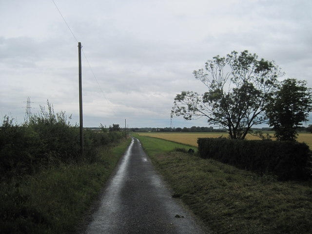
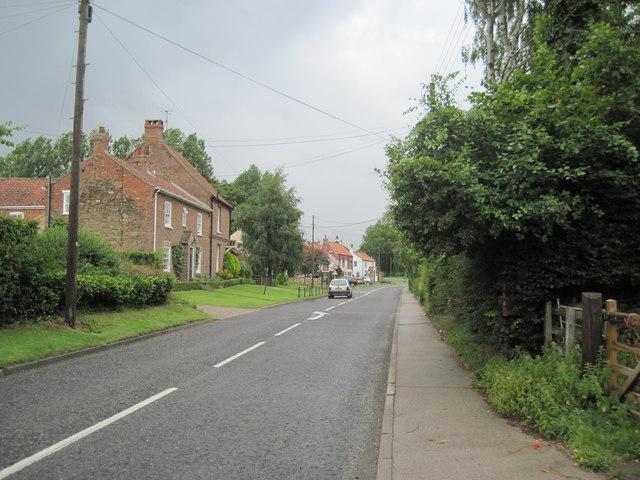
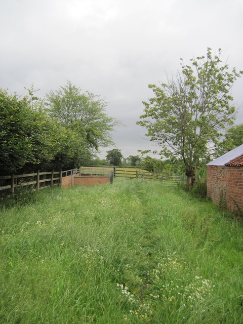
West Field Images

Images are sourced within 2km of 54.080949/-1.0334279 or Grid Reference SE6365. Thanks to Geograph Open Source API. All images are credited.

Cornborough Road, west of Sheriff Hutton
The way to Cornborough Hall
Sheriff Hutton village hall All the cyclists are taking part in the Acorn 100 bike ride from Bishop Monkton <span class="nowrap"><a title="http://www.acorncharity.org.uk/index.php?option=com_content&view=article&id=20&Itemid=31" rel="nofollow ugc noopener" href="http://www.acorncharity.org.uk/index.php?option=com_content&view=article&id=20&Itemid=31">Link</a><img style="margin-left:2px;" alt="External link" title="External link - shift click to open in new window" src="https://s1.geograph.org.uk/img/external.png" width="10" height="10"/></span> .
Sheriff Hutton village hall
All the cyclists are taking part in the Acorn 100 bike ride from Bishop Monkton LinkExternal link .
Village Hall car park Looking across towards the castle in Sheriff Hutton. Similar view to <a href="https://www.geograph.org.uk/photo/814028">SE6566 : Sheriff Hutton castle</a>.
Village Hall car park
Looking across towards the castle in Sheriff Hutton. Similar view to SE6566 : Sheriff Hutton castle.
New  Lane  south  of  West  Lilling This lane runs down to Lilling Low Lane. On the Centenary Way.
New Lane south of West Lilling
This lane runs down to Lilling Low Lane. On the Centenary Way.
West  Lilling  Village  Street A small village south of Sheriff Hutton, the Centenary Way crosses the street at this point.
West Lilling Village Street
A small village south of Sheriff Hutton, the Centenary Way crosses the street at this point.
Footpath  from  West  Lilling This F/P once through the gate splits but both go to Sheriff Hutton,the castle of which can be seen between the two trees in the distance. Part of the Centenary Way.
Footpath from West Lilling
This F/P once through the gate splits but both go to Sheriff Hutton,the castle of which can be seen between the two trees in the distance. Part of the Centenary Way.
Methodist Church, Sheriff Hutton In West End.
Methodist Church, Sheriff Hutton
In West End.
Castle View, Sheriff  Hutton Housing on the western edge of the village.
Castle View, Sheriff Hutton
Housing on the western edge of the village.
Saturated crop field Viewed from the track known as Mill Lane which is also the Foss Walk. On the horizon is Mount Pleasant.
Saturated crop field
Viewed from the track known as Mill Lane which is also the Foss Walk. On the horizon is Mount Pleasant.
Foss Walk A muddy section with view back towards the castle ruins at Sheriff Hutton.
Foss Walk
A muddy section with view back towards the castle ruins at Sheriff Hutton.
Pasture by the Foss Walk
Footbridge over drain View over waterlogged farmland towards Sheriff Hutton.
Footbridge over drain
View over waterlogged farmland towards Sheriff Hutton.
Footpath along field edge Following the overhead cables.
Footpath along field edge
Following the overhead cables.
Recent ploughing near Mill Hill Farm West of Sheriff Hutton.
Recent ploughing near Mill Hill Farm
West of Sheriff Hutton.
Field drainage Carrying water down to the River Foss.
Field drainage
Carrying water down to the River Foss.
Mill Hill Farm View from the south.
Mill Hill Farm
View from the south.
Corrugated outbuildings Mill Hill Farm from the south.
Corrugated outbuildings
Mill Hill Farm from the south.
Show me another place!

West Field is located at Grid Ref: SE6365 (Lat: 54.080949, Lng: -1.0334279)

Division: North Riding

Administrative County: North Yorkshire

District: Ryedale

Police Authority: North Yorkshire

What 3 Words

///owls.forgets.punctured. Near Sheriff Hutton, North Yorkshire

Nearby Locations

West Field

Related Wikis

Sheriff Hutton Castle

not to be confused with Hutton Castle in the Scottish Borders Sheriff Hutton Castle is a ruined quadrangular castle in the village of Sheriff Hutton,...

Sheriff Hutton

Sheriff Hutton is a village and civil parish in North Yorkshire, England. It lies about 10 miles (16 km) north by north-east of York. == History == The...

Lillings Ambo

Lillings Ambo is a civil parish in North Yorkshire, England. It is between the villages of Strensall and Sheriff Hutton, and its southern edge is the border...

Farlington, North Yorkshire

Farlington is a small village and civil parish in the Hambleton District of North Yorkshire, England. It is situated approximately 9.5 miles (15.3 km)...

Nearby Amenities

Located within 500m of 54.080949,-1.0334279
Power: tower
Lat/Long: 54.0824263/-1.0292388
Power: tower
Lat/Long: 54.08028/-1.0269965
Power: tower
Lat/Long: 54.0849041/-1.0318256
Information: route_marker
Tourism: information
Lat/Long: 54.0817324/-1.0385888
The data included in this document is from www.openstreetmap.org. The data is made available under ODbL.

Have you been to West Field?

Leave your review of West Field below (or comments, questions and feedback).