Hawthorpe

Settlement in Lincolnshire South Kesteven

England

Hawthorpe

Entrance to village of Bulby
Entrance to village of Bulby Credit: Tim Heaton

Hawthorpe is a small village located in the county of Lincolnshire, England. Situated just 5 miles east of the town of Louth, it is nestled in the picturesque rural landscape of the Lincolnshire Wolds, an Area of Outstanding Natural Beauty.

With a population of around 200 residents, Hawthorpe is known for its tight-knit community and tranquil surroundings. The village is predominantly residential, consisting of a mix of traditional stone cottages and more modern houses. The architecture reflects the area's rich history, with some buildings dating back to the 17th century.

Hawthorpe offers a quiet and peaceful lifestyle, away from the hustle and bustle of city living. The village is surrounded by rolling hills, open fields, and meandering country lanes, making it an ideal location for nature lovers and outdoor enthusiasts. Nearby, there are several walking and cycling trails, providing opportunities for exploring the stunning countryside.

Despite its small size, Hawthorpe benefits from its proximity to Louth, where residents can find a wider range of amenities including shops, supermarkets, schools, and healthcare facilities. The village itself has limited services, with a small local pub serving as a social hub for the community.

Overall, Hawthorpe is a charming village that offers a peaceful retreat for those seeking a rural lifestyle. Its idyllic setting, friendly community, and close proximity to the Lincolnshire Wolds make it a desirable place to live for those who appreciate the beauty of the English countryside.

If you have any feedback on the listing, please let us know in the comments section below.
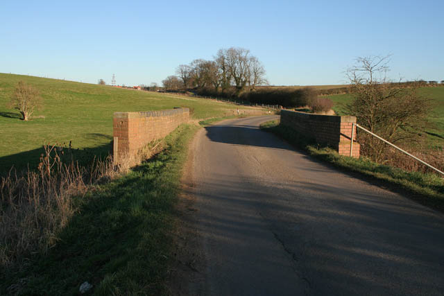
Hawthorpe Images

Images are sourced within 2km of 52.834839/-0.447964 or Grid Reference TF0427. Thanks to Geograph Open Source API. All images are credited.

Entrance to village of Bulby
Ford and bridge, entrance to Bulby
Road to Bulby from Irnham
Marwood House Farm
Marwood House Farm
Track and field drain between Keisby and Hawthorpe
Communications mast near Kirkby Underwood Communications mast, bristling with dishes for collecting and relaying data, sited north of Callan's Lane Wood near Kirkby Underwood
Communications mast near Kirkby Underwood
Communications mast, bristling with dishes for collecting and relaying data, sited north of Callan's Lane Wood near Kirkby Underwood
Staddle stone base at Rookery Farm This looks like a staddle stone base, but no sign of the top stone. Located right by the footpath from Callan's Lane, close to Rookery Farm Hawthorpe
Staddle stone base at Rookery Farm
This looks like a staddle stone base, but no sign of the top stone. Located right by the footpath from Callan's Lane, close to Rookery Farm Hawthorpe
Transco gas station Transco high pressure gas station: location 191700 Kirkby Underwood
Transco gas station
Transco high pressure gas station: location 191700 Kirkby Underwood
Dead tree in foreground and communications mast behind Dead tree, with evidence of lightning strikes on trunk, in the foreground with  a many-dish communications mast 500m behind.
Dead tree in foreground and communications mast behind
Dead tree, with evidence of lightning strikes on trunk, in the foreground with a many-dish communications mast 500m behind.
King Street Roman Road course of, no surface evidence left This image shows no surface evidence of the Roman Road King Street which crossed this field, at this position, in a northwest--southeast direction. Perhaps the farmer finds too many stones when cultivating here, or is it a 6 metre strip round the field that he receives payment to leave uncultivated?
King Street Roman Road course of, no surface evidence left
This image shows no surface evidence of the Roman Road King Street which crossed this field, at this position, in a northwest--southeast direction. Perhaps the farmer finds too many stones when cultivating here, or is it a 6 metre strip round the field that he receives payment to leave uncultivated?
Bracket fungus on a fallen branch In Callan's Lane Wood.
Bracket fungus on a fallen branch
In Callan's Lane Wood.
In Callan's Lane Wood This ancient woodland is part of the Kesteven Forest, see <span class="nowrap"><a title="http://www.forestry.gov.uk/kestevenforest" rel="nofollow ugc noopener" href="http://www.forestry.gov.uk/kestevenforest">Link</a><img style="margin-left:2px;" alt="External link" title="External link - shift click to open in new window" src="https://s1.geograph.org.uk/img/external.png" width="10" height="10"/></span>
In Callan's Lane Wood
This ancient woodland is part of the Kesteven Forest, see LinkExternal link
Keisby, Lincolnshire A small village predominantly limestone houses.
Keisby, Lincolnshire
A small village predominantly limestone houses.
Track to Osgodby This farm road allows public access from Keisby to Osgodby.
Track to Osgodby
This farm road allows public access from Keisby to Osgodby.
Weir on the East Glen River near Hawthorpe Hawthorpe Road crosses the river via the brick bridge. The wooden structure houses an Environment Agency gauging station.
Weir on the East Glen River near Hawthorpe
Hawthorpe Road crosses the river via the brick bridge. The wooden structure houses an Environment Agency gauging station.
East Glen River Looking north from the Hawthorpe Road bridge.
East Glen River
Looking north from the Hawthorpe Road bridge.
Hawthorpe Road The bridge crosses the East Glen River. Hawthorpe is on the horizon.
Hawthorpe Road
The bridge crosses the East Glen River. Hawthorpe is on the horizon.
Small limestone pit near Irnham There were several of these small "quarries" in this square.
Small limestone pit near Irnham
There were several of these small "quarries" in this square.
Show me another place!

Hawthorpe is located at Grid Ref: TF0427 (Lat: 52.834839, Lng: -0.447964)

Division: Parts of Kesteven

Administrative County: Lincolnshire

District: South Kesteven

Police Authority: Lincolnshire

What 3 Words

///enable.relaxed.everybody. Near Corby Glen, Lincolnshire

Nearby Locations

Hawthorpe

Related Wikis

Hawthorpe, Lincolnshire

Hawthorpe is a hamlet in the South Kesteven district of Lincolnshire, England, and the civil parish of Irnham, Bulby and Hawthorpe. It is west from the...

Keisby

Keisby is a small hamlet in the district of South Kesteven, in Lincolnshire, England. It is situated 6 miles (10 km) north-west from Bourne and 9 miles...

Bulby

Bulby is a hamlet in the South Kesteven district of Lincolnshire, England, and in the civil parish of Irnham, Bulby and Hawthorpe. The village is situated...

Irnham

Irnham is a village and civil parish in South Kesteven, Lincolnshire, England. It is situated approximately 10 miles (16 km) south-east from Grantham...
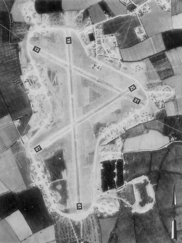
RAF Folkingham

Royal Air Force Folkingham or RAF Folkingham is a former Royal Air Force station located south west of Folkingham, Lincolnshire and about 29 miles (47...

Kirkby Underwood

Kirkby Underwood is a village and civil parish in the South Kesteven district of Lincolnshire, England. The population of the civil parish was 200 at the...

Aveland

Aveland was a Wapentake of Kesteven from the time of the Danelaw until the Local Government Act 1888. Its meeting place was The Aveland at grid reference...

Lenton, Lincolnshire

Lenton is a hamlet in the district of South Kesteven, Lincolnshire, England. It is situated approximately 7 miles (11 km) south-east from Grantham, and...

Nearby Amenities

Located within 500m of 52.834839,-0.447964
Hawthorpe
Is In: Lincolnshire, England, UK
Place: hamlet
Lat/Long: 52.8345498/-0.4483829
Rookery Farm
Naptan AtcoCode: 270000014556
Naptan Bearing: S
Naptan BusStopType: CUS
Naptan CommonName: Rookery Farm
Naptan Indicator: adj
Naptan Landmark: Rookery Farm
Naptan NaptanCode: linjpwmj
Naptan Street: Main Street
Naptan Verified: no
Source: naptan_import
Lat/Long: 52.8342796/-0.4479755
Rookery Farm
Naptan AtcoCode: 270000014557
Naptan Bearing: N
Naptan BusStopType: CUS
Naptan CommonName: Rookery Farm
Naptan Indicator: opp
Naptan Landmark: Rookery Farm
Naptan NaptanCode: linjpwmp
Naptan Street: Main Street
Naptan Verified: no
Source: naptan_import
Lat/Long: 52.8342094/-0.4481116
Bus Stop
Altaya
Naptan AtcoCode: 270002700507
Naptan Bearing: SE
Naptan CommonName: Altaya
Naptan Indicator: adj
Naptan Landmark: Altaya
Naptan Street: Lenton Road
Naptan Verified: no
Source: naptan_import
Lat/Long: 52.8347661/-0.4508086
Bus Stop
Altaya
Naptan AtcoCode: 270002700508
Naptan Bearing: NW
Naptan CommonName: Altaya
Naptan Indicator: opp
Naptan Landmark: Altaya
Naptan Street: Lenton Road
Naptan Verified: no
Source: naptan_import
Lat/Long: 52.8347583/-0.4508979
Hawthorpe Farm
Place: farm
Source: Bing
Lat/Long: 52.8353547/-0.4486812
Rookery Farm
Place: farm
Source: Bing
Lat/Long: 52.8339491/-0.4472341
Sunny Bank Farm
Place: farm
Source: Bing
Lat/Long: 52.8356267/-0.4461574
The Old Cottage
Place: isolated_dwelling
Source: Bing
Lat/Long: 52.8336334/-0.4514177
Give Way
Direction: forward
Source: Bing
Lat/Long: 52.8345066/-0.4505953
The data included in this document is from www.openstreetmap.org. The data is made available under ODbL.

Have you been to Hawthorpe?

Leave your review of Hawthorpe below (or comments, questions and feedback).